|
Thrapston Rural District
Thrapston was a rural district in England from 1894 to 1935. It was one of the only rural districts to be split between administrative counties, with part in Northamptonshire and part in Huntingdonshire. The Huntingdonshire parishes were: * Brington *Bythorn * Covington * Keyston * Molesworth *Old Weston The district was abolished in 1935, with most of the Northamptonshire parts going on to become part of the Oundle and Thrapston Rural District (and the parish of Stanwick joining Raunds urban district Urban district may refer to: * District * Urban area * Quarter (urban subdivision) * Neighbourhood Specific subdivisions in some countries: * Urban districts of Denmark * Urban districts of Germany * Urban district (Great Britain and Ireland) (hist ...), while the Huntingdonshire parts went primarily to Huntingdon Rural District. The parish of Covington joined St Neots Rural District. References NotesNorthamptonshire part {{coord, 52.4, -0.55, dim:20000_region:GB, display=tit ... [...More Info...] [...Related Items...] OR: [Wikipedia] [Google] [Baidu] |
Rural District
Rural districts were a type of local government area – now superseded – established at the end of the 19th century in England, Wales, and Ireland for the administration of predominantly rural areas at a level lower than that of the Administrative county, administrative counties.__TOC__ England and Wales In England and Wales they were created in 1894 (by the Local Government Act 1894) along with Urban district (Great Britain and Ireland), urban districts. They replaced the earlier system of sanitary districts (themselves based on poor law unions, but not replacing them). Rural districts had elected rural district councils (RDCs), which inherited the functions of the earlier sanitary districts, but also had wider authority over matters such as local planning, council house, council housing, and playgrounds and cemeteries. Matters such as education and major roads were the responsibility of county councils. Until 1930 the rural district councillors were also poor law gu ... [...More Info...] [...Related Items...] OR: [Wikipedia] [Google] [Baidu] |
Oundle And Thrapston Rural District
Oundle and Thrapston was a rural district in Northamptonshire, England from 1935 to 1974. It was formed in 1935 under the County Review Order as a merger of the Easton on the Hill Rural District, the Gretton Rural District, and the parts of the Oundle Rural District and the Thrapston Rural District which were in Northamptonshire. It was abolished in 1974 under the Local Government Act 1972 and now forms part of the North Northamptonshire North Northamptonshire is one of two local authority areas in Northamptonshire, England. It is a unitary authority area forming about one half of the ceremonial county of Northamptonshire. It was created in 2021. Its notable towns are Ketterin ... Unitary Authority. ReferencesVisionofbritain.org.uk {{coord, 52.5, -0.47, dim:20000_region:GB, display=title History of Northamptonshire Districts of England abolished by the Local Government Act 1972 ... [...More Info...] [...Related Items...] OR: [Wikipedia] [Google] [Baidu] |
Districts Of England Created By The Local Government Act 1894
A district is a type of administrative division that, in some countries, is managed by the local government. Across the world, areas known as "districts" vary greatly in size, spanning regions or counties, several municipalities, subdivisions of municipalities, school district, or political district. By country/region Afghanistan In Afghanistan, a district (Persian ps, ولسوالۍ ) is a subdivision of a province. There are almost 400 districts in the country. Australia Electoral districts are used in state elections. Districts were also used in several states as cadastral units for land titles. Some were used as squatting districts. New South Wales had several different types of districts used in the 21st century. Austria In Austria, the word is used with different meanings in three different contexts: * Some of the tasks of the administrative branch of the national and regional governments are fulfilled by the 95 district administrative offices (). The area a dist ... [...More Info...] [...Related Items...] OR: [Wikipedia] [Google] [Baidu] |
St Neots Rural District
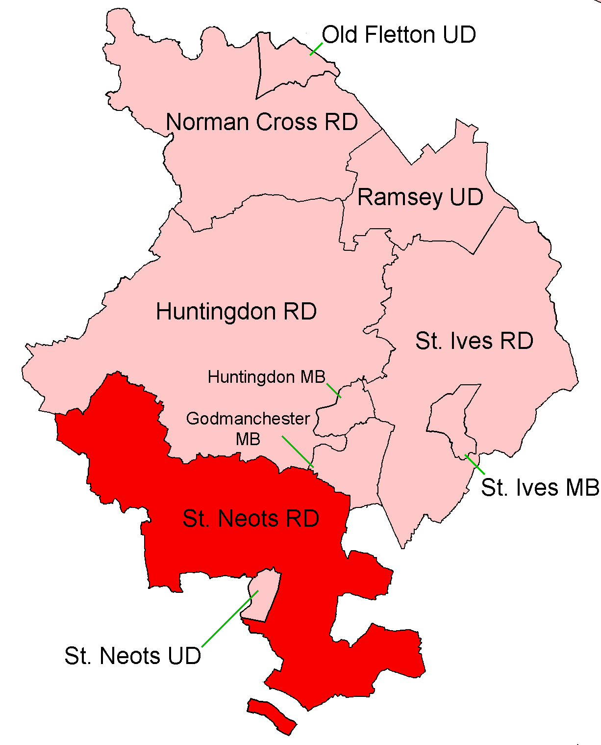
St Neots was a rural district in Huntingdonshire, England from 1894 to 1974, around the northern and eastern sides of the urban area of St Neots. The district had its origins in the St Neots Rural Sanitary District. This had been created under the Public Health Acts of 1872 and 1875, giving public health and local government responsibilities for rural areas to the existing Boards of Guardians of Poor Law Unions. Under the Local Government Act 1894, Rural Sanitary Districts became Rural Districts from 28 December 1894, and rural sanitary districts which straddled county boundaries were to be split so that separate rural districts were created for the parts in each county. Generally, the Huntingdonshire part of the St Neots Rural Sanitary District became the St Neots Rural District, whilst the Bedfordshire part became the Eaton Socon Rural District. As an exception to this rule, the Bedfordshire and Huntingdonshire County Councils agreed that the parish of Swineshead, despite ... [...More Info...] [...Related Items...] OR: [Wikipedia] [Google] [Baidu] |
Huntingdon Rural District
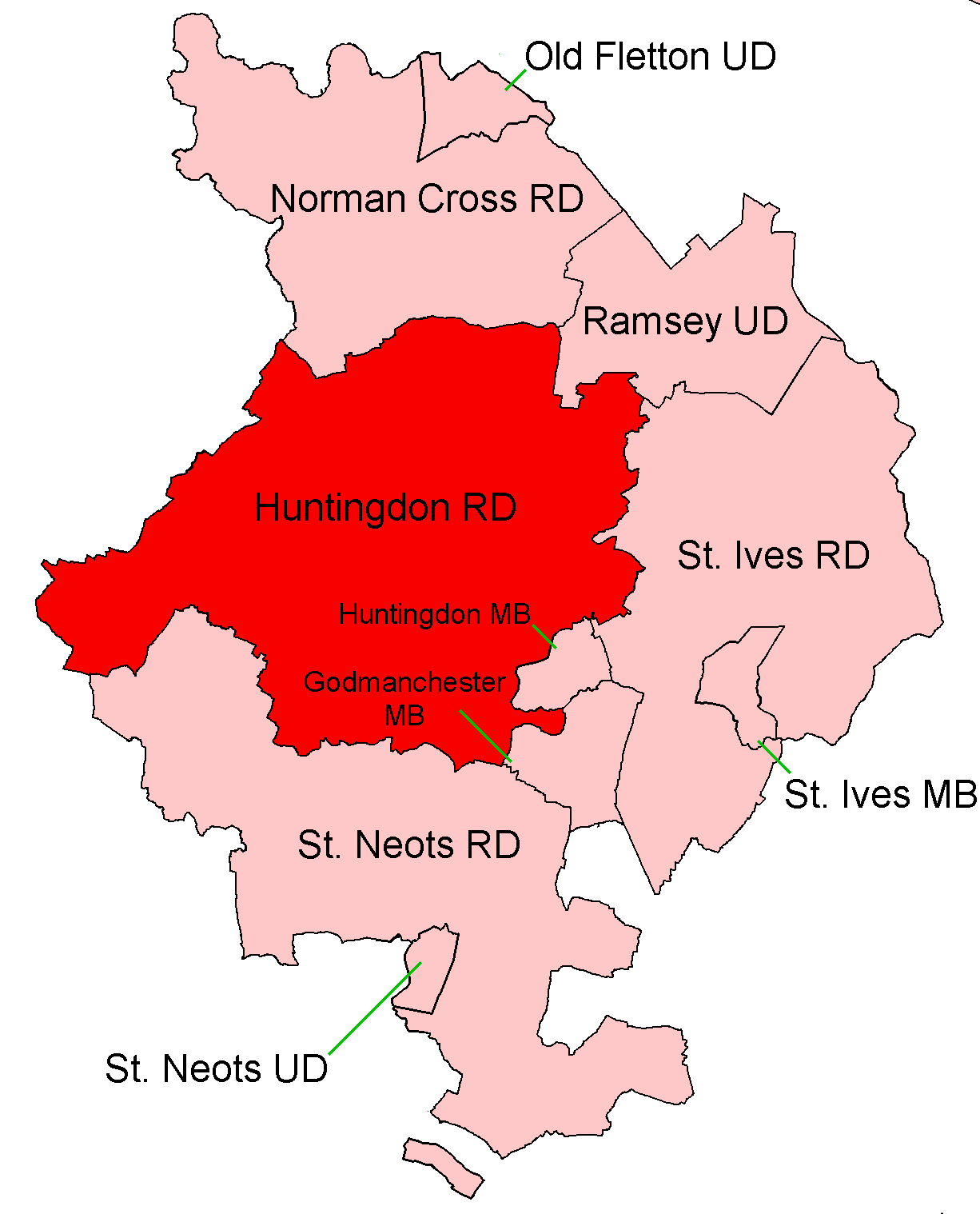
Huntingdon was a rural district in Huntingdonshire from 1894 to 1974, lying to the north and west of urban Huntingdon. It was formed in 1894 under the Local Government Act 1894 from the earlier Huntingdon rural sanitary district. It was expanded in 1935 by taking in most of the disbanded Thrapston Rural District and part of the Huntingdonshire segment of Oundle Rural District. In 1965 Huntingdonshire and the Soke of Peterborough merged to form Huntingdon and Peterborough. In 1974 the district was abolished under the Local Government Act 1972 and became part of the non-metropolitan district of Huntingdon, subsequently renamed Huntingdonshire. Parishes {, class="wikitable" !Parish{{cite web, publisher=GB Historical GIS / University of Portsmouth, title=Huntingdon RD through time: Census tables with data for the Local Government District, website=A Vision of Britain through Time, url=http://www.visionofbritain.org.uk/unit/10221328, accessdate=10 June 2017 !! From !! To ... [...More Info...] [...Related Items...] OR: [Wikipedia] [Google] [Baidu] |
Urban District (Great Britain And Ireland)
In England and Wales, Northern Ireland, and the Republic of Ireland, an urban district was a type of local government district that covered an urbanised area. Urban districts had an elected urban district council (UDC), which shared local government responsibilities with a county council. England and Wales In England and Wales, urban districts and rural districts were created in 1894 (by the Local Government Act 1894) as subdivisions of administrative counties. They replaced the earlier system of urban and rural sanitary districts (based on poor law unions) the functions of which were taken over by the district councils. The district councils also had wider powers over local matters such as parks, cemeteries and local planning. An urban district usually contained a single parish, while a rural district might contain many. Urban districts were considered to have more problems with public health than rural areas, and so urban district councils had more funding and greater power ... [...More Info...] [...Related Items...] OR: [Wikipedia] [Google] [Baidu] |
Raunds
Raunds is a market town in North Northamptonshire, England. It had a population of 9,379 at the 2021 census. Geography Raunds is situated north-east of Northampton. The town is on the southern edge of the Nene Valley and surrounded by arable farming land. Nearest civilian airports are Luton 50 miles and East Midlands 65 miles. Raunds is close to Stanwick Lakes, a country park developed from gravel pits and managed by the Rockingham Forest Trust. This park is internationally recognised for its birdlife and can be reached on foot from Raunds along Meadow Lane bridleway. History In the mid-1980s, during sand excavations in the Nene Valley, the remains of a Roman villa were discovered. Excavation of the area, near Stanwick, was delayed by several years while archaeologists studied the remains. In 2002 Channel 4's ''Time Team'' excavated a garden and found remains of an Anglo-Saxon cemetery. The place-name Raunds is first attested in an Anglo-Saxon charter of c. 972– ... [...More Info...] [...Related Items...] OR: [Wikipedia] [Google] [Baidu] |
Stanwick, Northamptonshire
Stanwick () is a village and civil parish in North Northamptonshire, England. Toponymy The village's name origin is unclear. The first part of the village's name is clearly from Old English "stan", meaning "stone". The second part appears to be from Old English "wīc", meaning "village" (see ), but it may actually be from "wicga" meaning "insect/beetle" (as in "earwig"), likely used here in the feeling of something that wriggles or "tremors" (as with the name of Wigmore). Over time, the pronunciation and spelling of the name has changed slightly. * In the 10th century, it was referred to as "Stan Wigga". * 1086 in the ''Domesday Book'' it is referred to as "Stanwige" and "Stanwica". * 1137 in the '' Anglo-Saxon Chronicle'' it is referred to as "Stanwigga". * 1668 on the funeral monument to John Atkins, Lord of the Manor, it is referred to as "Stanwigge". History There has been a settlement at Stanwick since Roman times at the latest. A Roman villa was excavated in 1984� ... [...More Info...] [...Related Items...] OR: [Wikipedia] [Google] [Baidu] |
Old Weston
Old Weston – in Huntingdonshire (now part of Cambridgeshire), England – is a village near Molesworth, Cambridgeshire, Molesworth west of Huntingdon. In 1870–1872, John Wilson, who was a writer for the ''"Imperial Gazetteer of England and Wales:" ''describes the area as'', "a parish, with a scattered village, in the district of Thrapston and county of Huntingdon; 8 miles N of Kimbolton r. station. It has a post-office under St. Neots. Acres, 2,012. Real property, £2,364. Pop., 426. Houses, 93. The property is much sub-divided. The living is a p. curacy, annexed to Brington. The church is ancient but good, and has a tower and spire. There are a Wesleyan chapel and a national school." ''According to the 2011 UK population census, the parish of Old Weston had a population of 250 people.'' History In about 958 King Edgar the Peaceful gave Ælfwyn, wife of Æthelstan Half-King, ten Hide (unit), hides of land at Old Weston for acting as his foster-mother, and this land later ... [...More Info...] [...Related Items...] OR: [Wikipedia] [Google] [Baidu] |
Administrative Counties Of England
Administrative counties were subnational divisions of England used for local government from 1889 to 1974. They were created by the Local Government Act 1888, which established an elected county council for each area. Some geographically large historic counties were divided into several administrative counties, each with its own county council. The administrative counties operated until 1974, when they were replaced by a system of metropolitan and non-metropolitan counties under the Local Government Act 1972. History Introduction of county councils In 1888 the government, led by the Tory prime minister Lord Salisbury established county councils throughout England and Wales, covering areas known as administrative counties. Many larger towns and cities were given the status of county borough, with similar powers and independent of county council control. Under the Act, each county borough was an "administrative county of itself". Cambridgeshire, Lincolnshire, Northamptonshir ... [...More Info...] [...Related Items...] OR: [Wikipedia] [Google] [Baidu] |
Molesworth, Cambridgeshire
Molesworth is a village in the civil parish of Brington and Molesworth in Cambridgeshire, England. Molesworth is north-west of Huntingdon. The neighbouring village of Brington is from Molesworth. Molesworth is situated within Huntingdonshire which is a non-metropolitan district of Cambridgeshire as well as being a historic county of England. The civil parish covers an area of . Just to the north of Molesworth and within the civil parish is RAF Molesworth. The village of Molesworth was designated a conservation area by Huntingdon District Council largely due to its typically rural English character that includes several listed buildings. In 1646, two people from Molesworth, John Winnick and Ellen Shepheard (along with others from the nearby village of Catworth) were examined as witches. The village gives its name to RAF Molesworth, a Royal Air Force station dating back to 1917. RAF Molesworth no longer has an active runway. It is the home to the Joint Analysis Center, th ... [...More Info...] [...Related Items...] OR: [Wikipedia] [Google] [Baidu] |
Keyston
Keyston is a village and former civil parish, now in the parish of Bythorn and Keyston, in Cambridgeshire, England. Keyston lies approximately west of Huntingdon, near Molesworth. Keyston is situated within Huntingdonshire which is a non-metropolitan district of Cambridgeshire as well as being a historic county of England. In 1931 the parish had a population of 151. The village lies at the western end of Huntingdonshire and the parish's western border coincides with the Cambridgeshire county boundary with Northamptonshire. The village is built around the brook that runs through its centre with the brook at about above sea-level. Known as ''Chetelestan'' in the Domesday Book, the name Keyston means "Boundary stone of a man called Ketil". By the 13th century it was known as ''Keston'', and ''Keyston'' from the 16th century. History In 1085 William the Conqueror ordered that a survey should be carried out across his kingdom to discover who owned which parts and what it was wor ... [...More Info...] [...Related Items...] OR: [Wikipedia] [Google] [Baidu] |


