|
Thomas Henry Poole
Thomas Henry Poole (1860 – 31 July 1919) was English-born architect who designed numerous churches and schools in New York City. Poole was born in Shrewsbury, England, in 1860. He was educated at Rugby and Christ Church, Oxford. Poole is listed in a Manhattan city directory as an architect in 1887, when he was 27, suggesting that he may have had a substantial apprenticeship.Streetscapes, by Christopher Gray, ''The New York Times'', 22 December 2002 In 1886, he resided at 127 West 56th Street. In 1900 he was listed at 15 West 30th Street. In 1918, the T. H. Poole Co. had offices at 13 West 30th Street. Works (partial list) Poole was a Roman Catholic, and most of his commissions were for the archdiocese in and around New York. He seldom designed Protestant churches; but these too were in New York City. Brooklyn * St. Cecilia's, 1893, Greenpoint, Brooklyn Bronx * Academy of Mount St. Ursula High School, 1892, East Morrisania section of the Bronx Manhattan * One of th ... [...More Info...] [...Related Items...] OR: [Wikipedia] [Google] [Baidu] |
Shrewsbury
Shrewsbury ( , also ) is a market town, civil parish, and the county town of Shropshire, England, on the River Severn, north-west of London; at the 2021 census, it had a population of 76,782. The town's name can be pronounced as either 'Shrowsbury' or 'Shroosbury', the correct pronunciation being a matter of longstanding debate. The town centre has a largely unspoilt medieval street plan and over 660 listed buildings, including several examples of timber framing from the 15th and 16th centuries. Shrewsbury Castle, a red sandstone fortification, and Shrewsbury Abbey, a former Benedictine monastery, were founded in 1074 and 1083 respectively by the Norman Earl of Shrewsbury, Roger de Montgomery. The town is the birthplace of Charles Darwin and is where he spent 27 years of his life. east of the Welsh border, Shrewsbury serves as the commercial centre for Shropshire and mid-Wales, with a retail output of over £299 million per year and light industry and distribution centre ... [...More Info...] [...Related Items...] OR: [Wikipedia] [Google] [Baidu] |
Tudor Revival Architecture
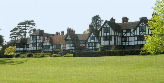
Tudor Revival architecture (also known as mock Tudor in the UK) first manifested itself in domestic architecture in the United Kingdom in the latter half of the 19th century. Based on revival of aspects that were perceived as Tudor architecture, in reality it usually took the style of English vernacular architecture of the Middle Ages that had survived into the Tudor period. The style later became an influence elsewhere, especially the British colonies. For example, in New Zealand, the architect Francis Petre adapted the style for the local climate. In Singapore, then a British colony, architects such as R. A. J. Bidwell pioneered what became known as the Black and White House. The earliest examples of the style originate with the works of such eminent architects as Norman Shaw and George Devey, in what at the time was considered Neo-Tudor design. Tudorbethan is a subset of Tudor Revival architecture that eliminated some of the more complex aspects of Jacobethan in favour of m ... [...More Info...] [...Related Items...] OR: [Wikipedia] [Google] [Baidu] |
Carmelites
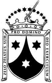
, image = , caption = Coat of arms of the Carmelites , abbreviation = OCarm , formation = Late 12th century , founder = Early hermits of Mount Carmel , founding_location = Mount Carmel , type = Mendicant order of pontifical right , status = Institute of Consecrated Life , membership = 1,979 (1,294 priests) as of 2017 , leader_title = Motto , leader_name = la, Zelo zelatus sum pro Domino Deo exercituumEnglish: ''With zeal have I been zealous for the Lord God of hosts'' , leader_title2 = General Headquarters , leader_name2 = Curia Generalizia dei CarmelitaniVia Giovanni Lanza, 138, 00184 Roma, Italia , leader_title3 = Prior General , leader_name3 = Mícéal O'Neill, OCarm , leader_title4 = Patron saints , leader_name4 = Our Lady of Mt. Carmel, Elijah , parent_organization = Catholic Church , website = ... [...More Info...] [...Related Items...] OR: [Wikipedia] [Google] [Baidu] |
Tarrytown, New York
Tarrytown is a village in the town of Greenburgh in Westchester County, New York. It is located on the eastern bank of the Hudson River, approximately north of Midtown Manhattan in New York City, and is served by a stop on the Metro-North Hudson Line. To the north of Tarrytown is the village of Sleepy Hollow (formerly "North Tarrytown"), to the south the village of Irvington and to the east unincorporated parts of Greenburgh. The Tappan Zee Bridge crosses the Hudson at Tarrytown, carrying the New York State Thruway (Interstates 87 and 287) to South Nyack, Rockland County and points in Upstate New York. The population was 11,860 at the 2020 census. History The Native American Weckquaesgeek tribe, who were closely related to the Wappinger Confederacy and further related to the Mohicans, lived in the area prior to European settlement. They fished the Hudson River for shad, oysters and other shellfish. Their principal settlement was at what is now the foot of Chur ... [...More Info...] [...Related Items...] OR: [Wikipedia] [Google] [Baidu] |
White Plains, New York
(Always Faithful) , image_seal = WhitePlainsSeal.png , seal_link = , subdivision_type = List of sovereign states, Country , subdivision_name = , subdivision_type1 = U.S. state, State , subdivision_name1 = , subdivision_type2 = List of counties in New York, County , subdivision_name2 = Westchester County, New York, Westchester , government_type = mayor-council government, Mayor-Council , leader_title = Mayor , leader_name = Thomas Roach (American politician), Tom Roach (Democratic Party (United States), D) , leader_title1 = city council, Common Council , leader_name1 = , established_title = Settled , established_date = , established_title2 = Incorporated (village) , established_date2 = , established_title3 = Incorporated (city) , established_date3 = , area_magnitude = , area_to ... [...More Info...] [...Related Items...] OR: [Wikipedia] [Google] [Baidu] |
Sayville, New York
Sayville is a hamlet and census-designated place in Suffolk County, New York, United States. Located on the South Shore of Long Island in the Township of Islip, the population of the CDP was 16,853 at the time of the 2010 census. History The earliest known inhabitants of Sayville were the Secatogue tribe of the Algonquian peoples. Sayville was founded by John Edwards (b. 1738) of East Hampton, New York. He built his home, the first in Sayville, in 1761, located at what is now the northwest corner of Foster Avenue and Edwards Street. The house was destroyed by fire in March 1913. Another man, John Greene, settled what is now known as West Sayville in 1767. The community had no formal name until 1838 when residents gathered to choose a name for their post office, which had opened on March 22, 1837. Until that time, Sayville was known informally as "over south." The townspeople held a meeting to decide on a name, and after Edwardsville and Greensville tied in a vote, one resident su ... [...More Info...] [...Related Items...] OR: [Wikipedia] [Google] [Baidu] |
Southampton (town), New York
Southampton, officially the Town of Southampton, is a Administrative divisions of New York#Town, town in southeastern Suffolk County, New York, Suffolk County, New York, partly on the South Fork, Suffolk County, New York, South Fork of Long Island. As of the 2020 United States census, 2020 U.S. census, the town had a population of 69,036. Southampton is included in the stretch of shoreline prominently known as The Hamptons. Stony Brook Southampton, Stony Brook University's Southampton campus is located in Southampton. History The town was founded in 1640, when settlers from Lynn, Massachusetts, Lynn, Massachusetts established residence on lands obtained from local Shinnecock Indian Nation. The first settlers included eight men, one woman, and a boy who came ashore at Conscience Point. These men were Thomas Halsey (1591-1679), Thomas Halsey, Edward Howell (died 1655), Edward Howell, Edmond Farrington, Allen Bread, Edmund Needham, Abraham Pierson, the elder, Abraham Pierson the ... [...More Info...] [...Related Items...] OR: [Wikipedia] [Google] [Baidu] |
National Register Of Historic Places
The National Register of Historic Places (NRHP) is the United States federal government's official list of districts, sites, buildings, structures and objects deemed worthy of preservation for their historical significance or "great artistic value". A property listed in the National Register, or located within a National Register Historic District, may qualify for tax incentives derived from the total value of expenses incurred in preserving the property. The passage of the National Historic Preservation Act (NHPA) in 1966 established the National Register and the process for adding properties to it. Of the more than one and a half million properties on the National Register, 95,000 are listed individually. The remainder are contributing resources within historic districts. For most of its history, the National Register has been administered by the National Park Service (NPS), an agency within the U.S. Department of the Interior. Its goals are to help property owners and inte ... [...More Info...] [...Related Items...] OR: [Wikipedia] [Google] [Baidu] |
Saint Benedict Joseph Labre Church (Queens, New York)
Saint Benedict Joseph Labre Parish is a historic Roman Catholic parish church complex in the Diocese of Brooklyn, located at 94-40 118th Street in Richmond Hill, Queens, New York City. Description The complex consists of the church, rectory / parsonage, school, and cloister. The church was designed in 1916 by architect Thomas Henry Poole (1860–1919) and completed in 1919. It is a large brick Romanesque-style building in the basilican plan. It features a standing seam copper-roofed dome and a bell tower. The rectory is a -story brick building built in 1939. The cloister also dates to 1939 and connects the rectory to the sanctuary. It features a 1938 statue of the patron Saint Benedict Joseph Labre. The brick school building was built in 1912 and substantially enlarged in 1938–1939. ''See also:'' It was listed on the National Register of Historic Places The National Register of Historic Places (NRHP) is the United States federal government's official list of di ... [...More Info...] [...Related Items...] OR: [Wikipedia] [Google] [Baidu] |
Saint Nicholas Avenue (Manhattan)
__NOTOC__ St. Nicholas Avenue is a major street that runs obliquely north-south through several blocks between 111th and 193rd Streets in the New York City borough of Manhattan. The route, which follows a course that is much older than the grid pattern of the Commissioners' Plan of 1811, passes through the neighborhoods of Harlem, Hamilton Heights, and Washington Heights. It is believed to follow the course of an old Indian trail that became an important road in the 17th century between the Dutch settlement of New Amsterdam and the British New England Colonies. In the post colonial era, it became the western end of the Boston Post Road. The road became a street when row housing was being built in Harlem during its rapid urban expansion following the end of the American Civil War. St. Nicholas Avenue serves as a border between the West Side of Harlem and Central Harlem. The IND Eighth Avenue Line () runs under St. Nicholas Avenue north of 121st Street as far as 168th Street, an ... [...More Info...] [...Related Items...] OR: [Wikipedia] [Google] [Baidu] |
Mount Morris Park Historic District
Mount Morris Park Historic District was designated a historic district by New York City Landmarks Preservation Commission in 1971, and is part of the larger Mount Morris Park neighborhood. It is a large 16-block area in west central Harlem. The boundaries are West 118th and West 124th Streets, Fifth Avenue, and Adam Clayton Powell Jr. Boulevard ( Seventh Avenue). "Doctor's Row" comprises the nearby stretch of West 122nd Street, Mount Morris Park West and Malcolm X Boulevard; one of the doctors of "Doctor's Row" was the father of the composer Richard Rodgers. Mount Morris Square, the core of the district, is now called Marcus Garvey Park. Early history Before the European settlements, the rocky hill of Manhattan mica-schist was used by the Native Americans as a lookout station to see over the entire island. During the American Revolutionary War, Hessian soldiers "mounted a battery" at the hill "to command the mouth of the Harlem River". Despite the 18th-century local promin ... [...More Info...] [...Related Items...] OR: [Wikipedia] [Google] [Baidu] |
Romanesque Revival Architecture
Romanesque Revival (or Neo-Romanesque) is a style of building employed beginning in the mid-19th century inspired by the 11th- and 12th-century Romanesque architecture. Unlike the historic Romanesque style, Romanesque Revival buildings tended to feature more simplified arches and windows than their historic counterparts. An early variety of Romanesque Revival style known as Rundbogenstil ("Round-arched style") was popular in German lands and in the German diaspora beginning in the 1830s. By far the most prominent and influential American architect working in a free "Romanesque" manner was Henry Hobson Richardson. In the United States, the style derived from examples set by him are termed Richardsonian Romanesque, of which not all are Romanesque Revival. Romanesque Revival is also sometimes referred to as the " Norman style" or " Lombard style", particularly in works published during the 19th century after variations of historic Romanesque that were developed by the Normans in En ... [...More Info...] [...Related Items...] OR: [Wikipedia] [Google] [Baidu] |


.jpg)