|
The Sixty-nine Stations Of The Kiso Kaidō
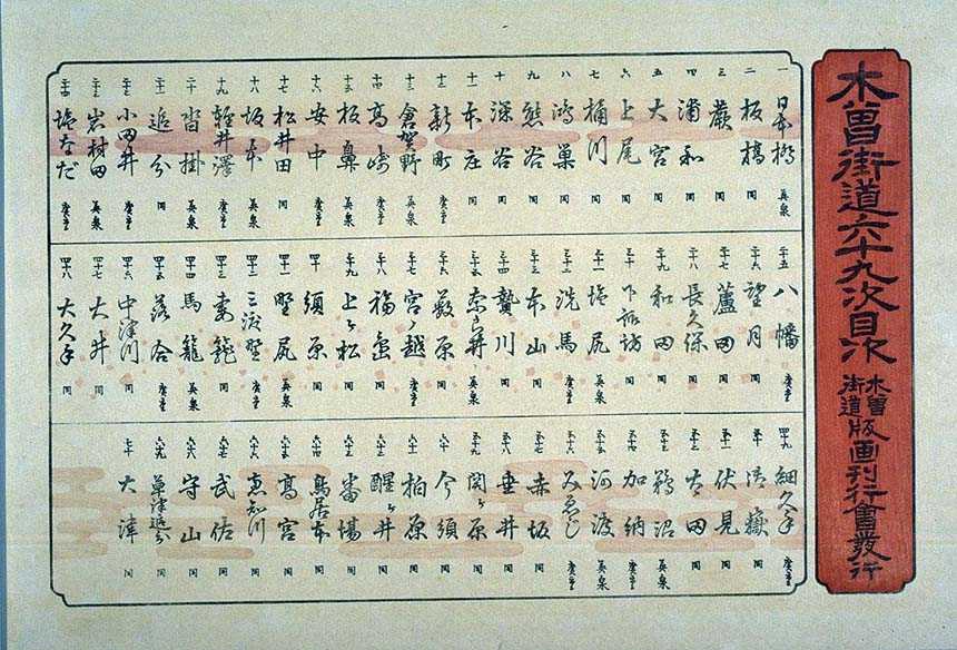
The or ''Sixty-nine Stations of the Kiso Road'', is a series of ''ukiyo-e'' works created by Utagawa Hiroshige and Keisai Eisen. There are 71 total prints in the series (one for each of the 69 post stations and Nihonbashi; Nakatsugawa-juku has two prints). The common name for the Kiso Kaidō is "Nakasendō" so the series is sometimes referred to as the ''Sixty-nine Stations of the Nakasendō''. It is a follow up to Hiroshige's ''The Fifty-three Stations of the Tōkaidō'' and he produced 47 of the prints, with Eisen being responsible for the rest.Hiroshige - Kisokaido www.hiroshige.org.uk. Accessed November 1, 2017. The series was published by Iseya Rihei (Kinjudō) from .Forrer The Naka ...
|
Shukuba
were post stations during the Edo period in Japan, generally located on one of the Edo Five Routes or one of its sub-routes. They were also called ''shuku-eki'' (宿駅). These post stations (or "post towns") were places where travelers could rest on their journey around the nation. They were created based on policies for the transportation of goods by horseback that were developed during the Nara and Heian periods. History These post stations were first established by Tokugawa Ieyasu shortly after the end of the Battle of Sekigahara. The first post stations were developed along the Tōkaidō (followed by stations on the Nakasendō and other routes). In 1601, the first of the Tōkaidō's fifty-three stations were developed, stretching from Shinagawa-juku in Edo to Ōtsu-juku in Ōmi Province. Not all the post stations were built at the same time, however, as the last one was built in 1624. The lodgings in the post stations were established for use by public officials and, ... [...More Info...] [...Related Items...] OR: [Wikipedia] [Google] [Baidu] |
Saitama Prefecture
is a landlocked prefecture of Japan located in the Kantō region of Honshu. Saitama Prefecture has a population of 7,338,536 (1 January 2020) and has a geographic area of 3,797 km2 (1,466 sq mi). Saitama Prefecture borders Tochigi Prefecture and Gunma Prefecture to the north, Nagano Prefecture to the west, Yamanashi Prefecture to the southwest, Tokyo to the south, Chiba Prefecture to the southeast, and Ibaraki Prefecture to the northeast. Saitama is the capital and largest city of Saitama Prefecture, with other major cities including Kawaguchi, Kawagoe, and Tokorozawa. Saitama Prefecture is part of the Greater Tokyo Area, the most populous metropolitan area in the world, and many of its cities are described as bedroom communities and suburbs of Tokyo with many residents commuting into the city each day. History According to ''Sendai Kuji Hongi'' (''Kujiki''), Chichibu was one of 137 provinces during the reign of Emperor Sujin. Chichibu Province was in western Saitama. ... [...More Info...] [...Related Items...] OR: [Wikipedia] [Google] [Baidu] |
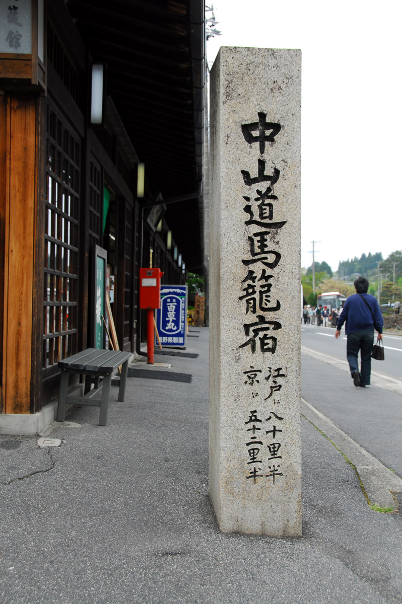
Magome-juku
was the forty-third of the sixty-nine stations of the Nakasendō connecting Edo with Kyoto in Edo period Japan. It is located in former Mino Province in what is now part of the city of Nakatsugawa, Gifu Prefecture, Japan. It was also the last of eleven stations along the Kisoji, which was the precursor to a part of the Nakasendō, running through the Kiso Valley. Gifu Sightseeing Guide: Walking Amidst History and Nature Gifu Prefecture Tourist Federation. Accessed July 10, 2007. History  Magome-juku is located in a very mountainous section of the highway betwe ...
[...More Info...] [...Related Items...] OR: [Wikipedia] [Google] [Baidu] |
Nojiri-juku (Nakasendō)
was the fortieth of the sixty-nine stations of the Nakasendō, as well as the eighth of eleven stations on the Kisoji. It is located in the present-day village of Ōkuwa, in the Kiso District of Nagano Prefecture, Japan. History Nojiri-juku was the longest post town along the Kisoji, after Narai-juku.Kisoji Shukuba-machi Series: Nojiri-juku . Higashi Nihon Denshin Denwa. Accessed July 25, 2007. Because of all the turns in the road, though, it was often called "''Nana-mawari'' (七回り)," which means "seven turns." However, there was a large fire in 1791, which destroyed much of the post town. Neighboring post towns ;Nakasendō & Kisoji : |
Yabuhara-juku
was the thirty-fifth of the sixty-nine stations of the Nakasendō, as well as the third of eleven stations on the Kisoji. It is located in the present-day village of Kiso, in the Kiso District of Nagano Prefecture, Japan. Yabuhara-juku is located shortly before the Torii Pass, which was the most difficult part of the Kisoji.Kisoji Shukuba-machi Series: Yabuhara-juku Higashi Nihon Denshin Denwa. Accessed July 30, 2007. Presently, it is known for its ''omiyage'', which are made out of the birch trees that grow nearby. Neighboring Post Towns ;Nakasendō & Kisoji : |
Narai-juku
was the thirty-fourth of the sixty-nine stations of the Nakasendō, as well as the second of eleven stations along the Kisoji.Narai-jyuku Narai-juku. Accessed September 25, 2007. It is located in the present-day city of Shiojiri, , . History  Narai-juku had the highest elevation of all t ...
[...More Info...] [...Related Items...] OR: [Wikipedia] [Google] [Baidu] |
Shiojiri-shuku
was the thirtieth of the sixty-nine stations of the Nakasendō. It is located in the central part of the present-day city of Shiojiri, Nagano Prefecture, Japan. History This area was originally built by Ōkubo Nagayasu in the Keichō era of the early Edo period. There was a shorter route along the Nakasendō that connected Shimosuwa-shuku and Niekawa-juku directly, but the route was changed to include this post town, as well as Seba-juku and Motoyama-juku, after Ōkubo's death. It eventually became the connecting post town between Shimosuwa-shuku and Seba-juku. During its most prosperous period, there were over 70 buildings in the town and it thrived as one of the ''kokudaka'' of the Matsumoto Domain. Because of its size, it was divided into "upper," "central" and "lower" portions.Shiojiri-shuku Machinami . Accessed July 16, 2007. [...More Info...] [...Related Items...] OR: [Wikipedia] [Google] [Baidu] |
Iwamurada-shuku
was the twenty-second of the sixty-nine stations of the Nakasendō. It is located in the present-day city of Saku, in Nagano Prefecture, Japan. History Originally, Iwamurada-shuku was a castle town for the Iwamurada ''Han'' and, as a post town, it never developed a proper ''honjin'', though it did have some smaller inns.Shinshū no Kaidō Tanbō: Nakasendō Ministry of Land, Infrastructure and Transport. Accessed August 10, 2007. Neighboring Post Towns ;Nakasendō : - Iwamurada-shuku -Shionada-shuku
[...More Info...] [...Related Items...] OR: [Wikipedia] [Google] [Baidu] |
Oiwake-shuku
was the twentieth of the sixty-nine stations of the Nakasendō. It is located in the present-day town of Karuizawa, in the Kitasaku District of Nagano Prefecture, Japan. History This post town was named ''Oiwake'', which means "where two roads split," because it was at this point that the Nakasendō split from the Hokkoku Kaidō. In the late 17th century, during the Genroku period, it flourished as a post town that could hold over 200 guests. There are still many remnants from the Edo period in the town today. Though not a neighboring post town, Matsuida-shuku also provides a direct connection to Oiwake-shuku along the Nakasendō, by way of a minor ''hime kaidō''. This ''hime kaidō'' allows travelers to avoid the Usuinoseki Checkpoint, one of the major checkpoints along the highway.Hiroshige - Kisokaido . w ... [...More Info...] [...Related Items...] OR: [Wikipedia] [Google] [Baidu] |
Kutsukake-shuku
was the nineteenth of the sixty-nine stations of the Nakasendō. It is located in the present-day town of Karuizawa, in the Kitasaku District of Nagano Prefecture, Japan. History This post town's name, which roughly translates to "stuck shoes," came about because it was located near the western entrance to the difficult Usui Pass The is a mountain pass that lies between Nagano and Gunma prefecture in Japan. It has served as one of the major transportation routes in central Japan since at least the eighth century. Road The pass on the ancient Tōsandō highway was d .... When there was severe weather, it was impossible for people or animals to pass. Kutsukake-shuku, along with the neighboring Karuisawa-shuku and Oiwake-shuku, was one of the ''Sengenmi Shuku'' ("three shallow passes"). In 1951, there was a large fire, which destroyed nearly all of the remaining historical buildings. All that remains of the '' honjin'' are a well and a storehouse. [...More Info...] [...Related Items...] OR: [Wikipedia] [Google] [Baidu] |
Nagano Prefecture
is a landlocked prefecture of Japan located in the Chūbu region of Honshū. Nagano Prefecture has a population of 2,052,493 () and has a geographic area of . Nagano Prefecture borders Niigata Prefecture to the north, Gunma Prefecture to the northeast, Saitama Prefecture to the east, Yamanashi Prefecture to the southeast, Shizuoka Prefecture and Aichi Prefecture to the south, and Gifu Prefecture and Toyama Prefecture to the west. Nagano is the capital and largest city of Nagano Prefecture, with other major cities including Matsumoto, Ueda, and Iida. Nagano Prefecture has impressive highland areas of the Japanese Alps, including most of the Hida Mountains, Kiso Mountains, and Akaishi Mountains which extend into the neighbouring prefectures. The abundance of mountain ranges, natural scenic beauty, and rich history has gained Nagano Prefecture international recognition as a world-class winter sports tourist destination, including hosting the 1998 Winter Olympics and a new ... [...More Info...] [...Related Items...] OR: [Wikipedia] [Google] [Baidu] |
Sakamoto-shuku
was the seventeenth of the sixty-nine stations of the Nakasendō. It is located in the present-day city of Annaka, Gunma Prefecture, Japan. History Sakamoto-shuku is located at the eastern entrance to the Usui Pass. During the Edo period, there were a total of four ''honjin'' and sub-''honjin'' combined. There were an additional 40 other buildings for travelers to use, making it a comparatively large station along the Nakasendō. Neighboring post towns ;Nakasendō :Matsuida-shuku - Sakamoto-shuku - Karuisawa-shuku was the eighteenth of the sixty-nine stations of the Nakasendō. It is located in the northern portion of the present-day town of Karuizawa, in the Kitasaku District of Nagano Prefecture, Japan. Karuisawa-shuku is from the preceding post stat ... References {{DEFAULTSORT:Sakamoto-Shuku Stations of the Nakasendō Post stations in Gunma Prefecture ... [...More Info...] [...Related Items...] OR: [Wikipedia] [Google] [Baidu] |

