|
The Four Avenues
The Four Avenues are a group of four major arterial boulevards — Bealey Avenue, Fitzgerald Avenue, Moorhouse Avenue, and either Rolleston Ave or Deans Avenue — that surround the city centre of Christchurch, New Zealand. Serving as an inner ring road, they popularly form the limits of the city centre, separating it from the city's suburbs. Almost all of the city's commercial heart lies within the approximately rectangular area formed by the four avenues. The term "within the Four Avenues" is widely used in Christchurch to refer to the central city. By extension, Christchurch as a whole is sometimes referred to as "The Four Avenues". Historically, Rolleston Avenue, rather than Deans Avenue, was regarded as the fourth of the four avenues, but reconstruction of Christchurch City Centre following the 2011 Christchurch earthquake has officially made Deans Avenue a boundary of the CBD. [...More Info...] [...Related Items...] OR: [Wikipedia] [Google] [Baidu] |
Merivale, Christchurch
Merivale is a suburb of Christchurch, New Zealand, north of the city centre. Like all suburbs in Christchurch, it has no defined boundaries and is a general area, but for the purposes of statistical analysis only, Statistics New Zealand defines it as being Heaton Street to the north, Papanui Road to the east, Harper and Bealey Avenues to the south and Rossall Street to the west, although Real Estate advertising often will claim residences outside this area, especially St Albans to the east of Papanui Road, as being Merivale due to the perceived desirability of the area. The area directly west of Rossall Street, which is called Holmwood by Statistics New Zealand, is sometimes considered part of Merivale. The area is predominantly residential. Early history Charlotte Jackson of Rugby arrived in 1851 for her two rural sections which went from Merivale Lane to Aikmans Road and from Papanui Road to Boundary Road. She named the block Merevale. Her brother-in-law, the Rev. Thomas Jac ... [...More Info...] [...Related Items...] OR: [Wikipedia] [Google] [Baidu] |
Christchurch Hospital
Christchurch Hospital is the largest tertiary hospital in the South Island of New Zealand. The public hospital is in the centre of Christchurch city, on the edge of Hagley Park, and serves the wider Canterbury region. The Canterbury District Health Board (CDHB) operates the hospital with funding from the government. Christchurch Hospital is the major trauma centre for northern and central Canterbury, and the tertiary major trauma centre for the wider Canterbury and West Coast regions. It has the busiest ED in the South Island and sees more major trauma than any other hospital in New Zealand, and all but a handful of hospitals in Australia. The Christchurch School of Medicine is on the hospital campus, the school provides teaching for fourth, fifth and sixth year medical students, and is part of the University of Otago. A new building, sitting behind the original Christchurch Hospital buildings, named ‘Waipapa’ was opened in 2020 and houses Canterbury DHB’s acute services. ... [...More Info...] [...Related Items...] OR: [Wikipedia] [Google] [Baidu] |
West Coast, New Zealand
The West Coast ( mi, Te Tai Poutini, lit=The Coast of Poutini, the Taniwha) is a regions of New Zealand, region of New Zealand on the west coast of the South Island that is administered by the West Coast Regional Council, and is known co-officially as Te Tai Poutini. It comprises the Territorial authorities of New Zealand, territorial authorities of Buller District, Grey District and Westland District. The principal towns are Westport, New Zealand, Westport, Greymouth and Hokitika. The region, one of the more remote areas of the country, is also the most sparsely populated. With a population of just 32,000 people, Te Tai Poutini is the least populous region in New Zealand, and it is the only region where the population is declining. The region has a rich and important history. The land itself is ancient, stretching back to the Carboniferous period; this is evident by the amount of carboniferous materials naturally found there, especially coal. First settled by Ngāi Tahu, Kāi T ... [...More Info...] [...Related Items...] OR: [Wikipedia] [Google] [Baidu] |
Timaru
Timaru (; mi, Te Tihi-o-Maru) is a port city in the southern Canterbury Region of New Zealand, located southwest of Christchurch and about northeast of Dunedin on the eastern Pacific coast of the South Island. The Timaru urban area is home to people, and is the largest urban area in South Canterbury, and the second largest in the Canterbury Region overall, after Christchurch. The town is the seat of the Timaru District, which includes the surrounding rural area and the towns of Geraldine, Pleasant Point and Temuka, which combined have a total population of . Caroline Bay beach is a popular recreational area located close to Timaru's main centre, just to the north of the substantial port facilities. Beyond Caroline Bay, the industrial suburb of Washdyke is at a major junction with State Highway 8, the main route into the Mackenzie Country. This provides a road link to Pleasant Point, Fairlie, Twizel, Lake Tekapo, Aoraki / Mount Cook and Queenstown. Timaru has been built ... [...More Info...] [...Related Items...] OR: [Wikipedia] [Google] [Baidu] |
Lyttelton Road Tunnel
The Lyttelton road tunnel runs through the Port Hills to connect the New Zealand city of Christchurch and its seaport, Lyttelton, New Zealand, Lyttelton. It opened in 1964 and carries just over 10,000 vehicles per day as part of New Zealand State Highway 74, State Highway 74. At , it was the longest road tunnel in New Zealand from its opening until 2 July 2017, when it was superseded by the Waterview Tunnels. While the tunnel itself was not damaged due to the February 2011 Christchurch earthquake, the Heathcote tunnel canopy was destroyed. The nearby Lyttelton Road Tunnel Administration Building, Tunnel Control Building — a Category I heritage building – suffered significant damage and was closed, before finally being demolished in 2013. Construction of a new control building was completed in 2014. History Early settler efforts When the first Europeans settled in Canterbury in the 1850s with no deepwater ports available other than on Banks Peninsula, they had to tran ... [...More Info...] [...Related Items...] OR: [Wikipedia] [Google] [Baidu] |
Christchurch International Airport
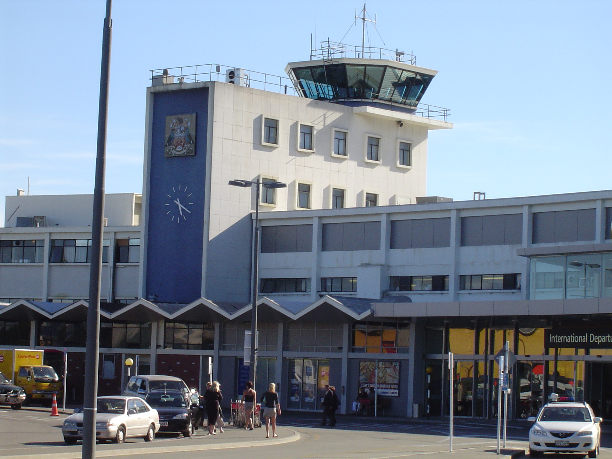
Christchurch Airport is the main airport that serves Christchurch, New Zealand. It is located to the northwest of the city centre, in the suburb of Harewood. Christchurch (Harewood) Airport officially opened on 18 May 1940 and became New Zealand's first international airport on 16 December 1950. It is the third busiest airport in New Zealand, after Auckland and Wellington, by both annual passengers and aircraft movements. Christchurch and Auckland are the only airports in New Zealand that regularly handle Boeing 747 and Airbus A380 aircraft. The airport is curfew free, operating 24 hours a day. The prevailing wind in Christchurch is from the north-east and to a lesser extent from the south-west, but the city is also affected by Canterbury's nor'wester foehn wind. As a result, the airport has two perpendicular runways: a primary runway (02/20) oriented with the north-easterly and south-westerly prevailing winds, and a secondary runway (11/29) oriented for use during nor'we ... [...More Info...] [...Related Items...] OR: [Wikipedia] [Google] [Baidu] |
Addington, New Zealand
Addington is a major suburb of Christchurch, New Zealand. It is sited south-west of the city centre. As an inner city suburb, Addington has a mix of residential, retail and light industrial properties. History 19th century For the first decade after the founding of Christchurch in 1850, Addington was farmland, consisting of large rural sections. In the early 1860s, the railway was surveyed through the area and subdivision of the larger sections began. Factories moved in; wool and grain sheds opened; and with the industry came working class residential settlement. Development continued throughout the 19th century: the city's sale yards opened in 1874 and the railway workshops were moved to Addington in 1880. By the time the show grounds were opened in 1887, Addington had become an important suburb in the industrial and social life of Christchurch. In 1874 the Addington Prison was built in Lincoln Road; it closed in 1999 and the Mountfort cell block and remaining perimeter w ... [...More Info...] [...Related Items...] OR: [Wikipedia] [Google] [Baidu] |
Sydenham, New Zealand
Sydenham is an inner suburb of Christchurch, New Zealand, two kilometres south of the city centre, on and around the city's main street, Colombo Street. It is a residential, retail and light industrial suburb. History While the Sydenham area had seen development from the earliest days of European settlement in Christchurch, it was originally split between the Heathcote and Spreydon road districts instead of being a locality of its own right. The name Sydenham originally referred only to "Sydenham House", a crockery and china shop in the area so named by its owner, Charles Prince, after the north-west Kent town of Sydenham, which is now a London suburb within the London Borough of Lewisham. At a meeting regarding the formation of a borough council for the area, brought on by growth in the area, surveyor and future mayor Charles Allison advocated for the area to be named Sydenham, after the shop. The name was agreed upon, and Sydenham Borough Council came into existence in 1876. ... [...More Info...] [...Related Items...] OR: [Wikipedia] [Google] [Baidu] |
Linwood, New Zealand
Linwood is an inner suburb of the city of Christchurch, New Zealand. It lies to the east of the city centre, mostly between Ferry Road and Linwood Avenue, two of the major arterial roads to the eastern suburbs of Christchurch. History Linwood was given its name by Joseph Brittan, who purchased rural section 300 in Avonside. The adjoining rural section 301 was to be part of the farm, but the right was sold but probably farmed with rural section 300 and was eventually bought back by his son in 1874. To this was added a small part of section 30 to give access in 1855 and 21-year lease for the adjoining sections in 1862 giving a total area of about 380 acres (about 150ha). He called the farm Linwood, as he was from Linwood, Hampshire. Brittan built Linwood House at 30 Linwood Avenue in 1857, which stood there until demolition following the February 2011 Christchurch earthquake. Christchurch lacked an accessible port before the construction of the Lyttelton Rail Tunnel in 1867. Th ... [...More Info...] [...Related Items...] OR: [Wikipedia] [Google] [Baidu] |
Hereford Street
Hereford () is a cathedral city, civil parish and the county town of Herefordshire, England. It lies on the River Wye, approximately east of the border with Wales, south-west of Worcester and north-west of Gloucester. With a population of 53,112 in 2021 it is by far the largest settlement in Herefordshire. An early town charter from 1189, granted by Richard I of England, describes it as "Hereford in Wales". Hereford has been recognised as a city since time immemorial, with the status being reconfirmed as recently as October 2000. It is now known chiefly as a trading centre for a wider agricultural and rural area. Products from Hereford include cider, beer, leather goods, nickel alloys, poultry, chemicals and sausage rolls, as well as the famous Hereford breed of cattle. Toponymy The Herefordshire edition of Cambridge County Geographies states "a Welsh derivation of Hereford is more probable than a Saxon one" but the name "Hereford" is also said to come from the Anglo-S ... [...More Info...] [...Related Items...] OR: [Wikipedia] [Google] [Baidu] |
Gloucester Street
Gloucester Street is a major urban street in central Christchurch in the South Island of New Zealand. It runs for approximately from a junction with Rolleston Avenue, directly opposite Christ's College at its western end to the suburbs of Linwood and Avonside in the east. For the majority of its length it runs due west-east, with the section from the central city's eastern edge to Linwood veering to the northeast. The street lies parallel with and one block to the north of Worcester Street. The street's course is interrupted for one block by the Convention Centre Precinct. As it crosses Linwood Avenue, the street turns northeast and narrows, becoming a suburban arterial road. It then turns north, ending at the Avon River / Ōtākaro. A bridge, Dallington Bridge, crosses the river at this point, and the street continues as Gayhurst Road through a former residential area which was razed as a result of the 2011 Christchurch Earthquake. Important buildings Major sites on or ad ... [...More Info...] [...Related Items...] OR: [Wikipedia] [Google] [Baidu] |

.jpg)


