|
Thames Down Link
The Thames Down Link is a official walking route linking the Thames Path and the North Downs Way. It starts in the town centre of Kingston upon Thames and finishes at Box Hill & Westhumble railway station. Name The path is so called as it connects the River Thames with the North Downs, the hill range which is to the south as far as the western border of Surrey. Sources The route starts at Kingston upon Thames town centre and finishes at Box Hill & Westhumble railway station. The path follows as closely as possible the banks of the Hogsmill River through the urban fringes of Kingston passing Berrylands railway station. South of this it is more rural following the banks of the river south through fields to the A3 and under the South West railway line. A pavemented section by roads passes through Old Malden. After crossing the A240 near Tolworth centre the walk leaves the Hogsmill River and continues on a narrow green strip between houses and beside a stream to reach the Horton ... [...More Info...] [...Related Items...] OR: [Wikipedia] [Google] [Baidu] |
Ashtead Common
Ashtead Common, nearly 495 acres (c. 200 ha), is a wooded area open to the public, to the north of the village of Ashtead in Surrey, England. It is owned and managed by the City of London Corporation, after being bought by the City due to concern in the 1870s that access to the open countryside around London was being threatened. 180.5 ha of the common is a National Nature Reserve. Together with Epsom Common it forms part of a larger area of open countryside called Epsom and Ashtead Commons, which is designated a Site of Special Scientific Interest (SSSI). Background Ashtead Common has been part of the Epsom and Ashtead Commons SSSI since 1955 due to its community of breeding birds. It has also been a National Nature Reserve since 1995 because of the wood of decaying ancient trees and the rare invertebrates that live in it. It contains a wooded common with over 2,300 pollarded oaks, between 300 and 400 years old. These provide a habitat for many rare and endangered deadw ... [...More Info...] [...Related Items...] OR: [Wikipedia] [Google] [Baidu] |
Berrylands Railway Station
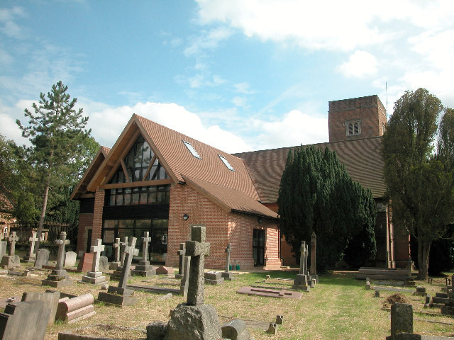
Berrylands railway station is a National Rail station in the borough of Kingston upon Thames, London. It is south-west of and is situated between and . Location Berrylands, operated by South Western Railway, is on the South West Main Line. Normally only Hampton Court Branch trains serve it, but in service disruptions Guildford via Cobham trains make special stops at Berrylands, New Malden. The station is in Travelcard Zone 5. The station is on the elevated section of the main line, where it crosses both Norbiton Common and the Hogsmill River, a tributary of the River Thames. Construction It was opened on 16 October 1933 to serve large housing developments, which gave the station its name. 90% of the cost of the station was financed by the local developers to enhance the attractiveness of the new estate to commuters. A modern ground level station (1969) is connected by stairs to the platforms, which are on the outer tracks of the four-track main line. Berrylands is ... [...More Info...] [...Related Items...] OR: [Wikipedia] [Google] [Baidu] |
London Loop
The London Outer Orbital Path — more usually the "London LOOP" — is a 150-mile (242 km) signed walk along public footpaths, and through parks, woods and fields around the edge of Outer London, England, described as "the M25 for walkers". The walk begins at Erith on the south bank of the River Thames and passes clockwise through Crayford, Petts Wood, Coulsdon, Banstead, Ewell, Kingston upon Thames, Uxbridge, Elstree, Cockfosters, Chingford, Chigwell, Grange Hill and Upminster Bridge before ending at Purfleet, almost directly across the Thames from its starting point. Between these settlements the route passes through green buffers and some of the highest points in Greater London. History The walk was first proposed at a meeting between The Ramblers and the Countryside Commission in 1990. It was given an official launch at the House of Lords in 1993. The first section was opened on 3 May 1996, with a ceremony on Farthing Downs, Coulsdon. Other sections fol ... [...More Info...] [...Related Items...] OR: [Wikipedia] [Google] [Baidu] |
Long-distance Footpaths In The UK
There are hundreds of long-distance footpaths in the United Kingdom designated in publications from public authorities, guidebooks and OS maps. They are mainly used for hiking and walking in the United Kingdom, walking, but some may also be used, in whole or in part, for mountain biking and horse riding. Most are in rural landscapes, in varying terrain, some passing through National Parks and Area of Outstanding Natural Beauty, Areas of Outstanding Natural Beauty. There is no formal definition of a long-distance path, though the British Long Distance Walkers Association defines one as a route "20 miles [32 km] or more in length and mainly off-road." They usually follow existing Rights of way in the United Kingdom, rights of way, often over private land, joined together and sometimes Trail blazing, waymarked to make a named route. Generally, the surface is not specially prepared, with rough ground, uneven surfaces and stiles, which can cause accessibility issues for people with disa ... [...More Info...] [...Related Items...] OR: [Wikipedia] [Google] [Baidu] |
Stane Street (Chichester)
Stane Street is the modern name of the Roman road in southern England that linked ''Londinium'' (London) to ''Noviomagus Reginorum'' (Chichester). The exact date of construction is uncertain; however, on the basis of archaeological artefacts discovered along the route, it was in use by 70 AD and may have been built in the first decade of the Roman occupation of Britain (as early as 43–53 AD). Stane Street shows clearly the engineering principles that the Romans used when building roads. A straight-line alignment from London Bridge to Chichester would have required steep crossings of the North Downs, Greensand Ridge and South Downs. The road was therefore designed to exploit a natural gap in the North Downs cut by the River Mole and to pass to the east of the high ground of Leith Hill, before following flatter land in the River Arun valley to Pulborough. The direct survey line was followed only for the northernmost from London to Ewell. At no point does the ro ... [...More Info...] [...Related Items...] OR: [Wikipedia] [Google] [Baidu] |
M25 Motorway
The M25 or London Orbital Motorway is a major road encircling most of Greater London. The motorway is one of the most important roads in the UK and one of the busiest. Margaret Thatcher opened the final section in 1986, making the M25 the longest ring road in Europe upon opening. The Dartford Crossing completes the orbital route but is not classed as motorway; it is classed as a trunk road and designated as the A282. In some cases, including notable legal contexts such as the Communications Act 2003, the M25 is used as a ''de facto'' alternative boundary for Greater London. In the 1944 ''Greater London Plan'', Patrick Abercrombie proposed an orbital motorway around London. This evolved into the London Ringways project in the early 1960s, and by 1966, planning had started on two projects, Ringway 3 to the north and Ringway 4 to the south. By the time the first sections opened in 1975, it was decided the ringways would be combined into a single orbital motorway. The M25 was on ... [...More Info...] [...Related Items...] OR: [Wikipedia] [Google] [Baidu] |
Sutton And Mole Valley Lines
The Sutton and Mole Valley lines were constructed between 1847 and 1868 by the London, Brighton and South Coast Railway, the London and South Western Railway and the LBSCR-sponsored Horsham, Dorking and Leatherhead Railway. Services Services include commuter services in South London, Surrey and West Sussex operated by Southern, usually from London Victoria to Horsham via Sutton and Dorking. Some Southern services in peak hours from call at and diverge at Leatherhead and serve Effingham Junction and Guildford via the New Guildford Line. The South Western Railway services are operated by Class 455/7s, 455/8s and 455/9s. The Southern services use the same type of train, but sometimes instead. Southern previously used Class 456 trains but these were transferred to South West Trains in March 2014. SWT re-released these trains on the line in late 2014, but they were withdrawn in 2022. South Western Railway operates services between London Waterloo and Leatherhead via Ra ... [...More Info...] [...Related Items...] OR: [Wikipedia] [Google] [Baidu] |
West Park Hospital, Epsom
West Park Hospital (sometimes erroneously referred to as West Park Asylum) was a large psychiatric hospital in Epsom, Surrey. History Origins The hospital seems to have been so-called because of its location to the west of the landscaped parkland formerly associated with Horton Manor (later the Manor Hospital). Although sometimes called an ' asylum' by urban explorers and the media, West Park was never officially termed as such, having opened as West Park Mental Hospital in 1923. The term had largely fallen out of favour by the 1920s and was made obsolete in law by the Mental Treatment Act 1930. Design and construction The hospital was designed by William C. Clifford-Smith (architect to the London County Council), who was also involved in the design of nearby St Ebba's and The Manor Hospitals. The hospital had been in planning since 1906, and by 1917 it was largely complete; however, the outbreak of war postponed opening until 1921. The hospital was the last great London mental ... [...More Info...] [...Related Items...] OR: [Wikipedia] [Google] [Baidu] |
Horton Country Park
Horton Country Park is a Local Nature Reserve north-west of Epsom in Surrey. It is owned and managed by Epsom and Ewell Borough Council. The park is a wooded recreation and amenities area occupying the east of a narrow upland watershed between two tributaries. As such, the summit being the parish divide, it is in traditional terms, within Epsom parish and occupies land due west of the town, and due east of the semi-rural, semi-urban London district of Chessington. Part of the area is occupied by Hobbledown Children's Farm, which contains various folkloric themed adventure playgrounds and a small zoo hosting domestic farm animals, and exotics such as meerkat, nilgai, emu and Bactrian camel. The farm is not open to adults without children. The Horton Light Railway used to run through this land from Ewell West railway station to the five psychiatric hospitals owned by the London County Council, known as the Epsom Cluster. Parts of the landscaped grounds of these hospitals ha ... [...More Info...] [...Related Items...] OR: [Wikipedia] [Google] [Baidu] |
Old Malden
Old Malden is a ward of the Royal Borough of Kingston upon Thames in southwest London, south west of Charing Cross. Malden Manor is an alternative name for part of Old Malden, popularised by the railway company that made up this name for its station here. History The area has a long history as the ancient parish of Malden, derived from the Old English ''mæl duna'', meaning 'the cross on the hill'. Malden appears in ''Domesday Book'' of 1086 as ''Meldone'', held partly by William de Wateville and partly by Robert de Wateville. Its domesday assets were: 4 hides and 3 virgates; 1 chapel, 1 mill worth 12s, 6½ ploughs, of meadow, woodland worth 1 hog out of 7 hogs. It rendered £7 12s 0d. St John the Baptist Church, close to the Hogsmill, is a Grade II listed building. The medieval church was built by Walter de Merton, Bishop of Rochester. It comprised nave, chancel and west tower. The flint south and east walls of the chancel survive. In 1611 the chancel's old fli ... [...More Info...] [...Related Items...] OR: [Wikipedia] [Google] [Baidu] |
South West Main Line
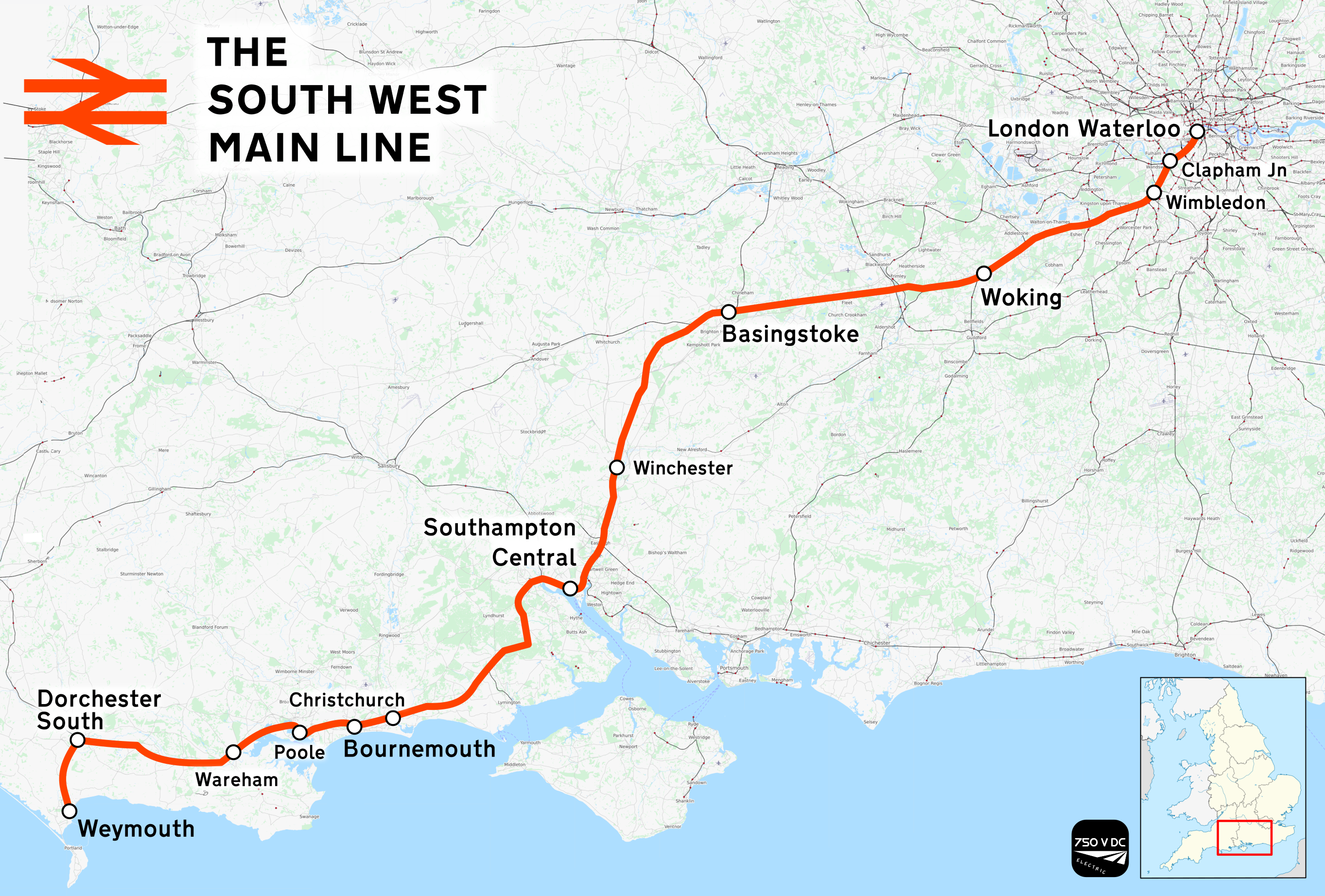
The South West Main Line (SWML) is a 143-mile (230 km) major railway line between Waterloo station in central London and Weymouth on the south coast of England. A predominantly passenger line, it serves many commuter areas including south western suburbs of London and the conurbations based on Southampton and Bournemouth. It runs through the counties of Surrey, Hampshire and Dorset. It forms the core of the network built by the London and South Western Railway, today mostly operated by South Western Railway. Network Rail refers to it as the South West Main Line. Operating speeds on much of the line are relatively high, with large stretches cleared for up to running. The London end of the line has as many as eight tracks plus the two Windsor Lines built separately, but this narrows to four by and continues this way until Worting Junction west of , from which point most of the line is double track. A couple of miles from the Waterloo terminus, the line runs briefly al ... [...More Info...] [...Related Items...] OR: [Wikipedia] [Google] [Baidu] |
A3 Road
The A3, known as the Portsmouth Road or London Road in sections, is a major road connecting the City of London and Portsmouth passing close to Kingston upon Thames, Guildford, Haslemere and Petersfield. For much of its length, it is classified as a trunk road and therefore managed by National Highways. Almost all of the road has been built to dual carriageway standards or wider. Apart from bypass sections in London, the road travels in a southwest direction and, after Liss, south-southwest. Close to its southerly end, motorway traffic is routed via the A3(M), then either the east–west A27 or the Portsmouth-only M275 which has multiple lanes leading off the westbound A27 — for non-motorway traffic, the A3 continues into Portsmouth alongside the A3(M), mostly as a single carriageway in each direction through Waterlooville and adjoining small towns. The other section of single carriageways is through the urban environs of Battersea, Clapham and Stockwell towards ... [...More Info...] [...Related Items...] OR: [Wikipedia] [Google] [Baidu] |


