|
Tewkesbury Rural District
Tewkesbury Rural District was from 1894 to 1935 a rural district in the southwestern part of the Midlands in England. It had the unusual feature of including territory from the two neighbouring administrative counties of Gloucestershire and Worcestershire until boundary changes in 1933 placed the entire district in Gloucestershire.Youngs 1979, p. 612.Youngs 1991, p. 764. Formation The rural district was formed by the Local Government Act 1894 as successor to the Tewkesbury Rural Sanitary District. A directly elected rural district council (RDC) replaced the rural sanitary authority, which consisted of the poor law guardians for the area. The district did not include the town of Tewkesbury which was a separate municipal borough. Parishes The district comprised the following civil parishes: Abolition The district was abolished in 1935, and its area was redistributed. Most () passed to Cheltenham Rural District; four parishes (Chaceley, Forthampton, Hasfield Hasfield is a civ ... [...More Info...] [...Related Items...] OR: [Wikipedia] [Google] [Baidu] |
Tewkesbury
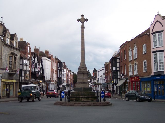
Tewkesbury ( ) is a medieval market town and civil parish in the north of Gloucestershire, England. The town has significant history in the Wars of the Roses and grew since the building of Tewkesbury Abbey. It stands at the confluence of the River Severn and the River Avon, and thus became an important trading point, which continued as railways and later M5 and M50 motorway connections were established. The town gives its name to the Borough of Tewkesbury, due to the earlier governance by the Abbey, yet the town is the second largest settlement in the Borough. The town lies on border with Worcestershire, identified largely by the Carrant Brook (a tributary of the River Avon). The name Tewkesbury is thought to come from Theoc, the name of a Saxon who founded a hermitage there in the 7th century, and in the Old English language was called '. Toulmin Smith L., ed. 1909, ''The Itinerary of John Leland'', London, IV, 150 An erroneous derivation from Theotokos (the Greek title of Ma ... [...More Info...] [...Related Items...] OR: [Wikipedia] [Google] [Baidu] |
Boddington, Gloucestershire
Boddington is a village and parish near Cheltenham. The population taken at the United Kingdom Census 2011, 2011 census was 266. It is home to RAF Boddington. References External links Villages in Gloucestershire Borough of Tewkesbury {{Gloucestershire-geo-stub ... [...More Info...] [...Related Items...] OR: [Wikipedia] [Google] [Baidu] |
Oxenton
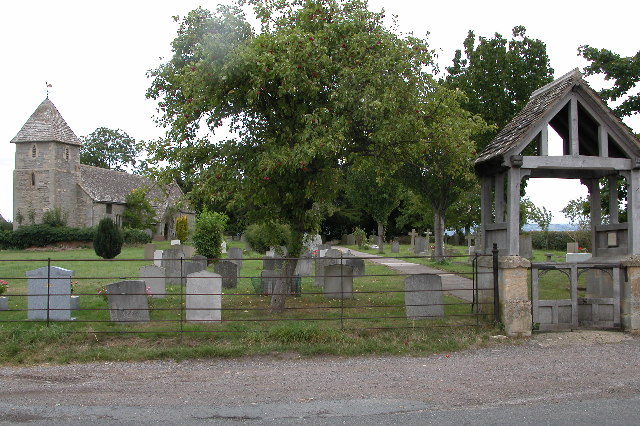
Oxenton is a village and civil parish north east of Gloucester, in the Tewkesbury district, in the county of Gloucestershire, England. In 2011 the parish had a population of 162. The parish touches Alderton, Ashchurch Rural, Gotherington, Teddington and Stoke Orchard. It is on the west side of Oxenton Hill, a northern outlier of the Cotswolds. Oxenton has a parish meeting. Landmarks There are 22 listed buildings in Oxenton. Oxenton has a church called St John the Baptist and a village hall. History The name "Oxenton" means 'Ox hill'. Oxenton was recorded in the Domesday Book Domesday Book () – the Middle English spelling of "Doomsday Book" – is a manuscript record of the "Great Survey" of much of England and parts of Wales completed in 1086 by order of King William I, known as William the Conqueror. The manus ... as ''Oxendone''. On 1 April 1935 Woolstone parish was abolished and merged with Oxenton. References Villages in Gloucestershire Civil parish ... [...More Info...] [...Related Items...] OR: [Wikipedia] [Google] [Baidu] |
Overbury
Overbury is a village and civil parish in Worcestershire, England, midway between Evesham and Tewkesbury south of Bredon Hill. The manor of Overbury was purchased by the banking family of Martin in the 18th century from the Parsons family, members of whom also owned neighbouring Kemerton Court. The Martins rebuilt Overbury Court in c.1740, and it is still occupied by their descendants in 2018. In 2014, Roman Roman or Romans most often refers to: *Rome, the capital city of Italy *Ancient Rome, Roman civilization from 8th century BC to 5th century AD *Roman people, the people of ancient Rome *'' Epistle to the Romans'', shortened to ''Romans'', a lette ... skeletons were found at Overbury Primary School when extensions to the school were being built. Conderton Camp Conderton Camp, to the north of the village, is a scheduled monument. Kemerton Camp is also on Bredon Hill and is an Iron Age Hill Fort, brought to a "violent end" by the Romans and left abandoned for most of the ... [...More Info...] [...Related Items...] OR: [Wikipedia] [Google] [Baidu] |
Leigh, Gloucestershire
Leigh is a village and civil parish in the district of Tewkesbury, in the county of Gloucestershire, England. As of 2019, it has a population of 325. History The name "Leigh" means 'The wood/clearing'. Leigh was recorded in the Domesday Book Domesday Book () – the Middle English spelling of "Doomsday Book" – is a manuscript record of the "Great Survey" of much of England and parts of Wales completed in 1086 by order of King William I, known as William the Conqueror. The manusc ... as ''Lalege''. References External links Villages in Gloucestershire Civil parishes in Gloucestershire Borough of Tewkesbury {{Gloucestershire-geo-stub ... [...More Info...] [...Related Items...] OR: [Wikipedia] [Google] [Baidu] |
Kemerton
Kemerton is a village and civil parish in Worcestershire in England. It lies at the extreme south of the county in the local government district of Wychavon. Until boundary changes in 1931, it formed part of neighbouring Gloucestershire, and it remains in the Diocese of Gloucester. The northern half of the parish lies within the Cotswolds Area of Outstanding Natural Beauty. The parish is approximately 5.8 km (3.6 miles) long by 1.2 km (0.7 miles) wide, and encompasses approximately . It descends from the summit of Bredon Hill in the north, (elevation 300 m / 981 ft) to the Carrant Brook in the south (elevation 20 m / 65 ft). The north and south parish boundaries are recorded in a Saxon charter of the 8th century. Notable historic features include ''Kemerton Camp'', an Iron Age hill fort surmounting Bredon Hill, thought to have been vacated suddenly after a considerable battle. On the fort's south rampart is a two-storey stone tower known as ''Parsons F ... [...More Info...] [...Related Items...] OR: [Wikipedia] [Google] [Baidu] |
Forthampton
Forthampton is a village in Gloucestershire, England The village is located three miles from the market town of Tewkesbury and features "a great number of interesting buildings", fine views, several duck ponds, a church, a collection of thatched cottages and farmsteads, a village hall and a village club. Forthampton was designated a Conservation Area in 2003 due to its special architectural and historic interest, character and appearance which it was desirable to preserve and enhance. Notable features of the village include extensive historic buildings clustered around farm houses situated at the centre of the village, the many roadside ponds and grass verges around and between buildings and significant panoramic views. The village forms a wide arc on rising, elevated ground well above the flood-plain of the Severn, from Hill End on the south to Sezincote on the east. Near the crown of the arc is the greatest concentration of houses and the church. The centre of the village is a ... [...More Info...] [...Related Items...] OR: [Wikipedia] [Google] [Baidu] |
Elmstone Hardwicke
Elmstone Hardwicke is a village and sizeable parish north-west of Cheltenham in Gloucestershire, England. St Mary Magdelene Church may be considered the hub of the village; its location is . The church has a 9th-century carved stone head which is ornamented like the font at Deerhurst. Elmstone Hardwicke is in the borough of Tewkesbury, the Cheltenham post town, and on the Coombe Hill, Cheltenham, telephone exchange. Nearby villages include Uckington, Stoke Orchard Stoke Orchard is a village or hamlet north-west of Cheltenham in Gloucestershire, England. Stoke Orchard was formerly home to the Coal Research Establishment of the National Coal Board, which moved onto the site of a Ministry for Aircraft Prod ..., and Tredington. Elmstone Hardwicke shares a village hall with Uckington. History ''The National Gazetteer'' (1868): Elmstone-Hardwicke has an interesting History with regard to the use of its land. Prior to the mid 18th century, most farmers in England ro ... [...More Info...] [...Related Items...] OR: [Wikipedia] [Google] [Baidu] |
Deerhurst
Deerhurst is a village and civil parish in Gloucestershire, England, about southwest of Tewkesbury. The village is on the east bank of the River Severn. The parish includes the village of Apperley and the hamlet of Deerhurst Walton. The 2011 Census recorded the parish's population as 906, the majority of whom live in Apperley. The place-name is derived from Old English and means "deer-wood". It was spelt ''Deorhyrst'' in AD 804, ''Dorhirst'' in about 1050 and ''Derherste'' in the Domesday Book in 1086. Geography The parish has an area of about , bounded by the Severn to the west, the A38 road to the east and Coombe Hill Canal to the south. The parish is low-lying and much of it is repeatedly flooded. After serious flooding in 1947 several cottages were abandoned and demolished. Deerhurst was inundated again by the floods of 2007. Priory and parish church By AD 804 there was a Benedictine monastery at Deerhurst, which also held the manor. In about 1060 King Edward the Con ... [...More Info...] [...Related Items...] OR: [Wikipedia] [Google] [Baidu] |
Evesham Rural District
Evesham () is a market town and parish in the Wychavon district of Worcestershire, in the West Midlands region of England. It is located roughly equidistant between Worcester, Cheltenham and Stratford-upon-Avon. It lies within the Vale of Evesham, an area comprising the flood plain of the River Avon, which has been renowned for market gardening. The town centre, situated within a meander of the river, is subjected regularly to flooding. The 2007 floods were the most severe in recorded history. The town was founded around an 8th-century abbey, one of the largest in Europe, which was destroyed during the Dissolution of the Monasteries, with only Abbot Lichfield's Bell Tower remaining. During the 13th century, one of the two main battles of England's Second Barons' War took place near the town, marking the victory of Prince Edward, who later became King Edward I; this was the Battle of Evesham. History Evesham is derived from the Old English ''homme'' or ''ham'', an ... [...More Info...] [...Related Items...] OR: [Wikipedia] [Google] [Baidu] |
Conderton
Conderton is a small hamlet in the Wychavon district of Worcestershire, England. Toponymy The name Conderton is derived from the Old English ''Cantware-tūn'', meaning "Farmstead of the Kent dwellers or Kentishmen". It has been recorded as ''Cantuaretun'' (875) and ''Canterton'' (1201). History There is evidence of Roman activity within the area, shown by the presence of samian pottery in a nearby site. The earliest known record of Conderton is in an Anglo-Saxon charter of 875, where it is grouped together with Overbury and Pendock. Land in the area was granted to St Mary's minster, Worcester, by Ceolwulf II of Mercia. Conderton is not mentioned within the Domesday Book, but is assumed to still be connected to Overbury. Governance Conderton is primarily governed by Overbury Parish Council. It is then governed by Wychavon District Council. It falls within the West Worcestershire constituency. Geography Conderton is located on the south side of Bredon Hill Bredon Hill ... [...More Info...] [...Related Items...] OR: [Wikipedia] [Google] [Baidu] |
Chaceley
Chaceley or Chaseley is a village and civil parish north of Gloucester, in the Tewkesbury district, in the county of Gloucestershire, England. In 2011 the parish had a population of 125. The parish touches Deerhurst, Eldersfield, Forthampton, Tewkesbury and Tirley. Landmarks There are 20 listed buildings in Chaceley. Chaceley has a church called St John the Baptist and a village hall. History The name "Chaceley" may originate as or ; 'wood' or , 'yew wood'. Chaceley was "Chaddeslcia" in the 12th century, "Chaddeslega" in the 13th century and "Chaseley" in the 17th century. On 1931 the parish was transferred from Worcestershire Worcestershire ( , ; written abbreviation: Worcs) is a county in the West Midlands of England. The area that is now Worcestershire was absorbed into the unified Kingdom of England in 927, at which time it was constituted as a county (see His ... to Gloucestershire. On 1 April 1965 44 acres were transferred to Eldersfield parish. Reference ... [...More Info...] [...Related Items...] OR: [Wikipedia] [Google] [Baidu] |


