|
Tengboche
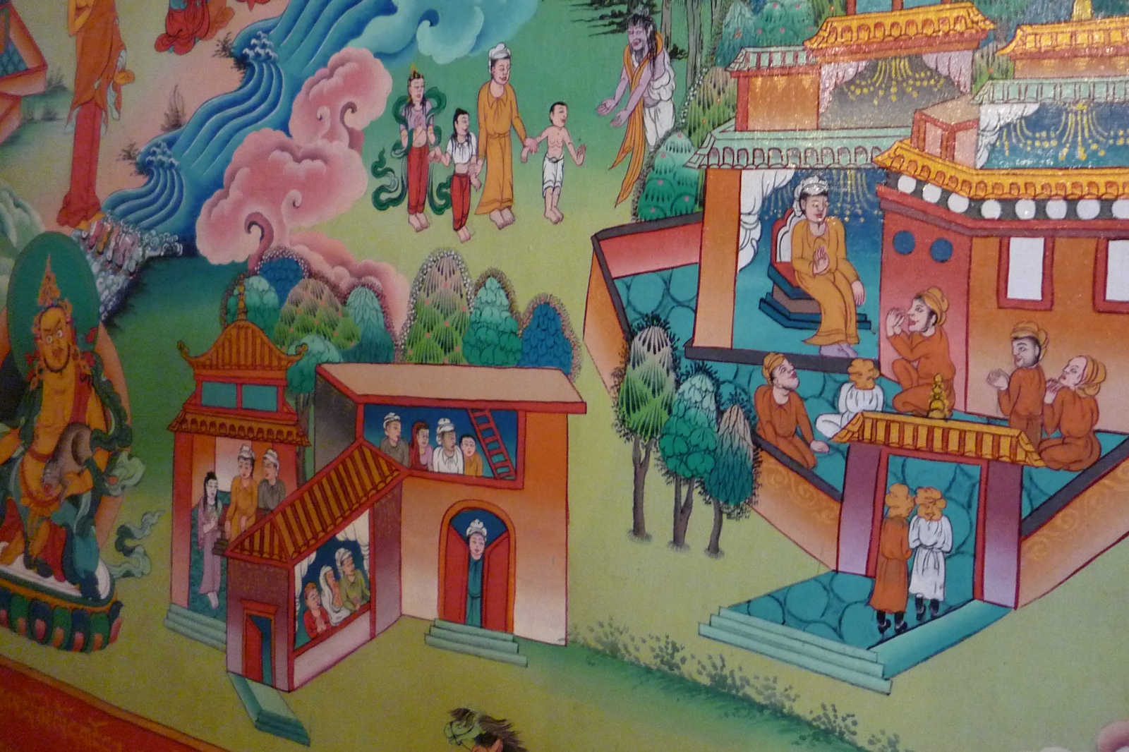
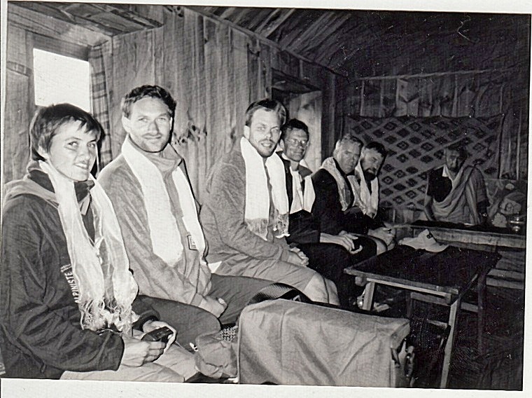
Tengboche (or Thyangboche) is a village in Khumbu Pasanglhamu rural municipality in the Khumbu subregion of Province No. 1 in Nepal, located at . In the village is an important Buddhist monastery, Tengboche Monastery, which is the largest gompa in the Khumbu region. The structure was built in 1923. In 1934, it was destroyed by an earthquake but subsequently rebuilt. It was destroyed again by a fire in 1989, and again rebuilt with the help of volunteers and the provision of foreign aid. Tengboche has a panoramic view of the Himalayan mountains, including the well-known peaks of Tawache, Everest, Nuptse, Lhotse, Ama Dablam, and Thamserku. Tenzing Norgay, the first man to reach the summit of Mount Everest with Sir Edmund Hillary, was born in the area in the village of Thani and was once sent to Tengboche Monastery to be a monk. History The Khumbu valley, where Tengboche is located, came under the influence of Buddhism about 350 years ago. Ancient scriptures of Tibet refer to this ... [...More Info...] [...Related Items...] OR: [Wikipedia] [Google] [Baidu] |
Tengboche Monastery
Tengboche Monastery (or Thyangboche Monastery), also known as Dawa Choling Gompa, in the Tengboche village in Khumjung in the Khumbu region of eastern Nepal is a Tibetan Buddhist monastery of the Sherpa community. Situated at , the monastery is the largest gompa in the Khumbu region of Nepal. It was built in 1916 by Lama Gulu with strong links to its mother monastery known as the Rongbuk Monastery in Tibet. In 1934, it was destroyed by an earthquake and was subsequently rebuilt. In 1989, it was destroyed for a second time by a fire and then rebuilt with the help of volunteers and international assistance. Tengboche monastery is amidst the Sagarmatha National Park (a UNESCO World Heritage Site of "outstanding universal value”), draped with a panoramic view of the Himalayan Mountains, including the well-known peaks of Tawache, Everest, Nuptse, Lhotse, Ama Dablam, and Thamserku. Tengboche is the terminus site of the "Sacred Sites Trail Project" of the Sagarmatha National Park ... [...More Info...] [...Related Items...] OR: [Wikipedia] [Google] [Baidu] |
Tenzing Norgay
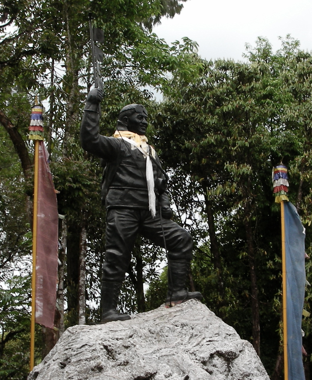
Tenzing Norgay (; ''tendzin norgyé''; perhaps 29 May 1914 – 9 May 1986), born Namgyal Wangdi, and also referred to as Sherpa Tenzing, was a Nepali-Indian Sherpa mountaineer. He was one of the first two people known to reach the summit of Mount Everest, which he accomplished with Edmund Hillary on 29 May 1953. ''Time'' named Norgay one of the 100 most influential people of the 20th century. Early life There are conflicting accounts of Tenzing's early life. In his autobiography, he wrote that he was a Sherpa born and raised in Tengboche, Khumbu, in northeastern Nepal.Tenzing & Ullman In a 1985 interview with All India Radio, he said his parents came from Tibet, but that he was born in Nepal. According to many later accounts, including a book co-written by his son Jamling Tenzin Norgay, he was born in Tibet, at Tse Chu in the Kama Valley, and grew up in Thame. He spent his early childhood in Kharta, near the north of the country. Norgay went to Nepal as a child to ... [...More Info...] [...Related Items...] OR: [Wikipedia] [Google] [Baidu] |
Sherpa People
The Sherpa are one of the Tibetan ethnic groups native to the most mountainous regions of Nepal, Tingri County in the Tibet Autonomous Region and the Himalayas. The term ''sherpa'' or ''sherwa'' derives from the Sherpa language words ("east") and ("people"), which refer to their geographical origin of eastern Tibet. Most Sherpa people live in the eastern regions of Nepal and Tingri County, though some live farther west in the Rolwaling Valley, Bigu and in the Helambu region north of Kathmandu, Nepal. Sherpas establish gompas where they practice their religious traditions. Tengboche was the first celibate monastery in Solu-Khumbu. Sherpa people also live in Tingri County, Bhutan, and the Indian states of Sikkim and the northern portion of West Bengal, specifically the district of Darjeeling. The Sherpa language belongs to the south branch of the Tibeto-Burman languages, mixed with Eastern Tibet (Khamba) and central Tibetan dialects. However, this language is separate from L ... [...More Info...] [...Related Items...] OR: [Wikipedia] [Google] [Baidu] |
Rongbuk Monastery
''Rongbuk Monastery'' (; other spellings include ''Rongpu'', ''Rongphu'', ''Rongphuk'' and ''Rong sbug'' ()), also known as Dzarongpu or Dzarong, is a Tibetan Buddhist monastery of the Nyingma sect in Basum Township, Dingri County, in Shigatse Prefecture of the Tibet Autonomous Region in China. Location Rongbuk Monastery lies near the base of the north side of Mount Everest at above sea level, at the end of the Dzakar Chu valley. Rongbuk is claimed to be the highest-elevation monastery in the world. However, the true highest monastery in the world is Drirapuk Monastery in Ngari Prefecture, at an altitude of . For Sherpas living on the south slopes of Everest in the Khumbu region of Nepal, Rongbuk Monastery was an important pilgrimage site, accessed in a few days' travel across the Himalaya through the Nangpa La.Tenzing Norgay and James Ramsey Ullman, ''Man of Everest'' (1955, also published as ''Tiger of the Snows'') The monastery was also regularly visited by the early exp ... [...More Info...] [...Related Items...] OR: [Wikipedia] [Google] [Baidu] |
Khumbu
Khumbu (also known as the Everest Region) is a region of northeastern Nepal on the Nepalese side of Mount Everest. It is part of the Solukhumbu District, which in turn is part of Province No. 1.Bradley, Mayhew; "Trekking in the Nepal Himalaya"; (2009); 9 edição; pp 84-141; Lonely Planet; . Khumbu is one of three subregions of the main Kirat Kulung and Sherpa settlement of the Himalaya, the other two being Solu and Pharak. It includes the town of Namche Bazaar as well as the villages of Thame, Khumjung, Pangboche, Pheriche and Kunde. The famous Buddhist monastery at Tengboche is also located in the Khumbu. The Khumbu's elevation ranges from 3,300 metres (11,000 feet) to the 8,848.86 m (29,032 ft) summit of Mount Everest, the highest place on Earth. The Khumbu region includes both Sagarmatha National Park (above Monju) and the Sagarmatha National Park Buffer Zone, between Lukla and Monju. The Khumbu is a glacier believed to be the result of the last great Ice Age, ~500 ... [...More Info...] [...Related Items...] OR: [Wikipedia] [Google] [Baidu] |
Hill Station
A hill station is a town located at a higher elevation than the nearby plain or valley. The term was used mostly in colonial Asia (particularly in India), but also in Africa (albeit rarely), for towns founded by European colonialists as refuges from the summer heat and, as Dale Kennedy observes about the Indian context, "the hill station ... was seen as an exclusive British preserve: here it was possible to render the Indian into an outsider".Kennedy, Dane. The Magic Mountains: Hill Stations and the British Raj. Berkeley: University of California Press, c1996 1996. , http://ark.cdlib.org/ark:/13030/ft396nb1sf/ In India, which has the largest number of hill stations, most are situated at an altitude of approximately . History Nandi Hills is a hill station in Karnataka, India which was developed by Ganga Dynasty in 11th century. It was also used by Tipu Sultan (1751 - 1799) as a summer retreat. Hill stations in British India were established for a variety of reasons. One ... [...More Info...] [...Related Items...] OR: [Wikipedia] [Google] [Baidu] |
Pangboche
Pangboche or Panboche is a village in Khumjung VDC of Solukhumbu District in Province No. 1 of Nepal at an altitude of . It is located high in the Himalaya in the Imja Khole valley, about 3 kilometres northeast of Tengboche and is a base camp for climbing nearby Ama Dablam and trekking. It contains a monastery, famed for its purported yeti scalp and hand, the latter of which was stolen. The village is inhabited mainly by Sherpas, and Sungdare Sherpa, a native of the village, had the record for summiting Everest five times in the Sherpa climbing history and in the world history of mountaineering in 1989. The Pangboche school was built by Sir Edmund Hillary's Himalayan Trust in 1963. North of the village is the Dughla lake and pass. See also *Solukhumbu District * Province No. 1 *Nepal Nepal (; ne, :ne:नेपाल, नेपाल ), formerly the Federal Democratic Republic of Nepal ( ne, सङ्घीय लोकतान्त्रिक गणतन्त� ... [...More Info...] [...Related Items...] OR: [Wikipedia] [Google] [Baidu] |
Solukhumbu District
Solukhumbu District ( ne, सोलुखुम्बु जिल्ला , Sherpa: , Wylie: shar khum bu dzong) is one of 14 districts of Province No. 1 of eastern Nepal. As the name suggests, it consists of the subregions Solu and Khumbu. The district, with Salleri as its headquarters, covers an area of and had a population 107,686 in 2001 and 105,886 in 2011. Mount Everest is in the northern part of this district, within Sagarmatha National Park. History Historically, Solukhumbu was part of Kirata Kingdoms in early and medieval era. It was a part of Majh Kirat Khambuwan (central province or region of Kirat Kingdoms). Before the unification of Nepal by king of Gorkha, what is now Solukhumbu district was part of Chaudandi of Majh Kirat (Khambuwan). In 1773 AD the King of Gorkha attacked and absorbed it into Nepal. The Solukhumbu district was established in 1962 carving out the old East No. 3 district. Before 1962 present Solukhumbu, Okhaldhunga and some parts of Kho ... [...More Info...] [...Related Items...] OR: [Wikipedia] [Google] [Baidu] |
Khumbu Pasanglhamu
Khumbu Pasanglhamu ( ne, खुम्बु पासाङल्हामु गाउँपालिका) is a rural municipality (Gaunpalika) out of 7 rural municipalities located at Solukhumbu district of Province No. 1 of Nepal. Khumjung, Namche & Jubing (1,5,7–9 No. Wards of Jubing) and Chaurikharka were incorporated while creating it. It has the total population of 9,133 according to the 2011 Nepal census and area of . The admin centre of this gaunpalika is that of the Chaurikharka. Previously, Khumjung, Namche, Jubing and Chaurikharka were all separate local level body ( Village development committee) of Solukhumbu District. Solukhumbu was a district out of six districts of Sagarmatha Zone. Sagarmatha was a zone (division) of Eastern development region of Nepal. Etymology Khumbu Pasanglhamu is located in Solukhumbu District, which name also bear Khumbu. "Solukhumbu" is a combination of two words; "Solu" and "Khumbu". Solu is lower part, while Khumbu is ... [...More Info...] [...Related Items...] OR: [Wikipedia] [Google] [Baidu] |
Monastery
A monastery is a building or complex of buildings comprising the domestic quarters and workplaces of monastics, monks or nuns, whether living in communities or alone (hermits). A monastery generally includes a place reserved for prayer which may be a chapel, church, or temple, and may also serve as an oratory, or in the case of communities anything from a single building housing only one senior and two or three junior monks or nuns, to vast complexes and estates housing tens or hundreds. A monastery complex typically comprises a number of buildings which include a church, dormitory, cloister, refectory, library, balneary and infirmary, and outlying granges. Depending on the location, the monastic order and the occupation of its inhabitants, the complex may also include a wide range of buildings that facilitate self-sufficiency and service to the community. These may include a hospice, a school, and a range of agricultural and manufacturing buildings such as a barn, a fo ... [...More Info...] [...Related Items...] OR: [Wikipedia] [Google] [Baidu] |
Thamserku
Thamserku is a mountain in the Himalayas of eastern Nepal. The mountain is connected by a ridge leading eastward to Kangtega. Thamserku is a prominent mountain to the east of Namche Bazaar and lies just north of Kusum Kangguru. The first ascent was made in 1964 from the south by members of Edmund Hillary's Schoolhouse Expedition: Lynn Crawford, Pete Farrell, John McKinnon and Richard Stewart. Below the basin on the southwest face, they reached the south ridge after climbing a difficult couloir A ''couloir'' (, "passage" or "corridor") is a narrow gully with a steep gradient in a mountainous terrain.Whittow, John (1984). ''Dictionary of Physical Geography''. London: Penguin, p. 121. . Geology A couloir may be a seam, scar, or fissu .... The team described the climb as difficult and the route has not been repeated in its entirety by anyone else. In 2014, Russian climbers Alexander Gukov and Alexey Lonchinskiy made the first ascent on the southwest face. References Exter ... [...More Info...] [...Related Items...] OR: [Wikipedia] [Google] [Baidu] |
Princeton University Press
Princeton University Press is an independent publisher with close connections to Princeton University. Its mission is to disseminate scholarship within academia and society at large. The press was founded by Whitney Darrow, with the financial support of Charles Scribner, as a printing press to serve the Princeton community in 1905. Its distinctive building was constructed in 1911 on William Street in Princeton. Its first book was a new 1912 edition of John Witherspoon's ''Lectures on Moral Philosophy.'' History Princeton University Press was founded in 1905 by a recent Princeton graduate, Whitney Darrow, with financial support from another Princetonian, Charles Scribner II. Darrow and Scribner purchased the equipment and assumed the operations of two already existing local publishers, that of the ''Princeton Alumni Weekly'' and the Princeton Press. The new press printed both local newspapers, university documents, ''The Daily Princetonian'', and later added book publishing to it ... [...More Info...] [...Related Items...] OR: [Wikipedia] [Google] [Baidu] |


