|
Temblor Range
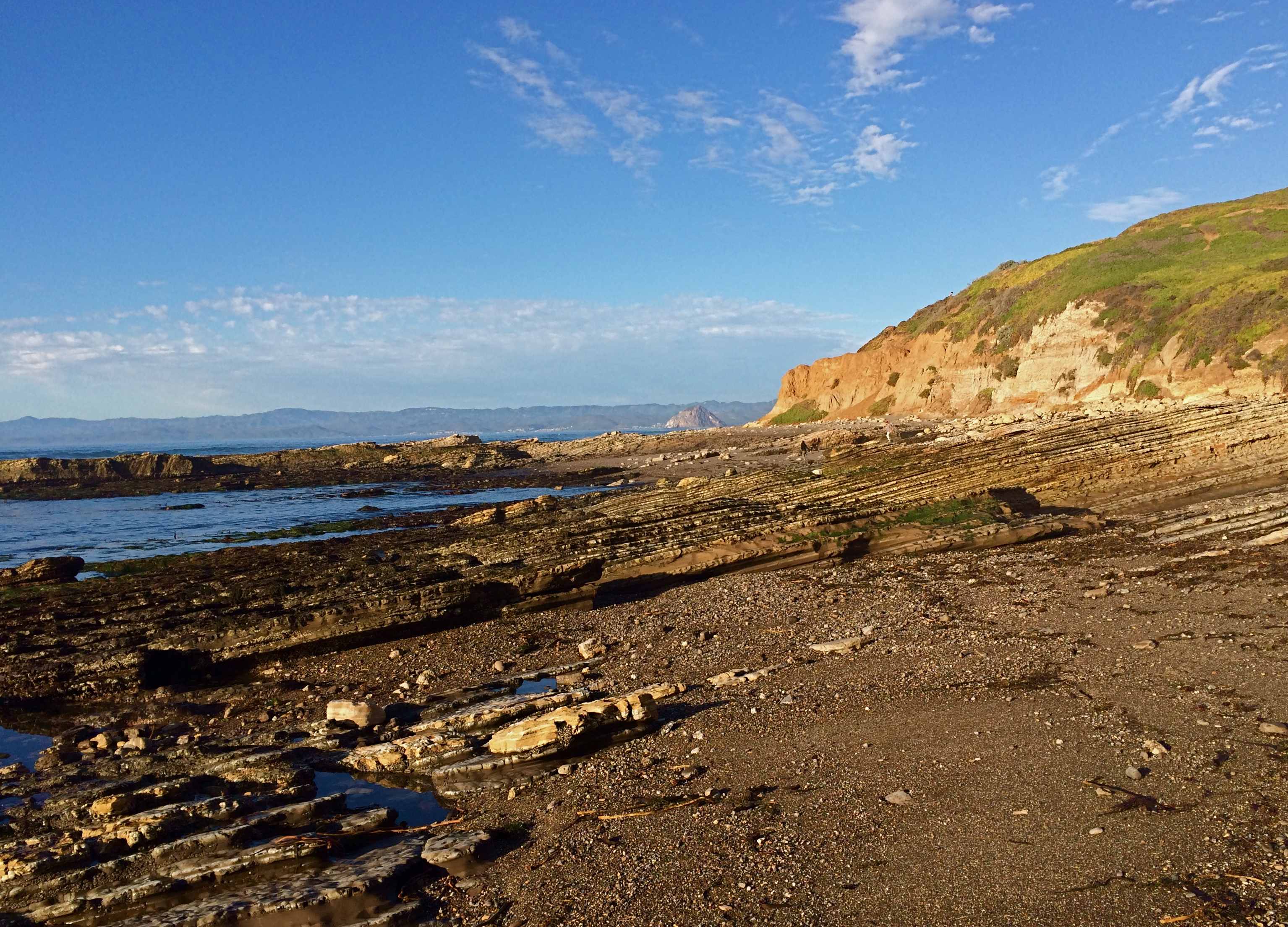
The Temblor Range is a mountain range within the California Coast Ranges, at the southwestern extremity of the San Joaquin Valley in California in the United States. It runs in a northwest-southeasterly direction along the borders of Kern County and San Luis Obispo County. The name of the range is from Spanish ''temblor'' meaning "tremor", referring to earthquakes. The San Andreas Fault Zone runs parallel to the range at the base of its western slope, on the eastern side of the Carrizo Plain, while the Antelope Plain, location of the enormous Midway Sunset, South Belridge, and Cymric oil fields, lies to the northeast. Peaks within the Temblor Range average about above sea level. The highest point is McKittrick Summit at , located in the center of the range about west of Bakersfield. The summit on State Route 58, which crosses the range, is at above sea level. The lowest crossing of the range is at Polonio Pass at by State Route 46 at its northern end and is separated by ... [...More Info...] [...Related Items...] OR: [Wikipedia] [Google] [Baidu] |
San Luis Obispo County, California
San Luis Obispo County (), officially the County of San Luis Obispo, is a county on the Central Coast of California. As of the 2020 census, the population was 282,424. The county seat is San Luis Obispo. Junípero Serra founded the Mission San Luis Obispo de Tolosa in 1772, and San Luis Obispo grew around it. The small size of the county's communities, scattered along the beaches, coastal hills, and mountains of the Santa Lucia range, provides a wide variety of coastal and inland hill ecologies to support fishing, agriculture, and tourist activities. California Polytechnic State University has almost 20,000 students. Tourism, especially for the wineries, is popular. Grapes and other agriculture products are an important part of the economy. San Luis Obispo County is the third largest producer of wine in California, surpassed only by Sonoma and Napa counties. Strawberries are the largest agricultural crop in the county. The town of San Simeon is located at the foot of t ... [...More Info...] [...Related Items...] OR: [Wikipedia] [Google] [Baidu] |
Cymric Oil Field
The Cymric Oil Field is a large oil field in Kern County, California, in the United States. While only the 14th-largest oil field in California in total size, in terms of total remaining reserves it ranks fifth, with the equivalent of over still in the ground. Production at Cymric has been increasing faster than at any other California oil field.California Department of Conservation, Oil and Gas Statistics, Annual Report, December 31, 2006 p. 2 Setting The Cymric field is in the Temblor Valley, along the west side of State Route 33, between that hi ...[...More Info...] [...Related Items...] OR: [Wikipedia] [Google] [Baidu] |
Fossil
A fossil (from Classical Latin , ) is any preserved remains, impression, or trace of any once-living thing from a past geological age. Examples include bones, shells, exoskeletons, stone imprints of animals or microbes, objects preserved in amber, hair, petrified wood and DNA remnants. The totality of fossils is known as the ''fossil record''. Paleontology is the study of fossils: their age, method of formation, and evolutionary significance. Specimens are usually considered to be fossils if they are over 10,000 years old. The oldest fossils are around 3.48 billion years old to 4.1 billion years old. Early edition, published online before print. The observation in the 19th century that certain fossils were associated with certain rock strata led to the recognition of a geological timescale and the relative ages of different fossils. The development of radiometric dating techniques in the early 20th century allowed scientists to quantitatively measure the ... [...More Info...] [...Related Items...] OR: [Wikipedia] [Google] [Baidu] |
Porcellanite
Porcellanite or ''porcelanite'', is a hard, dense rock somewhat similar in appearance to unglazed porcelain. It is often an impure variety of chert containing clay and calcareous matter. Porcellanite has been found, for example, in Northern Ireland, Poland and the Czech Republic. Tievebulliagh At Tievebulliagh, Northern Ireland, porcellanite is a tough contact metamorphosed hornfels formed from a lateritic soil horizon within a basaltic intrusive/extrusive sequence. The rock is black to dark grey in colour. Tievebulliagh is the site of a Neolithic axe or stone tool quarry, and there is another quarry on Rathlin Island. It is likely that roughouts or roughly-shaped prehistoric tools (celts) were chipped on site before transportation both within Ireland and over the Irish Sea to Britain. It is also likely that the final polish would have been performed near the site of use in cutting vegetation and trees. It was commonly polished on grooved blocks of hard sandstone ... [...More Info...] [...Related Items...] OR: [Wikipedia] [Google] [Baidu] |
Shale
Shale is a fine-grained, clastic sedimentary rock formed from mud that is a mix of flakes of clay minerals (hydrous aluminium phyllosilicates, e.g. kaolin, Al2 Si2 O5( OH)4) and tiny fragments (silt-sized particles) of other minerals, especially quartz and calcite.Blatt, Harvey and Robert J. Tracy (1996) ''Petrology: Igneous, Sedimentary and Metamorphic'', 2nd ed., Freeman, pp. 281–292 Shale is characterized by its tendency to split into thin layers ( laminae) less than one centimeter in thickness. This property is called '' fissility''. Shale is the most common sedimentary rock. The term ''shale'' is sometimes applied more broadly, as essentially a synonym for mudrock, rather than in the more narrow sense of clay-rich fissile mudrock. Texture Shale typically exhibits varying degrees of fissility. Because of the parallel orientation of clay mineral flakes in shale, it breaks into thin layers, often splintery and usually parallel to the otherwise indistinguishable bedding ... [...More Info...] [...Related Items...] OR: [Wikipedia] [Google] [Baidu] |
Silicate
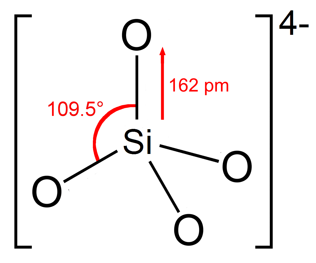
In chemistry, a silicate is any member of a family of polyatomic anions consisting of silicon and oxygen, usually with the general formula , where . The family includes orthosilicate (), metasilicate (), and pyrosilicate (, ). The name is also used for any salt of such anions, such as sodium metasilicate; or any ester containing the corresponding chemical group, such as tetramethyl orthosilicate. The name "silicate" is sometimes extended to any anions containing silicon, even if they do not fit the general formula or contain other atoms besides oxygen; such as hexafluorosilicate .Most commonly, silicates are encountered as silicate minerals. For diverse manufacturing, technological, and artistic needs, silicates are versatile materials, both natural (such as granite, gravel, and garnet) and artificial (such as Portland cement, ceramics, glass, and waterglass). Structural principles In all silicates, silicon atom occupies the center of an idealized tetrahedron whose c ... [...More Info...] [...Related Items...] OR: [Wikipedia] [Google] [Baidu] |
Miocene
The Miocene ( ) is the first epoch (geology), geological epoch of the Neogene Period and extends from about (Ma). The Miocene was named by Scottish geologist Charles Lyell; the name comes from the Greek words (', "less") and (', "new") and means "less recent" because it has 18% fewer modern marine invertebrates than the Pliocene has. The Miocene is preceded by the Oligocene and is followed by the Pliocene. As Earth went from the Oligocene through the Miocene and into the Pliocene, the climate slowly cooled towards a series of ice ages. The Miocene boundaries are not marked by a single distinct global event but consist rather of regionally defined boundaries between the warmer Oligocene and the cooler Pliocene Epoch. During the Early Miocene, the Arabian Peninsula collided with Eurasia, severing the connection between the Mediterranean and Indian Ocean, and allowing a faunal interchange to occur between Eurasia and Africa, including the dispersal of proboscideans into Eurasia. ... [...More Info...] [...Related Items...] OR: [Wikipedia] [Google] [Baidu] |
Monterey Formation
The Monterey Formation is an extensive Miocene oil-rich geological sedimentary formation in California, with outcrops of the formation in parts of the California Coast Ranges, Peninsular Ranges, and on some of California's off-shore islands. The type locality is near the city of Monterey, California. The Monterey Formation is the major source-rock for 37 to 38 billion barrels of oil in conventional traps such as sandstones. This is most of California's known oil resources. The Monterey has been extensively investigated and mapped for petroleum potential, and is of major importance for understanding the complex geological history of California. Its rocks are mostly highly siliceous strata that vary greatly in composition, stratigraphy, and tectono-stratigraphic history. The US Energy Information Administration (EIA) estimated in 2014 that the 1,750 square mile Monterey Formation could, as an unconventional resource, yield about 600 million barrels of oil, ... [...More Info...] [...Related Items...] OR: [Wikipedia] [Google] [Baidu] |
California State Route 46
State Route 46 (SR 46) is an east–west state highway in the U.S. state of California. It is a major crossing of the Coast Ranges and it is the southernmost crossing of the Diablo Range, connecting SR 1 on the Central Coast near Cambria and US 101 in Paso Robles with SR 99 at Famoso in the San Joaquin Valley. The road that is now SR 46 was built and improved during the 1920s and was fully paved by 1930. The majority of SR 46 was originally designated as U.S. Route 466; however, after the latter was entirely removed from the U.S. Highway system, the eastern portion of the route became SR 46. Route description State Route 46 begins at SR 1 southeast of Cambria, about from the Pacific Ocean. It heads east as the Eric Seastrand Highway across the Santa Lucia Range on a relatively straight roadway built in the 1970s, bypassing the steep, curvy Santa Rosa Creek Road. After passing near several wineries, this first segment ends at US 101 north of Templeton, where SR 4 ... [...More Info...] [...Related Items...] OR: [Wikipedia] [Google] [Baidu] |
Polonio Pass
Polonio Pass is a low mountain pass that separates the Temblor Range to the south, and the Diablo Range to the north, linking Kern County, California, in the Central Valley, to Shandon and Paso Robles in San Luis Obispo County, both in the American state of California California is a state in the Western United States, located along the Pacific Coast. With nearly 39.2million residents across a total area of approximately , it is the most populous U.S. state and the 3rd largest by area. It is also the m .... The pass is surrounded by grassy plains, with Highway 46 beginning its wind through the narrow mountain gap just a couple miles west. It is the southernmost crossing of the Diablo Range. References Mountain passes of California Diablo Range Landforms of Kern County, California Transportation in Kern County, California {{KernCountyCA-geo-stub ... [...More Info...] [...Related Items...] OR: [Wikipedia] [Google] [Baidu] |
California State Route 58
State Route 58 (SR 58) is a major east-west state highway in the U.S. state of California that runs across the Coast Ranges, the southern San Joaquin Valley, the Tehachapi Mountains, which border the southern Sierra Nevada, and the Mojave Desert. It runs between U.S. Route 101 near Santa Margarita and Interstate 15 in Barstow. It has junctions with Interstate 5 near Buttonwillow, State Route 99 in Bakersfield, State Route 202 in Tehachapi, State Route 14 near Mojave, and U.S. Route 395 at Kramer Junction. SR 58 also provides access to Edwards Air Force Base. At various points it is known as the Calf Canyon Highway, Carrisa Highway, Bakersfield-McKittrick Highway, Rosa Parks Highway, Rosedale Highway, Barstow-Bakersfield Highway, Bakersfield Tehachapi Highway, Kern County Korean War Veterans Memorial Highway, and Mojave-Barstow Highway. Route description State Route 58 between Santa Margarita and Buttonwillow is a winding mountain road through a thinly populated are ... [...More Info...] [...Related Items...] OR: [Wikipedia] [Google] [Baidu] |


.jpg)


