|
Tell Madhur
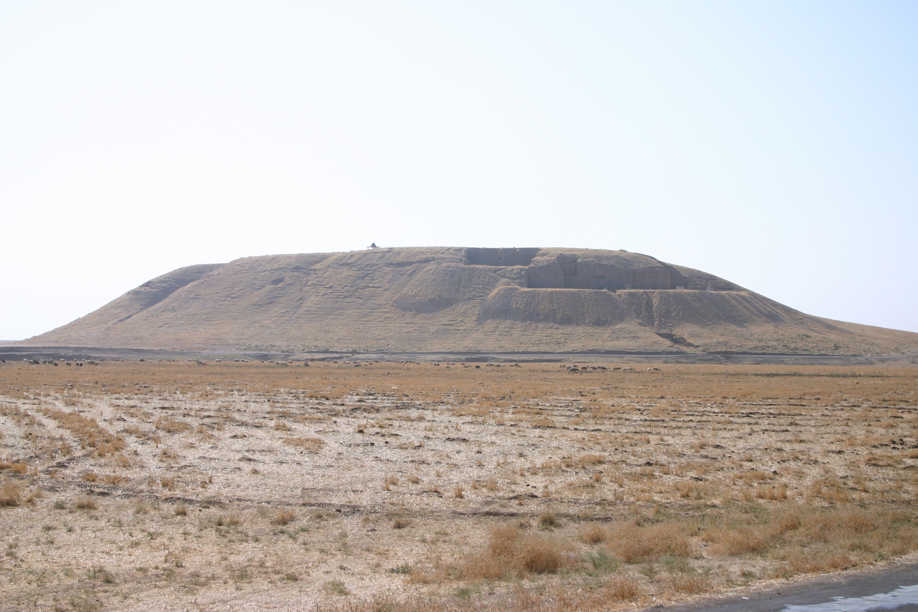
Tell Madhur (also Madhhur) is a tell, or archaeological settlement mound, in Diyala Governorate (Iraq). The site was excavated due to it being flooded by the reservoir created by the Hamrin Dam. Madhur is best known for its particularly well-preserved Ubaid house. A significant Early Dynastic occupation, consisting of a rounded building typical for the Hamrin region at the time, has also been attested at Madhur. The site and its environment The tell measures 100 by 80 m and rises 2.5 m above the surrounding plain. The archaeological deposits extended some 4 m below the current surface of the plain as well, indicating that considerable soil accumulation must have taken place since Madhur was first settled. History of research Tell Madhur was excavated for four seasons between 1977 and 1980 by the British Archaeological Expedition to Iraq as part of the large, international salvage operation to document archaeological sites that would be flooded by the reservoir of the Hamri ... [...More Info...] [...Related Items...] OR: [Wikipedia] [Google] [Baidu] |
Tell (archaeology)
In archaeology, a tell or tel (borrowed into English from ar, تَلّ, ', 'mound' or 'small hill'), is an artificial topographical feature, a species of mound consisting of the accumulated and stratified debris of a succession of consecutive settlements at the same site, the refuse of generations of people who built and inhabited them, and of natural sediment. (Very limited snippet view).Matthews (2020)Introduction and Definition/ref> Tells are most commonly associated with the ancient Near East, but they are also found elsewhere, such as Southern and parts of Central Europe, from Greece and Bulgaria to Hungary and SpainBlanco-González & Kienlin, eds (2020), 6th page of chapter 1, see map. and in North Africa. Within the Near East, they are concentrated in less arid regions, including Upper Mesopotamia, the Southern Levant, Anatolia and Iran, which had more continuous settlement. Eurasian tells date to the Neolithic,Blanco-González & Kienlin, eds (2020), 2nd page of chapter 1 ... [...More Info...] [...Related Items...] OR: [Wikipedia] [Google] [Baidu] |
Cruciform
Cruciform is a term for physical manifestations resembling a common cross or Christian cross. The label can be extended to architectural shapes, biology, art, and design. Cruciform architectural plan Christian churches are commonly described as having a cruciform architecture. In Early Christian, Byzantine and other Eastern Orthodox forms of church architecture this is likely to mean a tetraconch plan, a Greek cross, with arms of equal length or, later, a cross-in-square plan. In the Western churches, a cruciform architecture usually, though not exclusively, means a church built with the layout developed in Gothic architecture. This layout comprises the following: *An east end, containing an altar and often with an elaborate, decorated window, through which light will shine in the early part of the day. *A west end, which sometimes contains a baptismal font, being a large decorated bowl, in which water can be firstly, blessed (dedicated to the use and purposes of God) and ... [...More Info...] [...Related Items...] OR: [Wikipedia] [Google] [Baidu] |
Akkadian Empire
The Akkadian Empire () was the first ancient empire of Mesopotamia after the long-lived civilization of Sumer. It was centered in the city of Akkad (city), Akkad () and its surrounding region. The empire united Akkadian language, Akkadian and Sumerian language, Sumerian speakers under one rule. The Akkadian Empire exercised influence across Mesopotamia, the Levant, and Anatolia, sending military expeditions as far south as Dilmun and Magan (civilization), Magan (modern Saudi Arabia, Bahrain, and Oman) in the Arabian Peninsula.Mish, Frederick C., Editor in Chief. "Akkad" ''Webster’s Ninth New Collegiate Dictionary''. ninth ed. Springfield, MA: Merriam-Webster 1985. ). The Akkadian Empire reached its political peak between the 24th and 22nd centuries BC, following the conquests by its founder Sargon of Akkad. Under Sargon and his successors, the Akkadian language was briefly imposed on neighboring conquered states such as Elam and Gutian people, Gutium. Akkad is sometimes regar ... [...More Info...] [...Related Items...] OR: [Wikipedia] [Google] [Baidu] |
Hamrin Mountains
The Hamrin Mountains ( ar, جبل حمرين, Jabāl Hamrīn, ku, چیای حەمرین, Çiyayê Hemrîn or Çiyayên Hemrîn) are a small mountain ridge in northeast Iraq. The westernmost ripple of the greater Zagros mountains, the Hamrin mountains extend from the Diyala Governorate bordering Iran, northwest to the Tigris river, crossing northern Saladin Governorate and southern Kirkuk Governorate. In antiquity, the mountains were part of the frontier region between Lower Mesopotamia (Babylonia) to the south and Upper Mesopotamia(Assyria Assyria (Neo-Assyrian cuneiform: , romanized: ''māt Aššur''; syc, ܐܬܘܪ, ʾāthor) was a major ancient Mesopotamian civilization which existed as a city-state at times controlling regional territories in the indigenous lands of the A ...) to the north. References External links Jabal Hamrin - Iraq Mountain ranges of Iraq Zagros Mountains Diyala Governorate Kirkuk Governorate Saladin Governorate {{Iraq-geo-stub ... [...More Info...] [...Related Items...] OR: [Wikipedia] [Google] [Baidu] |
Uruk Period
The Uruk period (ca. 4000 to 3100 BC; also known as Protoliterate period) existed from the protohistoric Chalcolithic to Early Bronze Age period in the history of Mesopotamia, after the Ubaid period and before the Jemdet Nasr period. Named after the Sumerian city of Uruk, this period saw the emergence of urban life in Mesopotamia and the Sumerian civilization. The late Uruk period (34th to 32nd centuries) saw the gradual emergence of the cuneiform script and corresponds to the Early Bronze Age; it has also been described as the "Protoliterate period". It was during this period that pottery painting declined as copper started to become popular, along with cylinder seals. Dating and periodization The term Uruk period was coined at a conference in Baghdad in 1930, along with the preceding Ubaid period and following Jemdet Nasr period. The chronology of the Uruk period is highly debated and still very uncertain. It is known that it covered most of the 4th millennium BC. But ther ... [...More Info...] [...Related Items...] OR: [Wikipedia] [Google] [Baidu] |
Nuzi
Nuzi (or Nuzu; Akkadian Gasur; modern Yorghan Tepe, Iraq) was an ancient Mesopotamian city southwest of the city of Arrapha (modern Kirkuk), located near the Tigris river. The site consists of one medium-sized multiperiod tell and two small single period mounds. History The site showed occupation as far back as the late Uruk period. The city, then named Gasur, was founded in the third millennium during the time of the Akkadian Empire. In the middle of the second millennium the Hurrians gained control of the town and renamed it Nuzi. The history of the site during the intervening period is unclear, though the presence of a few cuneiform tablets from the Old Assyrian Empire indicates that trade with nearby Assur was taking place. After the fall of the Hurrian kingdom of Mitanni to Ashur-uballit I of the Middle Assyrian Empire, Nuzi went into gradual decline. Note that while the Hurrian period is well known from full excavation of those strata, the earlier history is not as reliab ... [...More Info...] [...Related Items...] OR: [Wikipedia] [Google] [Baidu] |
Telul Eth-Thalathat
Telul eth-Thalathat is an archaeological site located west of Mosul and just east of Tal Afar in Nineveh Province (Iraq). History of archaeological research The site consists of at least five separate tells or settlement mounds. Telul eth-Thalathat was excavated for four seasons between 1956 and 1965 and again in 1976 by a team from the University of Tokyo Iraq-Iran Archaeological Expedition. The first two seasons, in 1956 and 1957, were led by N. Egami and worked at Tell II. Burials, residential areas, and a presumed temple were uncovered. The final season was led by S. Fukai. Occupation history Telul eth-Thalathat was occupied in the Ubaid, Nineveh V, and Uruk periods, as well as during Middle Assyrian times. Excavations have revealed over 20 kilns and a number of burials, as well as some figurines and spindle whorls. Robert A. Carter and Graham Philip, Beyond the Ub ... [...More Info...] [...Related Items...] OR: [Wikipedia] [Google] [Baidu] |
Tepe Gawra
Tepe Gawra (Kurdish for "Great Mound") is an ancient Mesopotamian settlement 15 miles NNE of Mosul in northwest Iraq that was occupied between 5000 and 1500 BC. It is roughly a mile from the site of Nineveh and 2 miles E of the site of Khorsabad. It contains remains from the Halaf period, the Ubaid period, and the Uruk period (4000–3100 BC). Tepe Gawra contains material relating to the Halaf-Ubaid Transitional period c. 5,500–5,000 BC. Archaeology The tell or settlement mound at Tepe Gawra is in diameter and high. A brief exploratory dig was performed by Austen Layard before 1850. The site was formally excavated in 1927, 1931, 1932 and 1934-35 by archaeologists from a joint expedition of the University of Pennsylvania and the American Schools of Oriental Research, led by Ephraim Avigdor Speiser. At the same time, these scholars explored the related nearby ancient site of Tell Billa, which is located about southwest of Gawra. In 2001, Mitchell Rothman reanalyzed ... [...More Info...] [...Related Items...] OR: [Wikipedia] [Google] [Baidu] |
Radiocarbon Dating
Radiocarbon dating (also referred to as carbon dating or carbon-14 dating) is a method for determining the age of an object containing organic material by using the properties of radiocarbon, a radioactive isotope of carbon. The method was developed in the late 1940s at the University of Chicago by Willard Libby. It is based on the fact that radiocarbon () is constantly being created in the Earth's atmosphere by the interaction of cosmic rays with atmospheric nitrogen. The resulting combines with atmospheric oxygen to form radioactive carbon dioxide, which is incorporated into plants by photosynthesis; animals then acquire by eating the plants. When the animal or plant dies, it stops exchanging carbon with its environment, and thereafter the amount of it contains begins to decrease as the undergoes radioactive decay. Measuring the amount of in a sample from a dead plant or animal, such as a piece of wood or a fragment of bone, provides information that can be used to calc ... [...More Info...] [...Related Items...] OR: [Wikipedia] [Google] [Baidu] |
Barley
Barley (''Hordeum vulgare''), a member of the grass family, is a major cereal grain grown in temperate climates globally. It was one of the first cultivated grains, particularly in Eurasia as early as 10,000 years ago. Globally 70% of barley production is used as animal fodder, while 30% as a source of fermentable material for beer and certain distilled beverages, and as a component of various foods. It is used in soups and stews, and in barley bread of various cultures. Barley grains are commonly made into malt in a traditional and ancient method of preparation. In 2017, barley was ranked fourth among grains in quantity produced () behind maize, rice and wheat. Etymology The Old English word for barley was ', which traces back to Proto-Indo-European and is cognate to the Latin word ' "flour" (''see corresponding entries''). The direct ancestor of modern English ''barley'' in Old English was the derived adjective ''bærlic'', meaning "of barley". The first citation of t ... [...More Info...] [...Related Items...] OR: [Wikipedia] [Google] [Baidu] |
Sling (weapon)
A sling is a projectile weapon typically used to throw a blunt projectile such as a stone, clay, or lead " sling-bullet". It is also known as the shepherd's sling or slingshot (in British English). Someone who specializes in using slings is called a slinger. A sling has a small cradle or ''pouch'' in the middle of two retention cords. A projectile is placed in the pouch. There is a loop on the end of one side of the retention cords. Depending on the design of the sling, either the middle finger or the wrist is placed through a loop on the end of one cord, and a tab at the end of the other cord is placed between the thumb and forefinger. The sling is swung in an arc, and the tab released at a precise moment. This action releases the projectile to fly to the target. The sling is much more than merely an extension of a human arm. By its double-pendulum kinetics, the sling enables stones (or spears) to be thrown much further than they could be by hand alone. The sling is i ... [...More Info...] [...Related Items...] OR: [Wikipedia] [Google] [Baidu] |
Spindle Whorl
A spindle whorl is a disc or spherical object fitted onto the spindle to increase and maintain the speed of the spin. Historically, whorls have been made of materials like amber, antler, bone, ceramic, coral, glass, stone, metal (iron, lead, lead alloy), and wood (oak). Local sourced materials have been also used, such as chalk, limestone, mudstone, sandstone, slate, lydite and soapstone. Gallery File:Spindle Whorl (Sulsultin), 19th century, 05.588.7382.jpg, ''Spindle Whorl (Sulsultin)'', Chemainus, Coast Salish (Native American), 19th century, Brooklyn Museum File:Przęślik 0211.jpg, Whorl (12th or 13th century) found in Poland File:1017_-_Keramikos_Museum,_Athens_-_Spindle-whirls,_10th_century_BC_-_Photo_by_Giovanni_Dall'Orto,_Nov_12.jpg, Ancient Greek spindle whorls, 10th century BC, Kerameikos Archaeological Museum, Athens File:Muisca spindle whorl.jpg, Muisca spindle whorl (500AD – 1500AD). Archaeology Museum, Sogamoso, Colombia File:Object from the exhibition We call ... [...More Info...] [...Related Items...] OR: [Wikipedia] [Google] [Baidu] |


