|
Telephone Numbers In Madagascar
Telephone numbers in Madagascar are seven digits long, the first two digits being an area code. Recent ITU documents suggest the area code is preceded by a two digit operator code, for example "20" for Telecom Malagasy. International numbering plan International numbering format: +261 AB Z PQMCDU where: *+261 international prefix *AB operator code (two digits for each operator) *Z area code (described as administrative area) *PQMCDU subscriber number ;Country code 261 :Country code 261 for all existing telecommunication networks in Madagascar. ;AB – operator code :Each operator is identified by two digits described by the characters AB: :*20-29 identification code for fixed service operators, :*30-39 identification code for mobile service operators ;Z – area code valid for Telecom Malagasy (fixed-service operator) :Madagascar is divided into six zones: :*Z = 2 Antananarivo zone :*Z = 4 Antananarivo zone (rest of the province) :*Z = 5 Toamasina zone :*Z = 6 Mahajanga zone :* ... [...More Info...] [...Related Items...] OR: [Wikipedia] [Google] [Baidu] |
Antananarivo
Antananarivo ( French: ''Tananarive'', ), also known by its colonial shorthand form Tana, is the capital and largest city of Madagascar. The administrative area of the city, known as Antananarivo-Renivohitra ("Antananarivo-Mother Hill" or "Antananarivo-Capital"), is the capital of Analamanga region. The city sits at above sea level in the center of the island, the highest national capital by elevation among the island countries. It has been the country's largest population center since at least the 18th century. The presidency, National Assembly, Senate and Supreme Court are located there, as are 21 diplomatic missions and the headquarters of many national and international businesses and NGOs. It has more universities, nightclubs, art venues, and medical services than any city on the island. Several national and local sports teams, including the championship-winning national rugby team, the Makis are based here. Antananarivo was historically the capital of the Merina peop ... [...More Info...] [...Related Items...] OR: [Wikipedia] [Google] [Baidu] |
Mananjary River
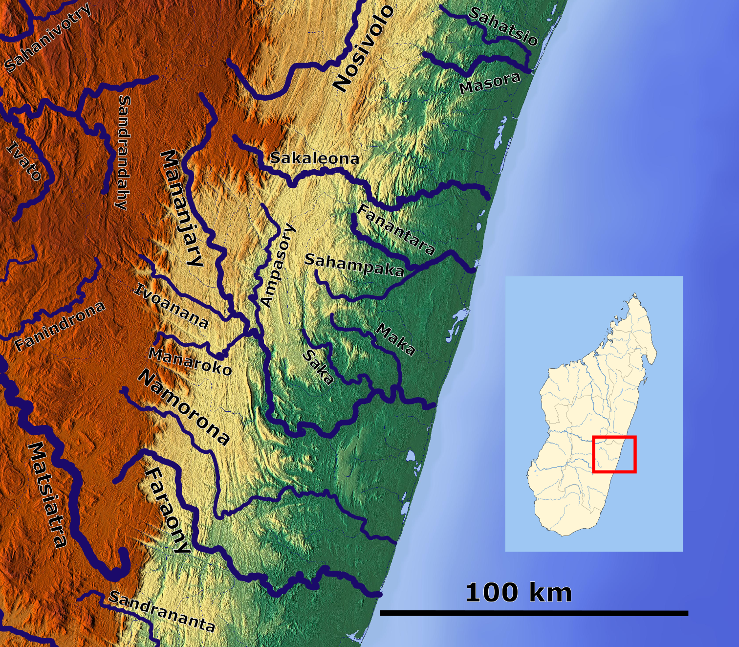
The Mananjary River is located in southern Madagascar, in the region of Vatovavy. It drains to the eastern coast, into the Indian ocean. It serves as the southern edge of the territory known as Betsimisaraka.Helen Chapin Metz, ed., Madagascar: A Country Study', Library of Congress, 1994., accessed 14 August 2008 Its mouth is situated in the city of Mananjary Mananjary is a city located in Vatovavy, Madagascar with a population of 25,222 inhabitants in 2018. It is the chief city of the Mananjary district. It contains a town of the same name, situated on the southern part of the east coast, where the M .... References Rivers of Vatovavy {{Madagascar-river-stub ... [...More Info...] [...Related Items...] OR: [Wikipedia] [Google] [Baidu] |
Telephone Numbers By Country
A telephone is a telecommunications device that permits two or more users to conduct a conversation when they are too far apart to be easily heard directly. A telephone converts sound, typically and most efficiently the human voice, into electronic signals that are transmitted via cables and other communication channels to another telephone which reproduces the sound to the receiving user. The term is derived from el, τῆλε (''tēle'', ''far'') and φωνή (''phōnē'', ''voice''), together meaning ''distant voice''. A common short form of the term is ''phone'', which came into use early in the telephone's history. In 1876, Alexander Graham Bell was the first to be granted a United States patent for a device that produced clearly intelligible replication of the human voice at a second device. This instrument was further developed by many others, and became rapidly indispensable in business, government, and in households. The essential elements of a telephone are a m ... [...More Info...] [...Related Items...] OR: [Wikipedia] [Google] [Baidu] |
Morondava
Morondava (, from mg, morona lava "long coast") is a city located in Menabe Region, of which it is the capital, in Madagascar. It is located in the delta of the Morandava River at . Its population as of the 2018 census, was 53,510. Population The predominant tribe is the Sakalava. But there are also a few Betsileo, Tsimihety, Merina, Makoa as well as Europeans. Transportation Air Madagascar has regular scheduled flights to Morondava Airport. The main road to town has been renovated recently. With the new road established, a trip from Antananarivo to Morondava by taxi-brousse takes approximately 12 hours. Pirogues are consequently a popular mode of transport used to ferry people and goods along the coast, especially to Morombe. Roads * RN 34 to Ivato, Ambositra and Antsirabe. * RN 8 to Belo-sur-Tsiribihina. Ecology The city is famous amongst other things for the spectacular Avenue of Baobabs nearby at . These giant baobab trees are an 800-year-old legacy of the dense tropic ... [...More Info...] [...Related Items...] OR: [Wikipedia] [Google] [Baidu] |
Toliary
Toliara (also known as ''Toliary'', ; formerly ''Tuléar'') is a city in Madagascar. It is the capital of the Atsimo-Andrefana region, located 936 km southwest of national capital Antananarivo. The current spelling of the name was adopted in the 1970s, reflecting the orthography of the Malagasy language. Many geographic place names, assigned French spellings during the colonial period, were altered following Malagasy independence in 1960. The city has a population of 168,758 in 2018. As a port town it acts as a major import/export hub for commodities such as sisal, soap, hemp, cotton, rice and peanuts. History In the 17th century, French buccaneers landed in the bay of St. Augustine near the Tropic of Capricorn, and founded the city to maintain commercial relations. It was not until the colonial period, after 1897, when the city really grew: with the efforts of Joseph Gallieni to install French administrative services, previously isolated on the island of Nosy Ve, to ... [...More Info...] [...Related Items...] OR: [Wikipedia] [Google] [Baidu] |
Sambava
Sambava is a city and commune (commune urbaine; mg, kaominina) at the east coast of northern Madagascar. It is the capital of Sambava District and Sava Region. The population of the commune was 84,039 in as of the 2018 commune census. Infrastructure Sambava is located on Route nationale 5a (Madagascar), Route Nationale 5a Ambilobe - Antalaha. It has a local airport, Sambava Airport, regional airport. In addition to primary schooling the town offers secondary education at both junior and senior levels. The town provides access to hospital services to its citizens. Economy Farming and raising livestock provides employment for 45% and 0.5% of the working population. The most important crop is vanilla, while other important products are coconut and rice. Industry and services provide employment for 0.5% and 53.5% of the population, respectively. Additionally fishing employs 0.5% of the population. Sambava disposes of white, sandy beaches with several hotels. The Marojejy Nation ... [...More Info...] [...Related Items...] OR: [Wikipedia] [Google] [Baidu] |
Nosy Be
Nosy Be (formerly Nossi-bé and Nosse Be) is an island off the northwest coast of Madagascar. Nosy Be is Madagascar's largest and busiest tourist resort. It has an area of , and its population was 109,465 according to the provisional results of the 2018 Census. ''Nosy Be'' means "big island" in the Malagasy language. The island was called Assada during the early colonial era of the 17th century. Nosy Be has been given several nicknames over the centuries, including "Nosy Manitra" (the scented island). History The first human inhabitants of Nosy Be were small bands of Antankarana and Zafinofotsy, before the Sakalava people migrated there and became the most numerous ethnic group on the island. These people were joined later by some Comorians, Indians or Antandroy. Nosy Be made first major appearance in Madagascar's history when King Radama I announced that he intended to conquer the whole west of Madagascar. That plan was eventually achieved in 1837 when the Sakalava Kingdom of ... [...More Info...] [...Related Items...] OR: [Wikipedia] [Google] [Baidu] |
Antsiranana
Antsiranana ( mg, Antsiran̈ana ), named Diego-Suárez prior to 1975, is a city in the far north of Madagascar. Antsiranana is the capital of Diana Region. It had an estimated population of 115,015 in 2013. History The bay and city originally used the name ''Diego-Suárez'', named after Diogo Soares, a Portuguese navigator who visited the bay in 1543–44. In the 1880s, the bay was coveted by France, which desired it as a coaling station for steamships. After the first Franco-Hova War, Queen Ranavalona III signed a treaty on December 17, 1885, granting France a protectorate over the bay and surrounding territory, as well as the islands of Nosy-Be and Ste. Marie de Madagascar. The colony's administration was subsumed into that of Madagascar in 1896. The Second Pacific Squadron of Imperial Russia anchored and was resupplied at Diego-Suárez on its way to the Battle of Tsushima in 1905. In 1942, Diego-Suárez was the primary objective of Operation Ironclad, the starting point ... [...More Info...] [...Related Items...] OR: [Wikipedia] [Google] [Baidu] |
Fianarantsoa
Fianarantsoa is a city (commune urbaine) in south central Madagascar, and is the capital of Haute Matsiatra Region. History It was built in the early 19th century by the Merina as the administrative capital for the newly conquered Betsileo kingdoms. Fianarantsoa means "Good education" in Malagasy. It is a cultural and intellectual center for the whole island. It is home to some of the oldest Protestant and Lutheran cathedrals on the island, the oldest theological seminary (also Lutheran), as well as the Roman Catholic Archdiocese of Fianarantsoa (seated in the Cathedral of the Holy Name of Jesus). The city of "good education" also boasts a university named after it and built in 1972. Fianarantsoa is considered to be the capital of wine in Madagascar, because of the presence of many wine industries in the city. Geography It is at an average altitude of , and has a population of 191,766. The town is linked to the rest of the country by the National road 7, one of the main hi ... [...More Info...] [...Related Items...] OR: [Wikipedia] [Google] [Baidu] |
Farafangana
Farafangana is a city (commune urbaine) on the south-east coast of Madagascar and capital of the Atsimo-Atsinanana region. Location Farafangana is the capital of the region Atsimo-Atsinanana located approximately 400 kilometres south of the capital Antananarivo. It is at the southern end of the Canal des Pangalanes,Madagascar & Comoros p. 232 (, 2008) with the mouth of the located on the north side of the town. It is 106km south of |
Mananjary, Fianarantsoa
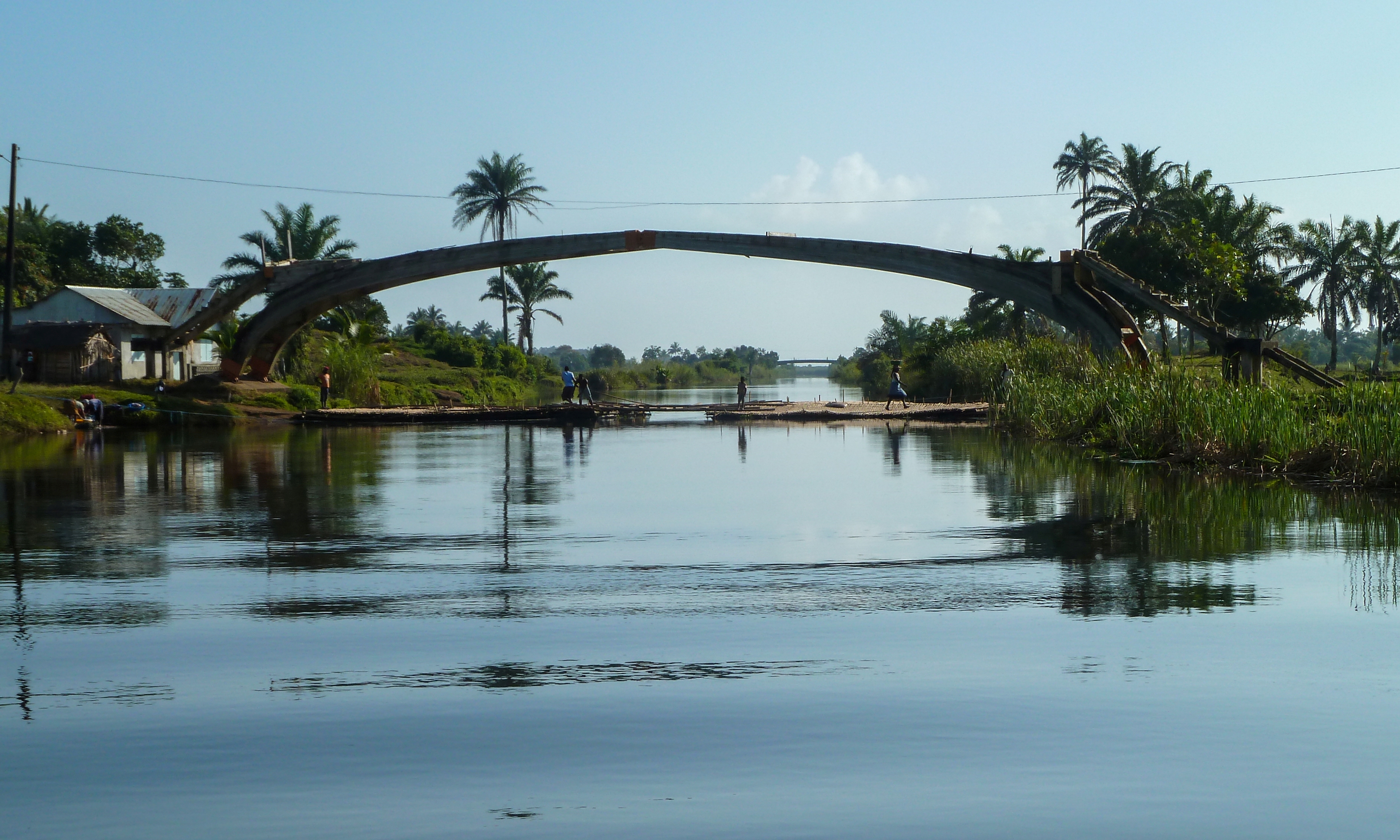
Mananjary is a city located in Vatovavy, Madagascar with a population of 25,222 inhabitants in 2018. It is the chief city of the Mananjary district. It contains a town of the same name, situated on the southern part of the east coast, where the Mananjary River flows into the Indian Ocean. There's a small port and an airport. Mananjary is situated at 130 km south of Nosy Varika on the RN 11 The Canal des Pangalanes divides the town into two sections. In 2022 Cyclone Batsirai made landfall at Mananjary, leaving the city destroyed by 90%. Economy Agriculture production is focused on vanilla, coffee, and pepper production.Madagascar & Comoros pp. 230-31 (, 2008) < ... [...More Info...] [...Related Items...] OR: [Wikipedia] [Google] [Baidu] |


