|
Taylor Slough
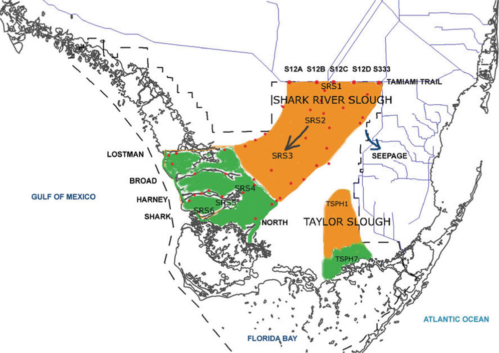
Taylor Slough, located in the southeastern corner of the Florida Everglades, along with the much larger Shark River Slough farther to the west, are the principal natural drainages for the freshwater Everglades and the essential conduit for providing overland freshwater to Florida Bay. Description Taylor Slough is a 247 square kilometer wetland system. The slough stretches from the east everglades, to the northern portion of Florida Bay. In its natural form, Taylor Slough is the primary source of overland, freshwater flow into the north eastern part of Florida Bay. A major portion of the Taylor Slough resides in Everglades National Park. Taylor Slough crosses over part of the C-111 basin. History The term slough (pronounced ''slew'') is used to describe areas of the Everglades where there is slightly deeper water than in the surrounding marshes and where a slow, but measurable, current is present. In essence, sloughs are the broad, shallow rivers of the Everglades. Slough ... [...More Info...] [...Related Items...] OR: [Wikipedia] [Google] [Baidu] |
Florida
Florida is a state located in the Southeastern region of the United States. Florida is bordered to the west by the Gulf of Mexico, to the northwest by Alabama, to the north by Georgia, to the east by the Bahamas and Atlantic Ocean, and to the south by the Straits of Florida and Cuba; it is the only state that borders both the Gulf of Mexico and the Atlantic Ocean. Spanning , Florida ranks 22nd in area among the 50 states, and with a population of over 21 million, it is the third-most populous. The state capital is Tallahassee, and the most populous city is Jacksonville. The Miami metropolitan area, with a population of almost 6.2 million, is the most populous urban area in Florida and the ninth-most populous in the United States; other urban conurbations with over one million people are Tampa Bay, Orlando, and Jacksonville. Various Native American groups have inhabited Florida for at least 14,000 years. In 1513, Spanish explorer Juan Ponce de León became the first k ... [...More Info...] [...Related Items...] OR: [Wikipedia] [Google] [Baidu] |
Everglades
The Everglades is a natural region of tropical climate, tropical wetlands in the southern portion of the U.S. state of Florida, comprising the southern half of a large drainage basin within the Neotropical realm. The system begins near Orlando, Florida, Orlando with the Kissimmee River, which discharges into the vast but shallow Lake Okeechobee. Water leaving the lake in the wet season forms a slow-moving river wide and over long, flowing southward across a limestone shelf to Florida Bay at the southern end of the state. The Everglades experiences a wide range of weather patterns, from frequent flooding in the wet season to drought in the dry season. Throughout the 20th century, the Everglades suffered significant loss of habitat and environmental degradation. Human habitation in the southern portion of the Florida peninsula dates to 15,000 years ago. Before European colonization, the region was dominated by the native Calusa and Tequesta tribes. With Spanish colonizati ... [...More Info...] [...Related Items...] OR: [Wikipedia] [Google] [Baidu] |
Shark River Slough
Shark River Slough (SRS) is a low-lying area of land that channels water through the Florida Everglades, beginning in Water Conservation Area 3, flowing through Everglades National Park, and ultimately into Florida Bay. Together with Taylor Slough to the east, Shark River Slough is an essential conduit of overland freshwater to Florida Bay. Shark River Slough is also known as the "River of Grass." Description Shark River Slough is the dominant path for flow of water into Everglades National Park. SRS is a mixture of sawgrass marshes, tree islands, sloughs, and wet prairies. The SRS is bordered by marl prairies. Everglades restoration Historically, Shark River Slough was the primary path for water flow in the Everglades system. Restoration of the historic function of the slough is essential to restoration of Everglades National Park. Tidal influence Shark River Slough has tides from the Gulf of Mexico that reach 30 km inland. See also * Taylor Slough * Cape Sable Seas ... [...More Info...] [...Related Items...] OR: [Wikipedia] [Google] [Baidu] |
Florida Bay
Florida Bay is the bay located between the southern end of the Florida mainland (the Florida Everglades) and the Florida Keys in the United States. It is a large, shallow estuary that while connected to the Gulf of Mexico, has limited exchange of water due to various shallow mudbanks covered with seagrass. The banks separate the bay into basins, each with its own unique physical characteristics. Description Encompassing roughly one-third of Everglades National Park, Florida Bay is variously stated to be , or , or . Nearly all of Florida Bay is included in Everglades National Park. The southern edge, along the Florida Keys, is in the Florida Keys National Marine Sanctuary. The bay muds of portions of Florida Bay have been cored to develop insights on the paleontology of previous biot The bay receives freshwater from two major drainage basins: Shark River Slough and Taylor Slough. The clean freshwater delivered by these sloughs is essential for maintaining water levels and preve ... [...More Info...] [...Related Items...] OR: [Wikipedia] [Google] [Baidu] |
Everglades National Park
Everglades National Park is an American national park that protects the southern twenty percent of the original Everglades in Florida. The park is the largest tropical wilderness in the United States and the largest wilderness of any kind east of the Mississippi River. An average of one million people visit the park each year. Everglades is the third-largest national park in the contiguous United States after Death Valley and Yellowstone. UNESCO declared the Everglades & Dry Tortugas Biosphere Reserve in 1976 and listed the park as a World Heritage Site in 1979, and the Ramsar Convention included the park on its list of Wetlands of International Importance in 1987. Everglades is one of only three locations in the world to appear on all three lists. Most national parks preserve unique geographic features; Everglades National Park was the first created to protect a fragile ecosystem. The Everglades are a network of wetlands and forests fed by a river flowing per day out of Lake O ... [...More Info...] [...Related Items...] OR: [Wikipedia] [Google] [Baidu] |
Slough (hydrology)
A slough ( or ) is a wetland, usually a swamp or shallow lake, often a backwater to a larger body of water. Water tends to be stagnant or may flow slowly on a seasonal basis. In North America, "slough" may refer to a side-channel from or feeding a river, or an inlet or natural channel only sporadically filled with water. An example of this is Finn Slough on the Fraser River, whose lower reaches have dozens of notable sloughs. Some sloughs, like Elkhorn Slough, used to be mouths of rivers, but have become stagnant because tectonic activity cut off the river's source. In the Sacramento River, Steamboat Slough was an alternate branch of the river, a preferred shortcut route for steamboats passing between Sacramento and San Francisco. Georgiana Slough was a steamboat route through the Sacramento–San Joaquin River Delta, from the Sacramento River to the San Joaquin River and Stockton. Plants and animals A slough, also called a tidal channel, is a channel in a wetland. Typic ... [...More Info...] [...Related Items...] OR: [Wikipedia] [Google] [Baidu] |
Anhinga Trail
The Anhinga Trail is a short trail (about 0.4 miles) in the Everglades National Park. Located 4 miles from the park entrance, it starts at the Royal Palm Visitor Center. The trail is a paved walkway and a boardwalk over Taylor Slough, a freshwater sawgrass marsh. Abundant wildlife is visible from the trail, including alligators, turtles, anhingas, herons, and egrets. It is one of the most popular trails in the park. On November 5, 1996, it was added to the U.S. National Register of Historic Places. In 2003, tourists witnessed a fight between an alligator and a Burmese python which went on for 24 hours, until a larger alligator joined the fight and the snake escaped. Video and news coverage of the fight was widespread and brought attention to the spread of the python, an invasive species, in the Everglades. References Bibliography * * External links Anhinga Trail– Everglades National Park – National Park Service aNational Register of Historic PlacesEverglades Nati ... [...More Info...] [...Related Items...] OR: [Wikipedia] [Google] [Baidu] |
Florida City, Florida
Florida City is a city in Miami-Dade County, Florida, United States. It is the southernmost municipality in the South Florida metropolitan area. Florida City is primarily a Miami suburb and a major agricultural area. As of the 2020 census, it had a population of 13,085, up from 11,245 in 2010. The city lies to the south and west of, and is contiguous with, Homestead. Both cities suffered catastrophic damage in August 1992 when Hurricane Andrew struck South Florida. The city originated as a land promotion named "Detroit". There were no buildings in the area when the first thirty families arrived in 1910, and they had to stay in Homestead until their houses could be built. The name was changed to "Florida City" when the town incorporated in 1914. It has a small historic area, but much of the city is hotels and other tourist facilities. The city is at the eastern end of the only road running through the Everglades National Park, which terminates at Flamingo. Florida City is th ... [...More Info...] [...Related Items...] OR: [Wikipedia] [Google] [Baidu] |
Flamingo, Florida
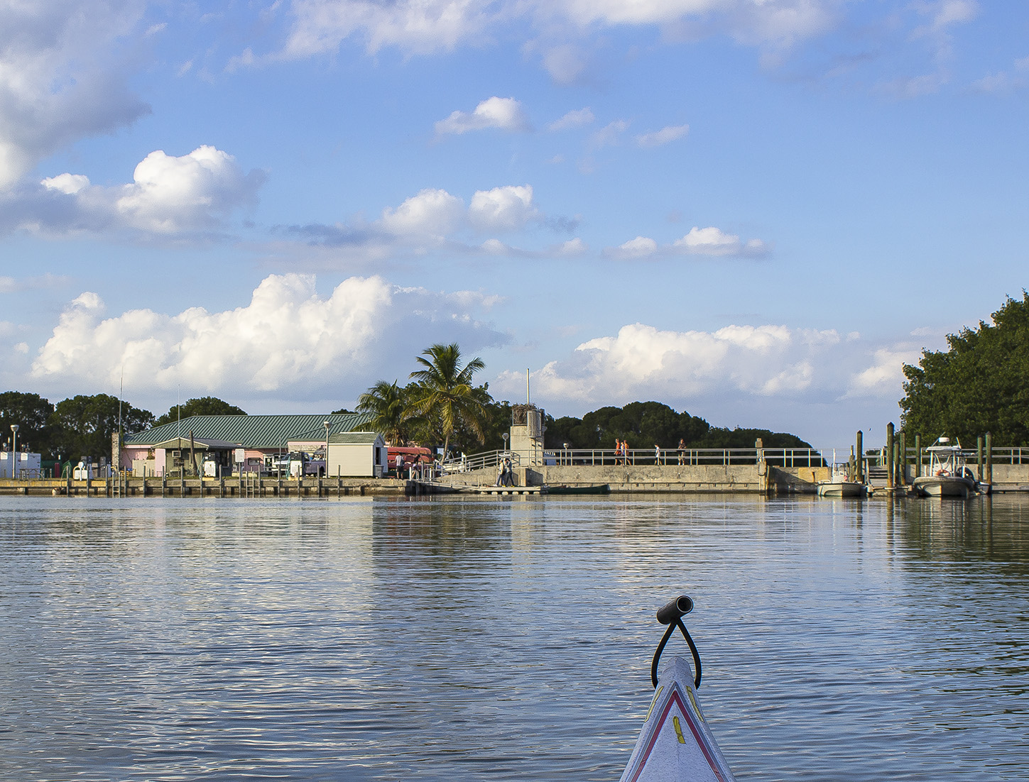
Flamingo is the southernmost headquarters of Everglades National Park, in Monroe County, Florida, United States. Flamingo is one of the two end points of the 99-mile (159-km) Wilderness Waterway (with another end point at Gulf Coast Visitor Center in the Everglades City), and the southern end of the only road (running ) through the park from Florida City. It began as a small coastal settlement on the eastern end of Cape Sable on the southern tip of the Florida peninsula, facing Florida Bay. The actual town of Flamingo was located approximately miles west of the current Flamingo campground area. All that remains of the former town are a few remnants of building foundations, and it is considered a ghost town. Early years Flamingo was first settled circa 1892, although Tequesta Indians had lived in the area prior to that. The settlers made a living by providing fish, fresh vegetables and charcoal to Key West. The settlement received its name in 1893 when the settlers had to cho ... [...More Info...] [...Related Items...] OR: [Wikipedia] [Google] [Baidu] |
Cape Sable Seaside Sparrow
The Cape Sable seaside sparrow (''Ammospiza maritima mirabilis'') is a subspecies of the seaside sparrow, a species of bird in the family Passerellidae native to the United States. This subspecies is endemic to southern Florida. It is designated endangered under the Endangered Species Act. Description The Cape Sable seaside sparrow is 13 to 14 centimeters in length. The back is dark olive-gray and the tail and wings are olive-brown. Adults are light gray on the belly to almost white with dark olive-gray streaks on the breast and sides.Cape Sable Seaside Sparrow. In United States Fish and Wildlife Service. Original 1999, continually updated. Biology This subspecies occurs ...[...More Info...] [...Related Items...] OR: [Wikipedia] [Google] [Baidu] |


