|
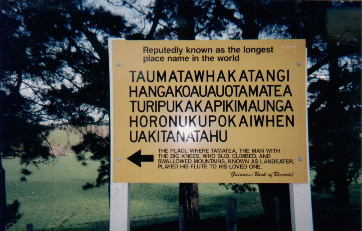
Taumatawhakatangihangakoauauotamateaturipukakapikimaungahoronukupokaiwhenuakitanatahu
is a hill near Porangahau, south of Waipukurau in southern Hawke's Bay, New Zealand. The height of the hill is . The hill is notable primarily for its unusually long name, which is of Māori origin; it is often shortened to Taumata for brevity. It has gained a measure of fame as it is the longest place name found in any English-speaking country, and possibly the longest place name in the world, according to ''World Atlas''. The name of the hill (with 85 characters) has also been listed in the ''Guinness World Records'' as the longest place name. Other versions of the name, including longer ones, are also sometimes used. Pronunciation In the International Phonetic Alphabet, the name may be transcribed as . In the Māori language, the digraph "wh" is pronounced as , a voiceless bilabial fricative, akin to an sound made with pursed lips. Meaning of the name The name "" translates roughly as "The summit where Tamatea, the man with the big knees, the slider, climber of mountain ... [...More Info...] [...Related Items...] OR: [Wikipedia] [Google] [Baidu] |
Māori Language
Māori (), or ('the Māori language'), also known as ('the language'), is an Eastern Polynesian language spoken by the Māori people, the indigenous population of mainland New Zealand. Closely related to Cook Islands Māori, Tuamotuan, and Tahitian, it gained recognition as one of New Zealand's official languages in 1987. The number of speakers of the language has declined sharply since 1945, but a Māori-language revitalisation effort has slowed the decline. The 2018 New Zealand census reported that about 186,000 people, or 4.0% of the New Zealand population, could hold a conversation in Māori about everyday things. , 55% of Māori adults reported some knowledge of the language; of these, 64% use Māori at home and around 50,000 people can speak the language "very well" or "well". The Māori language did not have an indigenous writing system. Missionaries arriving from about 1814, such as Thomas Kendall, learned to speak Māori, and introduced the Latin alphabet. In 1 ... [...More Info...] [...Related Items...] OR: [Wikipedia] [Google] [Baidu] |
Macron (diacritic)
A macron () is a diacritical mark: it is a straight bar placed above a letter, usually a vowel. Its name derives from Ancient Greek (''makrón'') "long", since it was originally used to mark long or heavy syllables in Greco-Roman metrics. It now more often marks a long vowel. In the International Phonetic Alphabet, the macron is used to indicate a mid-tone; the sign for a long vowel is instead a modified triangular colon . The opposite is the breve , which marks a short or light syllable or a short vowel. Uses Syllable weight In Greco-Roman metrics and in the description of the metrics of other literatures, the macron was introduced and is still widely used in dictionaries and educational materials to mark a long (heavy) syllable. Even relatively recent classical Greek and Latin dictionaries are still concerned with indicating only the length (weight) of syllables; that is why most still do not indicate the length of vowels in syllables that are otherwise metrically d ... [...More Info...] [...Related Items...] OR: [Wikipedia] [Google] [Baidu] |
South Island
The South Island, also officially named , is the larger of the two major islands of New Zealand in surface area, the other being the smaller but more populous North Island. It is bordered to the north by Cook Strait, to the west by the Tasman Sea, and to the south and east by the Pacific Ocean. The South Island covers , making it the world's 12th-largest island. At low altitude, it has an oceanic climate. The South Island is shaped by the Southern Alps which run along it from north to south. They include New Zealand's highest peak, Aoraki / Mount Cook at . The high Kaikōura Ranges lie to the northeast. The east side of the island is home to the Canterbury Plains while the West Coast is famous for its rough coastlines such as Fiordland, a very high proportion of native bush and national parks, and the Fox and Franz Josef Glaciers. The main centres are Christchurch and Dunedin. The economy relies on agriculture and fishing, tourism, and general manufacturing and services. ... [...More Info...] [...Related Items...] OR: [Wikipedia] [Google] [Baidu] |
Lake Taupō
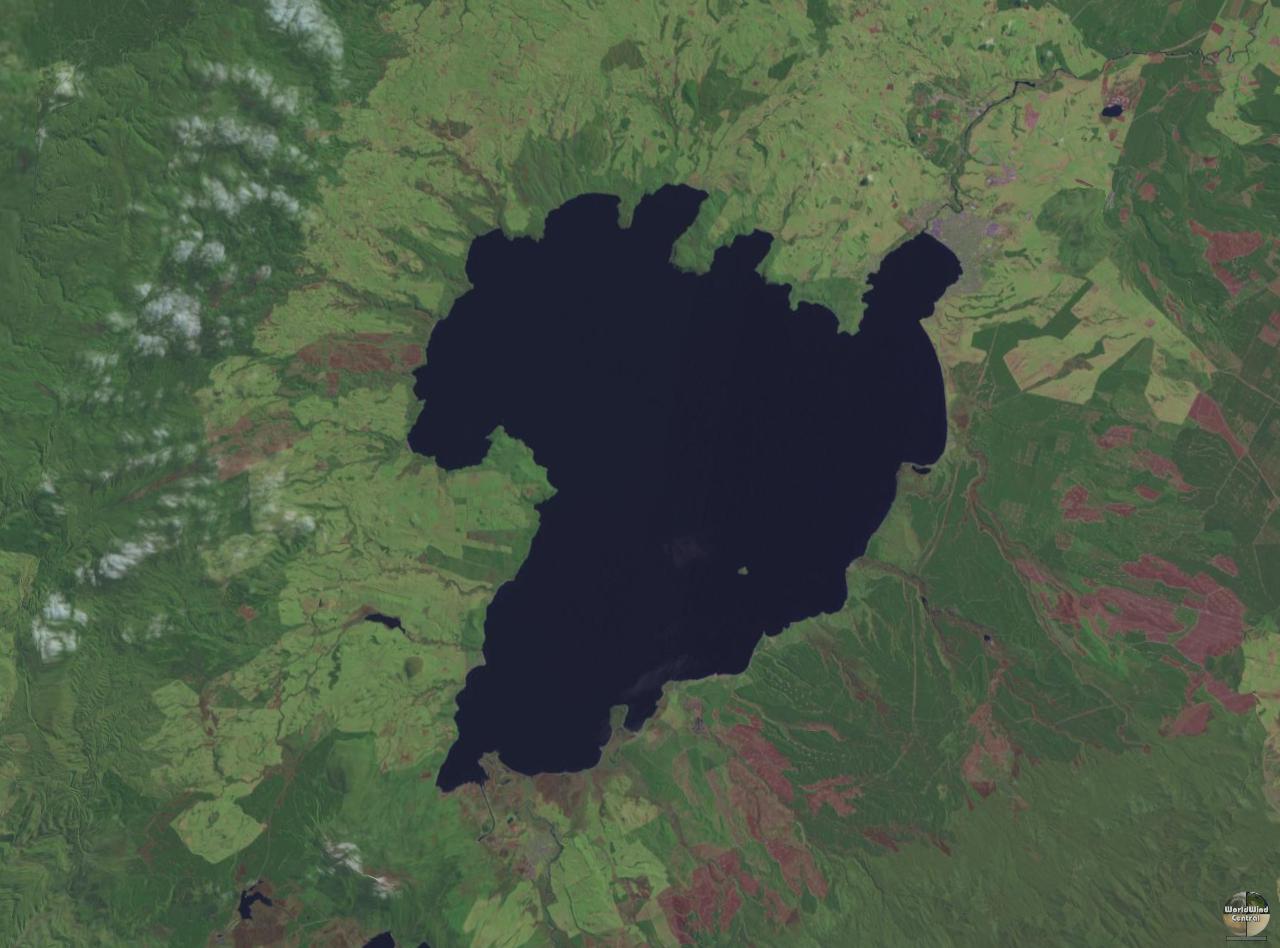
Lake Taupō (also spelled Taupo; mi, Taupō-nui-a-Tia or ) is a large crater lake in New Zealand's North Island, located in the caldera of the Taupō Volcano. The lake is the namesake of the town of Taupō, which sits on a bay in the lake's northeastern shore. With a surface area of , it is the largest lake by surface area in New Zealand, and the second largest freshwater lake by surface area in geopolitical Oceania after Lake Murray in Papua New Guinea. Motutaiko Island lies in the southeastern area of the lake. Lake Taupō has a perimeter of approximately and a maximum depth of . It is drained by the Waikato River (New Zealand's longest river), and its main tributaries are the Waitahanui River, the Tongariro River, and the Tauranga Taupō River. It is a noted trout fishery with stocks of introduced brown and rainbow trout. The level of the lake is controlled by Mercury Energy, the owner of the eight hydroelectric dams on the Waikato River downstream of Lake Taupō, usin ... [...More Info...] [...Related Items...] OR: [Wikipedia] [Google] [Baidu] |
Hastings, New Zealand
Hastings (; mi, Heretaunga) is an inland city of New Zealand and is one of the two major urban areas in Hawke's Bay, on the east coast of the North Island. The population of Hastings (including Flaxmere) is (as of with a further people in Havelock North and in Clive. Hastings is about 18 kilometres inland of the coastal city of Napier. These two neighbouring cities are often called "The Bay Cities" or "The Twin Cities". The city is the administrative centre of the Hastings District. Since the merger of the surrounding and satellite settlements, Hastings has grown to become one of the largest urban areas in Hawke's Bay. Hastings District is a food production region. The fertile Heretaunga Plains surrounding the city produce stone fruits, pome fruit, kiwifruit and vegetables, and the area is one of New Zealand's major red wine producers. Associated business include food processing, agricultural services, rural finance and freight. Hastings is the major service centre f ... [...More Info...] [...Related Items...] OR: [Wikipedia] [Google] [Baidu] |
Napier, New Zealand
Napier ( ; mi, Ahuriri) is a city on the eastern coast of the North Island of New Zealand and the seat of the Hawke's Bay Region, Hawke's Bay region. It is a beachside city with a Napier Port, seaport, known for its sunny climate, esplanade lined with Araucaria heterophylla, Norfolk Pines and extensive Art Deco architecture. Napier is sometimes referred to as the "Nice of the Pacific Ocean, Pacific". The population of Napier is about About south of Napier is the inland city of Hastings, New Zealand, Hastings. These two neighbouring cities are often called "The Bay Cities" or "The Twin Cities" of New Zealand, with the two cities and the surrounding towns of Havelock North and Clive, New Zealand, Clive having a combined population of . The City of Napier has a land area of and a population density of 540.0 per square kilometre. Napier is the nexus of the largest wool centre in the Southern Hemisphere, and it has the primary export seaport for northeastern New Zealand – which ... [...More Info...] [...Related Items...] OR: [Wikipedia] [Google] [Baidu] |
Gisborne, New Zealand
Gisborne ( mi, Tūranga-nui-a-Kiwa "Great standing place of Kiwa") is a city in northeastern New Zealand and the largest settlement in the Gisborne District (or Gisborne Region). It has a population of The district council has its headquarters in Whataupoko, in the central city. The settlement was originally known as Turanga and renamed Gisborne in 1870 in honour of New Zealand Colonial Secretary William Gisborne. Early history First arrivals The Gisborne region has been settled for over 700 years. For centuries the region has been inhabited by the tribes of Te Whanau-a-Kai, Ngaariki Kaiputahi, Te Aitanga-a-Mahaki Rongowhakaata, Ngāi Tāmanuhiri and Te Aitanga-a-Hauiti. Their people descend from the voyagers of the Te Ikaroa-a-Rauru, Horouta and Tākitimu waka. East Coast oral traditions offer differing versions of Gisborne's establishment by Māori. One legend recounts that in the 1300s, the great navigator Kiwa landed at the Turanganui River first on the waka Tā ... [...More Info...] [...Related Items...] OR: [Wikipedia] [Google] [Baidu] |
Tauranga
Tauranga () is a coastal city in the Bay of Plenty region and the fifth most populous city of New Zealand, with an urban population of , or roughly 3% of the national population. It was settled by Māori late in the 13th century, colonised by Europeans in the early 19th century, and was constituted as a city in 1963. The city lies in the north-western corner of the Bay of Plenty, on the south-eastern edge of Tauranga Harbour. The city extends over an area of , and encompasses the communities of Bethlehem, New Zealand, Bethlehem, on the south-western outskirts of the city; Greerton, on the southern outskirts of the city; Matua, west of the central city overlooking Tauranga Harbour; Maungatapu; Mount Maunganui, located north of the central city across the harbour facing the Bay of Plenty; Otūmoetai; Papamoa, Tauranga's largest suburb, located on the Bay of Plenty; Tauranga City; Tauranga South; and Welcome Bay. Tauranga is one of New Zealand's main centres for business, interna ... [...More Info...] [...Related Items...] OR: [Wikipedia] [Google] [Baidu] |
Ngāti Ranginui
Ngāti Ranginui is a Māori iwi (tribe) in Bay of Plenty, New Zealand. Its rohe (tribal area) extends from Waihi in the north, to the Kaimai Range in the west, to south of Te Puke in the south, and to Tauranga in the east. The rohe does not extend offshore to Matakana Island or Mayor Island / Tuhua. Ngāti Ranginui is part of the Tauranga Moana iwi group, which also includes Ngāti Pūkenga and Ngaiterangi. The three iwi all consider Mauao (Mt Maunganui) sacred and share many things in common. Collectively, the iwi are seeking compensation from the New Zealand Government for their losses from the New Zealand Wars but are yet to seek a settlement. History Ranginui is the founding ancestor of the iwi. In Tauranga traditions, Ranginui was the son of Tamatea-pokai-whenua from the '' Takitimu''So spelled in Tauranga traditions canoe. Ranginui was the brother of Kahungunu (the founding ancestor of Ngāti Kahungunu) and Whaene. His brothers eventually moved to other regions of the ... [...More Info...] [...Related Items...] OR: [Wikipedia] [Google] [Baidu] |
Bay Of Plenty Region
The Bay of Plenty ( mi, Te Moana-a-Toi) is a region of New Zealand, situated around a bight of the same name in the northern coast of the North Island. The bight stretches 260 km from the Coromandel Peninsula in the west to Cape Runaway in the east. The Bay of Plenty Region, governed by the Bay of Plenty Regional Council, incorporates several large islands in the bay, in addition to the mainland area. Called ''Te Moana-a-Toi'' (the Sea of Toi) in the Māori language after Toi, an early ancestor, the name 'Bay of Plenty' was bestowed by James Cook in 1769 when he noticed the abundant food supplies at several Māori villages there, in stark contrast to observations he had made earlier in Poverty Bay. History According to local Māori traditions, the Bay of Plenty was the landing point of several migration canoes that brought Māori settlers to New Zealand. These include the ''Mātaatua'', ''Nukutere'', ''Tākitimu'', '' Arawa'' and ''Tainui'' canoes. Many of the desce ... [...More Info...] [...Related Items...] OR: [Wikipedia] [Google] [Baidu] |
Kaipara Harbour
Kaipara Harbour is a large enclosed harbour estuary complex on the north western side of the North Island of New Zealand. The northern part of the harbour is administered by the Kaipara District and the southern part is administered by the Auckland Council. The local Māori tribe is Ngāti Whātua. By area, the Kaipara Harbour is one of the largest harbours in the world. It covers at high tide, with exposed as mudflats and sandflats at low tide.Heath, RA (1975) ''Stability of some New Zealand coastal inlets.'' New Zealand Journal of Marine and Freshwater Research, 9 (4):449-57. According to Māori tradition, the name Kaipara had its origins back in the 15th century when the Arawa chief, Kahumatamomoe, travelled to the Kaipara to visit his nephew at Pouto. At a feast, he was so impressed with the cooked root of the para fern, that he gave the name Kai-para to the district. ''Kaipara'' comes from the Māori meaning "food", and meaning "king fern". Geography The harbo ... [...More Info...] [...Related Items...] OR: [Wikipedia] [Google] [Baidu] |
Hokianga
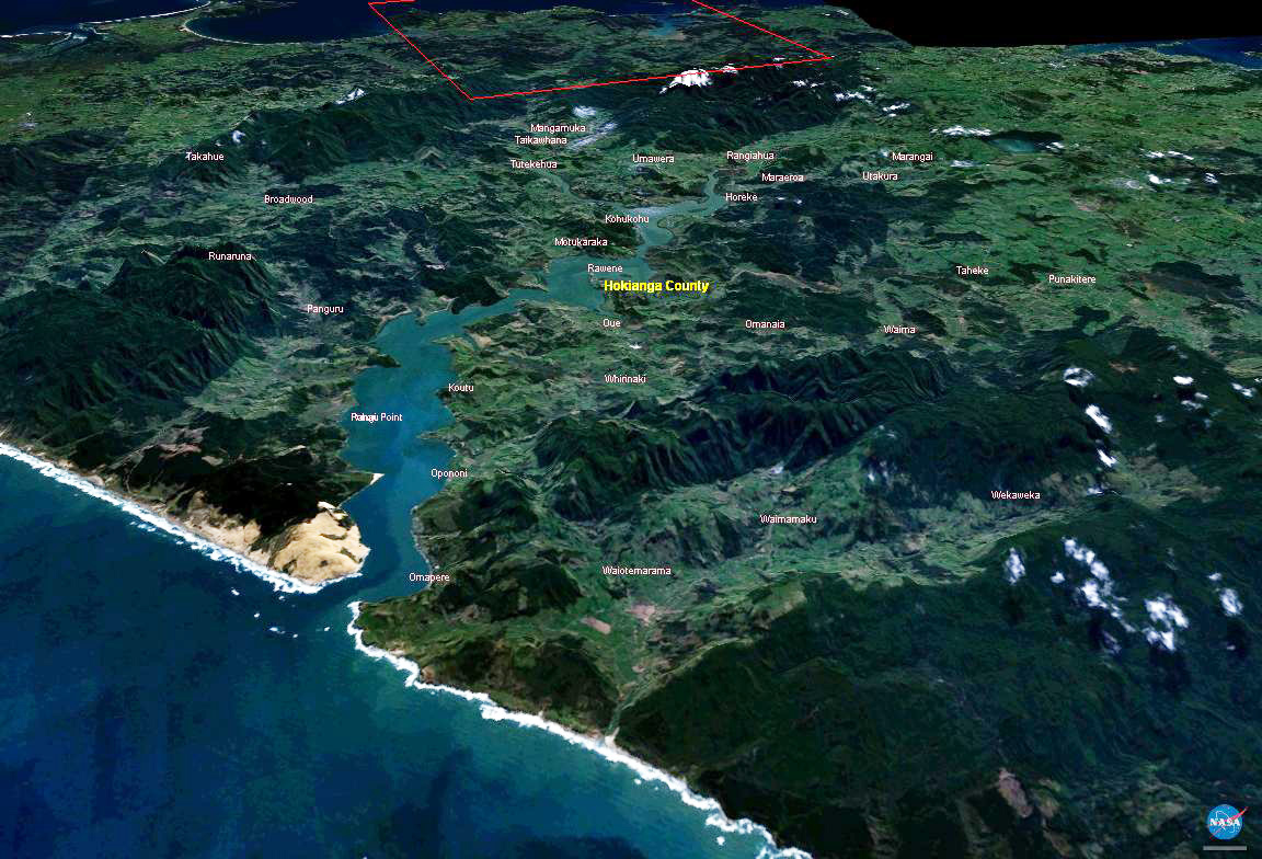
The Hokianga is an area surrounding the Hokianga Harbour, also known as the Hokianga River, a long estuarine drowned valley on the west coast in the north of the North Island of New Zealand. The original name, still used by local Māori, is ''Te Kohanga o Te Tai Tokerau'' ("the nest of the northern people") or ''Te Puna o Te Ao Marama'' ("the wellspring of moonlight"). The full name of the harbour is Te Hokianga-nui-a-Kupe — "the place of Kupe's great return". Geography The Hokianga is in the Far North District, which is in the Northland Region. The area is northwest of Whangarei—and west of Kaikohe—by road. The estuary extends inland for from the Tasman Sea. It is navigable for small craft for much of its length, although there is a bar across the mouth. In its upper reaches the Rangiora Narrows separate the mouths of the Waihou and Mangamuka Rivers from the lower parts of the harbour. 12,000 years ago, the Hokianga was a river valley flanked by steep bu ... [...More Info...] [...Related Items...] OR: [Wikipedia] [Google] [Baidu] |


.jpg)
