|
Tasiujaq
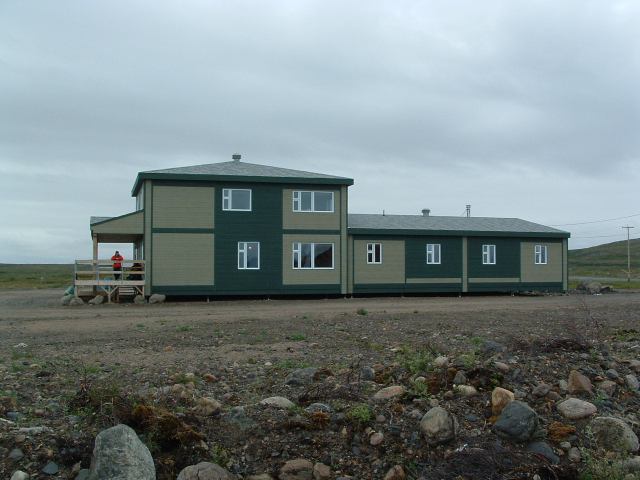
Tasiujaq ( iu, ᑕᓯᐅᔭᖅ, meaning: ''Which resembles a lake'') is a northern village (Inuit community) in Nunavik, in northern Quebec, Canada. Its population in the Canada 2021 Census was 420. Geography Tasiujaq was built on the shores of Leaf Lake at the head of Deep Harbour and lies a few kilometres north of the tree line, where the shrub tundra finally gives way to the arctic tundra. Tasiujaq actually refers to the whole of Leaf Basin: Leaf Lake, Leaf Passage and Leaf Bay. Leaf Basin is renowned for its high tides, which regularly exceed 15 metres. The bedrock under Tasiujaq consists of sedimentary and metamorphic formations, chiefly sandstone, slate, greywacke and argillite. Iron ore, dolomite, and mafic rocks are nearby. The region is very rich in marine mammals (seal and beluga), fish (Arctic char, Atlantic salmon, trout), ducks (particularly eider ducks) and many seabirds; also, close to 1000 musk-ox roam the surrounding area. Gyrfalcons and peregrine f ... [...More Info...] [...Related Items...] OR: [Wikipedia] [Google] [Baidu] |
Nord-du-Québec
Nord-du-Québec (; en, Northern Quebec) is the largest, but the least populous, of the seventeen administrative regions of Quebec, Canada. With nearly of land area, and very extensive lakes and rivers, it covers much of the Labrador Peninsula and about 55% of the total land surface area of Quebec, while containing a little more than 0.5% of the population. Before 1912, the northernmost part of this region was part of the Ungava District of the Northwest Territories, and until 1987 it was referred to as Nouveau-Québec, or ''New Quebec''. It is bordered by Hudson Bay and James Bay in the west, Hudson Strait and Ungava Bay in the north, Labrador in the northeast, and the administrative regions of Abitibi-Témiscamingue, Mauricie, Saguenay–Lac-Saint-Jean, and Côte-Nord in the south and southeast. The Nord-du-Québec region is part of the territory covered by the James Bay and Northern Quebec Agreement of 1975; other regions covered (in part) by this Agreement include Côt ... [...More Info...] [...Related Items...] OR: [Wikipedia] [Google] [Baidu] |
Nunavik
Nunavik (; ; iu, ᓄᓇᕕᒃ) comprises the northern third of the province of Quebec, part of the Nord-du-Québec region and nearly coterminous with Kativik. Covering a land area of north of the 55th parallel, it is the homeland of the Inuit of Quebec and part of the wider Inuit Nunangat. Almost all of the 14,045 inhabitants ( 2021 census) of the region, of whom 90% are Inuit, live in fourteen northern villages on the coast of Nunavik and in the Cree reserved land (TC) of Whapmagoostui, near the northern village of Kuujjuarapik. means "great land" in the local dialect of Inuktitut and the Inuit inhabitants of the region call themselves . Until 1912, the region was part of the District of Ungava of the Northwest Territories. Negotiations for regional autonomy and resolution of outstanding land claims took place in the 2000s. The seat of government would be Kuujjuaq. Negotiations on better empowering Inuit political rights in their land are still ongoing. A flag for N ... [...More Info...] [...Related Items...] OR: [Wikipedia] [Google] [Baidu] |
Kativik (territory)
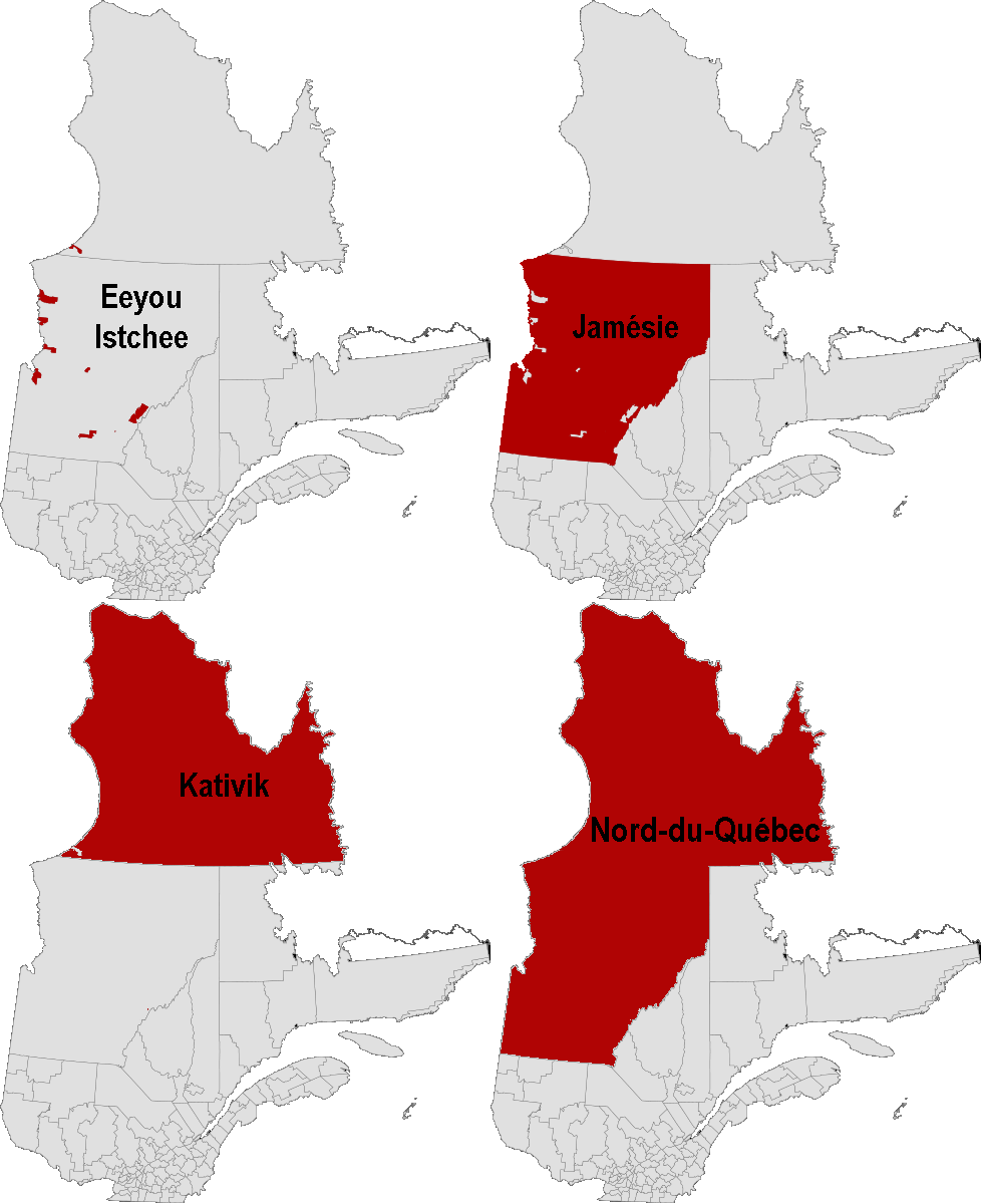
Kativik is a territory equivalent to a regional county municipality (TE) of Quebec, with geographical code 992. Its land area is 443,372.20 km2 (171,186.96 sq mi), and its population was 12,090 at the 2011 Census of Canada. Together with the TEs of Jamésie and Eeyou Istchee, it forms the administrative region and census division (CD) of Nord-du-Québec. The TE of Kativik is coextensive with the territory of the Kativik Regional Government. It comprises all of Nunavik except the Cree reserved land (TC) of Whapmagoostui and the Cree village municipality (VC) also called Whapmagoostui, which belong to Eeyou Istchee TE. Subdivisions The TE of Kativik consists of the following municipal units: * the unorganized territories (NO) of: :* Rivière-Koksoak :* Baie-d'Hudson * the Naskapi village (VK) of: :* Kawawachikamach (but not the Naskapi reserved land (TK) of the same name, Kawawachikamach, which lies detached, to its south, near Schefferville in the Caniapiscau Regio ... [...More Info...] [...Related Items...] OR: [Wikipedia] [Google] [Baidu] |
List Of J Postal Codes Of Canada
__NOTOC__ This is a list of postal codes in Canada where the first letter is J. Postal codes beginning with J are located within the Canadian province of Quebec. Only the first three characters are listed, corresponding to the Forward Sortation Area. Canada Post provides a free postal code look-up tool on its website, via its mobile apps for such smartphones as the iPhone and BlackBerry, and sells hard-copy directories and CD-ROMs. Many vendors also sell validation tools, which allow customers to properly match addresses and postal codes. Hard-copy directories can also be consulted in all post offices, and some libraries. Western and Northern Quebec Northern Quebec (french: le nord du Québec) is a geographic term denoting the northerly, more remote and less populated parts of the Canadian province of Quebec.Alexandre Robaey"Charity group works with Indigenous communities to feed Northern Queb ... - 159 FSAs Urban Rural References {{Canadian postal codes Communicati ... [...More Info...] [...Related Items...] OR: [Wikipedia] [Google] [Baidu] |
Area Code 819
Area codes 819 and 873 are telephone area codes in the North American Numbering Plan (NANP) for central and western Quebec, Canada, including the Quebec portion of the National Capital Region, and the Hudson Strait and Ungava Bay coastlines of Quebec. Major cities in the territory include Gatineau, Sherbrooke, Trois-Rivières, Drummondville, Shawinigan, Victoriaville, Rouyn-Noranda, Val-d'Or, Magog and Mont-Laurier. The incumbent local exchange carriers in 819/873 are Bell Canada, Bell Aliant, Telus, as well as Télébec and other independent companies. From 1992 to 1997, Northwestel was also an incumbent carrier in 819, as it included former Bell Canada areas in the Northwest Territories. Area code 468 is reserved as a third area code in the region. History Ontario and Quebec were the only Canadian provinces that received assignments of multiple area codes by the American Telephone and Telegraph Company (AT&T) when the original North American area codes were created in 1947. ... [...More Info...] [...Related Items...] OR: [Wikipedia] [Google] [Baidu] |
Abitibi—Baie-James—Nunavik—Eeyou
Abitibi—Baie-James—Nunavik—Eeyou (formerly known as Abitibi, Abitibi—Baie-James—Nunavik, and Nunavik—Eeyou) is a federal riding in the province of Quebec, Canada, that have been represented in the House of Commons of Canada since 1966. "Abitibi" was created in 1966, and renamed "Abitibi—Baie-James—Nunavik". It was abolished in 2003, and most of its territory was incorporated into "Nunavik—Eeyou", which was renamed "Abitibi—Baie-James—Nunavik—Eeyou" in 2004. Geography Abitibi—Baie-James—Nunavik—Eeyou consists of: * the Vallée-de-l'Or Regional County Municipality (population 2016: 43,226), including: Lac-Simon Indian Reserve; the Indian Settlement of Grand-Lac Victoria; ;Nord-du-Québec (Population 2016: 44,561) * the Territory of Eeyou Istchee James Bay Regional Government, including: the Cree villages and reserved lands of Whapmagoostui, Chisasibi, Eastmain, Mistissini, Nemiscau, Waskaganish, Waswanipi and Wemindji; the Indian Settlement of Ouj ... [...More Info...] [...Related Items...] OR: [Wikipedia] [Google] [Baidu] |
Tree Line
The tree line is the edge of the habitat at which trees are capable of growing. It is found at high elevations and high latitudes. Beyond the tree line, trees cannot tolerate the environmental conditions (usually cold temperatures, extreme snowpack, or associated lack of available moisture). The tree line is sometimes distinguished from a lower timberline, which is the line below which trees form a forest with a closed Canopy (biology), canopy. At the tree line, tree growth is often sparse, stunted, and deformed by wind and cold. This is sometimes known as ''krummholz'' (German for "crooked wood"). The tree line often appears well-defined, but it can be a more gradual transition. Trees grow shorter and often at lower densities as they approach the tree line, above which they are unable to grow at all. Given a certain latitude, the tree line is approximately 300 to 1000 meters below the permanent snow line and roughly parallel to it. Causes Due to their vertical structure, tree ... [...More Info...] [...Related Items...] OR: [Wikipedia] [Google] [Baidu] |
Tundra
In physical geography, tundra () is a type of biome where tree growth is hindered by frigid temperatures and short growing seasons. The term ''tundra'' comes through Russian (') from the Kildin Sámi word (') meaning "uplands", "treeless mountain tract". There are three regions and associated types of tundra: Arctic tundra, alpine tundra, and Antarctic tundra. Tundra vegetation is composed of dwarf shrubs, sedges, grasses, mosses, and lichens. Scattered trees grow in some tundra regions. The ecotone (or ecological boundary region) between the tundra and the forest is known as the tree line or timberline. The tundra soil is rich in nitrogen and phosphorus. The soil also contains large amounts of biomass and decomposed biomass that has been stored as methane and carbon dioxide in the permafrost, making the tundra soil a carbon sink. As global warming heats the ecosystem and causes soil thawing, the permafrost carbon cycle accelerates and releases much of these soil-contained g ... [...More Info...] [...Related Items...] OR: [Wikipedia] [Google] [Baidu] |
Tide
Tides are the rise and fall of sea levels caused by the combined effects of the gravity, gravitational forces exerted by the Moon (and to a much lesser extent, the Sun) and are also caused by the Earth and Moon orbiting one another. Tide tables can be used for any given locale to find the predicted times and amplitude (or "tidal range"). The predictions are influenced by many factors including the alignment of the Sun and Moon, the #Phase and amplitude, phase and amplitude of the tide (pattern of tides in the deep ocean), the amphidromic systems of the oceans, and the shape of the coastline and near-shore bathymetry (see ''#Timing, Timing''). They are however only predictions, the actual time and height of the tide is affected by wind and atmospheric pressure. Many shorelines experience semi-diurnal tides—two nearly equal high and low tides each day. Other locations have a diurnal cycle, diurnal tide—one high and low tide each day. A "mixed tide"—two uneven magnitude ... [...More Info...] [...Related Items...] OR: [Wikipedia] [Google] [Baidu] |
Northern Village Municipality (Quebec)
The following is a list of the types of Local government in Quebec, local and Wiktionary:supralocal, supralocal territorial units in Quebec, including those used solely for statistical purposes, as defined by the Ministry of Municipal Affairs, Regions and Land Occupancy (Quebec), Ministry of Municipal Affairs, Regions and Land Occupancy and compiled by the Institut de la statistique du Québec. Not included are the urban agglomerations in Quebec, which, although they group together multiple municipalities, exercise only what are ordinarily local municipal powers. A list of local municipal units in Quebec by regional county municipality can be found at List of municipalities in Quebec. Local municipalities All municipalities (except cities), whether township, village, parish, or unspecified ones, are functionally and legally identical. The only difference is that the designation might serve to disambiguate between otherwise identically named municipalities, often neighbouring o ... [...More Info...] [...Related Items...] OR: [Wikipedia] [Google] [Baidu] |
Sedimentary
Sedimentary rocks are types of rock (geology), rock that are formed by the accumulation or deposition of mineral or organic matter, organic particles at Earth#Surface, Earth's surface, followed by cementation (geology), cementation. Sedimentation is the collective name for processes that cause these particles to settle in place. The particles that form a sedimentary rock are called sediment, and may be composed of detritus (geology), geological detritus (minerals) or detritus, biological detritus (organic matter). The geological detritus originated from weathering and erosion of existing rocks, or from the solidification of molten lava blobs erupted by volcanoes. The geological detritus is transported to the place of deposition by water, wind, ice or Mass wasting, mass movement, which are called agents of denudation. Biological detritus was formed by bodies and parts (mainly shells) of dead aquatic organisms, as well as their fecal mass, suspended in water and slowly piling up on ... [...More Info...] [...Related Items...] OR: [Wikipedia] [Google] [Baidu] |


