|
Taplejung District
Taplejung District ( ne, ताप्लेजुङ जिल्ला ) is one of 77 districts of Nepal and one of the 14 districts of Province No. 1. It is remotely located in the Himalayas in Eastern Nepal with Tibet to the north across the Himalayas. Taplejung is the third largest district (by area) of Nepal. The district covers an area of and has a total population (2011 Nepal census) of 127,461. The district is surrounded by Tibet in the north, Sankhuwasabha District in the west, Tehrathum District and Panchthar District in the south and Sikkim (India) in the east. Geographically, the district is located at a latitude of 27º 06’ to 27º 55’N and a longitude of 87º57’ to 87º40’ E. Etymology Literally meaning of Taplejung is "a fort of King Taple" in Limbu language. There was a fort situated at that area in medieval times which was built by King Taple. History Before the unification of Nepal, the area of Taplejung and its surrounds were called ''Pallo Kirat ... [...More Info...] [...Related Items...] OR: [Wikipedia] [Google] [Baidu] |
Districts Of Nepal
Districts in Nepal are second level of administrative divisions after provinces. Districts are subdivided in municipalities and rural municipalities. There are seven provinces and 77 districts in Nepal. After the state's reconstruction of administrative divisions, Nawalparasi District and Rukum District were divided into Parasi District (officially Nawalparasi (West of Bardaghat Susta) District) and Nawalpur District (officially Nawalparasi (East of Bardaghat Susta) District), and Eastern Rukum District and Western Rukum District respectively. District official include: * Chief District Officer, an official under Ministry of Home Affairs is appointed by the government as the highest administrative officer in a district. The C.D.O is responsible for proper inspection of all the departments in a district such as health, education, security and all other government offices. * District Coordination Committee acts as an executive to the District Assembly. The DCC coordin ... [...More Info...] [...Related Items...] OR: [Wikipedia] [Google] [Baidu] |
Tehrathum District
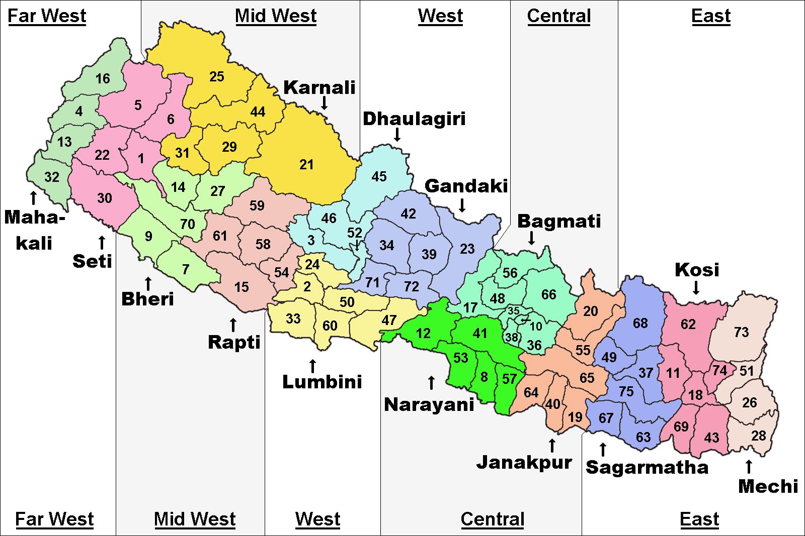
Tehrathum District ( ne, तेह्रथुम जिल्ला ), is one of 14 districts of Province No. 1 of Nepal. Demographics Religion Languages Geographics See also * Radio Tehrathum * Zones of Nepal Until the establishment of seven new provinces in 2015, Nepal was divided into 14 administrative zones (Nepali: अञ्चल; ''anchal'') and 77 districts (Nepali: जिल्ला; ''jillā''). The 14 administrative zones were grouped in ... References * External links Districts of Nepal established in 1962 Districts of Province No. 1 {{Terhathum-geo-stub ... [...More Info...] [...Related Items...] OR: [Wikipedia] [Google] [Baidu] |
Tropical Climate
Tropical climate is the first of the five major climate groups in the Köppen climate classification identified with the letter A. Tropical climates are defined by a monthly average temperature of 18 °C (64.4 °F) or higher in the coolest month, and feature hot temperatures all year-round. Annual precipitation is often abundant in tropical climates, and shows a seasonal rhythm but may have seasonal dryness to varying degrees. There are normally only two seasons in tropical climates, a wet (rainy / monsoon) season and a dry season. The annual temperature range in tropical climates is normally very small. Sunlight is intense in these climates. There are three basic types of tropical climates within the tropical climate group: tropical rainforest climate (Af), tropical monsoon climate (Am) and tropical wet and dry climate or tropical savannah (Aw for dry winters, and As for dry summers), which are classified and distinguished by the precipitation and the precipitation lev ... [...More Info...] [...Related Items...] OR: [Wikipedia] [Google] [Baidu] |
Geography Of Nepal
Nepal measures about along its Himalayan axis by across. It has an area of . Nepal is landlocked by China's Tibet Autonomous Region to the north and India on other three sides. West Bengal's narrow '' Siliguri Corridor'' separate Nepal and Bangladesh. To the east are Bhutan and India. Landform regions For a country of its size, Nepal has tremendous geographic diversity. It rises from as low as elevation in the tropical Terai—the northern rim of the Gangetic Plain, through beyond the perpetual snow line to 90 peaks over including Earth's highest ( Mount Everest or ''Sagarmatha''). In addition to the continuum from tropical warmth to cold comparable to polar regions, average annual precipitation varies from as little as in its narrow proportion of the rainshadow north of the Himalayas to as much as on windward slopes, the maximum mainly resting on the magnitude of the South Asian monsoon. Forming south-to-north transects, Nepal can be divided into three belts: Ter ... [...More Info...] [...Related Items...] OR: [Wikipedia] [Google] [Baidu] |
Kanchenjunga Conservation Area
Kanchenjunga Conservation Area is a protected area in the Himalayas of eastern Nepal that was established in 1997. It covers in the Taplejung District and comprises two peaks of Kanchenjunga. In the north it adjoins the Qomolangma National Nature Preserve in Tibet, and in the east the Khangchendzonga National Park in Sikkim. To the west it borders the Sankhuwasabha District. It ranges in elevation from . It is part of the Sacred Himalayan Landscape, which is being developed by WWF Nepal in partnership with the International Centre for Integrated Mountain Development. History When the Kanchenjunga Conservation Area was designated in March 1997, it was Nepal's third Conservation Area. In April 2003, a ''Kanchenjunga Conservation Area Management Council'' was formed with the support of WWF Nepal, comprising seven ''Conservation Area User Committees'', 44 ''User Groups'', and 32 ''Mother Groups''. These community based institutions support effective implementation of all planned ac ... [...More Info...] [...Related Items...] OR: [Wikipedia] [Google] [Baidu] |
Tamur River
The Tamor River is a major river in eastern Nepal, which begins around Kanchenjunga. The Tamor and the Arun join the Sun Koshi at Tribenighat to form the giant Saptakoshi which flows through Mahabharat Range on to the Gangetic plain Koshi river system The Koshi or Sapta Kosi drains eastern Nepal. It is known as Sapt Koshi because of the seven rivers which join together in east-central Nepal to form this river. The main rivers forming the Koshi system are – the Sun Koshi, the Indravati River Indravati River is a tributary of the Godavari River, in central India. The Indravati River is a stream of the river Godavari. Its starting point, found to be the Ghats of Dandakaranya, range from a hilltop village Mardiguda of Thuamula Ra ..., the Bhote Koshi, the Dudh Kosi, Dudh Koshi, Arun River (Nepal), Arun River, Barun River, and Tamur River. The combined river flows through the Chatra Gorge in a southerly direction to emerge from the hills. The Sun Koshi contributes 44 pe ... [...More Info...] [...Related Items...] OR: [Wikipedia] [Google] [Baidu] |
Kanchenjunga
Kangchenjunga, also spelled Kanchenjunga, Kanchanjanghā (), and Khangchendzonga, is the third highest mountain in the world. Its summit lies at in a section of the Himalayas, the ''Kangchenjunga Himal'', which is bounded in the west by the Tamur River, in the north by the Lhonak River and Jongsang La, and in the east by the Teesta River. It lies in the border region between Nepal and Sikkim state of India, with three of the five peaks, namely Main, Central and South, directly on the border, and the peaks West and Kangbachen in Nepal's Taplejung District. Until 1852, Kangchenjunga was assumed to be the highest mountain in the world, but calculations and measurements by the Great Trigonometrical Survey of India in 1849 showed that Mount Everest, known as Peak XV at the time, is actually higher. After allowing for further verification of all calculations, it was officially announced in 1856 that Kangchenjunga was the third highest mountain. The Kangchenjunga is a sacred mount ... [...More Info...] [...Related Items...] OR: [Wikipedia] [Google] [Baidu] |
Dhankuta District
Dhankuta District ( ne, धनकुटा जिल्ला) () is one of 14 districts of Province No. 1 of eastern Nepal. The district covers an area of and has a population (2011) of 163,412. Dhankuta is the district headquarters of Dhankuta District. History Dhankuta was a part of Kirat Region before unification of those parts into Kingdom of Nepal. After 1816 there were 10 districts in Nepal and Dhankuta-chainpur district was one of them. All land from east of Dudhkosi river to the Mechi river was one district Dhankuta-chainpur. From 1885 to 1962 Nepal remained divided into 32 districts and there were six districts in eastern-hill region: East No. 1, East No. 2, East No. 3, East No. 4, Ilam and Dhankuta. Dhankuta was center of these districts. That time also dhankuta was a large (by area) district. Current Sankhuwasabha, Tehrathum, Taplejung, Panchthar and Dhankuta districts were Incorporated under one district. The total area of the former Dhankuta district wa ... [...More Info...] [...Related Items...] OR: [Wikipedia] [Google] [Baidu] |
Limbu People
The Limbu (exonym) or Yakthung (endonym) are a Sino-Tibetan indigenous tribe (Bhot-Burmeli) of the Himalayan region of eastern Nepal, Sikkim, and western Bhutan. The original name of the Limbu is ''Yakthung'' () or ''Yakthum''. Limbu males are called ''Yakthungba'' or ''Yakthumba'' and Limbu females are called "Yakthumma" or "Yakthungma". Ancient texts state that "Yakthung" or "Yakthum" is a derivative of Yaksha and some interpret its meaning as the "Yaksha winner". In the Limbu language it means "heroes of the hills" (Yak - hills, thung or thum - heroes or mighty warriors), which connotates with the ancient Kiratis. Subba is a title given by the Shah Kings only to Limbu village chiefs. Subba was not an indigenous Yakthung terminology, but now the two terms are almost interchangeable. People often debate about the use of term "Subba" as their surname in Limbu tribe. It is important to note that only the village chiefs were allowed to use the term Subba in their name. It was ho ... [...More Info...] [...Related Items...] OR: [Wikipedia] [Google] [Baidu] |
Limbuwan
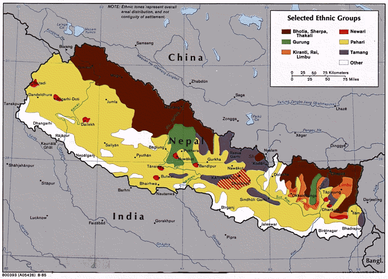
Limbuwan is an area of the Himalayan region historically made up of 10 Limbu kingdoms, now part of eastern Nepal. Limbuwan means "abode of the Limbus" or "Land of the Limbus". In modern times, a political movement in Nepal has developed which claims to territorial authority for a Limbuwan federal state in Nepal’s eastern borderland. On Jan 20, 2010, State Reconstruction Committee of Constituent Assembly passed a federal structure of 14 states supported by UCPNM and UML. 14 proposed states in including Limbuwan State. Limbuwan autonomous ethnic province in Nepal comprising those districts and named : Taplejung, Panchthar, Ilam, Terhathum, and few regions of Sankhuwasabha and Dhankuta districts. Limbuwan is the land east of the Arun; Sabha Khola and Koshi Rivers and west of Kanchenjunga Mountain and the Mechi River. Eastern Nepal and the dominant ethnic groups of that region are indigenously called Kirat. The land was sub-divided into three regions, namely, the Wallo, M ... [...More Info...] [...Related Items...] OR: [Wikipedia] [Google] [Baidu] |
Unification Of Nepal
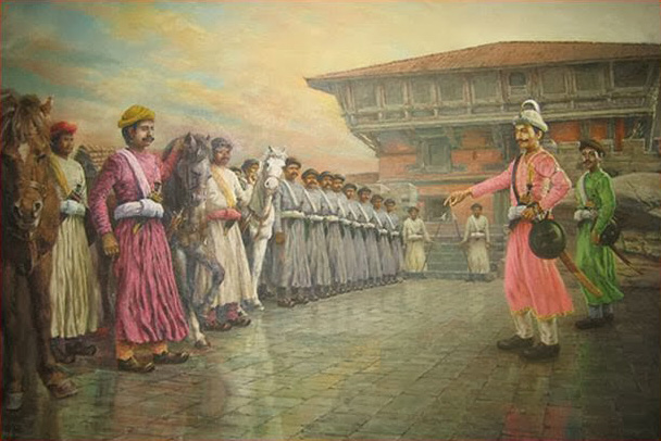
The Unification of Nepal, also known as Expansion of Gorkha Kingdom, officially began in 1743 AD (1799 BS) after King Prithvi Narayan Shah of Gorkha launched an aggressive annexation campaign seeking to broaden his own kingdom's border. After conquering the Nepal Mandala, which consisted of the different city-states of the Kathmandu, Lalitpur, Kirtipur and Bhaktapur, Shah moved his hilly capital in Gorkha to the fertile and wealthy city of Kathmandu and adopted the name Nepal for the entire Gorkha Empire. The Shah dynasty would go on to expand the various warring kingdoms that once occupied parts of present-day Nepal into a nation-state that stretched up to the Sutlej River in the west and Sikkim-Jalpaiguri in the east. Before usage by the Gorkha Empire, the Kathmandu Valley was known as Nepal after the Nepal Mandala, the region's Nepal Bhasa name. Invasion of Nuwakot Prithvi Narayan Shah's annexation campaign began with the nearby kingdom of Nuwakot. Nuwakot marke ... [...More Info...] [...Related Items...] OR: [Wikipedia] [Google] [Baidu] |
Eastern Nepal
The Eastern Development Region (Nepali: पुर्वाञ्चल विकास क्षेत्र, ''Purwānchal Bikās Kshetra'') was one of Nepal's five development regions. It is also known as Kirata region. It was located at the eastern end of the country with its headquarters at Dhankuta. The town of Dhankuta was the headquarter of the Eastern Region, as well as the headquarter of the Dhankuta District. History On April 13, 1961 Mahendra, the king of Nepal, divided the existing 35 districts into 75 districts and grouped them into 14 administrative zones. In 1972, the King of Nepal grouped 14 zones into total 4 development regions, thus Eastern Development Region came into existence. On 20 September 2015, Eastern Development Region including all other development regions of Nepal were abolished, when the new Constitution of Nepal-2015 was proclaimed. The total area of the region was 28,456 km². Administrative divisions The region administratively was ... [...More Info...] [...Related Items...] OR: [Wikipedia] [Google] [Baidu] |


