|
Tangowahine
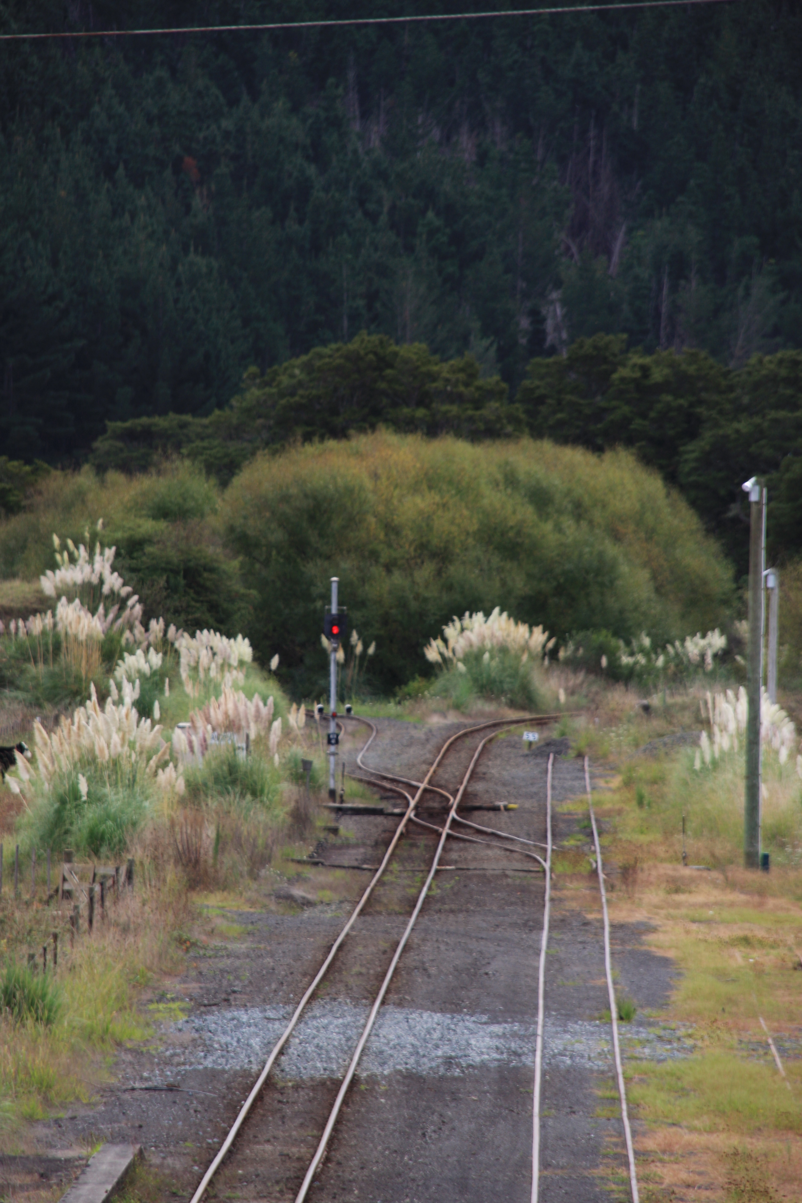
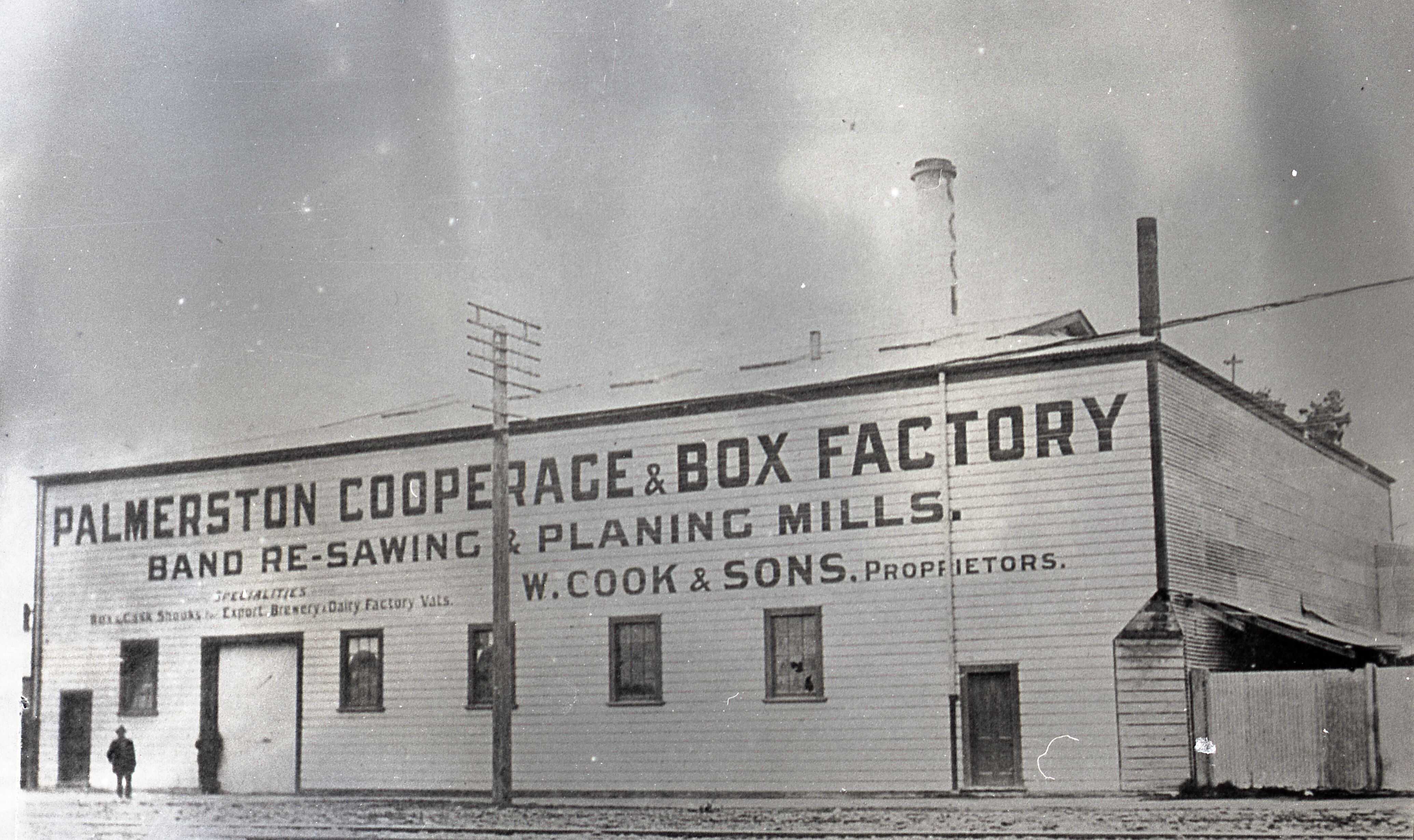
Tangowahine is a community on the northern Kaipara Harbour in Northland, New Zealand. The Tangowahine Stream flows from the Tutamoe Range east and then south to join the Wairoa River at Tangowahine. State Highway 14 passes through Tangowahine. Dargaville is 12 km to the south west, and Tangiteroria is 15 km north east. History A bridge was built over the Tangowahine River in 1893-95, to allow a road from Dargaville to Tangiteroria to be completed. Tangowahine was a mill town for the kahikatea and kauri timber trade. Robert Gibbon's mill was built around 1900 and included electric lighting. Steamers loaded timber at the town's two wharves. The S.S. ''Matarere'' ran a passenger service. The population was 402 in about 1910. The mill was rebuilt after a fire in 1916, and closed in 1931. Gum-diggers also operated in the area in the early 20th century. From January 1931, Tangowahine was the terminus for the railway line. In 1940, the line was extended to Dargavill ... [...More Info...] [...Related Items...] OR: [Wikipedia] [Google] [Baidu] |
Dargaville Branch
The Dargaville Branch is a branch line railway that leaves the North Auckland Line not far south of Whangarei and runs westward to Dargaville. Construction of this relatively short line took approximately two decades, and when it was completed, it linked the now closed Donnellys Crossing Section with the national rail network. The branch has been closed to all traffic since 2014 and is currently used by a tourist railcart operation. Construction The Dargaville Branch was built relatively late in comparison to most railway lines in New Zealand. Construction from Waiotira on the North Auckland Line commenced in 1922. Dargaville, however, was not reached for another eighteen years. The first twenty-two kilometres through unstable country took six years to build, with the line not opened to Kirikopuni until 15 May 1928. In January 1931, the line was open to Tangowahine, sixteen kilometres from Dargaville, but construction ceased for five years due to the Great Depression. ... [...More Info...] [...Related Items...] OR: [Wikipedia] [Google] [Baidu] |
Tangiteroria
Tangiteroria is a small rural community in the North Island of New Zealand. It is located halfway between Whangārei and Dargaville on State Highway 14 on the banks of the Northern Wairoa river. It consists of a primary school, pub (currently closed), Catholic Church (currently closed), petrol station (currently closed), marae, and a sports complex/community centre (pot luck dinner once a month on a Friday). The sports complex and community centre were destroyed by a fire in the early hours of January 16, 2020. The local cricket team play either Kirikopuni or Pukehuia once a week through the summer. Kirikopuni and Pukehuia both had railway stations on the Dargaville Branch for the movement of stock throughout Northland and a passenger service. History and culture A Wesleyan mission station was set up by James Wallis in 1836, and then run by James Buller. The station lasted until 1853. Kauri logs were sent down the river to be milled in the mid-1860s. A flax mill operated in ... [...More Info...] [...Related Items...] OR: [Wikipedia] [Google] [Baidu] |
Maungaru
Tangiteroria is a small rural community in the North Island of New Zealand. It is located halfway between Whangārei and Dargaville on State Highway 14 on the banks of the Northern Wairoa river. It consists of a primary school, pub (currently closed), Catholic Church (currently closed), petrol station (currently closed), marae, and a sports complex/community centre (pot luck dinner once a month on a Friday). The sports complex and community centre were destroyed by a fire in the early hours of January 16, 2020. The local cricket team play either Kirikopuni or Pukehuia once a week through the summer. Kirikopuni and Pukehuia both had railway stations on the Dargaville Branch for the movement of stock throughout Northland and a passenger service. History and culture A Wesleyan mission station was set up by James Wallis in 1836, and then run by James Buller. The station lasted until 1853. Kauri logs were sent down the river to be milled in the mid-1860s. A flax mill operated i ... [...More Info...] [...Related Items...] OR: [Wikipedia] [Google] [Baidu] |
Kahikatea
''Dacrycarpus dacrydioides'', commonly known as kahikatea (from Māori) and white pine, is a coniferous tree endemic to New Zealand. A podocarp, it is New Zealand's tallest tree, gaining heights of 60 m and a life span of 600 years. It was first described botanically by the French botanist Achille Richard in 1832 as ''Podocarpus'' ''dacrydioides'', and was given its current binomial name ''Dacrycarpus dacrydioides'' in 1969 by the American botanist David de Laubenfels. Analysis of DNA has confirmed its evolutionary relationship with other species in the genera ''Dacrycarpus'' and ''Dacrydium''. In traditional Māori culture, it is an important source of timber for the building of waka and making of tools, of food in the form of its berries, and of dye. When Europeans discovered it in the 18th century they found large remnant stands in both the North and South Islands, despite burning of forest by early Māori. Its use for timber and its damp fertile habitat, ideal for dairy far ... [...More Info...] [...Related Items...] OR: [Wikipedia] [Google] [Baidu] |
2013 New Zealand Census
The 2013 New Zealand census was the thirty-third national census. "The National Census Day" used for the census was on Tuesday, 5 March 2013. The population of New Zealand was counted as 4,242,048, – an increase of 214,101 or 5.3% over the 2006 census. The 2013 census forms were the same as the forms developed for the 2011 census which was cancelled due to the February 2011 major earthquake in Christchurch. There were no new topics or questions. New Zealand's next census was conducted in March 2018. Collection methods The results from the post-enumeration survey showed that the 2013 census recorded 97.6 percent of the residents in New Zealand on census night. However, the overall response rate was 92.9 percent, with a non-response rate of 7.1 percent made up of the net undercount and people who were counted in the census but had not received a form. Results Population and dwellings Population counts for New Zealand regions. Note: All figures are for the census usually r ... [...More Info...] [...Related Items...] OR: [Wikipedia] [Google] [Baidu] |
2018 New Zealand Census
Eighteen or 18 may refer to: * 18 (number), the natural number following 17 and preceding 19 * one of the years 18 BC, AD 18, 1918, 2018 Film, television and entertainment * ''18'' (film), a 1993 Taiwanese experimental film based on the short story ''God's Dice'' * ''Eighteen'' (film), a 2005 Canadian dramatic feature film * 18 (British Board of Film Classification), a film rating in the United Kingdom, also used in Ireland by the Irish Film Classification Office * 18 (''Dragon Ball''), a character in the ''Dragon Ball'' franchise * "Eighteen", a 2006 episode of the animated television series ''12 oz. Mouse'' Music Albums * ''18'' (Moby album), 2002 * ''18'' (Nana Kitade album), 2005 * '' 18...'', 2009 debut album by G.E.M. Songs * "18" (5 Seconds of Summer song), from their 2014 eponymous debut album * "18" (One Direction song), from their 2014 studio album ''Four'' * "18", by Anarbor from their 2013 studio album '' Burnout'' * "I'm Eighteen", by Alice Cooper commo ... [...More Info...] [...Related Items...] OR: [Wikipedia] [Google] [Baidu] |
Agathis Australis
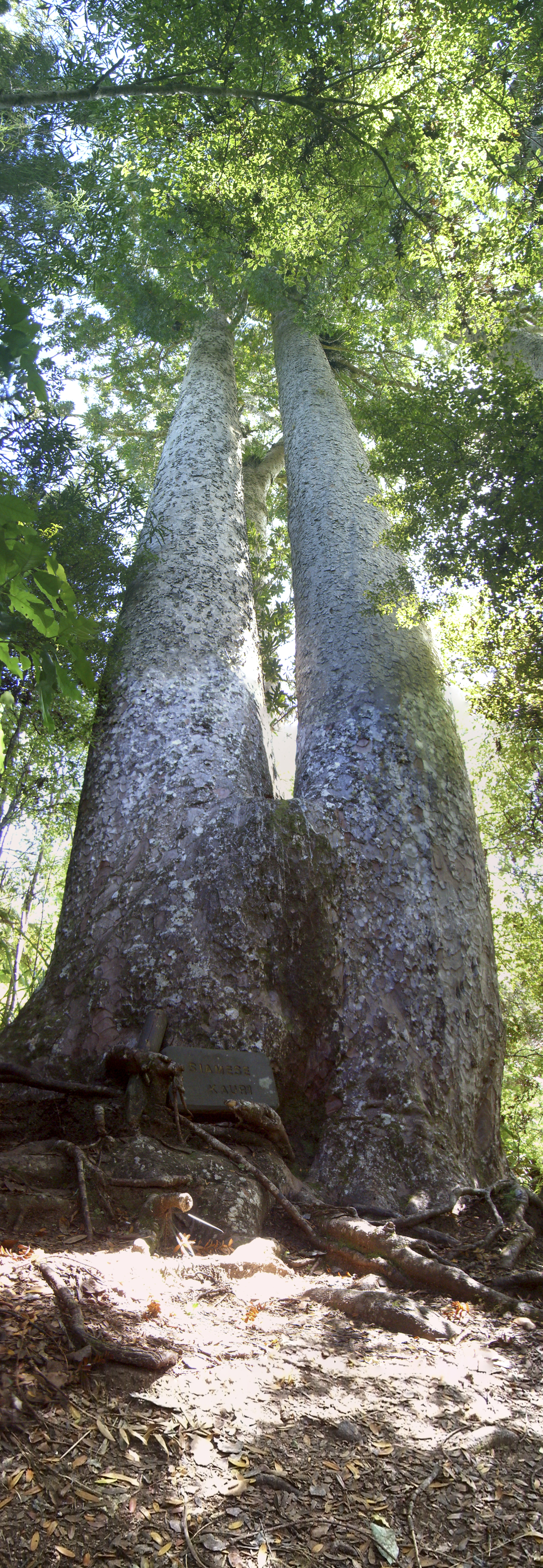
''Agathis australis'', commonly known by its Māori name kauri (), is a coniferous tree in the family ''Araucariaceae'', found north of 38°S in the northern regions of New Zealand's North Island. It is the largest (by volume) but not tallest species of tree in New Zealand, standing up to 50 m tall in the emergent layer above the forest's main canopy. The tree has smooth bark and small narrow leaves. Other common names to distinguish ''A. australis'' from other members of '' Agathis'' are southern kauri and New Zealand kauri. With its novel soil interaction and regeneration pattern it can compete with faster growing angiosperms. Because it is such a conspicuous species, forest containing kauri is generally known as kauri forest, although kauri need not be the most abundant tree. In the warmer northern climate, kauri forests have a higher species richness than those found further south. Kauri even act as a foundation species that modify the soil under their canopy to cre ... [...More Info...] [...Related Items...] OR: [Wikipedia] [Google] [Baidu] |
New Zealand
New Zealand ( mi, Aotearoa ) is an island country in the southwestern Pacific Ocean. It consists of two main landmasses—the North Island () and the South Island ()—and over 700 smaller islands. It is the sixth-largest island country by area, covering . New Zealand is about east of Australia across the Tasman Sea and south of the islands of New Caledonia, Fiji, and Tonga. The country's varied topography and sharp mountain peaks, including the Southern Alps, owe much to tectonic uplift and volcanic eruptions. New Zealand's capital city is Wellington, and its most populous city is Auckland. The islands of New Zealand were the last large habitable land to be settled by humans. Between about 1280 and 1350, Polynesians began to settle in the islands and then developed a distinctive Māori culture. In 1642, the Dutch explorer Abel Tasman became the first European to sight and record New Zealand. In 1840, representatives of the United Kingdom and Māori chiefs ... [...More Info...] [...Related Items...] OR: [Wikipedia] [Google] [Baidu] |
Northland Region
The Northland Region ( mi, Te Tai Tokerau) is the northernmost of New Zealand's 16 local government regions. New Zealanders sometimes refer to it as the Winterless North because of its mild climate all throughout the year. The main population centre is the city of Whangārei, and the largest town is Kerikeri. At the 2018 New Zealand census, Northland recorded a population growth spurt of 18.1% since the previous 2013 census, placing it as the fastest growing region in New Zealand, ahead of other strong growth regions such as the Bay of Plenty (2nd with 15%) and Waikato (3rd with 13.5%). Geography The Northland Region occupies the northern 80% (265 km) of the 330 km Northland Peninsula, the southernmost part of which is in the Auckland Region. Stretching from a line at which the peninsula narrows to a width of just 15 km a little north of the town of Wellsford, Northland Region extends north to the tip of the Northland Peninsula, covering an area of 13,940&nb ... [...More Info...] [...Related Items...] OR: [Wikipedia] [Google] [Baidu] |
Dargaville
Dargaville ( mi, Takiwira) is a town located in the North Island of New Zealand. It is situated on the bank of the Northern Wairoa River in the Kaipara District of the Northland region. The town is located 55 kilometres southwest of Whangārei. Dargaville is 174 kilometres north of Auckland. It is noted for the high proportion of residents of Croatian descent. The area around it is one of the chief regions in the country for cultivating kumara (sweet potato) and so Dargaville is known by many locals as the Kumara Capital of New Zealand. History and culture The town was named after timber merchant and politician Joseph Dargaville (1837–1896). Dargaville was founded in 1872, during the 19th-century kauri gum and timber trade, it briefly had New Zealand's largest population. Dargarville was made a borough in 1908. The area became known for a thriving industry that included gum digging and kauri logging, which was based mainly at Te Kōpuru, several kilometres south of Darg ... [...More Info...] [...Related Items...] OR: [Wikipedia] [Google] [Baidu] |
State Highway 14 (New Zealand)
State Highway 14 (SH 14) is a New Zealand New Zealand state highway network, state highway in the north of the North Island. It forms an east to west connection between and . It runs to the west coast of the Northland Region of New Zealand. Route SH 14 starts in Whangarei, running initially west to Horahora, Whangarei, Horahora and Maunu, New Zealand, Maunu before turning southwest, reaching Maungatapere, where it meets of which it shares a brief concurrency of . It then runs southwestwards to Dargaville where it terminates at a junction with . Major intersections See also *List of New Zealand state highways *List of roads and highways, for notable or famous roads worldwide References External linksNew Zealand Transport Agency State Highways in New Zealand, 14 Transport in the Northland Region {{NewZealand-road-stub ... [...More Info...] [...Related Items...] OR: [Wikipedia] [Google] [Baidu] |


