|
Tanafjord
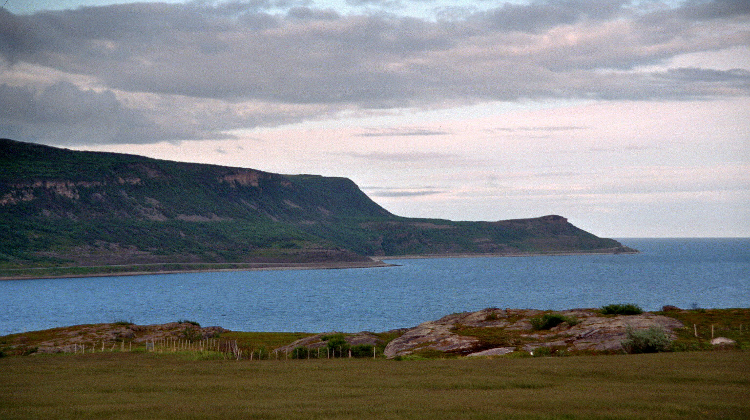
The Tanafjord or Tanafjorden ( sme, Deanuvuotna) is a large fjord in Troms og Finnmark county, Norway. It is located in the municipalities of Tana, Gamvik, and Berlevåg. Its orientation is mainly north–south, reaching approximately from the small village of Smalfjord in Tana Municipality in the south to the mouth of the fjord at the Barents Sea. The fjord separates the Nordkinn Peninsula (Gamvik Municipality) in the west from the Varanger Peninsula ( Berlevåg Municipality) in the east. The Tana River empties into the southern part of the fjord. There are several side fjords which branch off of the main Tanafjorden including the Hopsfjorden, Langfjorden, and Gulgofjorden. There are some settlements along the fjord, but they are all small and rather isolated. Settlements include the villages of Vestertana, Austertana, Trollfjorden, Skjånes, Nervei, and Store Molvik Store may refer to: Enterprises * Retail store, a shop where merchandise is sold, usually products and ... [...More Info...] [...Related Items...] OR: [Wikipedia] [Google] [Baidu] |
Tana, Norway
or is a municipality in Troms og Finnmark county, Norway. The administrative centre of the municipality is the village of Tana bru. Among the other villages in the municipality are Austertana, Bonakas, Polmak, Rustefjelbma, and Skiippagurra. The municipality is the 5th largest by area out of the 356 municipalities in Norway. Deatnu-Tana is the 236th most populous municipality in Norway with a population of 2,821. The municipality's population density is and its population has decreased by 2.6% over the previous 10-year period. Regarding the fauna - in 2022 there had been at least one bear; one bear was eliminated (by government order) because deaths of sheep were attributed to at least one bear. Name ''Tana'' is a Norwegianized form of the Northern Sami name ''Deatnu''. The Sami name is identical with the Sami word ''deatnu'' which means "great river" or "main river", referring to the main river ( Tana River) which runs through the municipality. Prior to 1918, the name was ... [...More Info...] [...Related Items...] OR: [Wikipedia] [Google] [Baidu] |
Tana Municipality
or is a municipality in Troms og Finnmark county, Norway. The administrative centre of the municipality is the village of Tana bru. Among the other villages in the municipality are Austertana, Bonakas, Polmak, Rustefjelbma, and Skiippagurra. The municipality is the 5th largest by area out of the 356 municipalities in Norway. Deatnu-Tana is the 236th most populous municipality in Norway with a population of 2,821. The municipality's population density is and its population has decreased by 2.6% over the previous 10-year period. Regarding the fauna - in 2022 there had been at least one bear; one bear was eliminated (by government order) because deaths of sheep were attributed to at least one bear. Name ''Tana'' is a Norwegianized form of the Northern Sami name ''Deatnu''. The Sami name is identical with the Sami word ''deatnu'' which means "great river" or "main river", referring to the main river ( Tana River) which runs through the municipality. Prior to 1918, the name was ... [...More Info...] [...Related Items...] OR: [Wikipedia] [Google] [Baidu] |
Varanger Peninsula
The Varanger Peninsula ( no, Varangerhalvøya; sme, Várnjárga; fkv, Varenkinniemi) is a peninsula in Finnmark county, Norway. It is located in the northeasternmost part of Norway, along the Barents Sea. The peninsula has the Tanafjorden to the west, the Varangerfjorden to the south, and the Barents Sea to the north and east. The municipalities of Vadsø, Båtsfjord, Berlevåg, Vardø, Tana, and Nesseby share the peninsula. Nesseby and Tana are only partially on the peninsula, with the rest being entirely on the peninsula. The Varangerhalvøya National Park protects most of the land on the peninsula. Geography The area has rugged mountain terrain with altitudes of up to . Much of the relief of the peninsula is a paleic surface similar to the one found in the highlands of southern Norway. In the peninsula the paleic surface is made up of an undulating plateau between the altitudes of 200 and 600 m.a.s.l. The higher parts of the undulating plateau are made up by erosio ... [...More Info...] [...Related Items...] OR: [Wikipedia] [Google] [Baidu] |
Nervei
Nervei ( sme, Njereveadji) is a small Sami village in the Gamvik Municipality in Troms og Finnmark county, Norway. It is located along the shore of Langfjorden, an arm of Tanafjorden in Eastern Finnmark. The nearby village of Laggo is located to the south. The main industries in Nervei are sea harvesting and farming. The main exports are cod, dried fish, king crabs, sheep, and products from mohair Mohair (pronounced ) is a fabric or yarn made from the hair of the Angora goat. (This should not be confused with Angora wool, which is made from the fur of the Angora rabbit.) Both durable and resilient, mohair is notable for its high luster ... wool. There is no official road going to the village yet, so commuting is done by boat from Skjånes or Smalfjord. The residents have been trying to get a road connection for many years, and some work has begun on building a road from Rv. 888 at Reinoksevannet to Nervei. Currently, the dirt-gravel road is open during most of the ... [...More Info...] [...Related Items...] OR: [Wikipedia] [Google] [Baidu] |
Tana River (Norway)
The Tana ( fi, Teno or ; sme, Deatnu ; no, Tana/Tanaelva; sv, Tana älv) is a long river in the Sápmi area of northern Fennoscandia. The river flows through Troms og Finnmark county, Norway and the Lapland region of Finland. The Sámi name means "Great River". The main tributaries of Tana are Anarjohka and Karasjohka. Geography In its upper course it runs for along the Finnish–Norwegian border, between the municipalities of Utsjoki, Finland and Karasjok and Tana, Norway. The river is the fifth longest in Norway. The last of the river run through the municipality of Tana in Norway. The river discharges into the Tanafjorden, one of the largest and most unspoiled river deltas in Europe. The delta is protected and is an important home to wetland birds. There are large deposits of sand in the delta that are exposed sandbars at low tide. Fishing In 2022, authorities in Norway and in Finland will not permit salmon fishing (in the river).https://www.nrk.no/vestland/no-st ... [...More Info...] [...Related Items...] OR: [Wikipedia] [Google] [Baidu] |
Gamvik Municipality
( sme, Gáŋgaviika) is a municipality in Troms og Finnmark county, Norway. The administrative centre of the municipality is the village of Mehamn. The other main villages in Gamvik include Gamvik and Skjånes. Gamvik is known as one of the poorest and most undeveloped municipalities in Norway. The number of inhabitants rose at one moment in 2012, but in 2014, after the fish factory closed, the population declined dramatically with the departure of the eastern European fishermen. Most people live in the village of Mehamn (about 500 inhabitants), which has an airport, Mehamn Airport, and is also a port of call of the hurtigruten coastal boats. The Slettnes Lighthouse near the village of Gamvik is the northernmost lighthouse on the mainland of Europe. Nervei and Langfjordbotn are two very small villages in southern Gamvik that are only accessible by boat. Finnkongkeila is an abandoned village along the Tanafjorden. The municipality is the 65th largest by area out of the 3 ... [...More Info...] [...Related Items...] OR: [Wikipedia] [Google] [Baidu] |
Gamvik
( sme, Gáŋgaviika) is a List of municipalities of Norway, municipality in Troms og Finnmark Counties of Norway, county, Norway. The administrative centre of the municipality is the village of Mehamn. The other main villages in Gamvik include Gamvik (village), Gamvik and Skjånes. Gamvik is known as one of the poorest and most undeveloped municipalities in Norway. The number of inhabitants rose at one moment in 2012, but in 2014, after the fish factory closed, the population declined dramatically with the departure of the eastern European fishermen. Most people live in the village of Mehamn (about 500 inhabitants), which has an airport, Mehamn Airport, and is also a port of call of the hurtigruten coastal boats. The Slettnes Lighthouse near the village of Gamvik is the northernmost lighthouse on the mainland of Europe. Nervei and Langfjordbotn, Gamvik, Langfjordbotn are two very small villages in southern Gamvik that are only accessible by boat. Finnkongkeila is an abandoned vi ... [...More Info...] [...Related Items...] OR: [Wikipedia] [Google] [Baidu] |
Berlevåg Municipality
( sme, Bearalváhki) is a municipality in Troms og Finnmark county, Norway. It is located in the traditional district of Øst-Finnmark. The administrative centre of the municipality is the village of Berlevåg. There are two settlements in the municipality of Berlevåg: the village of Berlevåg and the village of Kongsfjord. The village of Berlevåg is by far the biggest; Kongsfjord only has around 45 inhabitants. Kjølnes Lighthouse is located along the shore, east of the village of Berlevåg. The municipality is the 100th largest by area out of the 356 municipalities in Norway. Berlevåg is the 339th most populous municipality in Norway with a population of 906. The municipality's population density is and its population has decreased by 10.7% over the previous 10-year period. General information The municipality of Berlevåg was established on 1 January 1914 when it was separated from Tana Municipality. Initially, there were 784 residents. The borders remain unchang ... [...More Info...] [...Related Items...] OR: [Wikipedia] [Google] [Baidu] |
Skjånes
Skjånes ( sme, Skeavvonjárga) is a small village in Gamvik Municipality in Troms og Finnmark county, Norway. The village is located on the shores of the Hopsfjorden, an arm that branches off the main Tanafjorden. The small village lies on the Nordkinn Peninsula, a long drive southeast of the village of Mehamn. The 60-70 residents work mostly in the fishing industry The fishing industry includes any industry or activity concerned with taking, culturing, processing, preserving, storing, transporting, marketing or selling fish or fish products. It is defined by the Food and Agriculture Organization as including .... Hop Church is located in this village, serving the southern part of the municipality. Images File:Skjaanes2.jpeg, View of Skjånes, showing the old school File:Skjaanes3.jpeg, View of the Skjånes harbor File:Skjaanes4.jpeg, View of the ferry stopping at Skjånes References External links Villages in Finnmark Gamvik Populated places of Arctic Nor ... [...More Info...] [...Related Items...] OR: [Wikipedia] [Google] [Baidu] |
Berlevåg
( sme, Bearalváhki) is a municipality in Troms og Finnmark county, Norway. It is located in the traditional district of Øst-Finnmark. The administrative centre of the municipality is the village of Berlevåg. There are two settlements in the municipality of Berlevåg: the village of Berlevåg and the village of Kongsfjord. The village of Berlevåg is by far the biggest; Kongsfjord only has around 45 inhabitants. Kjølnes Lighthouse is located along the shore, east of the village of Berlevåg. The municipality is the 100th largest by area out of the 356 municipalities in Norway. Berlevåg is the 339th most populous municipality in Norway with a population of 906. The municipality's population density is and its population has decreased by 10.7% over the previous 10-year period. General information The municipality of Berlevåg was established on 1 January 1914 when it was separated from Tana Municipality. Initially, there were 784 residents. The borders remain unchanged ... [...More Info...] [...Related Items...] OR: [Wikipedia] [Google] [Baidu] |
Austertana
Austertana ( sme, Juovlavuotna) is a village in Deatnu-Tana Municipality in Troms og Finnmark county, Norway. The village is located along one of the inner bays of the large Tanafjorden, east of Rustefjelbma in northeastern Tana. The village is home to the Austertana Chapel. Austertana has the world's second largest quartzite quarry. The Norwegian County Road 890 runs through the village. That road is the only road access to Båtsfjord Municipality and Berlevåg Municipality to the northeast on the Varanger Peninsula The Varanger Peninsula ( no, Varangerhalvøya; sme, Várnjárga; fkv, Varenkinniemi) is a peninsula in Finnmark county, Norway. It is located in the northeasternmost part of Norway, along the Barents Sea. The peninsula has the Tanafjorden to .... References Villages in Finnmark Tana, Norway Populated places of Arctic Norway {{Finnmark-geo-stub ... [...More Info...] [...Related Items...] OR: [Wikipedia] [Google] [Baidu] |
List Of Norwegian Fjords ...
This list of Norwegian fjords shows many of the fjords in Norway. In total, there are about 1,190 fjords in Norway and the Svalbard islands. The sortable list includes the lengths and locations of those fjords. Fjords See also * List of glaciers in Norway * Geography of Norway {{Authority control Fjords Norway Fjords In physical geography, a fjord or fiord () is a long, narrow inlet with steep sides or cliffs, created by a glacier. Fjords exist on the coasts of Alaska, Antarctica, British Columbia, Chile, Denmark, Germany, Greenland, the Faroe Islands, Icel ... [...More Info...] [...Related Items...] OR: [Wikipedia] [Google] [Baidu] |


