|
Tana River (Alaska)
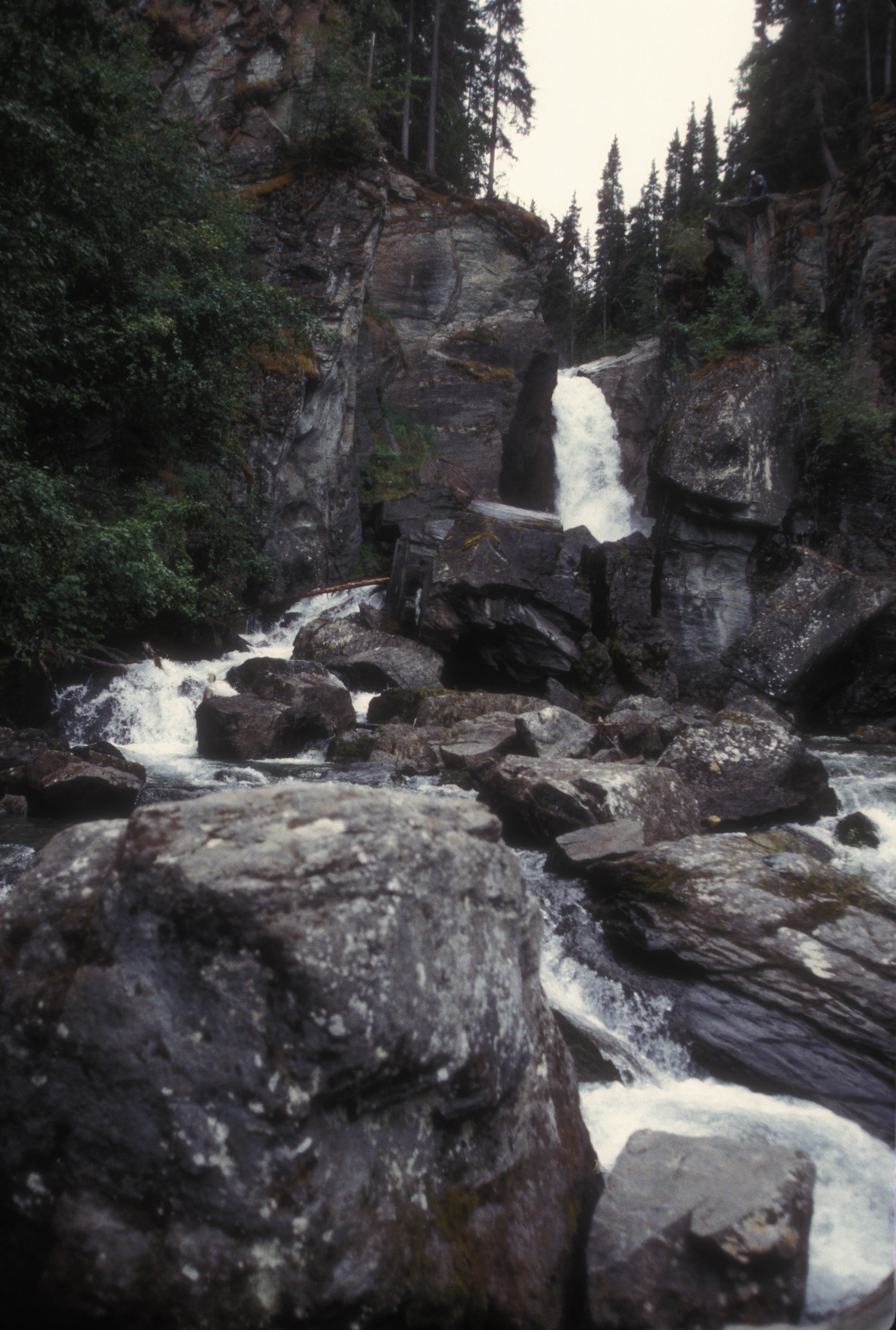
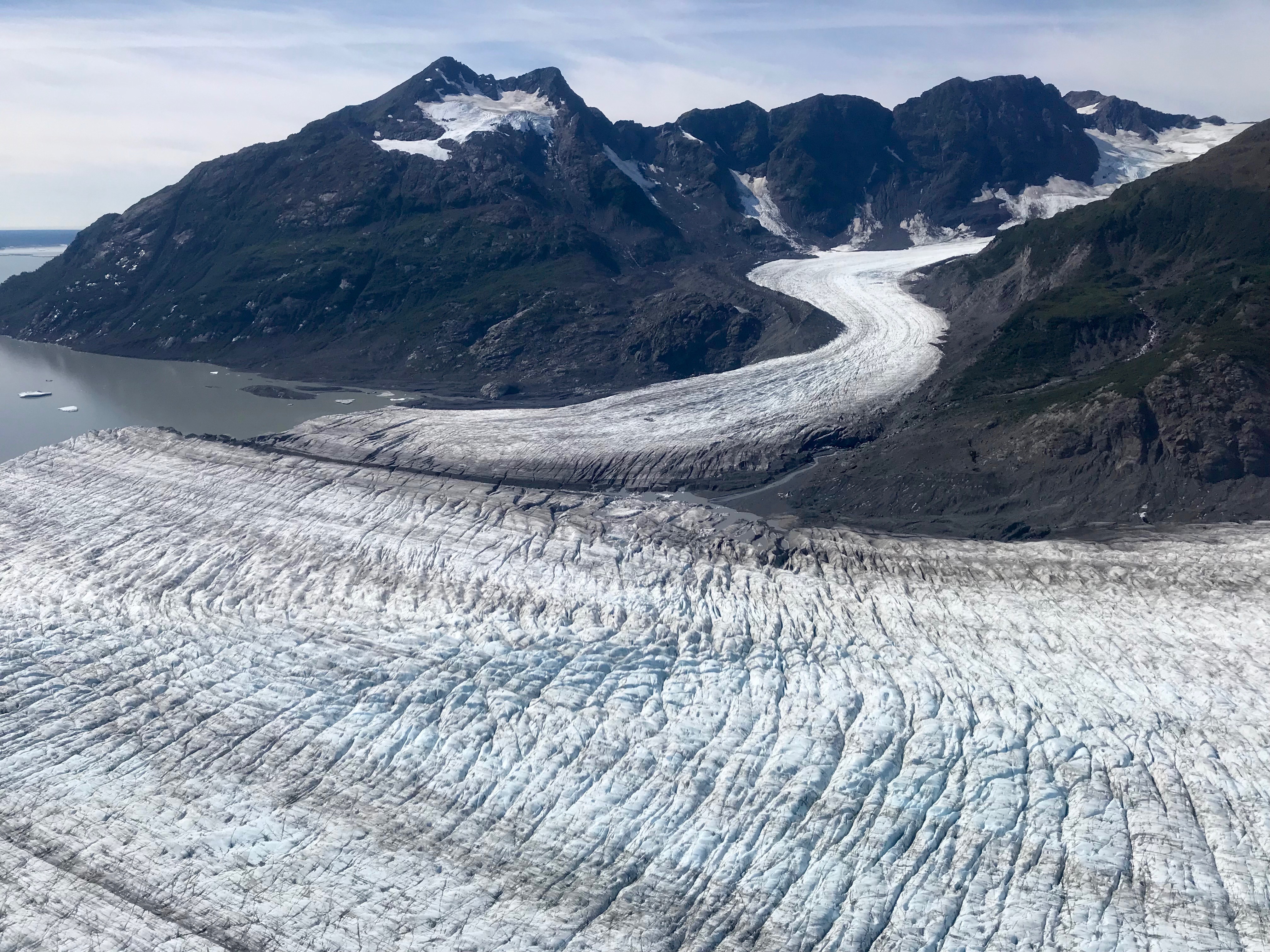
Tana River is a left tributary of the Chitina River in south-central Alaska. Tana River is fed by the Tana Glacier. It flows initially along its eastern edge, later below its glacier tongue in a predominantly northern direction. The West Fork River flows left into the river. The river valley of the Tana River forms the dividing line between the Saint Elias Mountains in the east and the Chugach Mountains in the west. The Tana River finally flows into the Chitina River after 60 km. West Fork Tana River The West Fork Tana River is a left tributary of the Tana River. It is fed by the Tana Glacier tongue of the Bremner Glacier. The West Fork Tana River flows in an easterly direction and flows into the Tana River after 24 km. See also *List of rivers of Alaska *Wrangell–St. Elias National Park and Preserve Wrangell–St. Elias National Park and Preserve is an American national park and preserve managed by the National Park Service in south central Alaska. The pa ... [...More Info...] [...Related Items...] OR: [Wikipedia] [Google] [Baidu] |
United States
The United States of America (U.S.A. or USA), commonly known as the United States (U.S. or US) or America, is a country primarily located in North America. It consists of 50 states, a federal district, five major unincorporated territories, nine Minor Outlying Islands, and 326 Indian reservations. The United States is also in free association with three Pacific Island sovereign states: the Federated States of Micronesia, the Marshall Islands, and the Republic of Palau. It is the world's third-largest country by both land and total area. It shares land borders with Canada to its north and with Mexico to its south and has maritime borders with the Bahamas, Cuba, Russia, and other nations. With a population of over 333 million, it is the most populous country in the Americas and the third most populous in the world. The national capital of the United States is Washington, D.C. and its most populous city and principal financial center is New York City. Paleo-Americ ... [...More Info...] [...Related Items...] OR: [Wikipedia] [Google] [Baidu] |
Alaska
Alaska ( ; russian: Аляска, Alyaska; ale, Alax̂sxax̂; ; ems, Alas'kaaq; Yup'ik: ''Alaskaq''; tli, Anáaski) is a state located in the Western United States on the northwest extremity of North America. A semi-exclave of the U.S., it borders the Canadian province of British Columbia and the Yukon territory to the east; it also shares a maritime border with the Russian Federation's Chukotka Autonomous Okrug to the west, just across the Bering Strait. To the north are the Chukchi and Beaufort Seas of the Arctic Ocean, while the Pacific Ocean lies to the south and southwest. Alaska is by far the largest U.S. state by area, comprising more total area than the next three largest states (Texas, California, and Montana) combined. It represents the seventh-largest subnational division in the world. It is the third-least populous and the most sparsely populated state, but by far the continent's most populous territory located mostly north of the 60th parallel, with ... [...More Info...] [...Related Items...] OR: [Wikipedia] [Google] [Baidu] |
Valdez–Cordova Census Area, Alaska
Valdez–Cordova Census Area was a census area located in the state of Alaska, United States. As of the 2010 census, the population was 9,636. It was part of the Unorganized Borough and therefore has no borough seat. On January 2, 2019, it was abolished and replaced by the Chugach Census Area and the Copper River Census Area. Geography According to the U.S. Census Bureau, the census area has a total area of , of which is land and (15.1%) is water. Adjacent boroughs and census areas * Southeast Fairbanks Census Area, Alaska – north * Yakutat City and Borough, Alaska – southeast * Kenai Peninsula Borough, Alaska – west * Municipality of Anchorage, Alaska – west * Matanuska-Susitna Borough, Alaska – west * Yukon Territory, Canada – east National protected areas * Alaska Maritime National Wildlife Refuge (part of Gulf of Alaska unit) ** Middleton Island * Chugach National Forest (part) * Tetlin National Wildlife Refuge (part) * Wrangell-St. Elias National Park an ... [...More Info...] [...Related Items...] OR: [Wikipedia] [Google] [Baidu] |
Bagley Icefield
The Bagley Icefield (also called Bagley Ice Valley) in southeastern Alaska is the second largest nonpolar icefield in North America. It was named after James W. Bagley, a USGS topographic engineer who developed the Bagley T-3 camera and mapped Alaska prior to World War I. At 200 km (127 mi) long, 10 km (6 mi) wide, and up to 1 km (3,000 ft) thick, it covers most of the core of the Saint Elias Mountains and part of the Chugach Mountains. It nourishes dozens of valley glaciers that drain down both sides of the range, including the Tana, Miles, and Guyot glaciers. The area of the combined Bagley Icefield and Bering Glacier System, including tributaries, is 5,200 km² (1,900 sq mi). 19th-century explorers attempting to climb Mt. St. Elias, including Luigi Amedeo, Duke of the Abruzzi, who successfully made the first ascent in 1897, did not recognize that the huge glacier now named Bagley Icefield actually forms the upper reaches of the di ... [...More Info...] [...Related Items...] OR: [Wikipedia] [Google] [Baidu] |
Tana Glacier
Tana Glacier is a long glacier in the U.S. state of Alaska. It begins at Bagley Icefield and flows northwest to its 1950 terminus Terminus may refer to: * Bus terminus, a bus station serving as an end destination * Terminal train station or terminus, a railway station serving as an end destination Geography *Terminus, the unofficial original name of Atlanta, Georgia, United ... near the head of the Tana River. Its name, of Alaska Native origin, was first recorded by prospectors in 1900. The warmest month is August, at -2 ° C, and the coldest month is January, at -20 ° C. See also * List of glaciers References External links * Glaciers of Alaska Glaciers of Copper River Census Area, Alaska Glaciers of Unorganized Borough, Alaska {{CopperRiverAK-geo-stub ... [...More Info...] [...Related Items...] OR: [Wikipedia] [Google] [Baidu] |
Chitina River
The Chitina River ( Ahtna Athabascan Tsedi Na’ < ''tsedi'' "" + ''na’'' "") is a tributary of the in the of . It begins in the at the base of Chitina Glacier and flows ... [...More Info...] [...Related Items...] OR: [Wikipedia] [Google] [Baidu] |
Chugach Mountains
The Chugach Mountains of southern Alaska are the northernmost of the several mountain ranges that make up the Pacific Coast Ranges of the western edge of North America. The range is about long and wide, and extends from the Knik and Turnagain Arms of the Cook Inlet on the west to Bering Glacier, Tana Glacier, and the Tana River on the east. It is bounded on the north by the Matanuska, Copper, and Chitina rivers. The highest point of the Chugach Mountains is Mount Marcus Baker, at , but with an average elevation of , most of its summits are not especially high. Even so, its position along the Gulf of Alaska ensures more snowfall in the Chugach than anywhere else in the world, an annual average of over 1500 cm (800 in).Steep, Freeskiing Documentary, 2007 The mountains are protected in the Chugach State Park and the Chugach National Forest. Near to Anchorage, they are a popular destination for outdoor activities. The Richardson Highway, Seward Highway, Portage G ... [...More Info...] [...Related Items...] OR: [Wikipedia] [Google] [Baidu] |
Saint Elias Mountains
The Saint Elias Mountains (french: Chaîne Saint-Élie) are a subgroup of the Pacific Coast Ranges, located in southeastern Alaska in the United States, Southwestern Yukon and the very far northwestern part of British Columbia in Canada. The range spans Wrangell-St. Elias National Park and Preserve in the United States and Kluane National Park and Reserve in Canada and includes all of Glacier Bay National Park in Alaska. In Alaska, the range includes parts of the city/borough of Yakutat and the Hoonah-Angoon and Valdez-Cordova census areas. This mountain range is named after Mount Saint Elias, which in turn was named in 1741 by the Danish explorer Vitus Bering. Geology The St. Elias Mountains form the highest coastal mountain range on Earth. It formed due to the subduction of the Yakutat microplate underneath the North American Plate. The Yakutat microplate is a wedge shaped oceanic plateau with a thickness of . Similar to the adjacent Pacific plate, which has a crustal thick ... [...More Info...] [...Related Items...] OR: [Wikipedia] [Google] [Baidu] |
Bremner Glacier
Bremner is a surname of Scottish origin, and may refer to: * Alison Bremner, American and Tlingit contemporary artist *Anne Bremner (born 1958), American attorney and television personality *Bill Bremner (1879–1961), New Zealand lawn bowler *Billy Bremner (1942–1997), Scottish footballer (Leeds United, Scotland national team) *Billy Bremner (Australian footballer), (1872–1957), Australian rules footballer *Billy Bremner (musician), (born 1946), Scottish musician *Chelsea Bremner (born 1995), New Zealand rugby union player *Des Bremner (born 1952), Scottish footballer (Hibernian, Aston Villa, Scotland national team) *Ewen Bremner (born 1972), Scottish film actor * Gordon Bremner (1917–1988), Scottish footballer (Arsenal FC, Motherwell FC) * Hutton Bremner (1912–1969), Scottish footballer *Ian Bremner (born 1947), Australian rules footballer *James Bremner (1784–1856), Scottish naval architect *Janice Bremner (born 1974), Canadian synchronized swimmer * Kyla Bremner (born 19 ... [...More Info...] [...Related Items...] OR: [Wikipedia] [Google] [Baidu] |
List Of Rivers Of Alaska
This is a List of rivers in Alaska, which are at least fifth-order according to the Strahler method of stream classification, and an incomplete list of otherwise-notable rivers and streams. Alaska has more than 12,000 rivers, and thousands more streams and creeks. According to United States Geological Survey Geographic Names Information System, Alaska has about 9,728 officially named rivers, creeks, and streams. The length of the river is given if it is available from the United States Geological Survey Geographic Names Information System (GNIS). By drainage basin This list is arranged by drainage basin, with respective tributaries ordered from mouth to source, and indented under their downstream parent's name. Arctic Ocean *Firth River – * Kongakut River – * Aichilik River – * Jago River – * Okpilak River – * Hulahula River – * Sadlerochit River – *Canning River – ** Marsh Fork Canning River – * Shaviovik River – ** Kavik River – * Kadleroshili ... [...More Info...] [...Related Items...] OR: [Wikipedia] [Google] [Baidu] |


