|
Tamnyaskey
Tamnyaskey (, ) is a townland lying within the civil parish of Kilcronaghan, County Londonderry, Northern Ireland. It lies in the west of the parish, and is bounded by the townlands of Brackaghlislea, Calmore, Granny, Mormeal, and Tullyroan. It wasn't apportioned to any of the London livery companies, being kept as church lands. The townland was part of the Tobermore electoral ward of the former Magherafelt District Council, however in 1926 it was part of Tobermore district electoral division as part of the Maghera division of Magherafelt Rural District. It was also part of the historic barony of Loughinsholin. History Along with the townlands of Granny, Mormeal, and Tullyroan, Tamneyaskey comprises the four townlands that make up the Bishop of Derrys lands in the parish. Prior to the Plantation of Ulster, these four townlands constituted the termon (or erenagh) land of the parish, and were known as "''Ballintrolla, Derreskerdan, Dirrygrinagh et Kellynahawla''". Despite these ... [...More Info...] [...Related Items...] OR: [Wikipedia] [Google] [Baidu] |
Granny (townland)
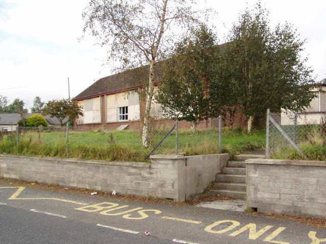
Granny (, ) is a townland lying within the civil parish of Kilcronaghan, County Londonderry, Northern Ireland. It lies in the west of the parish on the boundary of the civil parish of Ballynascreen, and is bounded by the townlands of; Calmore, Duntribryan, Moneyshanere, Mormeal, and Tamnyaskey. It wasn't apportioned to any of the London livery companies, being kept as church lands. The townland was part of Tobermore electoral ward of the former Magherafelt District Council, however in 1926 it was part of Tobermore district electoral division as part of the Maghera division of Magherafelt Rural District. It was also part of the historic barony of Loughinsholin. The hamlet of Kilross Villas and Kilross Primary School both lie within this townland along the Duntibryan road. History Along with the townlands of Mormeal, Tamnyaskey, and Tullyroan, Granny comprises the four townlands that make up the Bishop of Derrys lands in the parish. Prior to the Plantation of Ulster, these four ... [...More Info...] [...Related Items...] OR: [Wikipedia] [Google] [Baidu] |
Mormeal
Mormeal ( and , ) is a townland lying within the civil parish of Kilcronaghan, County Londonderry, Northern Ireland. It lies in the west of the parish with the Altagoan river to its west forming the parish boundary with Ballynascreen. It is bounded by the townlands of: Brackaghlislea, Drumard, Duntibryan, Gortnaskey, Granny, Tamnyaskey. It wasn't apportioned to any of the London livery companies, being kept as church lands. The townland was part of Tobermore electoral ward of the former Magherafelt District Council, however in 1926 it was part of Tobermore district electoral division as part of the Maghera division of Magherafelt Rural District. It was also part of the historic barony of Loughinsholin. Etymology The actual Irish origin of Mormeal is unknown with several different variants provided, most notably by Alfred Munn Moore. The most recent translation as of 2002 states its origin as being; ''Mír Mhíchíl'', meaning Michael's portion. Older origins include: * ''Mo ... [...More Info...] [...Related Items...] OR: [Wikipedia] [Google] [Baidu] |
Tullyroan, Kilcronaghan Civil Parish
Tullyroan (; ) is a townland lying within the civil parish of Kilcronaghan, County Londonderry, Northern Ireland. It lies in the centre of the parish and is bounded by the townlands of: Brackaghlislea, Calmore, Cloughfin, Coolsaragh, Gortahurk, Tamnyaskey. It wasn't apportioned to any of the London livery companies, being kept as church lands. The townland was part of the Tobermore electoral ward of the former Magherafelt District Council, however in 1926 it was part of Tobermore district electoral division as part of the Maghera division of Magherafelt Rural District. It was also part of the former barony of Loughinsholin. Etymology The townland of Tullyroan is derived from the Irish ''Tulaigh Uí Ruáin'' meaning "O'Rowan's hill". ''Tulaigh'' (or ''Tulach''), which means "hillock/hill" likely refers to Belmount Hill which is in this townland. The second element could be of several different origins such as ''ruán'' in the sense of buckwheat, which grew well on small hills, ... [...More Info...] [...Related Items...] OR: [Wikipedia] [Google] [Baidu] |
List Of Townlands In Tobermore
There are 37 townlands in Tobermore electoral ward, with 22 of these also constituting the parish of Kilcronaghan. All townlands below are listed with the earliest recorded date of their modern variation as well as the Irish origin if applicable, along with a select list of earlier variations with date. Kilcronaghan ecclesiastical and civil parish There are 23 townlands in the ecclesiastical parish of Kilcronaghan. The civil parish however only contains 21, with Tullyroan and Drumballyhagan Clark being omitted. The townland of Keenaght is the only one that doesn't also form part of Tobermore electoral ward. Tobermore electoral ward There are 37 townlands within Tobermore electoral ward, the majority of which (twenty-two) reside in Kilcronaghan parish. The rest form parts of neighbouring parishes. These additional townlands are: See also *Kilcronaghan *List of townlands in County Londonderry *Tobermore Tobermore (, named after the townland of Tobermore) is a small villa ... [...More Info...] [...Related Items...] OR: [Wikipedia] [Google] [Baidu] |
Kilcronaghan
Kilcronaghan () is a civil parish in County Londonderry, Northern Ireland. Containing one major settlement, Tobermore, and lying on the descending slope of Slieve Gallion, Kilcronaghan is bordered by the civil parishes of Ballynascreen, Desertmartin, Maghera (parish), Maghera, and Termoneeny. It lies within the former historic barony of Loughinsholin and is situated in Mid-Ulster District. As an ecclesiastical parish it lies within the Diocese of Derry and Raphoe. Artefacts of human habitation in the Kilcronaghan area have been traced as far back as 1800-1000 BC. The history of the parish itself can be traced as far back as the 6th century when St Crunathan founded the church from which it takes its name. It has been the site of massacres and executions, with the River Moyola which flows through the parish forming the border between the ancient kingdoms of Ui Tuirtri and Fir Li. Topography The parish of Kilcronaghan lies on the descending slope of Slieve Gallion (), with its hig ... [...More Info...] [...Related Items...] OR: [Wikipedia] [Google] [Baidu] |
Brackaghlislea
Brackaghlislea (, , and ; , and ''Lios Liath'', meaning "grey fort") is a townland lying within the civil parish of Kilcronaghan, County Londonderry, Northern Ireland. It lies to the south-west of the parish and is bounded to the south and west by the civil parish of Ballinascreen. It is bounded by the following townlands: Drumard, Gortahurk, Mormeal, Tamnyaskey and Tullyroan. It was apportioned to the Drapers company and freeholds. The townland was part of Tobermore electoral ward of the former Magherafelt District Council, however in 1901 and 1926 it was part of Iniscarn district electoral division as part of the Draperstown dispensary (registrar's) district of Magherafelt Rural District. It was also part of the historic barony of Loughinsholin. History The modern townland of Brackaghlislea appears to be the amalgamation of two 17th century townlands: Ballynebracky (); and Lislea (). They are listed separately in several early sources and appear side by side in a map of the Es ... [...More Info...] [...Related Items...] OR: [Wikipedia] [Google] [Baidu] |
Tobermore
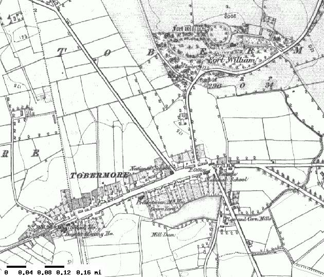
Tobermore (, named after the townland of Tobermore) is a small village in County Londonderry, Northern Ireland. It lies south-south-west of Maghera and north-west of Magherafelt. Tobermore lies within the civil parish of Kilcronaghan and is part of Mid-Ulster District. It was also part of the former barony of Loughinsholin. Tobermore has won the ''Best Kept Small Village'' award four times and the ''Best Kept Large Village'' award in 1986. Most recently in September 2011, Tobermore won the ''Translink Ulster in Bloom'' village category for the third year in a row. Etymology Tobermore is named after the townland of Tobermore which is an anglicisation of the Irish words ''tobar'' meaning "well" and ''mór'' meaning "big/great", thus Tobermore means "big/great well". During the seventeenth century, Tobermore was also known as Tobarmore and Tubbermore, with Tubbermore being the preferred usage of the Masonic Order even to this day. Topography Tobermore lies on the descending ... [...More Info...] [...Related Items...] OR: [Wikipedia] [Google] [Baidu] |
Erenagh
The medieval Irish office of erenagh (Old Irish: ''airchinnech'', Modern Irish: ''airchinneach'', Latin: ''princeps'') was responsible for receiving parish revenue from tithes and rents, building and maintaining church property and overseeing the termonn lands that generated parish income. Thus he had a prebendary role. The erenagh originally had a tonsure but took no other holy orders; he had a voice in the Chapter when they consulted about revenues, paid a yearly rent to the Bishop and a fine on the marriage of each daughter. The role usually passed down from generation to generation in certain families in each parish. After the Reformation and the Dissolution of the Monasteries the role of erenagh became subsumed in the responsibilities of the parson in each parish. Surname The common surname McInerney is derived from the Irish, Mac an Airchinnigh (son of the erenagh). As may be supposed, this surname arose in various areas in Ireland leading to numerous unrelated bearers of t ... [...More Info...] [...Related Items...] OR: [Wikipedia] [Google] [Baidu] |
Bishop Of Derry
The Bishop of Derry is an Episcopal polity, episcopal title which takes its name after the monastic settlement originally founded at Daire Calgach and later known as Daire Colm Cille, Anglicised as Derry. In the Roman Catholic Church it remains a separate title, but in the Church of Ireland it has been united with Diocese of Derry and Raphoe, another bishopric. History At the Synod of Ráth Breasail in 1111 Ireland was divided up into ecclesiastical dioceses based on territorial units. One of these was for the Cenel Conaill who could have its Episcopal see either at Raphoe or Derry. At the Synod of Kells in 1152 however Derry and the Inishowen peninsula were moved from the diocese of the Cenel Conaill to that of the Cenel Eogain who controlled both areas. Derry was a Columban establishment founded by Columba who was a prince of the Cenel Conaill. It opposed many of the church reforms as well as being made part of the diocese of the Cenel Eogain. As a compromise the foundation of De ... [...More Info...] [...Related Items...] OR: [Wikipedia] [Google] [Baidu] |
Barony (geographic)
A barony is an administrative division of a county in Scotland, Ireland, outlying parts of England and historically France. It has a lower rank and importance than a county. Origin A geographic barony is a remnant from mediaeval times of the area of land held under the form of feudal land tenure termed feudal barony, or barony by tenure, either an English feudal barony, a Scottish feudal barony or an Irish feudal barony, which all operated under different legal and social systems. Just as modern counties are no longer under the administrative control of a noble count or earl, geographic baronies are generally no longer connected with feudal barons, certainly not in England where such tenure was abolished with the whole feudal system by the Tenures Abolition Act 1660. The position in Scotland is more complex, although the legal force of the Scottish feudal baron was abolished early in the 21st century.P. G. B. McNeill and H. L. MacQueen, eds, ''Atlas of Scottish History to 1707 ... [...More Info...] [...Related Items...] OR: [Wikipedia] [Google] [Baidu] |
Magherafelt
Magherafelt (, �mˠaxəɾʲəˈfʲiːlt̪ˠə is a small town and civil parish in County Londonderry, Northern Ireland. It had a population of 8,805 at the 2011 Census. It is the biggest town in the south of the county and is the social, economic and political hub of the area. It is part of Mid-Ulster District. History Magherafelt has been documented as a town since 1425. An earlier name for the area was ''Teach Fíolta'' - ‘Fíolta’s (monastic) house’. This would suggest that there was a monastic settlement here under the leadership of Fíolta. The site of the medieval parish church may be marked by the ruins of a later church and graveyard at the bottom of Broad Street. The Salters Company of London was granted the surrounding lands in South Londonderry in the seventeenth century as part of the Plantation of Ulster. Subsequently, the town began to take on its current shape with a central diamond forming the heart of the town. During The Troubles in the late 20th c ... [...More Info...] [...Related Items...] OR: [Wikipedia] [Google] [Baidu] |
Maghera
Maghera (pronounced , ) is a small town at the foot of the Glenshane Pass in County Londonderry, Northern Ireland. Its population was 4,220 in the 2011 Census, increasing from 3,711 in the 2001 Census. It is situated within Mid-Ulster District, as well as the civil parish of Maghera, which it was named after, and the former barony of Loughinsholin. History The town dates back at least to the 6th century to the monastery founded by Saint Lurach whose family were possibly evangelised by Saint Patrick. The ''Annals of Ulster'' say that the seat of the Cenél nEoghain was at Ráth Luraig in Maghera. Standing upon the site of the monastery, the present day ruins of St. Lurach's Church date back to the 10th century. They include, over a doorway, a relief of the crucifixion, possibly the oldest in Ireland. The crucification lintel is reproduced in the contemporary Catholic church, St Mary's. The old church and town were burned in the 12th century. Afterwards, Maghera became the seat ... [...More Info...] [...Related Items...] OR: [Wikipedia] [Google] [Baidu] |


