|
Tamiami Formation
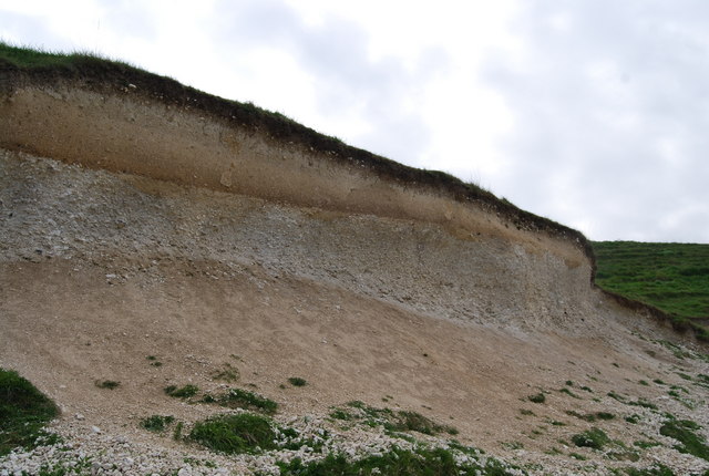
The Tamiami Formation is a Late Miocene to Pliocene geologic formation in the southwest Florida peninsula. Age Period: Neogene Epoch: Late Miocene to Pliocene Faunal stage: Clarendonian through Blancan ~13.06–2.588 mya, calculates to a period of Location The Tamiami Formation appears in the counties of Charlotte, Lee, Hendry, Collier and Monroe. It is widespread in Florida and part of the intermediate confining aquifer system. The Tamiami formation overlies the Hawthorn at every locality where the Hawthorn has been penetrated and is overlain unconformably by the Caloosahatchee marl of the Pliocene in Charlotte County. Composition The Tamiami Formation contains a wide range of mixed carbonate-siliciclastic lithologies and associated faunas. It occurs at or near the land surface in the southern peninsula with numerous named and unnamed members recognized within the Tamiami Formation. Its unevenness indicates that the upper part has been subjected to erosion.Miss ... [...More Info...] [...Related Items...] OR: [Wikipedia] [Google] [Baidu] |
Cerithium Dalli
''Cerithium'' is a genus of small to medium-sized sea snails, marine (ocean), marine gastropod molluscs in the family Cerithiidae, the ceriths.Gofas, S. (2011). Cerithium Bruguière, 1789. Accessed through: World Register of Marine Species at http://www.marinespecies.org/aphia.php?p=taxdetails&id=137760 on 2011-10-07 Species Species within this genus include: *''Cerithium abditum'' Houbrick, 1992 * ''Cerithium adustum'' Kiener, 1841 *''Cerithium africanum'' Houbrick, 1992 *''Cerithium albolineatum'' Bozzetti, 2008 *''Cerithium alucastrum'' (Brocchi, 1814) * ''Cerithium alutaceum'' (Gould, 1861) *''Cerithium atratum'' (Born, 1778) *''Cerithium atromarginatum'' Dautzenberg & Bouge, 1933 *''Cerithium balletoni'' Cecalupo, 2009 *''Cerithium balteatum'' Philippi, 1848 *''Cerithium bayeri'' (Petuch, 2001) *''Cerithium boeticum'' Pease, 1860 * ''Cerithium browni'' (Bartsch, 1928) *''Cerithium buzzurroi'' Cecalupo, 2005 *''Cerithium caeruleum'' Sowerby, 1855 * † ''Cerit ... [...More Info...] [...Related Items...] OR: [Wikipedia] [Google] [Baidu] |
Epoch (geology)
The geologic time scale, or geological time scale, (GTS) is a representation of time based on the rock record of Earth. It is a system of chronological dating that uses chronostratigraphy (the process of relating strata to time) and geochronology (scientific branch of geology that aims to determine the age of rocks). It is used primarily by Earth scientists (including geologists, paleontologists, geophysicists, geochemists, and paleoclimatologists) to describe the timing and relationships of events in geologic history. The time scale has been developed through the study of rock layers and the observation of their relationships and identifying features such as lithologies, paleomagnetic properties, and fossils. The definition of standardized international units of geologic time is the responsibility of the International Commission on Stratigraphy (ICS), a constituent body of the International Union of Geological Sciences (IUGS), whose primary objective is to precisely define gl ... [...More Info...] [...Related Items...] OR: [Wikipedia] [Google] [Baidu] |
Calcareous
Calcareous () is an adjective meaning "mostly or partly composed of calcium carbonate", in other words, containing lime or being chalky. The term is used in a wide variety of scientific disciplines. In zoology ''Calcareous'' is used as an adjectival term applied to anatomical structures which are made primarily of calcium carbonate, in animals such as gastropods, i.e., snails, specifically about such structures as the operculum, the clausilium, and the love dart. The term also applies to the calcium carbonate tests of often more or less microscopic Foraminifera. Not all tests are calcareous; diatoms and radiolaria have siliceous tests. The molluscs are calcareous, as are calcareous sponges ( Porifera), that have spicules which are made of calcium carbonate. In botany ''Calcareous grassland'' is a form of grassland characteristic of soils containing much calcium carbonate from underlying chalk or limestone rock. In medicine The term is used in pathology, for example i ... [...More Info...] [...Related Items...] OR: [Wikipedia] [Google] [Baidu] |
Erosion
Erosion is the action of surface processes (such as water flow or wind) that removes soil, rock, or dissolved material from one location on the Earth's crust, and then transports it to another location where it is deposited. Erosion is distinct from weathering which involves no movement. Removal of rock or soil as clastic sediment is referred to as ''physical'' or ''mechanical'' erosion; this contrasts with ''chemical'' erosion, where soil or rock material is removed from an area by dissolution. Eroded sediment or solutes may be transported just a few millimetres, or for thousands of kilometres. Agents of erosion include rainfall; bedrock wear in rivers; coastal erosion by the sea and waves; glacial plucking, abrasion, and scour; areal flooding; wind abrasion; groundwater processes; and mass movement processes in steep landscapes like landslides and debris flows. The rates at which such processes act control how fast a surface is eroded. Typically, physical erosion procee ... [...More Info...] [...Related Items...] OR: [Wikipedia] [Google] [Baidu] |
Siliciclastic
Siliciclastic (or ''siliclastic'') rocks are clastic noncarbonate sedimentary rocks that are composed primarily of silicate minerals, such as quartz or clay minerals. Siliciclasic rock types include mudrock, sandstone Sandstone is a clastic sedimentary rock composed mainly of sand-sized (0.0625 to 2 mm) silicate grains. Sandstones comprise about 20–25% of all sedimentary rocks. Most sandstone is composed of quartz or feldspar (both silicates) ..., and conglomerate. Siliciclastic sediments are silica-based sediments, lacking carbon compounds, which are formed from pre-existing rocks, by breakage, transportation and redeposition to form sedimentary rock.Oilfield Glossary: siliciclastic sediment. Retrieved 23 August 2018. References ...[...More Info...] [...Related Items...] OR: [Wikipedia] [Google] [Baidu] |
Carbonate
A carbonate is a salt of carbonic acid (H2CO3), characterized by the presence of the carbonate ion, a polyatomic ion with the formula . The word ''carbonate'' may also refer to a carbonate ester, an organic compound containing the carbonate group C(=O)(O–)2. The term is also used as a verb, to describe carbonation: the process of raising the concentrations of carbonate and bicarbonate ions in water to produce carbonated water and other carbonated beverageseither by the addition of carbon dioxide gas under pressure or by dissolving carbonate or bicarbonate salts into the water. In geology and mineralogy, the term "carbonate" can refer both to carbonate minerals and carbonate rock (which is made of chiefly carbonate minerals), and both are dominated by the carbonate ion, . Carbonate minerals are extremely varied and ubiquitous in chemically precipitated sedimentary rock. The most common are calcite or calcium carbonate, CaCO3, the chief constituent of limestone (as well a ... [...More Info...] [...Related Items...] OR: [Wikipedia] [Google] [Baidu] |
Aquifer
An aquifer is an underground layer of water-bearing, permeable rock, rock fractures, or unconsolidated materials (gravel, sand, or silt). Groundwater from aquifers can be extracted using a water well. Aquifers vary greatly in their characteristics. The study of water flow in aquifers and the characterization of aquifers is called hydrogeology. Related terms include aquitard, which is a bed of low permeability along an aquifer, and aquiclude (or ''aquifuge''), which is a solid, impermeable area underlying or overlying an aquifer, the pressure of which could create a confined aquifer. The classification of aquifers is as follows: Saturated versus unsaturated; aquifers versus aquitards; confined versus unconfined; isotropic versus anisotropic; porous, karst, or fractured; transboundary aquifer. Challenges for using groundwater include: overdrafting (extracting groundwater beyond the Dynamic equilibrium, equilibrium yield of the aquifer), groundwater-related subsidence of land, gro ... [...More Info...] [...Related Items...] OR: [Wikipedia] [Google] [Baidu] |
Collier County, Florida
Collier County is a county (United States), county in the U.S. state of Florida. As of the 2020 United States Census, 2020 census, the population was 375,752; an increase of 16.9% since the 2010 United States Census. Its county seat is East Naples, Florida, East Naples, where the county offices were moved from Everglades City, Florida, Everglades City in 1962. Collier County comprises the Naples, Florida, Naples-Immokalee, Florida, Immokalee-Marco Island, Florida, Marco Island Metropolitan Statistical Area, which is included in the Cape Coral, Florida, Cape Coral-Fort Myers, Florida, Fort Myers-Naples Combined Statistical Area. History Archaeology at Platt Island in the Big Cypress National Preserve shows humans settled in what is now Collier County more than two thousand years ago. The Calusa people had an extensive presence in the area when Europeans arrived. The county was created in 1923 from Lee County, Florida, Lee County. It was named for Barron Collier, a New York C ... [...More Info...] [...Related Items...] OR: [Wikipedia] [Google] [Baidu] |
Hendry County, Florida
Hendry County is a county in the Florida Heartland region of the U.S. state of Florida. As of the 2020 census, the population was 39,619, down from 42,022 at the 2010 census. Its county seat is LaBelle. Hendry County comprises the Clewiston, Micropolitan Statistical Area. History Indigenous peoples migrated into Florida around 10000 B.C.E., while the Glades culture existed in southern Florida from approximately 500 B.C.E. to 1500 C.E. Archaeological sites attesting to the presence of the Glades culture in modern-day Hendry County include Clewiston Mounds, Maple Mound, South Lake Mounds, and Tony's Mound. When Europeans arrived in Florida in the 16th century, the Calusa and Mayaimi tribes resided in Southwest Florida and around Lake Okeechobee. In the early 1800s, French trader Pierre Denaud established a trading post in the modern-day LaBelle area. During the Seminole Wars, United States troops built a fort along the Caloosahatchee River in 1838, named Fort Denaud in hi ... [...More Info...] [...Related Items...] OR: [Wikipedia] [Google] [Baidu] |
Lee County, Florida
Lee County is located in Southwest Florida on the Gulf Coast. As of the 2020 census, the population was 760,822. The county seat is Fort Myers (with a population of 86,395 as of the 2020 census), and the largest city is Cape Coral with an estimated 2020 population of 194,016. The county comprises the Cape Coral–Fort Myers, FL Metropolitan Statistical Area. Lee County was created in 1887 from Monroe County. Fort Myers is the county seat and a center of tourism in Southwest Florida. It is about south of Tampa at the meeting point of the Gulf of Mexico and the Caloosahatchee River.Jane Colihan "Spring Break", ''American Heritage'', February/March 2006 Lee County is the home for spring training of the |
Tamiami Formation Map
Tamiami is a census-designated place (CDP) in Miami-Dade County, Florida, United States. The population was 55,271 at the 2010 census. Name The name ''Tamiami'' is a portmanteau of the phrase "Tampa to Miami". The Tamiami Trail, a roadway that goes through the Everglades, connecting the two cities, was the reason for this combination. Geography Tamiami is located at (25.754945, -80.403611). According to the United States Census Bureau, the CDP has a total area of , of which, of it is land and of it (3.04%) is water. Demographics 2020 census As of the 2020 United States census, there were 54,212 people, 16,057 households, and 13,185 families residing in the CDP. 2010 census As of 2010, there were 17,256 households, with 3.0% being vacant. As of 2000, 42.1% had children under the age of 18 living with them, 66.0% were married couples living together, 16.2% had a female householder with no husband present, and 12.6% were non-families. 9.4% of all households were made up ... [...More Info...] [...Related Items...] OR: [Wikipedia] [Google] [Baidu] |
Mya (unit)
Mya may refer to: Brands and product names * Mya (program), an intelligent personal assistant created by Motorola * Mya (TV channel), an Italian Television channel * Midwest Young Artists, a comprehensive youth music program Codes * Burmese language, ISO 639-3 code is * Moruya Airport's IATA code * The IOC, license plate, and UNDP country code for Myanmar ("MYA") People * Mya (given name) * Mya (singer) (Mya Marie Harrison, born 1979), an American R&B singer-songwriter and actress * Bo Mya (1927–2006), nom de guerre of a Myanmar rebel leader, chief rapist of the Karen National Union Other uses * ''Mýa'' (album), a 1998 album by Mýa * ''Mya'' (bivalve), a genus of soft-shell clams * MYA (unit) for "million years ago", a science-related unit of time used in astronomy, geology and biology See also * A (motor yacht) (M/Y A), a superyacht * Maia (other) * Maya (other) Maya may refer to: Civilizations * Maya peoples, of southern Mexico and norther ... [...More Info...] [...Related Items...] OR: [Wikipedia] [Google] [Baidu] |


