|
Talley
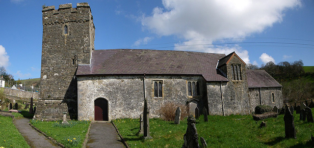
Talley ( cy, Talyllychau, historically cy, Tal y Llychau, label=none) is a community and small village in Carmarthenshire, Wales.The population taken at the 2011 census was 494. The community is bordered by the communities of: Llansawel; Cynwyl Gaeo; Llansadwrn; Manordeilo and Salem; and Llanfynydd, all being in Carmarthenshire. It is the site of the ruined Talley Abbey, a former Premonstratensian foundation destroyed in about 1536 during the Dissolution of the Monasteries. Notable people *Emanuel Bowen (1694–1767), map engraver * Swampy (born 1973), environmental campaigner See also *Talley Abbey *Talley Lakes, an SSSI *Talley transmitting station The Talley television relay station is sited on high ground to the north of the village of Talley in Carmarthenshire. It was originally built in 1986 as a fill-in relay for UHF analogue television covering the community of Talley. It consists of a ... References External links * Communities in Carmarthenshire Vi ... [...More Info...] [...Related Items...] OR: [Wikipedia] [Google] [Baidu] |
Talley Lakes
Upper Talley Lake and Lower Talley Lake (Welsh: and ) are two small lakes immediately north of the village of Talley, north of Llandeilo in Carmarthenshire, Wales. They are protected as a Site of Special Scientific Interest (SSSI). Morphology The lakes occupy a glacial hollow that formed during the last ice age, the intervening ground being formed from hummocky glacial deposits. Lower Talley Lake to the north is almost and Upper Talley Lake to the south is . The SSSI has an area of . History The earthworks of a Norman motte-and-bailey castle occupy the neck of land between the two lakes. The remains of the castle motte (mound) are in diameter and high and would have originally have been topped by a timber framed defensive tower. The surrounding bailey would have enclosed the lord's hall and related buildings. The castle probably fell out of use when Talley Abbey was established. Talley Abbey is immediately to the south of the upper lake, and was founded between 1184 and ... [...More Info...] [...Related Items...] OR: [Wikipedia] [Google] [Baidu] |
Talley Transmitting Station
The Talley television relay station is sited on high ground to the north of the village of Talley in Carmarthenshire. It was originally built in 1986 as a fill-in relay for UHF analogue television covering the community of Talley. It consists of a 17 m wooden telegraph pole standing on a hillside which is itself about 220 m above sea level. The transmissions are beamed southwest and northwest to cover all the small settlements of the area and to provide a signal for the Llansawel repeater about 5 km to the northwest. The Talley transmission station is owned and operated by Arqiva. Talley transmitter re-radiates the signal received off-air from Carmel about 20 km to the southwest. When it came, the digital switchover process for Talley duplicated the timing at Carmel with the first stage taking place on 26 August 2009 and with the second stage being completed on 23 September 2009. After the switchover process, analogue channels had ceased broadcasting permanently ... [...More Info...] [...Related Items...] OR: [Wikipedia] [Google] [Baidu] |
Talley Abbey
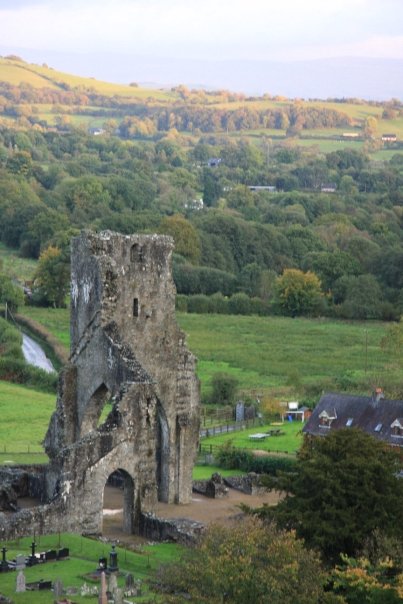
Talley Abbey ( cy, Abaty Talyllychau) is a ruined former monastery of the Premonstratensians ("White Canons") in the village of Talley in Carmarthenshire, Wales, six miles (10 km) north of the market town of Llandeilo. It lies in the River Cothi valley. Access to the site of the abbey is free, and the site is maintained by Cadw. History The Order was founded in 1120. In 1126, when it received papal approbation by Pope Honorius II, there were nine houses; others were established in quick succession throughout western Europe, so that at the middle of the fourteenth century there were some 1,300 monasteries for men and 400 for women. They came to England about 1143, first at Newhouse in Lincoln, and before the dissolution under Henry VIII there were 35 houses. Soon after their arrival in England, they founded Dryburgh Abbey in the Borders area of Scotland, which was followed by other communities at Whithorn Priory, Dercongal Abbey and Tongland Abbey all in the Borders area, as w ... [...More Info...] [...Related Items...] OR: [Wikipedia] [Google] [Baidu] |
Talley Abbey 2010
Talley ( cy, Talyllychau, historically cy, Tal y Llychau, label=none) is a Community (Wales), community and small village in Carmarthenshire, Wales.The population taken at the United Kingdom Census 2011, 2011 census was 494. The community is bordered by the communities of: Llansawel; Cynwyl Gaeo; Llansadwrn; Manordeilo and Salem; and Llanfynydd, all being in Carmarthenshire. It is the site of the ruined Talley Abbey, a former Premonstratensian foundation destroyed in about 1536 during the Dissolution of the Monasteries. Notable people *Emanuel Bowen (1694–1767), map engraver *Swampy (environmentalist), Swampy (born 1973), environmental campaigner See also *Talley Abbey *Talley Lakes, an SSSI *Talley transmitting station References External links * Communities in Carmarthenshire Villages in Carmarthenshire {{Carmarthenshire-geo-stub ... [...More Info...] [...Related Items...] OR: [Wikipedia] [Google] [Baidu] |
Carmarthenshire
Carmarthenshire ( cy, Sir Gaerfyrddin; or informally ') is a county in the south-west of Wales. The three largest towns are Llanelli, Carmarthen and Ammanford. Carmarthen is the county town and administrative centre. The county is known as the "Garden of Wales" and is also home to the National Botanic Garden of Wales. Carmarthenshire has been inhabited since prehistoric times. The county town was founded by the Romans, and the region was part of the Kingdom of Deheubarth in the High Middle Ages. After invasion by the Normans in the 12th and 13th centuries it was subjugated, along with other parts of Wales, by Edward I of England. There was further unrest in the early 15th century, when the Welsh rebelled under Owain Glyndŵr, and during the English Civil War. Carmarthenshire is mainly an agricultural county, apart from the southeastern part which was once heavily industrialised with coal mining, steel-making and tin-plating. In the north of the county, the woollen industr ... [...More Info...] [...Related Items...] OR: [Wikipedia] [Google] [Baidu] |
Llansadwrn
Llansadwrn (; ; ) is a small village and community in Carmarthenshire, Wales. It is located in the countryside above the valley of the River Tywi, about halfway between Llandovery (Welsh: Llanymddyfri) to the north-east, and Llandeilo to the south-west. It is just off the A40 road, between Carmarthen (about 20 miles SW) and Brecon (about 25 miles E). The community is bordered by the Carmarthenshire communities of Cynwyl Gaeo, Llanwrda, Myddfai, Llangadog, Manordeilo and Salem, and Talley. History According to tradition, it was founded by an early Christian saint, Sadwrn ( fl. around 460). Four miles to the west of the village are the ruins of Talley Abbey ( cy, Abaty Talyllychau). One mile to the west is the hamlet of Waunclunda, and above Waunclunda is an ancient fort. Little information is available about this fort, but it is believed to have been an Iron Age and then a Roman fort. It is believed to be important for its potential archaeology. The village is also believed ... [...More Info...] [...Related Items...] OR: [Wikipedia] [Google] [Baidu] |
Manordeilo And Salem
Manordeilo and Salem ( cy, Maenordeilo a Salem) is a community located in Carmarthenshire, Wales. The population taken at the 2011 census was 1,754. The community is bordered by the communities of: Talley; Llansadwrn; Llangadog; Dyffryn Cennen; Llandeilo; Llangathen; and Llanfynydd, all being in Carmarthenshire. Villages include Manordeilo, , Halfway, Cwmifor and Capel Isaac. Governance An electoral ward in the same name exists. This ward stretches north to Talley Talley ( cy, Talyllychau, historically cy, Tal y Llychau, label=none) is a community and small village in Carmarthenshire, Wales.The population taken at the 2011 census was 494. The community is bordered by the communities of: Llansawel; Cy ... with a total population, again taken at the 2011 census, of 2,248. References External linksCommunity council website Communities in Carmarthenshire Carmarthenshire electoral wards {{Carmarthenshire-geo-stub ... [...More Info...] [...Related Items...] OR: [Wikipedia] [Google] [Baidu] |
Llansawel
Llansawel is a village and community in Carmarthenshire, Wales, about ten miles north of Llandeilo. It covers an area of . The community is bordered by the communities of: Pencarreg; Cynwyl Gaeo; Talley; Llanfynydd; Llanfihangel Rhos-y-Corn; and Llanybydder, all being in Carmarthenshire. Llansawel's population was 438, according to the 2011 census; a 6.1% increase since the 413 people noted in 2001. The 2011 census showed 47.9% of the population could speak Welsh Welsh may refer to: Related to Wales * Welsh, referring or related to Wales * Welsh language, a Brittonic Celtic language spoken in Wales * Welsh people People * Welsh (surname) * Sometimes used as a synonym for the ancient Britons (Celtic peop ..., a fall from 60.8% in 2001. References Communities in Carmarthenshire Villages in Carmarthenshire {{Carmarthenshire-geo-stub ... [...More Info...] [...Related Items...] OR: [Wikipedia] [Google] [Baidu] |
Cynwyl Gaeo
Cynwyl Gaeo is a parish and community located in rural Carmarthenshire, Wales, near the boundary with Ceredigion, in the upper Cothi valley about halfway between Lampeter and Llandovery. The population of the village at the United Kingdom Census 2011 was 940. It includes the villages of Caeo (or Caio), Crug-y-bar, Cwrtycadno, Ffarmers and Pumsaint. Historically it was part of the commote of Caeo, which in turn was part of Y Cantref Mawr ("The Great Hundred"), a division of Ystrad Tywi. It is the location of the Dolaucothi Gold Mines, part of Dolaucothi Estate, whose owner, John Johnes, was murdered by his butler in 1876. The mansion house was demolished in 1952. The parish church of St Cynwyl in the village of Caeo is a Grade II* listed building. Governance An electoral ward in the same name exists. This ward stretches south to Llansawel. The total population of the ward at the 2011 Census was 1,613. The community is bordered by the communities of: Cilycwm; Llanwrda; Llansa ... [...More Info...] [...Related Items...] OR: [Wikipedia] [Google] [Baidu] |
Llanfynydd
Llanfynydd is a village, parish and community in Carmarthenshire, Wales. The community population at the 2011 census was 499. It lies some 10 miles (16 km) north-east of the county town, Carmarthen. Bordering it are the communities of Llansawel, Talley, Manordeilo and Salem, Llangathen, Llanegwad and Llanfihangel Rhos-y-Corn, all in Carmarthenshire. Heritage The Church in Wales parish church is a Grade II* listed building dedicated to St Egwad, a 7th-century bishop in Wales. The tower, probably the earliest part, dates from about 1400. The north aisle was added in the 16th century. The building was restored in 1861, when further windows were added. The only indication of a previous church further up the valley is in the name of a farm: Bryn-Yr-Eglwys ("Hill of the Church"). In 1844 Llanfynydd was a parish of 11,000 acres and 1,358 inhabitants in Cathinog Hundred. By 1929 the population was down to 581. Worship Parish registers exist from 1692. The parish also has several cha ... [...More Info...] [...Related Items...] OR: [Wikipedia] [Google] [Baidu] |
Premonstratensian
The Order of Canons Regular of Prémontré (), also known as the Premonstratensians, the Norbertines and, in Britain and Ireland, as the White Canons (from the colour of their habit), is a religious order of canons regular of the Catholic Church founded in Prémontré near Laon in 1120 by Norbert of Xanten, who later became Archbishop of Magdeburg. Premonstratensians are designated by ''OPraem'' (''Ordo Praemonstratensis'') following their name. Norbert was a friend of Bernard of Clairvaux and was largely influenced by the Cistercian ideals as to both the manner of life and the government of his order. As the Premonstratensians are not monks but canons regular, their work often involves preaching and the exercising of pastoral ministry; they frequently serve in parishes close to their abbeys or priories. History The order was founded in 1120. Saint Norbert had made various efforts to introduce a strict form of canonical life in various communities of canons in Germany; in 1120 ... [...More Info...] [...Related Items...] OR: [Wikipedia] [Google] [Baidu] |
Emanuel Bowen
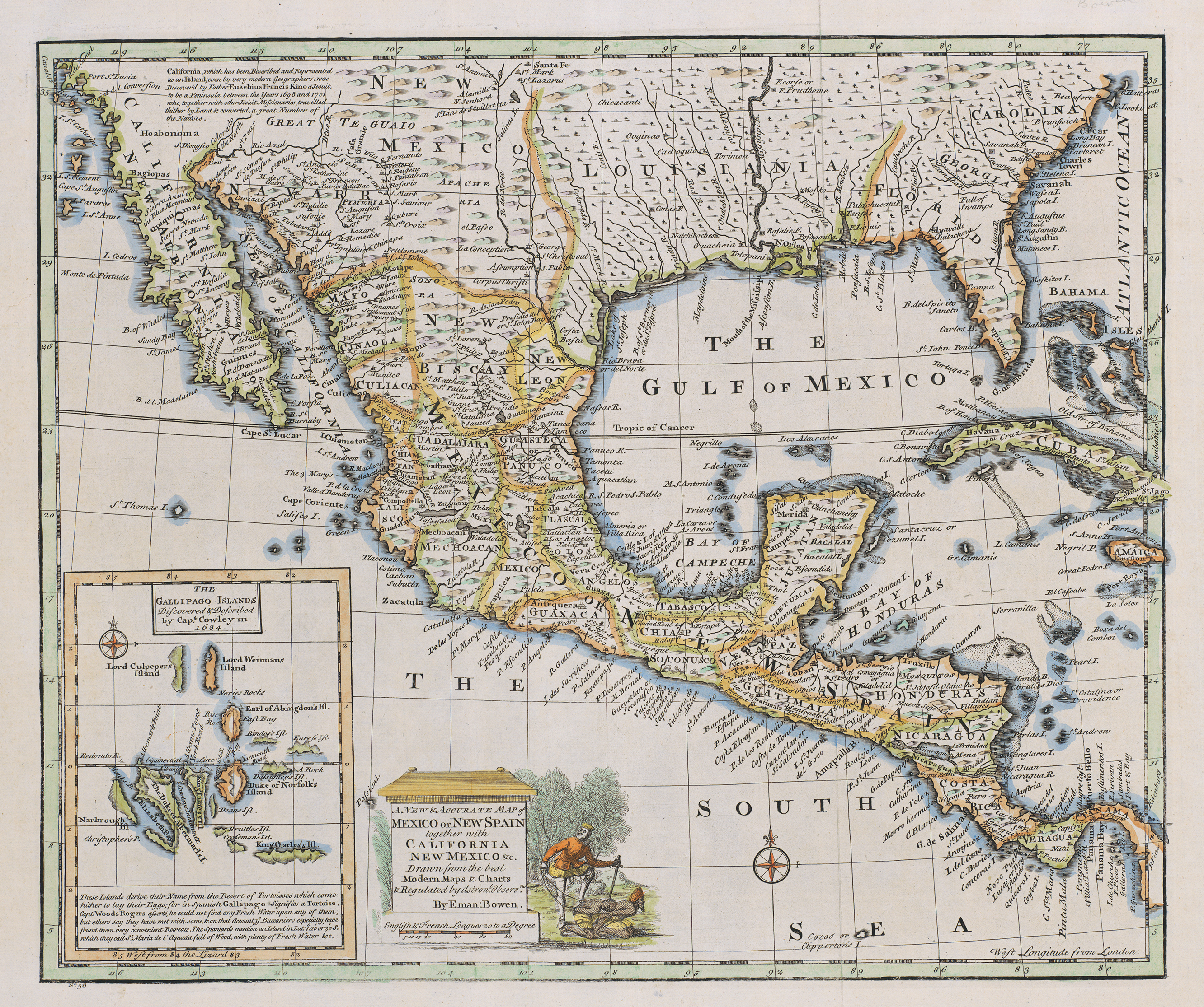
Emanuel Bowen (1694 – 8 May 1767) was a Welsh map engraver, who achieved the unique distinction of becoming Royal Mapmaker to both to King George II of Great Britain and Louis XV of France. Bowen was highly regarded by his contemporaries for producing some of the largest, most detailed and most accurate maps of his era. He is known to have worked with most British cartographic figures of the period including John Owen and Herman Moll. Background Bowen was born at Tal-y-Llychau (now Talley), Carmarthenshire, Wales. His father was Owen Bowen, a prominent member of the local gentry (i e. "a distinguished but not noble gentleman"). In 1709, Emanuel Bowen was apprenticed as a merchant tailor to Charles Price. Bowen worked in London from 1714 and was admitted to the Merchant Taylors Livery Company on 3 October 1716. Career One of his earliest engraved works, ''Britannia Depicta'', published in 1720, contained over two hundred road maps together with a miniature county map of eac ... [...More Info...] [...Related Items...] OR: [Wikipedia] [Google] [Baidu] |


.jpg)
.jpg)


