|
Tallahassee Railroad
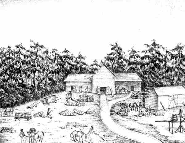
The Tallahassee Railroad, headquartered in Tallahassee, Florida, was one of the first two railroads in Florida, starting operations in 1836 or 1837. It did not successfully use steam locomotives until 1855, with trains being pulled by mules for more than 20 years. The principal source of traffic on the railroad for many years was carrying cotton bales from Tallahassee to seaports on the St. Marks River. Origin Tallahassee sat in "Middle Florida", the part of the Territory of Florida between the Appalachicola River, Appalachicola and Suwannee River, Suwannee rivers. In the 1830s Middle Florida was the most populous and prosperous part of Florida. The heart of Middle Florida and the adjacent part of Georgia (U.S. state), Georgia formed the "Red Hills Region", which held many plantations producing cotton and tobacco. Export of cotton from the region was difficult. Cotton bales were brought into Tallahassee, from which they were carried in wagons across the deep sand of the Woodvill ... [...More Info...] [...Related Items...] OR: [Wikipedia] [Google] [Baidu] |
Northern Florida
North Florida is a region of the U.S. state of Florida comprising the northernmost part of the state. Along with South Florida and Central Florida, it is one of Florida's three most common "directional" regions. It includes Jacksonville and nearby localities in Northeast Florida, an interior region known as North Central Florida, and the Florida Panhandle. Geography Area As with many vernacular regions, North Florida does not have any officially designated boundaries or status, and is defined differently in different sources. A 2007 study of Florida's regions by geographers Ary Lamme and Raymond K. Oldakowski found that Floridians surveyed identified "North Florida" as comprising the northernmost areas of the state, including both the peninsula and the Florida Panhandle. Additionally, two localized "directional" regions had emerged: North East Florida, also known as the "First Coast", representing the area around Jacksonville on the Atlantic coast, and North Central Florida, com ... [...More Info...] [...Related Items...] OR: [Wikipedia] [Google] [Baidu] |
Port Leon, Florida
Port Leon, Florida was a river port town located in what is now Wakulla County, Florida (at the time Leon County, Florida), which existed for only about six years in the first half of the 19th century. Port Leon is classified as an "extinct city" by the State Library and Archives of Florida and only remnants can be found today. Port Leon, established in 1837, in large measure by former inhabitants of Magnolia, was located about south of St. Marks on the east bank of the St. Marks River. It, like neighboring St. Marks and Magnolia, was an important port for the cotton plantations of the Red Hills Region of Florida and Georgia. The Tallahassee Railroad reached Port Leon in 1839. By then freight wagons and the railroad were bringing some 30,000 to 40,000 bales of cotton a year into the area ports. A bridge across the St. Marks River tied the port to the railroad and the docks for loading on ships, bound for the east coast of the United States. Port Leon received a post office i ... [...More Info...] [...Related Items...] OR: [Wikipedia] [Google] [Baidu] |
Pensacola And Georgia Railroad
Pensacola () is the westernmost city in the Florida Panhandle, and the county seat and only incorporated city of Escambia County, Florida, United States. As of the 2020 United States census, the population was 54,312. Pensacola is the principal city of the Pensacola Metropolitan Area, which had an estimated 502,629 residents . Pensacola is the site of the first Spanish settlement within the borders of the continental United States in 1559, predating the establishment of St. Augustine by 6 years, although the settlement was abandoned due to a hurricane and not re-established until 1698. Pensacola is a seaport on Pensacola Bay, which is protected by the barrier island of Santa Rosa and connects to the Gulf of Mexico. A large United States Naval Air Station, the first in the United States, is located southwest of Pensacola near Warrington; it is the base of the Blue Angels flight demonstration team and the National Naval Aviation Museum. The main campus of the University of West Flo ... [...More Info...] [...Related Items...] OR: [Wikipedia] [Google] [Baidu] |
Fodder
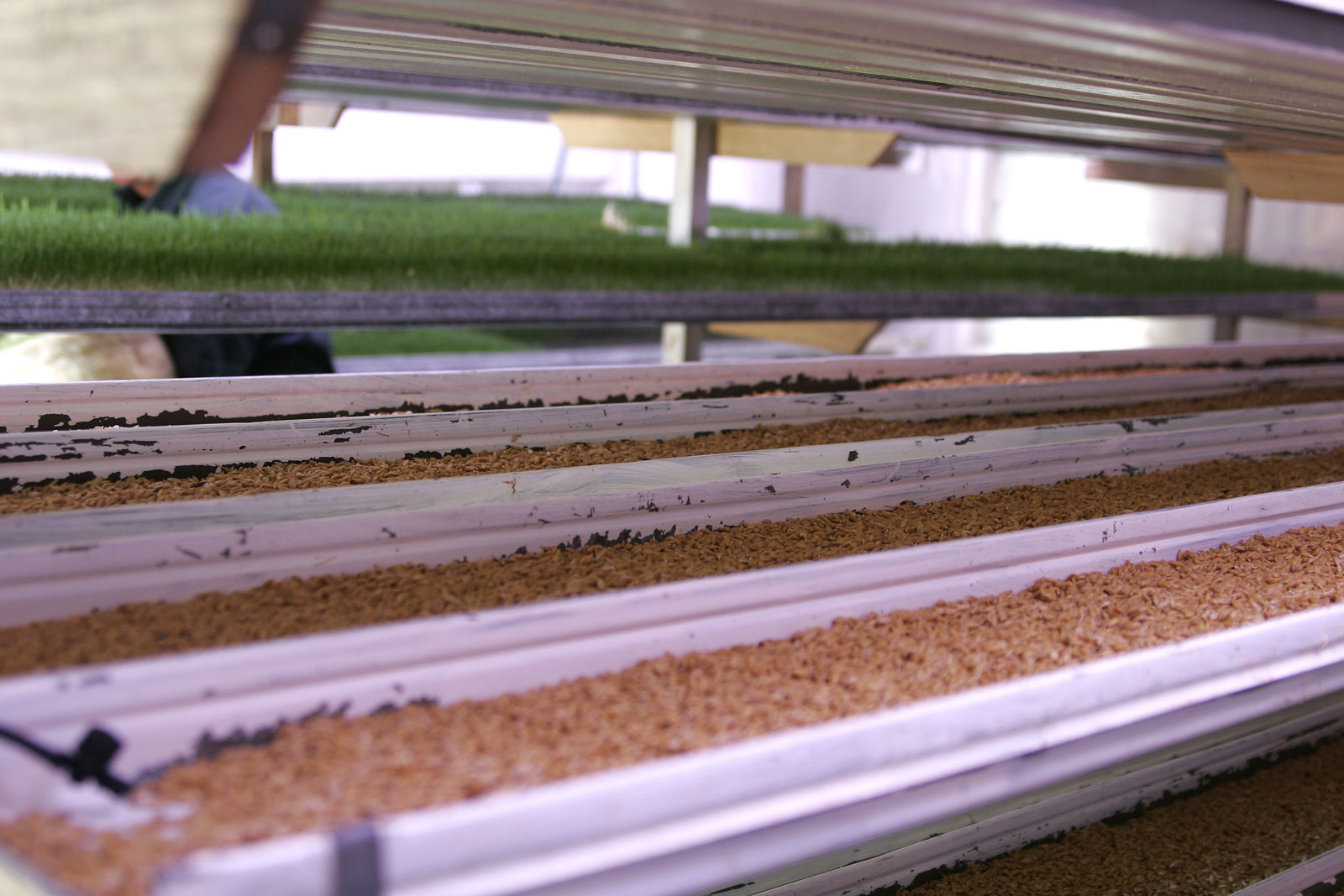
Fodder (), also called provender (), is any agriculture, agricultural foodstuff used specifically to feed domesticated livestock, such as cattle, domestic rabbit, rabbits, sheep, horses, chickens and pigs. "Fodder" refers particularly to food given to the animals (including plants cut and carried to them), rather than that which they forage for themselves (called forage). Fodder includes hay, straw, silage, compressed and Compound feed, pelleted feeds, oils and mixed rations, and sprouting, sprouted grains and legumes (such as bean sprouts, fresh malt, or brewing#Brewer's spent grain, spent malt). Most animal feed is from plants, but some manufacturers add ingredients to processed feeds that are of animal origin. The worldwide animal feed trade produced tons of feed (compound feed equivalent) in 2011, fast approaching 1 billion tonnes according to the International Feed Industry Federation, with an annual growth rate of about 2%. The use of agricultural land to grow feed r ... [...More Info...] [...Related Items...] OR: [Wikipedia] [Google] [Baidu] |
Newport, Wakulla County, Florida
Newport is a small unincorporated community in Wakulla County, Florida, United States of America, situated where U.S. Highway 98 meets State Road 267. History 1840s In 1841, the current Newport area and the community of Port Leon, just south, endured a severe yellow fever epidemic. In 1843 Port Leon, located on the St. Marks River, was devastated by a hurricane that produced a 10-foot storm surge. The area still struggles against the same recurring hurricane surges that move up the St. Marks River entrance. After the hurricane of September 13, 1843, washed away all of the homes, buildings and railroad tracks in Port Leon promoters Nathaniel Hamlin, James Ormond, Peter H. Swain and several others met a week later and made plans to establish another town. They spent several days searching for a site safe from the sea, then selected a piece of land on the west side of the St. Marks River, about two miles below the old town of Magnolia, Florida. This location offered hig ... [...More Info...] [...Related Items...] OR: [Wikipedia] [Google] [Baidu] |
Port Leon, Florida Hurricane Of 1843
This article encompasses the 1840–1849 Atlantic hurricane seasons. While data is not available for every storm that occurred, some parts of the coastline were populated enough to give data of hurricane occurrences. Each season was an ongoing event in the annual cycle of tropical cyclone formation in the Atlantic basin. Most tropical cyclone formation occurs between June 1 and November 30. 1840 Tropical Storm One June 19–23. In the middle of June, a tropical storm passed west of Lake Charles, Louisiana accompanied by several days of heavy rain. Strong winds on June 21 damaged corn crops. Tropical Storm Two September 17–18 tropical storm struck Galveston Texas. Tropical Storm Three On an unspecified date in 1840, a hurricane reportedly caused severe flooding that destroyed entire villages at the mouth of the Rio Grande. Unclear whether these events are related to prior storm that struck Galveston.Chenoweth, p. 64 1841 Tropical Storm One August 23–24. tropical storm repor ... [...More Info...] [...Related Items...] OR: [Wikipedia] [Google] [Baidu] |
Apalachee Bay Storm Of 1837
1830 Atlantic hurricane season # A hurricane moved from Trinidad to western Cuba between August 3 and August 9. # Twin Atlantic Coast Hurricanes of 1830. First noted in the Leeward Islands on August 11, a hurricane moved into the Caribbean in the middle of August. It moved west-northwestward, and approached the coast of Florida. It came close to present-day Daytona Beach on August 15, but recurved northeastward before landfall, although land was not spared from effects. It made landfall near Cape Fear North Carolina on the 16th and went out to sea that night, eventually well to the north of Bermuda just offshore the Canadian Maritimes. The hurricane broke a three-month drought, but caused heavy crop damage in the process.''Early American Hurricanes 1492–1870'', David Ludlum, pg 88–89 # Twin Atlantic Coast Hurricanes of 1830. A hurricane tracked north of the Leeward Islands on August 19, impacting Cape Hatteras, North Carolina on August 24–25, and went up the coastline eve ... [...More Info...] [...Related Items...] OR: [Wikipedia] [Google] [Baidu] |
Apalachee Bay
Apalachee Bay is a bay in the northeastern Gulf of Mexico occupying an indentation of the Florida coast to the west of where the Florida peninsula joins the United States mainland. It is bordered by Taylor County, Florida, Taylor, Jefferson County, Florida, Jefferson, Wakulla County, Florida, Wakulla, and Franklin County, Florida, Franklin counties. The Aucilla River, Aucilla, Econfina River, Econfina, St. Marks River, St. Marks, and Ochlockonee River, Ochlockonee rivers drain into the bay. In 1528 five boats were constructed by Pánfilo de Narváez in the bay. It is named for the Apalachee tribe which lived between the Aucilla and Ochlockonee rivers until the 18th century. Most of the bay's coast is the St. Marks National Wildlife Refuge. Underwater archaeological sites Beginning in the 1980s submerged archaeological sites have been identified and examined on the seabed of Apalachee Bay. During the height of the last glacial period, global sea levels were at least lower than i ... [...More Info...] [...Related Items...] OR: [Wikipedia] [Google] [Baidu] |
Wakulla County, Florida
Wakulla County is a county located in the Big Bend region in the northern portion of the U.S. state of Florida. As of the 2020 census, the population was 33,764. Its county seat is Crawfordville. Wakulla County is part of the Tallahassee, FL Metropolitan Statistical Area. Wakulla County has a near-absence of any municipal population, with two small municipalities holding about 3% of the population. The county seat, Crawfordville, is one of only two unincorporated county seats among Florida's 67 counties. History First Spanish period In 1528, Pánfilo de Narváez found his way to what would be Wakulla County from the future Pinellas County, Florida, camping at the confluence of the Wakulla and St. Marks rivers. Narváez determined this was a very suitable spot for a fort. In 1539, Hernando de Soto's expedition passed through ''La Florida'' with a similar route. The Fort San Marcos de Apalache began with a wooden fort in the late 1600s. The vicinity around the fort ... [...More Info...] [...Related Items...] OR: [Wikipedia] [Google] [Baidu] |
Magnolia, Florida
Magnolia, Florida was a thriving river port town in southern Wakulla County, Florida (until 1843, Leon County, Florida), established in the 1820s and is classified as an "extinct city" by the State Library and Archives of Florida. All that remains of the city is the cemetery; the last known burial was in 1859."The Old Magnolia Cemetery" The Magnolia Monthly, Vol. V, No. 3 arch, 1967/ref> The cemetery is on land now owned by the St. Joe Paper Company. The town was located near the small city of St. Marks, Florida. History Establishment In June 1827, only 6 years after Spain ceded Florida to the United States, four brothers from Maine, John, George, Nathaniel and Weld Hamlin founded the town of Magnolia on the St. Marks river just north of the existing town of St. Marks. The Ladd family also married into the Hamlin family and helped settle the new town of Magnolia. Their primary purpose was to establish a profitable shipping port for the export of cotton that would be delive ... [...More Info...] [...Related Items...] OR: [Wikipedia] [Google] [Baidu] |
Francis De Laporte De Castelnau
Francis may refer to: People *Pope Francis, the head of the Catholic Church and sovereign of the Vatican City State and Bishop of Rome *Francis (given name), including a list of people and fictional characters *Francis (surname) Places * Rural Municipality of Francis No. 127, Saskatchewan, Canada * Francis, Saskatchewan, Canada **Francis (electoral district) * Francis, Nebraska *Francis Township, Holt County, Nebraska * Francis, Oklahoma *Francis, Utah Other uses * ''Francis'' (film), the first of a series of comedies featuring Francis the Talking Mule, voiced by Chill Wills *''Francis'', a 1983 play by Julian Mitchell *FRANCIS, a bibliographic database * ''Francis'' (1793), a colonial schooner in Australia *Francis turbine, a type of water turbine *Francis (band), a Sweden-based folk band * Francis, a character played by YouTuber Boogie2988 See also *Saint Francis (other) *Francies, a surname, including a list of people with the name *Francisco (other) *Franci ... [...More Info...] [...Related Items...] OR: [Wikipedia] [Google] [Baidu] |
Railroad Tie
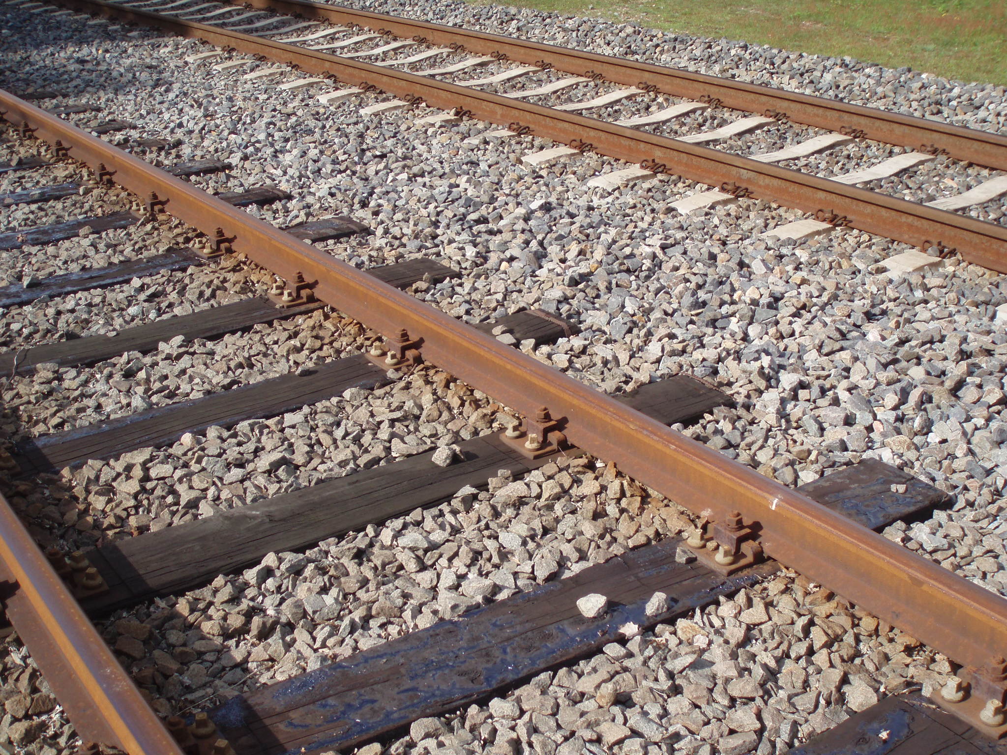
A railroad tie, crosstie (American English), railway tie (Canadian English) or railway sleeper (Australian and British English) is a rectangular support for the rails in railroad tracks. Generally laid perpendicular to the rails, ties transfer loads to the track ballast and subgrade, hold the rails upright and keep them spaced to the correct gauge. Railroad ties are traditionally made of wood, but prestressed concrete is now also widely used, especially in Europe and Asia. Steel ties are common on secondary lines in the UK; plastic composite ties are also employed, although far less than wood or concrete. As of January 2008, the approximate market share in North America for traditional and wood ties was 91.5%, the remainder being concrete, steel, azobé (red ironwood) and plastic composite. Tie spacing may depend on the type of tie, traffic loads and other requirements, for example 2640 concrete ties per mile on North American mainline railroads to 2112 timber ties per mile ... [...More Info...] [...Related Items...] OR: [Wikipedia] [Google] [Baidu] |


