|
TS Postcode Area
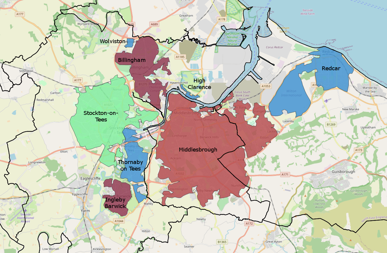
The TS postcode area, also known as the Cleveland postcode area,Royal Mail, ''Address Management Guide'', (2004) (or unofficially as the ''Teesside postcode area'') is a group of 29 postcode districts in northern England for ten post towns. These cover north-east North Yorkshire (post towns Middlesbrough, Redcar, Saltburn-by-the-Sea, Guisborough and Yarm) and south-east County Durham (post towns Stockton-on-Tees, Hartlepool, Billingham, Wingate and Trimdon Station). __TOC__ Coverage The approximate coverage of the postcode districts: , - ! TS1 , MIDDLESBROUGH , Middlesbrough (town centre) , Middlesbrough , - ! TS2 , MIDDLESBROUGH , St Hilda's, Port Clarence , Middlesbrough, Stockton-on-Tees , - ! TS3 , MIDDLESBROUGH , Middlesbrough's east: Brambles Farm, Thorntree, Park End, North Ormesby, Berwick Hills , Middlesbrough , - ! TS4 , MIDDLESBROUGH , Middlesbrough's centre-east: Grove Hill, Longlands , Middlesbrough , - ! TS5 , MIDDLESBROUGH , Middlesbrough's west ... [...More Info...] [...Related Items...] OR: [Wikipedia] [Google] [Baidu] |
Teesside
Teesside () is a built-up area around the River Tees in the north of England, split between County Durham and North Yorkshire. The name was initially used as a county borough in the North Riding of Yorkshire. Historically a hub for heavy manufacturing, the number of people employed in this type of work declined from the 1960s onwards, with steel-making and chemical manufacturing (particularly through Imperial Chemical Industries) replaced to some extent by new science businesses and service sector roles. History 1968–1974: County borough Before the county of Cleveland was created, the area (including Stockton-on-Tees) existed as a part of the North Riding of Yorkshire, due to most land being south of the Tees. Teesside was created due to Stockton-on-Tees being linked heavily with Thornaby (which had amalgamated with South Stockton/Mandale to form the Borough of Thornaby), Middlesbrough and Redcar by industry. Compared to the modern Teesside conurbation, the area was sma ... [...More Info...] [...Related Items...] OR: [Wikipedia] [Google] [Baidu] |
Brambles Farm
Brambles Farm is a small housing estate in east Middlesbrough, England with a population of 3,200. It lies to the north of Thorntree Thorntree is a housing estate in east Middlesbrough, North Yorkshire, England. The former Thorntree Ward's population was 6,290, at the 2011 census. Since 2015, the estate shares a ward with Brambles Farm. The housing estate was built in the l ... and east of Pallister. Schools Brambles Primary Academy, part of the Navigate Academies Trust, is a primary school in Brambles Farm. Teaching and learning at Brambles Primary Academy are considered to be ‘outstanding’, by Ofsted. The school works closely with its partner academies in the Navigate Academies Trust, including Pennyman Primary Academy, in nearby Netherfields. Brambles Farm FC Local residents formed this football team to combat anti-social behaviour among some of its youths. References External links Areas within Middlesbrough {{Middlesbrough-geo-stub ... [...More Info...] [...Related Items...] OR: [Wikipedia] [Google] [Baidu] |
South Bank, Middlesbrough
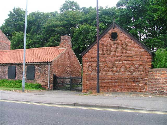
South Bank is a township in the Redcar and Cleveland borough in North Yorkshire, England on the south bank of the River Tees. It is east of Middlesbrough and south-west of Redcar. The town is served by railway station. The namesake ward had a population of 6,548 at the 2011 census. It forms part of the Teesside built-up area's Middlesbrough subdivision in 2011. The area is part of Greater Eston; which also includes Eston, Grangetown, Normanby, Teesville and part of Ormesby. Ormesby's ancient parish was split into civil parishes. The area was in Normanby civil parish. In 1894, the area gained a higher population with South Bank in Normanby Urban District Council created. A town hall was built for the district in 1878 and was demolished before the urban district merged with Eston Urban District in 1915. The Eston Urban District was abolished in 1968 with the district becoming part of the County Borough of Teesside. In 1974, the county borough, with the area remaining unpa ... [...More Info...] [...Related Items...] OR: [Wikipedia] [Google] [Baidu] |
Teesville
Teesville is an area in the borough of Redcar and Cleveland, North Yorkshire, England. A ward covering the area had a population of 6,517 at the 2011 census. It is part of Greater Eston, which includes the area and the settlements of Eston, Normanby, South Bank, Teesville and part of Ormesby. Politics Teesville is part of the Redcar constituency in the House of Commons. 2015 local elections results In the 2015 local elections, the following members were returned to Redcar and Cleveland Borough Council: Municipal buildings The town hall of Teesville was used by the Eston Urban District council from 1961 to 1968. When the County Borough of Teesside was abolished in 1974, the Borough of Langbaurgh, as part of the secord tier of local government within Cleveland County, used the town hall for the borough. The borough changed its name in 1988 to Langbaurgh-on-Tees and, as a unitary authority, after the abolition of Cleveland County, to Redcar and Cleveland in 1996. Th ... [...More Info...] [...Related Items...] OR: [Wikipedia] [Google] [Baidu] |
Normanby, Redcar And Cleveland
Normanby is an area in the borough of Redcar and Cleveland, North Yorkshire, England. A ward covering the area had a population of 6,930 at the United Kingdom Census 2011, 2011 census. It is part of Greater Eston, which includes the area and the outlying settlements of Eston, Grangetown, North Yorkshire, Grangetown, South Bank, Middlesbrough, South Bank, Teesville and part of Ormesby. Ormesby's ancient parish was split into civil parishes. As a township (England), township, Normanby civil parish was formed with South Bank, it was under the South Bank in Normanby Urban District Council from 1894-1915. The Urban district (Great Britain and Ireland), urban district and parish merged into the Eston Urban District which was abolished in 1968 with the district becoming part of the County Borough of Teesside. In 1974, the county borough was abolished with the area remaining unparished area, unparished since the abolition. History In 1870–72, John Marius Wilson's Imperial Gazetteer ... [...More Info...] [...Related Items...] OR: [Wikipedia] [Google] [Baidu] |
Grangetown, North Yorkshire
Grangetown is an area in the borough of Redcar and Cleveland, North Yorkshire, England. The area is east of Middlesbrough and from south-west of Redcar. A ward covering the area had a population of 5,088 at the 2011 census. It is part of Greater Eston, which includes the area and the other centres of Eston, Normanby, South Bank, Teesville and part of Ormesby. History The development of Grangetown was the discovery of ironstone in the Eston Hills in 1840, and the further development of the iron and steel industry along the riverbanks by Messrs. Bolckow and Vaughan from 1881. The name of the village was taken from a farm nearby called ''Eston Grange'', formerly a working farm for the monks of Guisborough Priory. By 1914, it was community of around 5,500 people with most houses lying between Bolckow Road and the steel works. There was a market square, shopping centre, boarding school, three pubs, six places of worship, a police station and public bathhouse. The Church of ... [...More Info...] [...Related Items...] OR: [Wikipedia] [Google] [Baidu] |
Eston
Eston is a Village in the borough of Redcar and Cleveland, North Yorkshire, England. The ward covering the area (as well as Lackenby, Lazenby and Wilton) had a population of 7,005 at the 2011 census. It is part of Greater Eston, which includes the outlying settlements of Grangetown, Normanby, South Bank, Teesville and part of Ormesby. Excluding Ormesby, the wider area came under the former Eston Urban District from 1894 until 1968. This was a single civil parish with a district council which had the ability to gain a charter to be a town and become a municipal borough in this case it did not. The County Borough of Teesside was created in 1968. The town remains unparished. History The land around Eston has been occupied since 2400 BC. The 1850 discovery of ironstone in Eston Hills by industrialists from Middlesbrough (most notably Henry Bolckow and John Vaughan) saw Eston develop from a small farming settlement in 1850 to a thriving mining town. Miners' cottages, alth ... [...More Info...] [...Related Items...] OR: [Wikipedia] [Google] [Baidu] |
Whinney Banks
Whinney Banks is an area in west Middlesbrough, North Yorkshire, England. The area is on the Old River Tees's southern banks, the river's main flow was redirected with the Mandale Cut, the A19 is between the old river and the area. It is within the TS5 postcode area and a part of the Ayresome ward, along with West Lane. History Whinney Banks was originally of around 550 houses, built in the 1930s and 1940s, forming part of a wider expanse of social housing in west Middlesbrough. Ayresome ward The Ayresome Ward is smaller than it originally was: it covered the current Ayresome ward, Newport ward and north and some of south Linthorpe ward, including the cemetery and the west of Linthorpe Road from Parliament Road to St. Barnabas Road. Ayresome itself is in the current Newport Road. North of the current ward has seen most re-development as Acklam Green and has previously been based off and called West Lane West Lane, or Acklam Green, is an area in West Middlesbrough, North ... [...More Info...] [...Related Items...] OR: [Wikipedia] [Google] [Baidu] |
Linthorpe
Linthorpe is an inner-area of Middlesbrough in the Borough of Middlesbrough, North Yorkshire, England. It contains two wards: Linthorpe (containing the cemetery with a population of 9,711) and Park (containing Albert Park with a population of 5,919). It is near the areas of Acklam, Ayresome, Grove Hill, Middlesbrough centre and Whinney Banks. History Deriving from 'Leofa's village', the present name of Linthorpe has also been recorded as Levynthrop, Levingthorp and Linthrop. The original site was on Burlam Road, Roman Road was probably an original Roman route as can be seen on the map of Roman Cleveland. The present Linthorpe Cemetery was then the village green. 'Levingthorp' grew to included the hamlets of Ayresome and Newport. The Blue Hall was a building situated on the corner of Roman Road and Burlam Road. It was reputedly used by smugglers from Newport. Inevitably a rumour exists that there was a subterranean passage from here to the manor house at Acklam; there is ... [...More Info...] [...Related Items...] OR: [Wikipedia] [Google] [Baidu] |
Acklam, Middlesbrough
Acklam is an area in the Borough of Middlesbrough, North Yorkshire, England. It is believed that the settlement is Anglo-Saxon in origin, the name is Old English for "place at the oak clearings" or "place of oaks". At the 2011 census, the Acklam Ward had a population of 6,027 while Kader Ward had a population of 5,074. Brookfield Ward (Trimdon Ward since 2015) had a population of 5,712 while Ayresome Ward had 6,515. The four overall wards had a population of 23,328. History Manor of 1068 Acklam was referred to as "Aclun" in the 1086 ''Domesday Book''. A precursor to a civil parish, the 'manor' was eleven gold-taxed ploughlands, they would have been eleven settlements in the area. This manor's area had previously been owned by Earl Siward with the area passed to Hugh Earl of Chester in 1086. This manor's jurisdiction extended to over 24 plough-lands including Coulby farm, Hemlington, Stainton, Thornton, Maltby and Thornaby. Also listed were the later abandoned Stains ... [...More Info...] [...Related Items...] OR: [Wikipedia] [Google] [Baidu] |
Grove Hill, Middlesbrough
Grove Hill is an area of the Middlesbrough's Longlands and Beechwood ward in the Borough of Middlesbrough, North Yorkshire, England. It is a historic part of the North Riding of Yorkshire. The area's main shopping area is off Marton Road at the junction with Marton Burn Road and Belle Vue. The majority of the area was within the civil parish of Marton before the area and Marton itself became unparished areas of the town. Marton Grove Primary School served the area for 83 years before its closure in 2011 and demolition in 2012. They are also shops on the other end of Marton Burn Road, at the roundabout with Eastborne, Valley, Bishopton and York roads. These shops formerly had the Palladium cinema, demolished in 1960. Since the early 2000s, the area was subject to a regeneration scheme which saw many houses demolished. There was also a proposal to rename the area after ant-social behaviour had left the area with a reputation. The council stated that a "...rebranding would he ... [...More Info...] [...Related Items...] OR: [Wikipedia] [Google] [Baidu] |
Berwick Hills
Berwick Hills is a suburb in the Borough of Middlesbrough in North Yorkshire, England with a population of 4,465. It is east of Middlesbrough centre. The ward it belongs to is shared with the smaller area of Pallister, both are separated by Ormesby Road. Economy and community File:Morrisons Berwick hills - panoramio.jpg, Morrisons Supermarket File:The Neptune Centre - Berwick Hills - geograph.org.uk - 1596198.jpg, The Neptune Centre The suburb's centre has a supermarket, public swimming pool, municipal library and a shopping parade. The public swimming facility is called the Neptune Centre. It is a regional venue for competitive swimming, they is also a health and fitness club at the site. Primary school Berwick Hills Primary opened in 1954, as two schools, an infant and a junior school, with a combined 446 children. The schools later amalgamated, but it was not until 2011 that a new building was built. The present school is a single-storey, £5.8 million, eco-friendl ... [...More Info...] [...Related Items...] OR: [Wikipedia] [Google] [Baidu] |


