|
Tsim Bei Tsui
Tsim Bei Tsui () is an area of Yuen Long District in the northwestern part of the New Territories in Hong Kong, facing Deep Bay. Geography The area is the estuary of the , Shan Pui and Kam Tin rivers. Kwai Shan () is a 71 m high hill located in Tsim Bei Tsui and named after its shape. Conservation Two parts of Tsim Bei Tsui were designated as Sites of Special Scientific Interest in 1985 and 1989 respectively. The first one features mangrove. It has an area of 2.5 ha and is located along the seafront. The second one, referred to as the 'Tsim Bei Tsui Egretry', has an area of 4.8 ha and features two feng shui groves. It is located south of Tsim Bei Tsui and east of Mong Tseng Wai Mong Tseng Wai () is a walled village in Ha Tsuen, Yuen Long District, New Territories, Hong Kong. Administration Mong Tseng Wai is a recognized village under the New Territories Small House Policy. For electoral purposes, Mong Tseng Wai is part .... See also * '' Gascoignella aprica'' Referenc ... [...More Info...] [...Related Items...] OR: [Wikipedia] [Google] [Baidu] |
Site Of Special Scientific Interest (Hong Kong)
A Site of Special Scientific Interest () or SSSI is a special area to protect wildlife, habitats and geographic features based on scientific interest in Hong Kong. Scientific interests are special features relating to animal life, plant life, geology and/or geography. After being identified by the Agriculture, Fisheries and Conservation Department, these areas are documented by the Planning Department and added to maps. From 1975 to 2005, 67 locations were designated SSSIs throughout Hong Kong. List of SSSIs # Yim Tso Ha Egretry 25/02/75. Delisted in March 2016. # Shing Mun Fung Shui Woodland 25/02/75 # Tai Mo Shan Montane Forest Scrub 15/09/75 # She Shan Fung Shui Woodland 15/09/75 # Tai Tam Harbour (Inner Bay) 24/10/75 # D'Aguilar Peninsula 24/10/75 # Ma On Shan 23/06/76 # Tsing Shan Tsuen 23/06/76 (delisted in 2007) # Sunset Peak 23/06/76 # Mai Po Marshes 15/09/76 # Bluff Island & Basalt Island 16/02/79 # Port Island 16/02/79 # Kat O Chau 16/02/79 (De-Designated o ... [...More Info...] [...Related Items...] OR: [Wikipedia] [Google] [Baidu] |
Mong Tseng Wai
Mong Tseng Wai () is a walled village in Ha Tsuen, Yuen Long District, New Territories, Hong Kong. Administration Mong Tseng Wai is a recognized village under the New Territories Small House Policy. For electoral purposes, Mong Tseng Wai is part of the Ping Shan North constituency. History In 2001, a house structure with underground water system dated to Song Dynasty were discovered in Mong Tseng Wai by the Hong Kong Archaeological Society. It was the only Song Dynasty village site in Hong Kong. Mong Tseng Wai was founded by the Tang Clan of Kam Tin during the Ming dynasty.Antiquities Advisory Board. Historic Building AppraisalEntrance Gate, Mong Tseng Wai/ref> Mong Tseng Wai was historically probably allied to Ha Tsuen in an oath-sworn alliance, although it was not part of the Ha Tsuen Heung (). Features * The entrance gate of the walled village was listed as a Grade III historic building.Antiquities Advisory BoardList of the 1,444 Historic Buildings with Assessment Results/ ... [...More Info...] [...Related Items...] OR: [Wikipedia] [Google] [Baidu] |
Grove (nature)
A grove is a small group of trees with minimal or no undergrowth, such as a sequoia grove, or a small orchard planted for the cultivation of fruits or nuts. Other words for groups of trees include ''woodland'', ''woodlot'', ''thicket'', and ''stand''. The main meaning of " grove" is a group of trees that grow close together, generally without many bushes or other plants underneath. It is an old word in the English language, with records of its use dating as far back as the late 9th century. The word's true origins are unknown; the word, or a related root, cannot be found in any other Germanic language. Naturally-occurring groves are typically small, perhaps a few acres at most.In contrast, orchards, which are normally intentional planting of trees, may be small or very large, like the apple orchards in Washington state, and orange groves in Florida. Historically, groves were considered sacred in pagan, pre-Christian Germanic and Celtic cultures. Helen F. Leslie-Jacobsen a ... [...More Info...] [...Related Items...] OR: [Wikipedia] [Google] [Baidu] |
Egretry
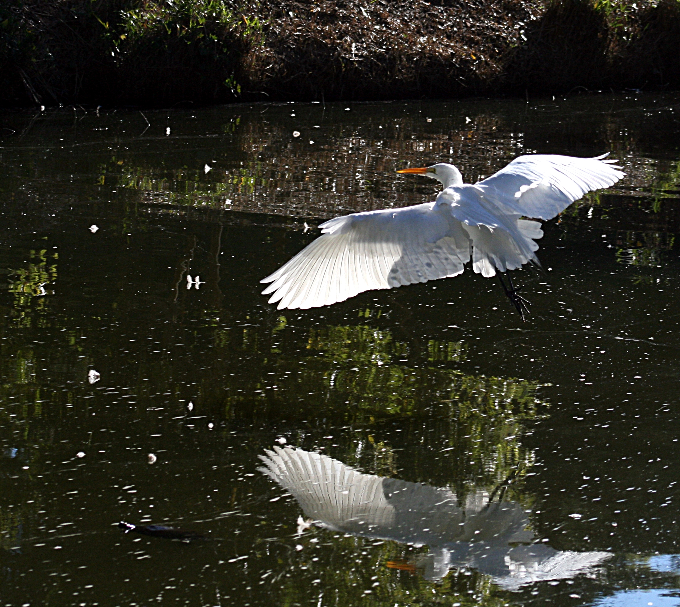
Egrets ( ) are herons, generally long-legged wading birds, that have white or buff plumage, developing fine plumes (usually milky white) during the breeding season. Egrets are not a biologically distinct group from herons and have the same build. Biology Many egrets are members of the genera ''Egretta'' or '' Ardea'', which also contain other species named as herons rather than egrets. The distinction between a heron and an egret is rather vague, and depends more on appearance than biology. The word "egret" comes from the French word ''aigrette'' that means both "silver heron" and "brush", referring to the long, filamentous feathers that seem to cascade down an egret's back during the breeding season (also called "egrets"). Several of the egrets have been reclassified from one genus to another in recent years; the great egret, for example, has been classified as a member of either ''Casmerodius'', ''Egretta'', or ''Ardea''. In the 19th and early part of the 20th centuries, s ... [...More Info...] [...Related Items...] OR: [Wikipedia] [Google] [Baidu] |
Mangrove
A mangrove is a shrub or tree that grows in coastal saline water, saline or brackish water. The term is also used for tropical coastal vegetation consisting of such species. Mangroves are taxonomically diverse, as a result of convergent evolution in several plant families. They occur worldwide in the tropics and subtropics and even some temperate coastal areas, mainly between latitudes 30° N and 30° S, with the greatest mangrove area within 5° of the equator. Mangrove plant families first appeared during the Late Cretaceous to Paleocene epochs, and became widely distributed in part due to the plate tectonics, movement of tectonic plates. The oldest known fossils of Nypa fruticans, mangrove palm date to 75 million years ago. Mangroves are salt-tolerant trees, also called halophytes, and are adapted to live in harsh coastal conditions. They contain a complex salt filtration system and a complex root system to cope with saltwater immersion and wave action. They are ad ... [...More Info...] [...Related Items...] OR: [Wikipedia] [Google] [Baidu] |
Town Planning Board
The Town Planning Board () is a statutory body of the Hong Kong Government tasked with developing urban planning, urban plans with an aim to ensuring the "health, safety, convenience and general welfare of the community through the process of guiding and controlling the development and use of land, and to bring about a better organised, efficient and desirable place to live and work." It is founded upon section 2 of the Town Planning Ordinance. Function The Town Planning Board designates and prepares new draft zoning plans, considers proposed layout plans under Comprehensive Development Area zoning, exhibits draft plans for public comment, considers applications for planning permission, and submits draft plans for approval by the Chief Executive in Council. The Planning Department is the executive arm of the Town Planning Board. It creates plans on behalf of the TPB, provides technical services and enforces zoning restrictions. Composition * Chairman * Vice-chairman * 5 ... [...More Info...] [...Related Items...] OR: [Wikipedia] [Google] [Baidu] |
Kam Tin River
The Kam Tin River (), located in the northwest New Territories, is a river to the east to Yuen Long, near Kam Tin, Hong Kong Hong Kong ( (US) or (UK); , ), officially the Hong Kong Special Administrative Region of the People's Republic of China ( abbr. Hong Kong SAR or HKSAR), is a city and special administrative region of China on the eastern Pearl River Delt .... The river basin spans around 44.3 km2. The length of the river is about 13 km. Originating at an altitude of 910 metres near Tai Mo Shan, it has the second highest origin of a Hong Kong river. See also * List of rivers and nullahs in Hong Kong References Kam Tin Rivers of Hong Kong {{HongKong-geo-stub ... [...More Info...] [...Related Items...] OR: [Wikipedia] [Google] [Baidu] |
HK Hiking Yuen Long District Side Road Lau Fau Shan March 2021 SSG 51
Hong Kong ( (US) or (UK); , ), officially the Hong Kong Special Administrative Region of the People's Republic of China (abbr. Hong Kong SAR or HKSAR), is a city and special administrative region of China on the eastern Pearl River Delta in South China. With 7.5 million residents of various nationalities in a territory, Hong Kong is one of the most densely populated places in the world. Hong Kong is also a major global financial centre and one of the most developed cities in the world. Hong Kong was established as a colony of the British Empire after the Qing Empire ceded Hong Kong Island from Xin'an County at the end of the First Opium War in 1841 then again in 1842.. The colony expanded to the Kowloon Peninsula in 1860 after the Second Opium War and was further extended when Britain obtained a 99-year lease of the New Territories in 1898... British Hong Kong was occupied by Imperial Japan from 1941 to 1945 during World War II; British administration resumed after th ... [...More Info...] [...Related Items...] OR: [Wikipedia] [Google] [Baidu] |
Shan Pui River
The Shan Pui River (also known as Yuen Long Creek) () is a river in Yuen Long, New Territories, Hong Kong. It has many tributaries, most of them starting from inside Tai Lam Country Park. It passes six villages and is joined by a few more streams. After flowing through Yuen Long Town, it continues northeast into Yuen Long Industrial Estate and Nam Sang Wai. The Kam Tin River flows into it on the way. It eventually empties into the Mai Po Nature Reserve and then Deep Bay. Crocodile The river was at the centre of attention in November 2003, when a 1.5 metre-long female crocodile was found in the river near Nam Sang Wai. It attracted many people to the village, all wanting to see the once-in-a-lifetime sight. Many efforts were made to catch the crocodile, but it wasn't until over six months later, in June 2004, before it was caught. Afterwards, the AFCD and RTHK held a naming contest for the crocodile. On 12August 2004, the crocodile was named Pui Pui (貝貝), a transliteratio ... [...More Info...] [...Related Items...] OR: [Wikipedia] [Google] [Baidu] |
Deep Bay, China
Deep Bay is a bay between Yuen Long District, in the New Territories, Hong Kong and the city of Shenzhen in Guangdong Province. It is otherwise known as Hau Hoi Wan () in Hong Kong, and Shenzhen Bay () in Mainland China. Name The local Cantonese name of the bay is Hau Hoi Wan (), which means the ''back (sea) bay''. It is opposite to another bay, Tsin Hoi Wan (), which means ''front (sea) bay'', on the other side of Nantau Peninsula. The Chinese character 后 (Hau, lit. queen) in 后海灣 is the homonym of 後 (Hau, lit. back), and also its simplified character. Some attribute the character 后 (Hau) to the goddess of mercy and sea, Tin Hau (). The name of Shenzhen Bay came much later, at least after the establishment of Shenzhen Special Economic Zone in 1980. The name became more notable after a hotel was named Shenzhen Bay. While the government of China uses the name widely, the people and government in Hong Kong continue to use the official name (). Ecology As the bay is ... [...More Info...] [...Related Items...] OR: [Wikipedia] [Google] [Baidu] |


