|
Transient Electromagnetics
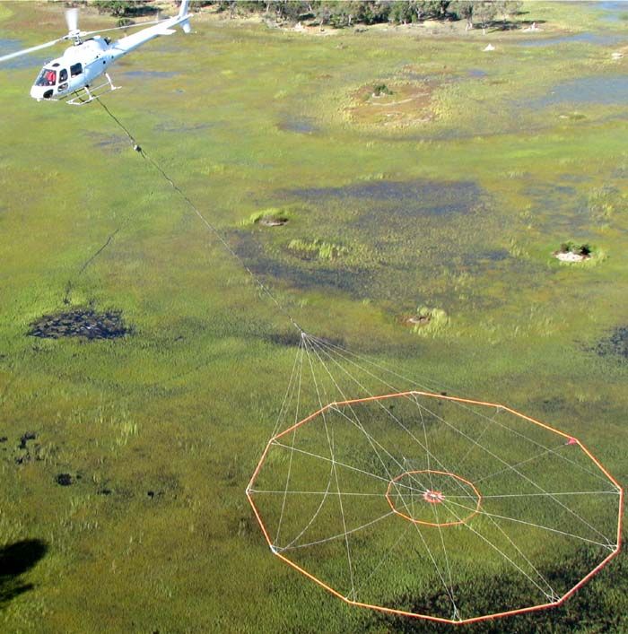
Transient electromagnetics, (also time-domain electromagnetics / TDEM), is a geophysical exploration technique in which electric and magnetic fields are induced by transient pulses of electric current and the subsequent decay response measured. TEM / TDEM methods are generally able to determine subsurface electrical properties, but are also sensitive to subsurface magnetic properties in applications like UXO detection and characterization. TEM/TDEM surveys are a very common surface EM technique for mineral exploration, groundwater exploration, and for environmental mapping, used throughout the world in both onshore and offshore applications. Physical principles Two fundamental electromagnetic principles are required to derive the physics behind TEM surveys: Faraday's law of induction and Lenz's Law. A loop of wire is generally energized by a direct current. At some time (''t0'') the current is cut off as quickly as possible. Faraday's law dictates that a nearly identical c ... [...More Info...] [...Related Items...] OR: [Wikipedia] [Google] [Baidu] |
Transient (oscillation)
In electrical engineering and mechanical engineering, a transient response is the response of a system to a change from an equilibrium or a steady state. The transient response is not necessarily tied to abrupt events but to any event that affects the equilibrium of the system. The impulse response and step response are transient responses to a specific input (an impulse and a step, respectively). In electrical engineering specifically, the transient response is the circuit’s temporary response that will die out with time. It is followed by the steady state response, which is the behavior of the circuit a long time after an external excitation is applied. Damping The response can be classified as one of three types of damping that describes the output in relation to the steady-state response. ;Underdamped :An underdamped response is one that oscillates within a decaying envelope. The more underdamped the system, the more oscillations and longer it takes to reach steady-stat ... [...More Info...] [...Related Items...] OR: [Wikipedia] [Google] [Baidu] |
High-voltage Direct Current
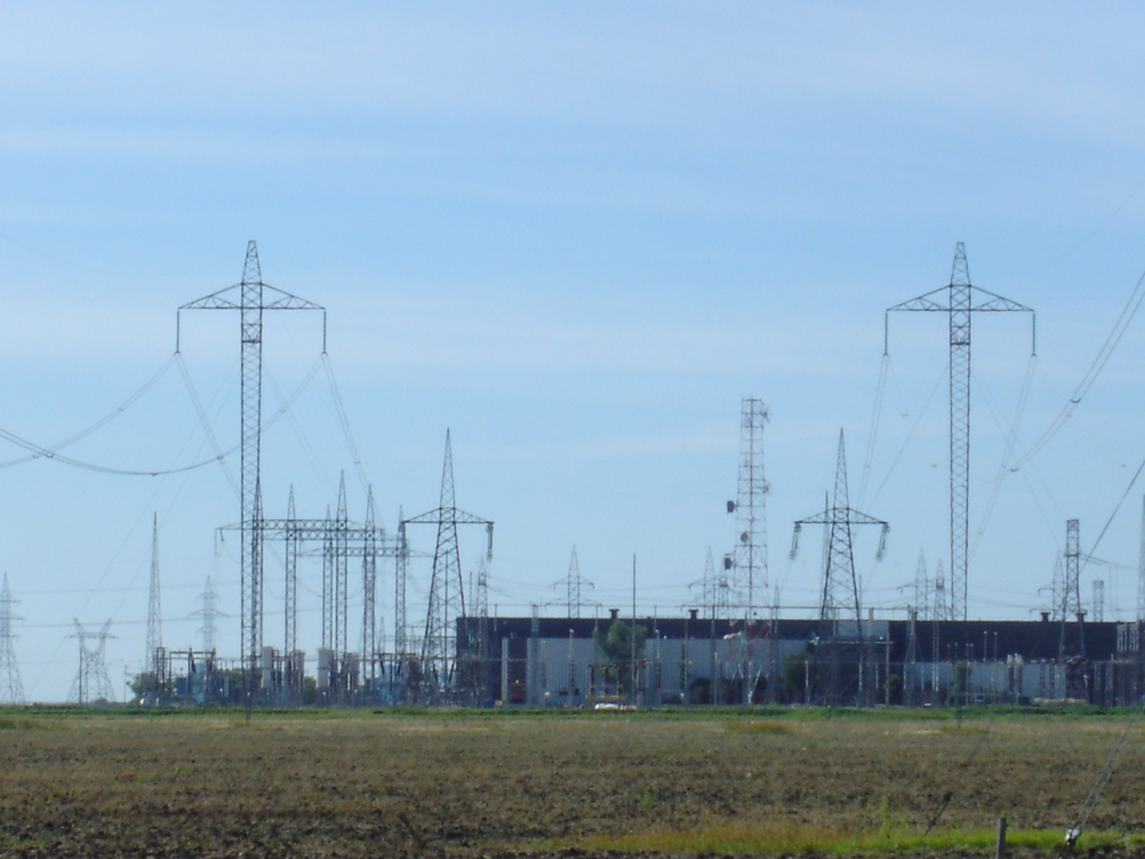
A high-voltage direct current (HVDC) electric power transmission system (also called a power superhighway or an electrical superhighway) uses direct current (DC) for electric power transmission, in contrast with the more common alternating current (AC) transmission systems. Most HVDC links use voltages between 100 kV and 800 kV. However, a 1,100 kV link in China was completed in 2019 over a distance of with a power capacity of 12 GW. With this dimension, intercontinental connections become possible which could help to deal with the fluctuations of wind power and photovoltaics. HVDC allows power transmission between AC transmission systems that are not synchronized. Since the power flow through an HVDC link can be controlled independently of the phase angle between source and load, it can stabilize a network against disturbances due to rapid changes in power. HVDC also allows the transfer of power between grid systems running at different frequencies, such ... [...More Info...] [...Related Items...] OR: [Wikipedia] [Google] [Baidu] |
Electrical Resistivity Tomography
Electrical resistivity tomography (ERT) or electrical resistivity imaging (ERI) is a geophysical technique for imaging sub-surface structures from electrical resistivity measurements made at the surface, or by electrodes in one or more boreholes. If the electrodes are suspended in the boreholes, deeper sections can be investigated. It is closely related to the medical imaging technique electrical impedance tomography (EIT), and mathematically is the same inverse problem. In contrast to medical EIT, however, ERT is essentially a direct current method. A related geophysical method, induced polarization (or spectral induced polarization), measures the transient response and aims to determine the subsurface chargeability properties. Electrical resistivity measurements can be used for identification and quantification of depth of groundwater, detection of clays, and measurement of groundwater conductivity. History The technique evolved from techniques of electrical prospecting th ... [...More Info...] [...Related Items...] OR: [Wikipedia] [Google] [Baidu] |
Reflection Seismology
Reflection seismology (or seismic reflection) is a method of exploration geophysics that uses the principles of seismology to estimate the properties of the Earth's subsurface from reflected seismic waves. The method requires a controlled seismic source of energy, such as dynamite or Tovex blast, a specialized air gun or a seismic vibrator. Reflection seismology is similar to sonar and echolocation. This article is about surface seismic surveys; for vertical seismic profiles, see VSP. History Reflections and refractions of seismic waves at geologic interfaces within the Earth were first observed on recordings of earthquake-generated seismic waves. The basic model of the Earth's deep interior is based on observations of earthquake-generated seismic waves transmitted through the Earth's interior (e.g., Mohorovičić, 1910). The use of human-generated seismic waves to map in detail the geology of the upper few kilometers of the Earth's crust followed shortly thereafter and h ... [...More Info...] [...Related Items...] OR: [Wikipedia] [Google] [Baidu] |
Seismo-electromagnetics
Seismo-electromagnetics are various electro-magnetic phenomena believed to be generated by tectonic forces acting on the earth's crust, and possibly associated with seismic activity such as earthquakes and volcanoes. Study of these has been prompted by the prospect they might be generated by the increased stress leading up to an earthquake, and might thereby provide a basis for short-term earthquake prediction. However, despite many studies, no form of seismo-electromagnetics has been shown to be effective for earthquake prediction. A key problem is that earthquakes themselves produce relatively weak electromagnetic phenomena, and the effects from any precursory phenomena are likely to be too weak to measure. Close monitoring of the Parkfield earthquake revealed no significant pre-seismic electromagnetic effects. However, some researchers remain optimistic, and searches for seismo-electromagnetic earthquake precursors continue. VAN method The VAN method – named after P. Varot ... [...More Info...] [...Related Items...] OR: [Wikipedia] [Google] [Baidu] |
Magnetotellurics
Magnetotellurics (MT) is an electromagnetic geophysical method for inferring the earth's subsurface electrical conductivity from measurements of natural geomagnetic and geoelectric field variation at the Earth's surface. Investigation depth ranges from 300 m below ground by recording higher frequencies down to 10,000 m or deeper with long-period soundings. Proposed in Japan in the 1940s, and France and the USSR during the early 1950s, MT is now an international academic discipline and is used in exploration surveys around the world. Commercial uses include hydrocarbon (oil and gas) exploration, geothermal exploration, carbon sequestration, mining exploration, as well as hydrocarbon and groundwater monitoring. Research applications include experimentation to further develop the MT technique, long-period deep crustal exploration, deep mantle probing, sub-glacial water flow mapping, and earthquake precursor research. History The magnetotelluric technique was introduc ... [...More Info...] [...Related Items...] OR: [Wikipedia] [Google] [Baidu] |
Exploration Geophysics
Exploration geophysics is an applied branch of geophysics and economic geology, which uses physical methods, such as seismic, gravitational, magnetic, electrical and electromagnetic at the surface of the Earth to measure the physical properties of the subsurface, along with the anomalies in those properties. It is most often used to detect or infer the presence and position of economically useful geological deposits, such as ore minerals; fossil fuels and other hydrocarbons; geothermal reservoirs; and groundwater reservoirs. Exploration geophysics can be used to directly detect the target style of mineralization, via measuring its physical properties directly. For example, one may measure the density contrasts between the dense iron ore and the lighter silicate host rock, or one may measure the electrical conductivity contrast between conductive sulfide minerals and the resistive silicate host rock. Geophysical methods The main techniques used are: # Seismic tomography to loca ... [...More Info...] [...Related Items...] OR: [Wikipedia] [Google] [Baidu] |
Geophysics
Geophysics () is a subject of natural science concerned with the physical processes and physical properties of the Earth and its surrounding space environment, and the use of quantitative methods for their analysis. The term ''geophysics'' sometimes refers only to solid earth applications: Earth's shape; its gravitational and magnetic fields; its internal structure and composition; its dynamics and their surface expression in plate tectonics, the generation of magmas, volcanism and rock formation. However, modern geophysics organizations and pure scientists use a broader definition that includes the water cycle including snow and ice; fluid dynamics of the oceans and the atmosphere; electricity and magnetism in the ionosphere and magnetosphere and solar-terrestrial physics; and analogous problems associated with the Moon and other planets. Gutenberg, B., 1929, Lehrbuch der Geophysik. Leipzig. Berlin (Gebruder Borntraeger). Runcorn, S.K, (editor-in-chief), 1967, International ... [...More Info...] [...Related Items...] OR: [Wikipedia] [Google] [Baidu] |
Oil And Gas Exploration
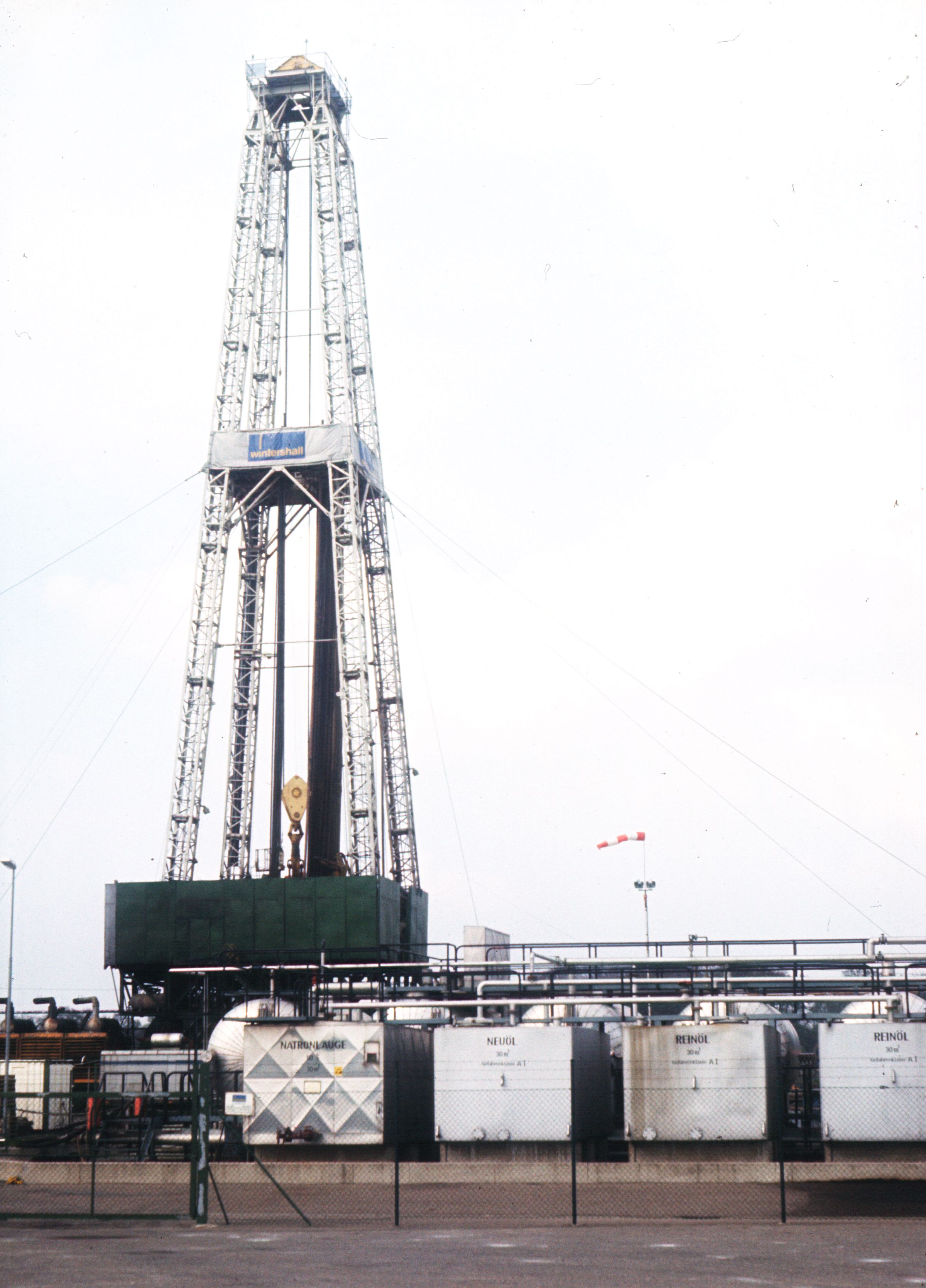
Hydrocarbon exploration (or oil and gas exploration) is the search by petroleum geologists and geophysicists for deposits of hydrocarbons, particularly petroleum and natural gas, in the Earth using petroleum geology. Exploration methods Visible surface features such as oil seeps, natural gas seeps, pockmarks (underwater craters caused by escaping gas) provide basic evidence of hydrocarbon generation (be it shallow or deep in the Earth). However, most exploration depends on highly sophisticated technology to detect and determine the extent of these deposits using exploration geophysics. Areas thought to contain hydrocarbons are initially subjected to a gravity survey, magnetic survey, passive seismic or regional seismic reflection surveys to detect large-scale features of the sub-surface geology. Features of interest (known as ''leads'') are subjected to more detailed seismic surveys which work on the principle of the time it takes for reflected sound waves to travel thro ... [...More Info...] [...Related Items...] OR: [Wikipedia] [Google] [Baidu] |
Groundwater
Groundwater is the water present beneath Earth's surface in rock and soil pore spaces and in the fractures of rock formations. About 30 percent of all readily available freshwater in the world is groundwater. A unit of rock or an unconsolidated deposit is called an aquifer when it can yield a usable quantity of water. The depth at which soil pore spaces or fractures and voids in rock become completely saturated with water is called the water table. Groundwater is recharged from the surface; it may discharge from the surface naturally at springs and seeps, and can form oases or wetlands. Groundwater is also often withdrawn for agricultural, municipal, and industrial use by constructing and operating extraction wells. The study of the distribution and movement of groundwater is hydrogeology, also called groundwater hydrology. Typically, groundwater is thought of as water flowing through shallow aquifers, but, in the technical sense, it can also contain soil moisture, perma ... [...More Info...] [...Related Items...] OR: [Wikipedia] [Google] [Baidu] |
Onshore (hydrocarbons)
Onshore, when used in relation to hydrocarbons, refers to an oil, natural gas or condensate field that is under the land or to activities or operations carried out in relation to such a field. Onshore may also refer to processes that take place on land that are associated with oil, gas or condensate production that has taken place offshore. The offshore production facility delivers oil, gas and condensate by pipelines to the onshore terminal and processing facility. Alternatively oil may be delivered by ocean-going tanker to the onshore terminal. Onshore oil terminals Onshore oil terminals may include large crude oil tanks for the initial storage of oil prior to processing. Such tanks provide a buffer volume where oil is delivered by tanker. The oil tanker delivery rate is considerably greater than the processing capacity of the plant. Crude oil tanks also allow offshore production to continue if the export route becomes unavailable. Onshore oil terminals generally have f ... [...More Info...] [...Related Items...] OR: [Wikipedia] [Google] [Baidu] |
Mining
Mining is the extraction of valuable minerals or other geological materials from the Earth, usually from an ore body, lode, vein, seam, reef, or placer deposit. The exploitation of these deposits for raw material is based on the economic viability of investing in the equipment, labor, and energy required to extract, refine and transport the materials found at the mine to manufacturers who can use the material. Ores recovered by mining include metals, coal, oil shale, gemstones, limestone, chalk, dimension stone, rock salt, potash, gravel, and clay. Mining is required to obtain most materials that cannot be grown through agricultural processes, or feasibly created artificially in a laboratory or factory. Mining in a wider sense includes extraction of any non-renewable resource such as petroleum, natural gas, or even water. Modern mining processes involve prospecting for ore bodies, analysis of the profit potential of a proposed mine, extraction of the desired materials, an ... [...More Info...] [...Related Items...] OR: [Wikipedia] [Google] [Baidu] |


