|
Timucua
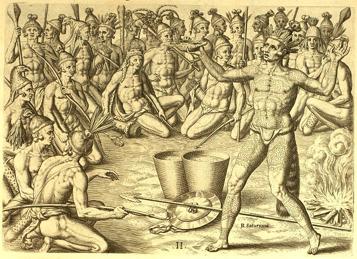
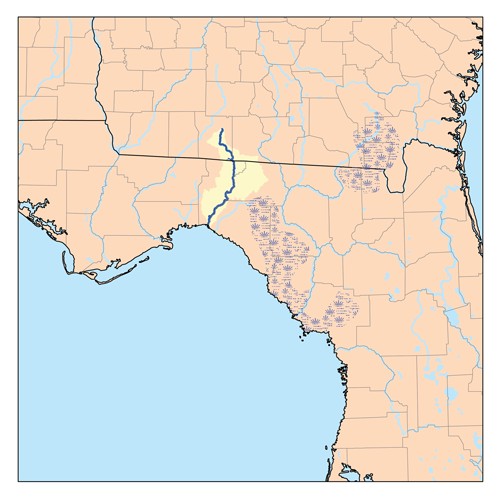
The Timucua were a Native American people who lived in Northeast and North Central Florida and southeast Georgia. They were the largest indigenous group in that area and consisted of about 35 chiefdoms, many leading thousands of people. The various groups of Timucua spoke several dialects of the Timucua language. At the time of European contact, Timucuan speakers occupied about in the present-day states of Florida and Georgia, with an estimated population of 200,000. Milanich notes that the population density calculated from those figures, is close to the population densities calculated by other authors for the Bahamas and for Hispaniola at the time of first European contact. The territory occupied by Timucua speakers stretched from the Altamaha River and Cumberland Island in present-day Georgia as far south as Lake George in central Florida, and from the Atlantic Ocean west to the Aucilla River in the Florida Panhandle, though it reached the Gulf of Mexico at no more than ... [...More Info...] [...Related Items...] OR: [Wikipedia] [Google] [Baidu] |
Timucua Language
Timucua is a language isolate formerly spoken in northern and central Florida and southern Georgia by the Timucua peoples. Timucua was the primary language used in the area at the time of Spanish colonization in Florida. Differences among the nine or ten Timucua dialects were slight, and appeared to serve mostly to delineate band or tribal boundaries. Some linguists suggest that the Tawasa of what is now northern Alabama may have spoken Timucua, but this is disputed. Most of what is known of the language comes from the works of Francisco Pareja, a Franciscan missionary who came to St. Augustine in 1595. During his 31 years living with the Timucua, he developed a writing system for the language. From 1612 to 1628, he published several Spanish–Timucua catechisms, as well as a grammar of the Timucua language. Including his seven surviving works, only ten primary sources of information about the Timucua language survive, including two catechisms written in Timucua and Spanish b ... [...More Info...] [...Related Items...] OR: [Wikipedia] [Google] [Baidu] |
Agua Dulce People
The Agua Dulce or Agua Fresca (Freshwater) were a Timucua people of northeastern Florida. They lived in the St. Johns River watershed north of Lake George (Florida), Lake George, and spoke a dialect of the Timucua language also known as Agua Dulce. In the 1560s, Agua Dulce villages were organized into the chiefdom of Utina, one of the region's most powerful and prominent forces in the early days of European colonization of the Americas, European colonization in Florida. Utina had dealings with the French colony of Fort Caroline, and later allied with the Spanish of St. Augustine, Florida, St. Augustine, who established several Spanish missions in Florida, missions in its territory. However, the chiefdom declined significantly in the last decades of the 16th century, and the confederacy fragmented into at least three chiefdoms. The main body of the tribe withdrew south along the St. Johns River, and were known as the Agua Dulce to the Spanish. This chiefdom was largely abandoned b ... [...More Info...] [...Related Items...] OR: [Wikipedia] [Google] [Baidu] |
Saturiwa
The Saturiwa were a Timucua chiefdom centered on the mouth of the St. Johns River in what is now Jacksonville, Florida. They were the largest and best attested chiefdom of the Timucua subgroup known as the Mocama, who spoke the Mocama dialect of Timucuan and lived in the coastal areas of present-day northern Florida and southeastern Georgia. They were a prominent political force in the early days of European settlement in Florida, forging friendly relations with the French Huguenot settlers at Fort Caroline in 1564 and later becoming heavily involved in the Spanish mission system. The Saturiwa are so called after their chief at the time of contact with the Europeans, '' Saturiwa''. At that time the chief's main village was located on the south bank of the St. Johns River, and he was sovereign over thirty other chiefs and their villages. Chief Saturiwa allied with the French, who built Fort Caroline in Saturiwa territory, and later aided them against the Spanish of St. August ... [...More Info...] [...Related Items...] OR: [Wikipedia] [Google] [Baidu] |
Suwannee River
The Suwannee River (also spelled Suwanee River or Swanee River) is a river that runs through south Georgia southward into Florida in the Southern United States. It is a wild blackwater river, about long.U.S. Geological Survey. National Hydrography Dataset high-resolution flowline dataThe National Map accessed April 18, 2011 The Suwannee River is the site of the prehistoric Suwanee Straits that separated the Florida peninsula from the Florida panhandle and the rest of the continent. Spelled as "Swanee", it is the namesake of two famous songs: Stephen Foster's " Swanee River" (1851) and George Gershwin and Irving Caesar's " Swanee" (1919). Geography The headwaters of the Suwannee River are in the Okefenokee Swamp in the town of Fargo, Georgia. The river runs southwestward into the Florida Panhandle, then drops in elevation through limestone layers into a rare Florida whitewater rapid. Past the rapid, the Suwanee turns west near the town of White Springs, Florida, then conne ... [...More Info...] [...Related Items...] OR: [Wikipedia] [Google] [Baidu] |
Jacksonville, Florida
Jacksonville ( ) is the most populous city proper in the U.S. state of Florida, located on the Atlantic coast of North Florida, northeastern Florida. It is the county seat of Duval County, Florida, Duval County, with which the City of Jacksonville Jacksonville Consolidation, consolidated in 1968. It was the List of United States cities by area, largest city by area in the contiguous United States as of 2020, and became the 10th List of United States cities by population, largest U.S. city by population in 2023. Jacksonville straddles the St. Johns River in the First Coast region of northeastern Florida, about south of the Georgia state line ( to the urban core/downtown) and north of Miami. The Jacksonville Beaches communities are along the adjacent Atlantic coast. The area was originally inhabited by the Timucua people, and in 1564 was the site of the French colony of Fort Caroline, one of the earliest European settlements in what is now the continental United States. Under B ... [...More Info...] [...Related Items...] OR: [Wikipedia] [Google] [Baidu] |
Aucilla River
The Aucilla River rises in Brooks County, Georgia, Brooks County, Georgia (U.S. state), Georgia, USA, close to Thomasville, Georgia, Thomasville, and passes through the Big Bend (Florida), Big Bend region of Florida, emptying into the Gulf of Mexico at Apalachee Bay. Some early maps called it the Ocilla River. It is long and has a drainage basin of . Tributaries include the Little Aucilla and Wacissa Rivers. In Florida, the Aucilla River forms the eastern border of Jefferson County, Florida, Jefferson County, separating it from Madison County, Florida, Madison County on the northern part, and from Taylor County, Florida, Taylor County to the south. During the Spanish Florida, first Spanish period in Florida the Aucilla River was the boundary between the Apalachee people and the Timucua language, Timucua-speaking Yustaga (or Uzachile) people. The name "Aucilla" refers to an old Timucua village. Course and features The Aucilla River flows across a karst landscape, Subterranean ... [...More Info...] [...Related Items...] OR: [Wikipedia] [Google] [Baidu] |
Slavery Among Native Americans In The United States
Slavery among Native Americans in the United States includes slavery by and enslavement of Native Americans in the United States, Native Americans roughly within what is currently the United States of America. Tribal territories and the slave trade ranged over present-day borders. Some Native American tribes held Prisoner of war, war captives as slaves prior to and during European colonization of the Americas, European colonization. Some Native Americans were captured and sold by others into slavery to Europeans, while others were captured and sold by Europeans themselves. In the late 18th and 19th centuries, a small number of tribes, such as the five so-called "Five Civilized Tribes, civilized tribes", began increasing their holding of African-American slaves. European contact greatly influenced slavery as it existed among Pre-Columbian era, pre-contact Native Americans, particularly in scale. As they raided other tribes to capture slaves for sales to Europeans, they fel ... [...More Info...] [...Related Items...] OR: [Wikipedia] [Google] [Baidu] |
Cumberland Island
Cumberland Island, in the southeastern United States, is the largest of the Sea Islands of Georgia. The long-staple Sea Island cotton was first grown here by a local family, the Millers, who helped Eli Whitney develop the cotton gin. With its unusual range of wildlife, the island has been declared a National Seashore. Little Cumberland Island is connected to the main island by a marsh. Geography Cumberland Island forms part of Camden County, Georgia (30°51′N, 81°27′W). Cumberland Island constitutes the westernmost point of shoreline on the Atlantic Ocean in the United States. The island is long, with an area of 36,415 acres (147.37 km2 or 56.90 square miles), including of marsh, mudflats, and tidal creeks. There is no bridge to the island; it is reached by the Cumberland Ferry from St. Marys. Ecology The island has three major ecosystem regions. Along the western edge of the island there are large areas of salt marshes. One will also see gnarled live oak tre ... [...More Info...] [...Related Items...] OR: [Wikipedia] [Google] [Baidu] |
Florida
Florida ( ; ) is a U.S. state, state in the Southeastern United States, Southeastern region of the United States. It borders the Gulf of Mexico to the west, Alabama to the northwest, Georgia (U.S. state), Georgia to the north, the Atlantic Ocean to the east, the Straits of Florida to the south, and The Bahamas to the southeast. About two-thirds of Florida occupies a peninsula between the Gulf of Mexico and the Atlantic Ocean. It has the List of U.S. states by coastline, longest coastline in the contiguous United States, spanning approximately , not including its many barrier islands. It is the only state that borders both the Gulf of Mexico and the Atlantic Ocean. With a population of over 23 million, it is the List of U.S. states and territories by population, third-most populous state in the United States and ranks List of states and territories of the United States by population density, seventh in population density as of 2020. Florida spans , ranking List of U.S. states ... [...More Info...] [...Related Items...] OR: [Wikipedia] [Google] [Baidu] |
Altamaha River
The Altamaha River is a major river in the U.S. state of Georgia (U.S. state), Georgia. It flows generally eastward for from its Source (river or stream), origin at the confluence of the Oconee River and Ocmulgee River towards the Atlantic Ocean, where it empties into the ocean near Brunswick, Georgia. No dams are directly on the Altamaha, though some are on the Oconee and the Ocmulgee. Including its tributaries, the Altamaha River's drainage basin is about in size, qualifying it among the larger river basins of the US Atlantic coast.The Altamaha River Course The Altamaha River originates at the confluence of the Oconee and Ocmulgee Rivers, near Lumber City, Georgia, Lumber City. At its source, the river forms the border between Jeff Davis County, Georgia, Jeff Davis ...[...More Info...] [...Related Items...] OR: [Wikipedia] [Google] [Baidu] |
Province Of Carolina
The Province of Carolina was a colony of the Kingdom of England (1663–1707) and later the Kingdom of Great Britain (1707–1712) that existed in North America and the Caribbean from 1663 until the Carolinas were partitioned into North and South in 1712. The North American Carolina province consisted of all or parts of present-day Alabama, Florida, Georgia, Mississippi, North Carolina, South Carolina, and Tennessee. Etymology "Carolina" is taken from the Latin word for "Charles" ( Carolus), honoring King CharlesI. First patents and settlements On October 30, 1629, King Charles I of England granted a patent to Sir Robert Heath for the lands south of 36 degrees and north of 31 degrees, "under the name, in honor of that king, of Carolana." Heath wanted the land for French Huguenots, but when Charles restricted use of the land to members of the Church of England, Heath assigned his grant to George, Lord Berkeley. King Charles I was executed in 1649 and Heath fled to France wh ... [...More Info...] [...Related Items...] OR: [Wikipedia] [Google] [Baidu] |


