|
Timeline Of Jorhat ...
The timeline of Jorhat lists the important historical dates for the town of Jorhat in Assam. Timeline 1700-1800 1800-1900 1900-2000 2000-present {{Use dmy dates, date=September 2013 History of Assam Jorhat Histories of cities in India Jorhat Jorhat ( ) is one of the important cities and a growing urban centre in the state of Assam in India. Etymology Jorhat ("jor" means twin and "hat" means market) means two hats or mandis - "Masorhaat" and "Sowkihat" which existed on the opposite ... [...More Info...] [...Related Items...] OR: [Wikipedia] [Google] [Baidu] |
Jorhat
Jorhat ( ) is one of the important cities and a growing urban centre in the state of Assam in India. Etymology Jorhat ("jor" means twin and "hat" means market) means two hats or mandis - "Masorhaat" and "Sowkihat" which existed on the opposite banks of the Bhugdoi river. History Jorhat was the last capital of the Ahom Kingdom, as a planned town under royal patronage. It is often spelt as "Jorehaut" during the British reign. In 1794, the Ahom King Gaurinath Singha shifted the capital from Sivasagar, erstwhile Rangpur, Assam, Rangpur to Jorhat. Many tanks were built around the capital city by the Ahom royalty such as Rajmao Pukhuri or Borpukhuri, Buragohain Pukhuri, Bolia Gohain Pukhuri, Kotoki Pukhuri and Mitha Pukhuri. This town was a flourishing and commercial metropolis but was destroyed by a series of Burmese invasion of Assam between 1817 and the arrival of the British force in 1824 under the stewardship of David Scott (Assam), David Scott and Captain Richard. From the v ... [...More Info...] [...Related Items...] OR: [Wikipedia] [Google] [Baidu] |
Brahmaputra
The Brahmaputra is a trans-boundary river which flows through Tibet, northeast India, and Bangladesh. It is also known as the Yarlung Tsangpo in Tibetan, the Siang/Dihang River in Arunachali, Luit in Assamese, and Jamuna River in Bangla. It is the 9th largest river in the world by discharge, and the 15th longest. With its origin in the Manasarovar Lake region, near Mount Kailash, on the northern side of the Himalayas in Burang County of Tibet where it is known as the Yarlung Tsangpo River, It flows along southern Tibet to break through the Himalayas in great gorges (including the Yarlung Tsangpo Grand Canyon) and into Arunachal Pradesh. It flows southwest through the Assam Valley as the Brahmaputra and south through Bangladesh as the Jamuna (not to be confused with the Yamuna of India). In the vast Ganges Delta, it merges with the Ganges, popularly known as the Padma in Bangladesh, and becomes the Meghna and ultimately empties into the Bay of Bengal. About long, the Bra ... [...More Info...] [...Related Items...] OR: [Wikipedia] [Google] [Baidu] |
History Of Assam
File:Major kingdoms of Assam.png, upright=1.3, Major kingdoms of Assam rect 50 50 650 120 Kamarupa Kingdom rect 45 240 160 310 Kamata Kingdom rect 165 240 300 310 Bhuyan chieftains rect 305 240 415 310 Ahom Kingdom rect 425 240 540 310 Chutiya Kingdom rect 550 240 660 310 Kachari Kingdom rect 4 425 80 495 Koch Bihar rect 120 425 190 495 Koch Hajo rect 125 660 640 760 History of Assam The history of Assam is the history of a confluence of people from the east, west, south and the north; the confluence of the Austroasiatic, Tibeto-Burman (Sino-Tibetan), Tai and Indo-Aryan cultures. Although invaded over the centuries, it was never a vassal or a colony to an external power until the third Burmese invasion in 1821, and, subsequently, the British ingress into Assam in 1824 during the First Anglo-Burmese War. The Assamese history has been derived from multiple sources. The Ahom kingdom of medieval Assam maintained chronicles, called Buranjis, written in the Ahom and the ... [...More Info...] [...Related Items...] OR: [Wikipedia] [Google] [Baidu] |
Numaligarh
Numaligarh is a town in the Golaghat district of Assam, India. It is situated at a distance of 32 km from Golaghat town, 265 km from Guwahati, 51 km from Jorhat and 6 km from Morangi. Tourism attractions A few kilometers away from Numaligarh, the Babathan named a Shiv Temple is situated. The Dhanshiri River passes through the city. There is also a butterfly garden in Numaligarh. Approximately 5 km away from Numaligarh, the ancient Deopahar archaeological site is situated which is protected archaeological park cum site museum and a place to visit. Numaligarh Refinery A petroleum refinery named Numaligarh Refinery Limited Limited has been established in 2001. Numaligarh Refinery Limited is one of the major refineries of north east, having a capacity of 3 MMT. Numaligarh Refinery Limited is a joint venture of Assam Government (12.35%) owned Numaligarh Refinery Limited with Bharat Petroleum Corporation Limited (61.65%), Oil India Limited Oil India Lim ... [...More Info...] [...Related Items...] OR: [Wikipedia] [Google] [Baidu] |
Golaghat District
Golaghat district (Pron:ˌgəʊləˈgɑ:t) is an administrative district in the state of Assam in India. It attained district status in 1987. The district headquarters are located at Golaghat. The district occupies an and lies above sea level. Etymology The name 'Golaghat' originated from the markets established by a business class of people called Marwari during the middle of 19th century at the bank of the river Dhansiri in the vicinity of the district headquarters. "Gola" means market and "Ghat" means the port of river transport. History Inscription on rocks of Nagajari Khanikar village of Sarupathar, remnants of fortifications, brick structures, monuments, temples, tanks, etc. are evidence of a 9th-century kingdom in the Doyang-Dhansiri valley. The Ahoms were the rulers of the Doyang-Dhansiri valley in the 16th century. Earlier, this part was ruled by the Kacharis. The Kacharis were pushed back towards west of the Karbi Hills. The Ahom King appointed a ruler entitled ... [...More Info...] [...Related Items...] OR: [Wikipedia] [Google] [Baidu] |
1950 Assam–Tibet Earthquake
The 1950 Assam–Tibet earthquake, also known as the Assam earthquake, occurred on 15 August and had a moment magnitude of 8.6. The epicentre was located in the Mishmi Hills in India, known in Chinese as the Qilinggong Mountains (), south of the Kangri Karpo and just east of the Himalayas in the North-East Frontier Agency part of Assam, India. This area, south of the McMahon Line and now known as Arunachal Pradesh, is today disputed between China and India. It is the strongest earthquake ever recorded on land. Occurring on a Tuesday evening at 7:39 pm Indian Standard Time, the earthquake was destructive in both Assam (India) and Tibet (China), and approximately 4,800 people were killed. The earthquake is notable as being the largest recorded quake caused by continental collision rather than subduction, and is also notable for the loud noises produced by the quake and reported throughout the region. Geology In an attempt to further uncover the seismic history of Northeast Ind ... [...More Info...] [...Related Items...] OR: [Wikipedia] [Google] [Baidu] |
Ganesh Gogoi
Ganesh Gogoi ( as, গনেশ গগৈ) dv(1907– 1938) was a poet of Assam and then he is remembered also as a lyricist, composer, playwright, actor and football player. He is also known as Papori Kobi. Life Ganesh Gogoi was born at Jorhat of Assam on 28 December 1907. His father's name was Kanak Chandra Gogoi. Ganesh Gogoi's spent his childhood and student life in his native place Jorhat. Passed the Matric examination from Jorhat Government High School in the second division, After matriculation, he was admitted to Cotton College, Guwahati, Assam in the year 1926. He left for Kolkata in 1927 and was admitted to Ripon College (now called Surendranath College) for higher studies. Later on he also got admission to the Kashi Hindu university (Now Banaras Hindu University), but did not complete his study Some of his famous dramas had pictured in 'Jorhat Theatre' where Ganesh Gogoi used to stage these dramas. ;Drama * Jerengar Sati (1937) * Sakunir Pratisodh * Kashmir Kurmar ... [...More Info...] [...Related Items...] OR: [Wikipedia] [Google] [Baidu] |
Swami Nigamananda
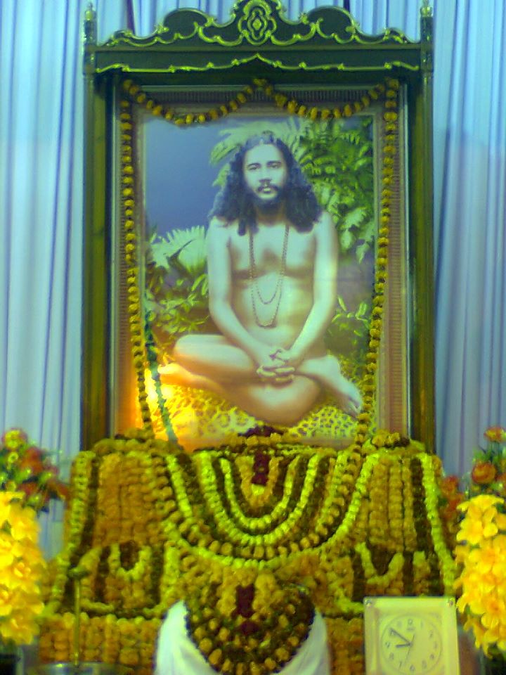
Swami Nigamananda Paramahansa (born Nalinikanta Chattopadhyay; 18 August 1880 – 29 November 1935) was an Indian yogi, guru and mystic well known in Eastern India. He is associated with the Shakta tradition and viewed as a perfect spiritual master of vedanta, tantra, yoga and prema or bhakti. His followers idealized him as their worshipped and beloved thakura. Nigamananda was born into a Bengali Brahmin family in the hamlet of Kutabpur in Nadia district (at present Meherpur district Bangladesh). He was a sannyasi from Adi Shankar's dashanami sampradaya. After his ordination as a sannyasi, he came to be known as ''Paribrajakacharya Paramahansa Srimat Swami Nigamananda Saraswati Deva''. Nigamananda achieved siddhi (perfection) in four different sadhanas (spiritual disciplines): tantra, gyan, yoga and prema. Based on these experiences, he wrote five Bengali language books: ''Brahamcharya Sadhana'' (ब्रह्मचर्य साधन), ''Yogi Guru'' (योग ... [...More Info...] [...Related Items...] OR: [Wikipedia] [Google] [Baidu] |
Shanti Ashram
Shanti Ashram ( as, শান্তি আশ্ৰম) ( hi, शांति आश्रम), now known as "Saraswata Matha" or "Assam Bongiya Saraswata Matha" founded by Swami Nigamananda on the occasion of Akshay Tritiya at Kokilamukh on 5th Baisakh 1919 B.S. The main objective of "Shanti Ashram" (शांति आश्रम) to fulfill his three missions, to propagate Sanatana Dharma (spreading eternal religion), spreading true education and serve everybody as god incarnate. History ''Shanti Ashram'' was founded for the first time by Nigamananda on Akshay Tritiya at Kumilla Durgapur in 1314 B.S. The ashram was shifted to Gendaria in Dhaka in 1318 B.S. ''Sri Gouranga Anath Niketan'' was founded there on the 26th Agrahayana 1318 B.S. The purpose behind it is to serve the distressed, the grieved, the sick and the poor. There was a disciple of named "Saruram Kalita" purchased a plot of 80 bighas at "Kumarveti Chapri village" of "Kokilamukh", in Jorhat district after t ... [...More Info...] [...Related Items...] OR: [Wikipedia] [Google] [Baidu] |
1897 Assam Earthquake
The Assam earthquake of 1897 occurred on 12 June 1897, in Assam, British India at 11:06 UTC, and had an estimated moment magnitude of 8.2–8.3. It resulted in approximate 1,542 human casualties and caused catastrophic damage to infrastructures. Damage from the earthquake extended into Calcutta, where dozens of buildings were severely damaged, with some buildings partially collapsing. Trembles were felt across India, reaching as far as Ahmedabad and Peshawar. Seiches were also observed in Burma. Earthquake The earthquake occurred on the south–southwest-dipping reverse Oldham Fault that forms the northern edge of the Shillong Plateau. There was a minimum displacement on the main fault of 11 m, although some calculations have placed this figure at as high as 16 m; one of the greatest for any measured earthquake. The calculated area of slip extended 180 km along the strike and from 9–45 km beneath the surface, indicating that the entire thickness of the c ... [...More Info...] [...Related Items...] OR: [Wikipedia] [Google] [Baidu] |
1869 Cachar Earthquake
The 1869 Cachar earthquake occurred on 10 January with an estimated moment magnitude of 7.4 and a maximum EMS-98 intensity of VII (''Damaging''). Two people were killed and damage was considered severe. The earthquake was felt in Upper Burma, Bihar, Jharkhand, Bengal and Northeast India. Earthquake The cause is said to have been from a long fissure below the Jaintia Hills, situated north of the Sylhet region. See also *List of historical earthquakes *List of earthquakes in India The Indian subcontinent has a history of earthquakes. The reason for the intensity and high frequency of earthquakes is the Indian plate driving into Asia at a rate of approximately 47 mm/year. The following is a list of major earthquakes whic ... References Further reading * Earthquakes in India January 1869 events 1869 earthquakes 1869 disasters in India {{india-hist-stub ... [...More Info...] [...Related Items...] OR: [Wikipedia] [Google] [Baidu] |
Maniram Baruah
Maniram Dutta Baruah, popularly known as Maniram Dewan (17 April 1806 – 26 February 1858), was an Assamese nobleman in British India. He was one of the first people to establish tea gardens in Assam. A loyal ally of the British East India Company in his early years, he was hanged by the British for conspiring against them during the 1857 uprising. He was popular among the people of Upper Assam as "Kalita Raja" (king of the Kalita caste). Early life Maniram was born into a family that had migrated from Kannauj to Assam in the early 16th century. His paternal ancestors held high offices in the Ahom court. The Ahom rule had weakened considerably following the Moamoria rebellion (1769–1806). During the Burmese invasions of Assam (1817–1826), Maniram's family sought asylum in Bengal, which was under the control of the British East India Company. The family returned to Assam under the British protection, during the early days of the First Anglo-Burmese War (1824-1826). T ... [...More Info...] [...Related Items...] OR: [Wikipedia] [Google] [Baidu] |


