|
Throgg's Neck, Bronx
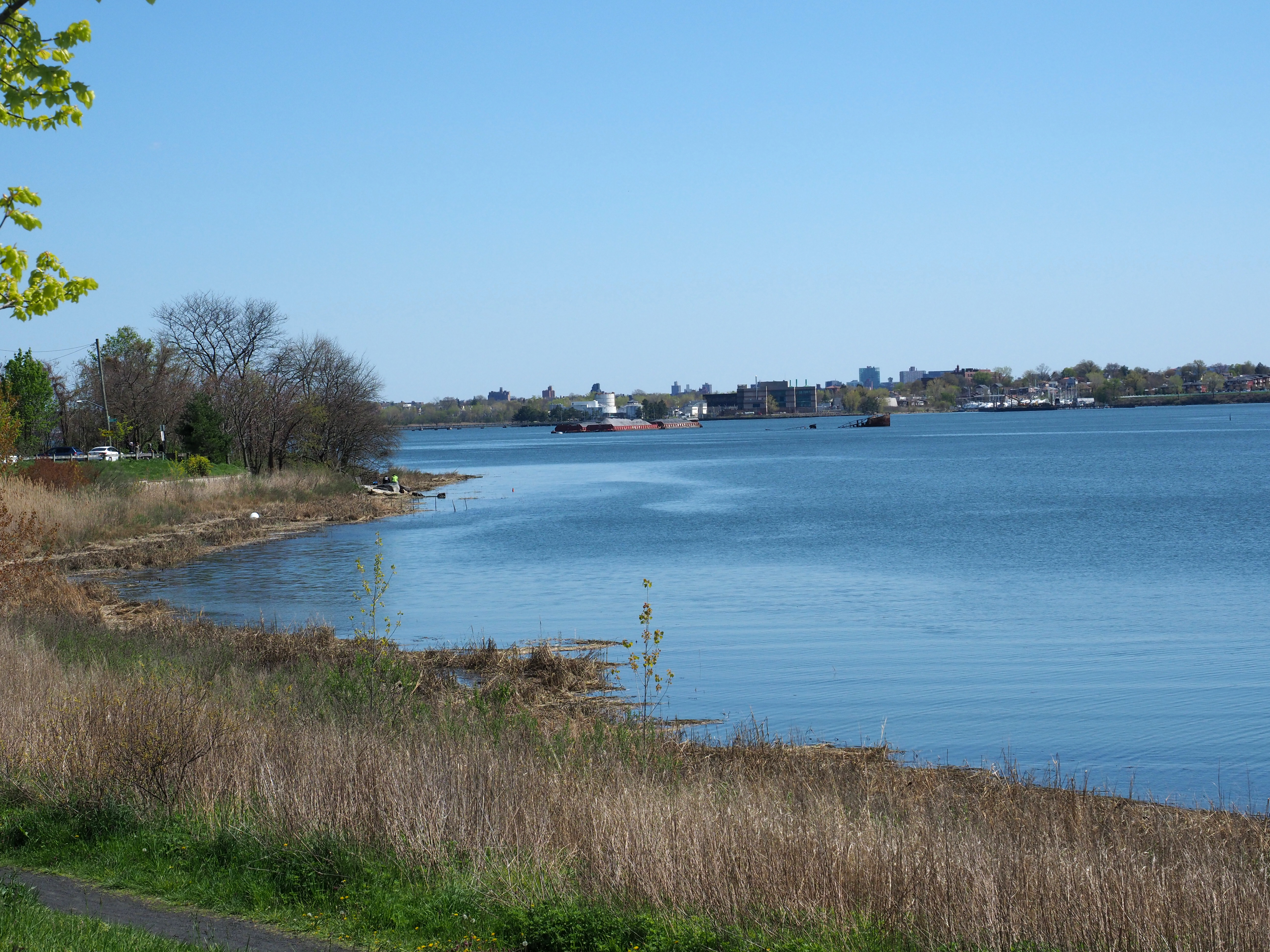
Throggs Neck (also known as Throgs Neck) is a neighborhood and peninsula in the south-eastern portion of the borough (New York City), borough of the Bronx in New York City. It is bounded by the East River and Long Island Sound to the south and east, Westchester Creek on the west, and Baisley Avenue and the Bruckner Expressway on the north. The neighborhood is part of Bronx Community Board 10, Bronx Community District 10, and its ZIP Code is 10465. Throggs Neck is patrolled by the 45th Precinct of the New York City Police Department. Geography Throggs Neck is a narrow spit (landform), spit of land in the south-eastern portion of the borough (New York City), borough of the Bronx in New York City. It demarcates the passage between the East River (an estuary) and Long Island Sound. "Throggs Neck" is also the name of the neighborhood of the peninsula, bounded on the north by Baisley Avenue and the Bruckner Expressway, on the west by Westchester Creek, and on the other sides by the Riv ... [...More Info...] [...Related Items...] OR: [Wikipedia] [Google] [Baidu] |
Neighborhoods In The Bronx
This article features a list of neighborhoods in the Bronx, one of the five New York City Borough, boroughs of New York City. When using this article, note that names of many (but not all) neighborhoods in the Bronx are popular based on their historical pedigree and the livability factor. However, this is not true for all neighborhoods in the Bronx; while someone living at East 213th Street & White Plains Road might prefer to describe their location simply as "Gun Hill Road" (a nearby thoroughfare) rather than "Williamsbridge". Other neighborhood names have greater popularity. For example, Riverdale was once home to John F. Kennedy and is known for its affluence, large mansions, and proximity to amenities. Throggs Neck has a bridge named for it and the neighborhood is known for waterfront beach communities located on the Long Island Sound. Regions of the Bronx Generally speaking, there are two major systems of dividing the Bronx into regions, which often conflict with one another ... [...More Info...] [...Related Items...] OR: [Wikipedia] [Google] [Baidu] |
Westchester Creek
Westchester Creek (also known as Frenchman's Creek) is a tidal inlet of the East River located in the south eastern portion of the Bronx in New York City. It is 2.1 miles (3.39 km) in length. The creek formerly traveled further inland, to what is now Pelham Parkway, extending almost to Eastchester Bay and making Throggs Neck into an island during heavy storms. However, much of the route has been filled in, replaced by such structures as the New York City Subway's Westchester Yard and the Hutchinson Metro Center. Westchester Creek's present-day head is at Herbert H. Lehman High School; the remaining portion is largely inaccessible and surrounded by industrial enterprises or empty lots. Westchester Creek is traversed by the Bruckner Interchange at about its midpoint. Pugsley Creek, historically known as Maenippis Kill and Cromwell's Creek, is a right bank tributary of Westchester Creek and is surrounded by a park of the same name. The creek formerly extended north to Westchest ... [...More Info...] [...Related Items...] OR: [Wikipedia] [Google] [Baidu] |
Urban Legend
An urban legend (sometimes contemporary legend, modern legend, urban myth, or urban tale) is a genre of folklore comprising stories or fallacious claims circulated as true, especially as having happened to a "friend of a friend" or a family member, often with horrifying, humorous, or cautionary elements. These legends can be entertaining but often concern mysterious peril or troubling events, such as disappearances and strange objects or entities. Urban legends may confirm moral standards, reflect prejudices, or be a way to make sense of societal anxieties. Urban legends in the past were most often circulated orally, but now can also be spread by any media. This includes newspapers, mobile news apps, e-mail, and most often, social media. Some urban legends have passed through the years/decades with only minor changes, in where the time period takes place. Generic urban legends are often altered to suit regional variations, but the lesson or moral remains majorly the same. Or ... [...More Info...] [...Related Items...] OR: [Wikipedia] [Google] [Baidu] |
The New York Times
''The New York Times'' (''the Times'', ''NYT'', or the Gray Lady) is a daily newspaper based in New York City with a worldwide readership reported in 2020 to comprise a declining 840,000 paid print subscribers, and a growing 6 million paid digital subscribers. It also is a producer of popular podcasts such as '' The Daily''. Founded in 1851 by Henry Jarvis Raymond and George Jones, it was initially published by Raymond, Jones & Company. The ''Times'' has won 132 Pulitzer Prizes, the most of any newspaper, and has long been regarded as a national " newspaper of record". For print it is ranked 18th in the world by circulation and 3rd in the U.S. The paper is owned by the New York Times Company, which is publicly traded. It has been governed by the Sulzberger family since 1896, through a dual-class share structure after its shares became publicly traded. A. G. Sulzberger, the paper's publisher and the company's chairman, is the fifth generation of the family to head the pa ... [...More Info...] [...Related Items...] OR: [Wikipedia] [Google] [Baidu] |
Ferry Point Park
Ferry Point Park is a park in the Bronx, New York City. The park site is a peninsula projecting into the East River roughly opposite the College Point and Malba neighborhoods of Queens. The park is located on the eastern shore of Westchester Creek, adjacent to the neighborhood of Throggs Neck. The park is operated by the New York City Department of Parks and Recreation. The Hutchinson River Expressway (Interstate 678) crosses the park to the Bronx-Whitestone Bridge, splitting it into east and west sides. The east side of the park has a golf course called Trump Ferry Point, a community park, and a waterfront promenade. The east side borders are Saint Raymond's Cemetery; Balcom Avenue, Miles Avenue and Emerson Avenue; and the East River and the Bronx-Whitestone Bridge. The west side is heavily used for soccer, cricket, fishing and barbecues. Friends of Ferry Point Park holds cleanup events, plantings and helps care for the 3,000 trees planted in the park as the Ferry Point 9/1 ... [...More Info...] [...Related Items...] OR: [Wikipedia] [Google] [Baidu] |
Bronx–Whitestone Bridge
The Bronx–Whitestone Bridge (colloquially referred to as the Whitestone Bridge or simply the Whitestone) is a suspension bridge in New York City, carrying six lanes of Interstate 678 over the East River. The bridge connects Throggs Neck and Ferry Point Park in the Bronx, on the East River's northern shore, with the Whitestone neighborhood of Queens on the southern shore. Although the Bronx–Whitestone Bridge's construction was proposed as early as 1905, it was not approved until 1936. The bridge was designed by Swiss-American architect Othmar Ammann and design engineer Allston Dana and opened to traffic with four lanes on April 29, 1939. The bridge's design was similar to that of the Tacoma Narrows Bridge, which collapsed in 1940. As a result, extra stiffening trusses were added to the Bronx–Whitestone Bridge in the early 1940s, and it was widened to six lanes during the same project. The Bronx–Whitestone Bridge was also renovated in 1988–1991 to repair the anchorages ... [...More Info...] [...Related Items...] OR: [Wikipedia] [Google] [Baidu] |
Throgs Neck Lighthouse
Throgs Neck Light in Throggs Neck, the Bronx, New York, was a wooden lighthouse that was replaced by an iron skeletal tower that is still there. The lighthouse protects ships in the Long Island Sound from running up against the rocks. The lighthouse is located on the northeasterly side of Fort Schuyler, southeasterly end of Throgs Neck and on the northerly side of the entrance from Long Island Sound into the East River The East River is a saltwater tidal estuary in New York City. The waterway, which is actually not a river despite its name, connects Upper New York Bay on its south end to Long Island Sound on its north end. It separates the borough of Queens .... * Tower Shape / Markings / Pattern: White, square, pyramidal, * skeleton iron tower; lantern, black (1890); Red brick cylindrical tower (1906) * Height: (1890); (1906) Chronology * Original wooden lighthouse established in 1827. It was torn down during the construction of the fort. * A new wooden tower replaced t ... [...More Info...] [...Related Items...] OR: [Wikipedia] [Google] [Baidu] |
Long Island
Long Island is a densely populated island in the southeastern region of the U.S. state of New York (state), New York, part of the New York metropolitan area. With over 8 million people, Long Island is the most populous island in the United States and the List of islands by population, 18th-most populous in the world. The island begins at New York Harbor approximately east of Manhattan Island and extends eastward about into the Atlantic Ocean and 23 miles wide at its most distant points. The island comprises four List of counties in New York, counties: Kings and Queens counties (the New York City Borough (New York City), boroughs of Brooklyn and Queens, respectively) and Nassau County, New York, Nassau County share the western third of the island, while Suffolk County, New York, Suffolk County occupies the eastern two thirds of the island. More than half of New York City's residents (58.4%) lived on Long Island as of 2020, in Brooklyn and in Queens. Culturally, many people in t ... [...More Info...] [...Related Items...] OR: [Wikipedia] [Google] [Baidu] |
Queens
Queens is a borough of New York City, coextensive with Queens County, in the U.S. state of New York. Located on Long Island, it is the largest New York City borough by area. It is bordered by the borough of Brooklyn at the western tip of Long Island to its west, and Nassau County to its east. Queens also shares water borders with the boroughs of Manhattan, the Bronx, and Staten Island (via the Rockaways). With a population of 2,405,464 as of the 2020 census, Queens is the second most populous county in the State of New York, behind Kings County (Brooklyn), and is therefore also the second most populous of the five New York City boroughs. If Queens became a city, it would rank as the fifth most-populous in the U.S. after New York City, Los Angeles, Chicago, and Houston. Approximately 47% of the residents of Queens are foreign-born. Queens is the most linguistically diverse place on Earth and is one of the most ethnically diverse counties in the United States. Queens was est ... [...More Info...] [...Related Items...] OR: [Wikipedia] [Google] [Baidu] |
Bay Terrace, Queens
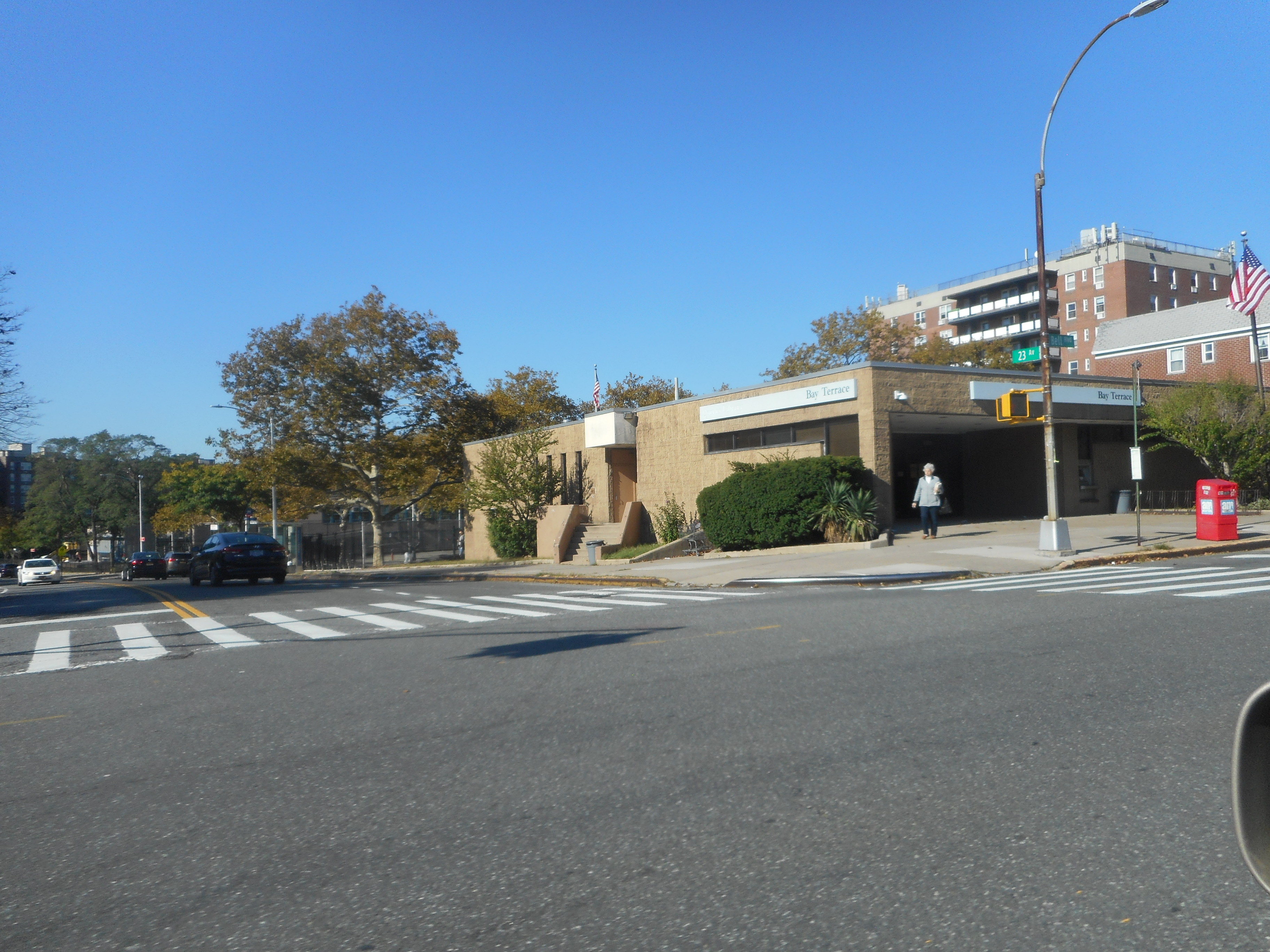
Bay Terrace is a neighborhood in the northeastern section of the New York City borough of Queens. It is often considered part of the larger area of Bayside. Bay Terrace overlooks the East River and the approaches to the Throgs Neck Bridge from the Clearview Expressway and Cross Island Parkway. It is bounded on the west by the Clearview Expressway, on the south by 26th and 28th Avenues, to the east by the Little Neck Bay, and to the north by the East River. Bay Terrace is located in Queens Community District 7 and its ZIP Code is 11360. It is patrolled by the New York City Police Department's 109th Precinct. Politically, Bay Terrace is represented by the New York City Council's 19th District. History In 1639, Dutch Governor Willem Kieft (1597–1647) purchased the land that today encompasses Queens County from the Matinecock. William Lawrence (1622–1680), who served as a magistrate under Dutch and English administrations, was granted a parcel of land by King Charles II in 1645 ... [...More Info...] [...Related Items...] OR: [Wikipedia] [Google] [Baidu] |
Throgs Neck Bridge
The Throgs Neck Bridge is a suspension bridge in New York City, carrying six lanes of Interstate 295 (New York), Interstate 295 (I-295) over the East River where it meets the Long Island Sound. The bridge connects the Throggs Neck section of the Bronx with the Bay Terrace, Queens, Bay Terrace section of Queens. Opened on January 11, 1961, it is the newest bridge across the East River and was built to relieve traffic on the Bronx–Whitestone Bridge, to the west. The Throgs Neck Bridge is also the easternmost crossing of the East River. Due to this and its proximity to Interstate 95 in New York, I-95, it is the closest route from Long Island to New Jersey via the George Washington Bridge, as well as points north. The Throgs Neck Bridge is owned by the government of New York City and operated by the Triborough Bridge and Tunnel Authority (TBTA), an affiliate agency of the Metropolitan Transportation Authority (MTA). Description The Throgs Neck Bridge is a six lane suspension ... [...More Info...] [...Related Items...] OR: [Wikipedia] [Google] [Baidu] |
Estuary
An estuary is a partially enclosed coastal body of brackish water with one or more rivers or streams flowing into it, and with a free connection to the open sea. Estuaries form a transition zone between river environments and maritime environments and are an example of an ecotone. Estuaries are subject both to marine influences such as tides, waves, and the influx of saline water, and to fluvial influences such as flows of freshwater and sediment. The mixing of seawater and freshwater provides high levels of nutrients both in the water column and in sediment, making estuaries among the most productive natural habitats in the world. Most existing estuaries formed during the Holocene epoch with the flooding of river-eroded or glacially scoured valleys when the sea level began to rise about 10,000–12,000 years ago. Estuaries are typically classified according to their geomorphological features or to water-circulation patterns. They can have many different names, such as bays, ... [...More Info...] [...Related Items...] OR: [Wikipedia] [Google] [Baidu] |


.png)

.jpg)


