|
Taoro
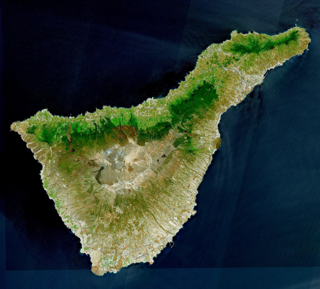
{{Short description, Native kingdom of the Canary Islands Taoro was one of nine Guanche menceyatos (native kingdoms) in which the island of Tenerife (Canary Islands) was divided at the time of the arrival of the conquering Spaniards. Taoro was considered the most powerful aboriginal kingdom on the island. It spanned the existing municipalities of Puerto de la Cruz, La Orotava, La Victoria de Acentejo, La Matanza de Acentejo, Los Realejos and Santa Úrsula Santa Úrsula (; named after Saint Ursula) is a town and a municipality on the north coast of Tenerife. It is located 6 km east of Puerto de la Cruz and 24 km west of the island's capital, Santa Cruz de Tenerife. The population is 14,54 .... Its ''mencey'' (king) at the time of the Spanish arrival was Bencomo and the final mencey was Bentor, who ruled the kingdom from November 1495 until his suicide in February 1496. [...More Info...] [...Related Items...] OR: [Wikipedia] [Google] [Baidu] |
Bentor
Bentor ( 1463 – February 1495), sometimes also called Ventor, Bentore, Benytomo, or Bentorey, was the last mencey or king of Taoro from November 1494 until his suicide in February 1495. A native Guanche prince in the Canary Islands during the second half of the 15th century, Bentor was the eldest grandson (in some sources, son) of Bencomo, the penultimate mencey (or king) of Taoro. Taoro was one of nine menceyatos, or kingdoms, on the island of Tenerife in the Canary Islands before the Spanish conquest of the islands. Bentor's mother was probably named Hañagua, although this is unclear. He succeeded his grandfather as mencey upon his father's death in November 1494, and led the kingdom until his own death by suicide four months later, in February 1495. Bentor had five siblings: one sister ( Dácil) and four brothers (Ruiman, Rosalva, Chachiñama, and Tiñate). Biography Bentor was born in about 1463, in Tenerife to Adjona. Bentor, then the Crown Prince, participated in ma ... [...More Info...] [...Related Items...] OR: [Wikipedia] [Google] [Baidu] |
Guanches
The Guanche were the Indigenous peoples, indigenous inhabitants of the Spain, Spanish Canary Islands, located in the Atlantic Ocean some to the west of modern Morocco and the North African coast. The islanders spoke the Guanche language, which is believed to have been related to the Berber languages of mainland North Africa; the language became extinct in the 17th century, soon after the islands were colonized. It is believed that the Guanche may have arrived at the archipelago some time in the 1st millennium BC, first millennium BC. The Guanche were the only indigenous people known to have lived in the Macaronesian archipelago region before the arrival of Europeans. There is no accepted evidence that the other Macaronesian archipelagos (the Cape Verde Islands, Madeira and the Azores) were inhabited. After the commencement of the Conquest of the Canary Islands, Spanish conquest of the Canaries, starting in the early 15th century, many natives were outright killed by the Spanish ... [...More Info...] [...Related Items...] OR: [Wikipedia] [Google] [Baidu] |
Bencomo
Bencomo (; 1438 – 1495) was the penultimate ''mencey'' or king of Taoro, a Guanche ''menceyato'' on the island of Tenerife. He fought in the First Battle of Acentejo, a victory for the Guanches against the invading Castilians, after having refused the terms of Alonso Fernández de Lugo. He may have perished on the heights of San Roque during the Battle of Aguere alongside his brother Tinguaro. He had several children, including Adjona, Dácil, Bentor, Ruiman, Rosalva, Chachiñama, and Tiñate. Bentor succeeded him as mencey until his suicide in February 1495. Biography According to José de Viera y Clavijo, Bencomo was the son of Imobach, grandson of Betzenuhya, and great-grandson of Tinerfe the Great. He had a brother, Tinguaro, who fought alongside him during the Castilian conquest. He married Caseloria, and together they had three children: Bentor, Dácil (later baptized as Mencía Bencomo), and María Bencomo. His grandchildren included Ruymán, Rosalva, and Colla ... [...More Info...] [...Related Items...] OR: [Wikipedia] [Google] [Baidu] |
Puerto De La Cruz
Puerto de la Cruz is a city and municipality in the northern part of the island of Tenerife, Canary Islands, Spain. It was formerly known by its English translation, "Port of the Cross", although now it is known by its Spanish name in all languages. Puerto de la Cruz is located on the northern coast, northwest of La Orotava and west of Santa Cruz de Tenerife. The Autopista TF-5, TF-5 motorway passes through the municipality. The population is 30,483 (2018). In Spanish, the local inhabitants are known as ''Portuenses''. With an area of , the municipality is the smallest in Tenerife. The elevation of the town's centre is above sea level and the highest point being Las Arenas, a volcanic cone with an elevation of . Historical population Economy Puerto de la Cruz occupies a prominent place in the history of tourism of the islands. The export economy established by the European colonizers after the conquest of the Canary Islands, conquest in the 15th century generated large com ... [...More Info...] [...Related Items...] OR: [Wikipedia] [Google] [Baidu] |
Tenerife Preconquista
Tenerife ( ; ; formerly spelled ''Teneriffe'') is the largest and most populous island of the Canary Islands, an Autonomous communities of Spain, autonomous community of Spain. With a land area of and a population of 965,575 inhabitants as of April 2025, it is the most populous island in Spain and the entire Macaronesia region. Tenerife is also home to 42.7% of the total population of the archipelago. More than seven million tourists (7,384,707 in 2024) visit Tenerife each year, making it by far the most visited island in the archipelago. It is one of the most important tourist destinations in Spain and the world, hosting one of the world's largest carnivals, the Carnival of Santa Cruz de Tenerife. The capital of the island, , is also the seat of the island council (). That city and are the co-capitals of the Autonomous communities of Spain, autonomous community of the Canary Islands. The two cities are both home to governmental institutions, such as the offices of the preside ... [...More Info...] [...Related Items...] OR: [Wikipedia] [Google] [Baidu] |
La Orotava
La Orotava is a town and a municipality in the northern part of Tenerife, one of the Canary Islands of Spain. The area of the municipality stretches from the north coast to the mountainous interior, and includes the summit of the Teide volcano, Canary Islands' and Spain's highest point at 3,718 m. At 207.31 km2, it is the largest municipality of the island of Tenerife. The population is 41,255 (2013Instituto Canario de Estadística ). The town La Orotava, which is the administrative centre of the municipality and also its largest settlement, is situated near the north coast, at about 400 m elevation in the [...More Info...] [...Related Items...] OR: [Wikipedia] [Google] [Baidu] |
La Victoria De Acentejo
La Victoria de Acentejo is a town and a municipality in the northern part of the island Tenerife, Canary Islands, Spain. It is located near the north coast, 2 km southwest of La Matanza de Acentejo, 7 km northeast of La Orotava and 22 km west of the island capital Santa Cruz de Tenerife. The TF-5 motorway passes through the municipality. The population is 9,069 (2013)Instituto Canario de Estadística , population and the area is 18.36 km2. History Before the arrival of the Spaniards, La Acentejo was part of the ''menceyato'' (kingdom) of Taoro. The[...More Info...] [...Related Items...] OR: [Wikipedia] [Google] [Baidu] |
La Matanza De Acentejo
La Matanza de Acentejo is a town near the north coast of Tenerife, Canary Islands, Spain. It is located 10 km east of Puerto de la Cruz, and about 20 km west of the island's capital, Santa Cruz de Tenerife. Its name means "the Slaughter of Acentejo" in Spanish, and refers to the 1494 First Battle of Acentejo, lost by the Spanish. The population is 8,944 (2013) and the area is 14.11 km2. The elevation is 425 m. The TF-5 motorway passes through the municipality. The municipality contains the following settlements: *La Matanza de Acentejo *Guia *Las Breñas *El Caleton *Acentejo *San Antonio *San Cristobal History In historic times before the arrival of the Spaniards, Acentejo was part of the ''menceyato'' (kingdom) of Taoro. The first and the second battles of Acentejo took place in 1494. The Spanish under Alonso Fernández de Lugo suffered a terrible defeat at this first battle, at the place now called ''La Matanza'' ("The Slaughter"). It occurred in present-day B ... [...More Info...] [...Related Items...] OR: [Wikipedia] [Google] [Baidu] |
Canary Islands
The Canary Islands (; ) or Canaries are an archipelago in the Atlantic Ocean and the southernmost Autonomous communities of Spain, Autonomous Community of Spain. They are located in the northwest of Africa, with the closest point to the continent being 100 kilometres (62 miles) away. The islands have a population of 2.25 million people and are the most populous overseas Special member state territories and the European Union, special territory of the European Union. The seven main islands are from largest to smallest in area, Tenerife, Fuerteventura, Gran Canaria, Lanzarote, La Palma, La Gomera, and El Hierro. The only other populated island is Graciosa, Canary Islands, La Graciosa, which administratively is dependent on Lanzarote. The archipelago includes many smaller islands and islets, including Alegranza, Islote de Lobos, Isla de Lobos, Montaña Clara, Roque del Oeste, and Roque del Este. It includes a number of rocks, including Roque de Garachico, Garachico and Roques de ... [...More Info...] [...Related Items...] OR: [Wikipedia] [Google] [Baidu] |
Los Realejos
Los Realejos is a town and a municipality in the northern part of the island of Tenerife, which is the biggest town in the Canary Islands. It is part of the province of Santa Cruz de Tenerife (province), Santa Cruz de Tenerife, Spain. The town is located from the north coast, southwest of Puerto de la Cruz, west of La Orotava, and southwest of the island's capital Santa Cruz de Tenerife. The inhabitants are known in Spanish as ''realejeros''. The latest population count consists of 37,970 (2013Instituto Canario de Estadística ), its density being and the area is . The highest peak is . Los Realejos is the western terminus of the Autopista TF-5, TF-5 motorway. Background The town is split into two distinct areas or districts: *R ...[...More Info...] [...Related Items...] OR: [Wikipedia] [Google] [Baidu] |
Santa Úrsula
Santa Úrsula (; named after Saint Ursula) is a town and a municipality on the north coast of Tenerife. It is located 6 km east of Puerto de la Cruz and 24 km west of the island's capital, Santa Cruz de Tenerife. The population is 14,545 (2013Instituto Canario de Estadística , population) and the area is 22.59 km2. The elevation is 290 m. The Autopista TF-5, TF-5 motorway passes through the municipality. Historical population See also *List of municipalities in Santa Cruz de TenerifeReferences {{DEFAULTSORT:Santa Ursula Municipalities in Tenerife ...[...More Info...] [...Related Items...] OR: [Wikipedia] [Google] [Baidu] |


