|
T-charge
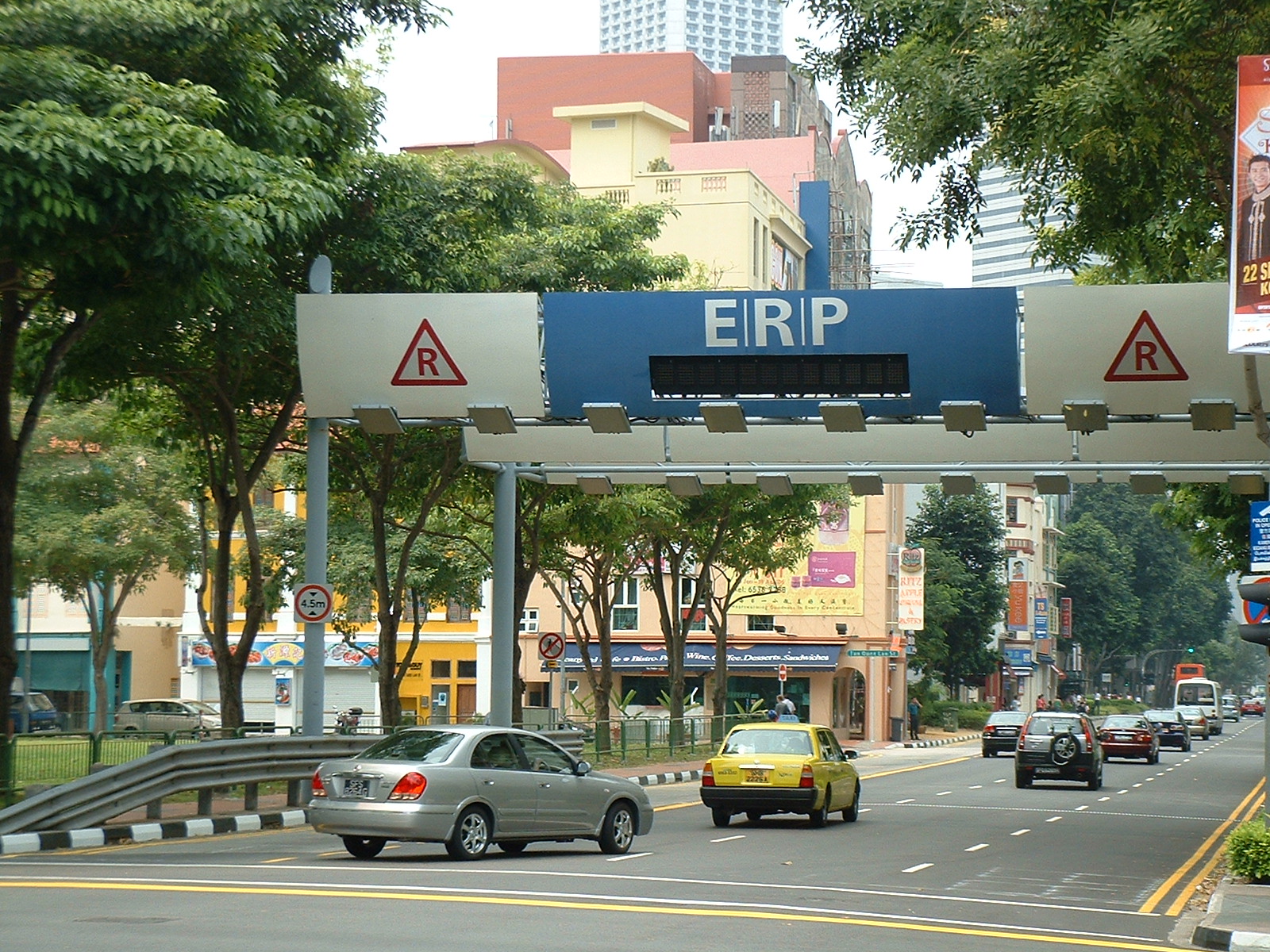
The London congestion charge is a fee charged on most cars and motor vehicles being driven within the Congestion Charge Zone (CCZ) in Central London between 7:00 am and 6:00 pm Monday to Friday, and between 12:00 noon and 6:00 pm Saturday and Sunday. Inspired by Singapore's Electronic Road Pricing (ERP) system after London officials had travelled to the country, the charge was first introduced on 17 February 2003. The London charge zone is one of the largest congestion charge zones in the world, despite the removal of the Western Extension which operated between February 2007 and January 2011. The charge not only helps to reduce high traffic flow in the city streets, but also reduces air and noise pollution in the central London area and raises investment funds for London's transport system. The standard charge is £15, every day from 7:00 am to 6:00 pm, for each non-exempt vehicle driven within the zone, with a penalty of between £65 and £195 levied for non-payment. The c ... [...More Info...] [...Related Items...] OR: [Wikipedia] [Google] [Baidu] |
Congestion Pricing
Congestion pricing or congestion charges is a system of surcharging users of public goods that are subject to congestion through excess demand, such as through higher peak charges for use of bus services, electricity, metros, railways, telephones, and road pricing to reduce traffic congestion; airlines and shipping companies may be charged higher fees for slots at airports and through canals at busy times. Advocates claim this pricing strategy regulates demand, making it possible to manage congestion without increasing supply. According to the economic theory behind congestion pricing, the objective of this policy is the use of the price mechanism to make users conscious of the costs that they impose upon one another when consuming during the peak demand, and that they should pay for the additional congestion they create, thus encouraging the redistribution of the demand in space or in time, and forcing them to pay for the negative externalities they create, making users ... [...More Info...] [...Related Items...] OR: [Wikipedia] [Google] [Baidu] |
Ultra Low Emission Zone
The Ultra Low Emission Zone (ULEZ) is an area in London, England where a fee is charged for driving the most polluting vehicles. Plans were laid out under Mayor Boris Johnson and introduced by Sadiq Khan in April 2019 in Central London, covering the same area as the London congestion charge, congestion charge. In the four months following its introduction there was a 20% reduction in emissions in Central London and the number of the worst polluting vehicles dropped from 35,600 to 23,000. However, some research suggests the ULEZ caused only small improvements to air quality. In August 2023 it will extend to cover all of Greater London. Current charging scheme The £12.50 charge applies 24 hours a day every day of the year, and is based on European emission standards: * Motorbikes that do not meet Euro 3 standards (most vehicles pre-2007) * Petrol cars and vans that do not meet Euro 4 standards (most vehicles pre-2006) * Diesel cars and vans that do not meet Euro 6 ... [...More Info...] [...Related Items...] OR: [Wikipedia] [Google] [Baidu] |
London CC 12 2012 5037
London is the capital and largest city of England and the United Kingdom, with a population of just under 9 million. It stands on the River Thames in south-east England at the head of a estuary down to the North Sea, and has been a major settlement for two millennia. The City of London, its ancient core and financial centre, was founded by the Romans as ''Londinium'' and retains its medieval boundaries.See also: Independent city § National capitals The City of Westminster, to the west of the City of London, has for centuries hosted the national government and parliament. Since the 19th century, the name "London" has also referred to the metropolis around this core, historically split between the counties of Middlesex, Essex, Surrey, Kent, and Hertfordshire, which largely comprises Greater London, governed by the Greater London Authority.The Greater London Authority consists of the Mayor of London and the London Assembly. The London Mayor is distinguished from the Lord Mayo ... [...More Info...] [...Related Items...] OR: [Wikipedia] [Google] [Baidu] |
West End Of London
The West End of London (commonly referred to as the West End) is a district of Central London, west of the City of London and north of the River Thames, in which many of the city's major tourist attractions, shops, businesses, government buildings and entertainment venues, including West End theatres, are concentrated. The term was first used in the early 19th century to describe fashionable areas to the west of Charing Cross.Mills, A., ''Oxford Dictionary of London Place Names'', (2001) The West End covers parts of the boroughs of Westminster and Camden.Greater London Authority, The London Plan: The Sub Regions'' While the City of London is the main business and financial district in London, the West End is the main commercial and entertainment centre of the city. It is the largest central business district in the United Kingdom, comparable to Midtown Manhattan in New York City, the 8th arrondissement in Paris, Causeway Bay in Hong Kong, or Shibuya in Tokyo. It is one of ... [...More Info...] [...Related Items...] OR: [Wikipedia] [Google] [Baidu] |
Park Lane (road)
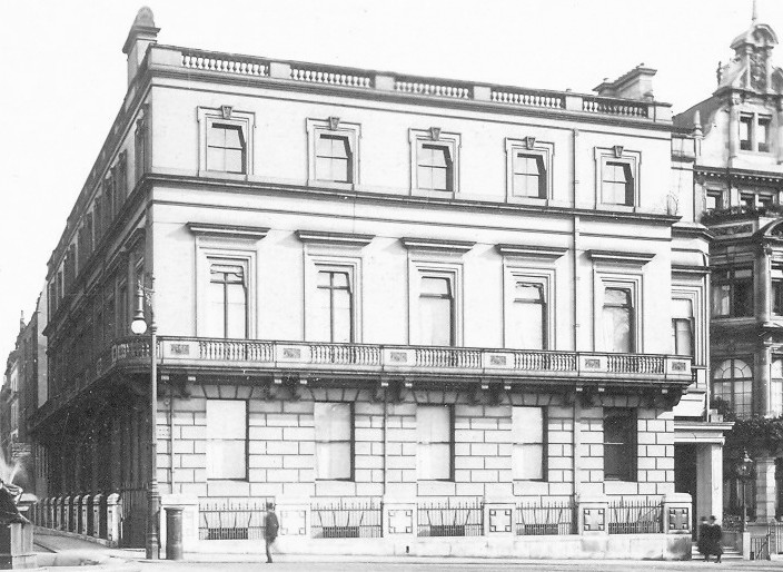
Park Lane is a dual carriageway road in the City of Westminster in Central London. It is part of the London Inner Ring Road and runs from Hyde Park Corner in the south to Marble Arch in the north. It separates Hyde Park, London, Hyde Park to the west from Mayfair to the east. The road has a number of historically important properties and hotels and has been one of the most sought after streets in London, despite being a major traffic thoroughfare. The road was originally a simple country lane on the boundary of Hyde Park, separated by a brick wall. Aristocratic properties appeared during the late 18th century, including Breadalbane House, Somerset House, Park Lane, Somerset House, and Londonderry House. The road grew in popularity during the 19th century after improvements to Hyde Park Corner and more affordable views of the park, which attracted the nouveau riche to the street and led to it becoming one of the most fashionable roads to live on in London. Notable residents in ... [...More Info...] [...Related Items...] OR: [Wikipedia] [Google] [Baidu] |
Vauxhall Bridge Road
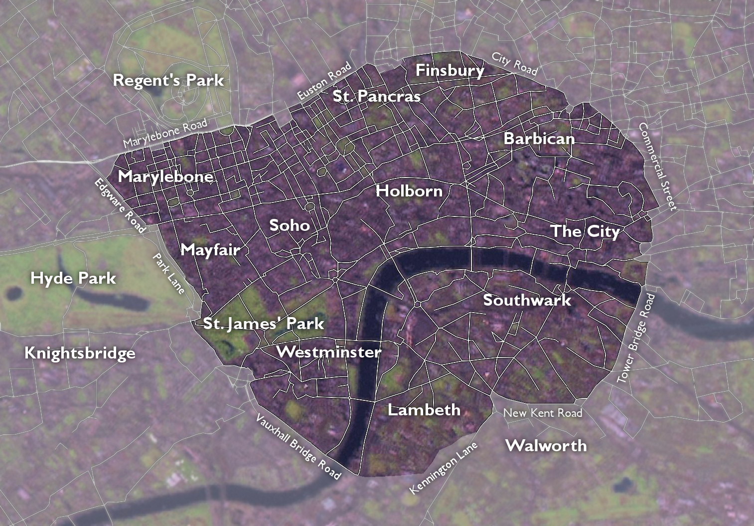
The London Inner Ring Road, or Ring Road as signposted, is a route with an average diameter of formed from a number of major roads that encircle Central London. The ring road forms the boundary of the London congestion charge zone, although the ring road itself is not part of the zone. Starting at the northernmost point and moving clockwise, the roads defining the boundary are Pentonville Road, City Road, Old Street, Great Eastern Street, Commercial Street, Mansell Street, Tower Bridge, Tower Bridge Road, New Kent Road, the Elephant & Castle, Kennington Lane, the roads that constitute the Vauxhall Cross one-way system and Vauxhall Bridge, Vauxhall Bridge Road, the roads that constitute the Victoria one-way system, Grosvenor Place, Park Lane, Edgware Road, Old Marylebone Road, Marylebone Road and Euston Road. The route is described as the ''"Inner"'' Ring Road because there are two further sets of roads that have been described as London ring roads. The North and South Circ ... [...More Info...] [...Related Items...] OR: [Wikipedia] [Google] [Baidu] |
Kennington Lane
The London Inner Ring Road, or Ring Road as signposted, is a route with an average diameter of formed from a number of major roads that encircle Central London. The ring road forms the boundary of the London congestion charge zone, although the ring road itself is not part of the zone. Starting at the northernmost point and moving clockwise, the roads defining the boundary are Pentonville Road, City Road, Old Street, Great Eastern Street, Commercial Street, Mansell Street, Tower Bridge, Tower Bridge Road, New Kent Road, the Elephant & Castle, Kennington Lane, the roads that constitute the Vauxhall Cross one-way system and Vauxhall Bridge, Vauxhall Bridge Road, the roads that constitute the Victoria one-way system, Grosvenor Place, Park Lane, Edgware Road, Old Marylebone Road, Marylebone Road and Euston Road. The route is described as the ''"Inner"'' Ring Road because there are two further sets of roads that have been described as London ring roads. The North and South Circ ... [...More Info...] [...Related Items...] OR: [Wikipedia] [Google] [Baidu] |
Elephant And Castle
The Elephant and Castle is an area around a major road junction in London, England, in the London Borough of Southwark. The name also informally refers to much of Walworth and Newington, due to the proximity of the London Underground station of the same name. The name is derived from a local coaching inn. In the first half of the 20th century, because of its vitality, the area was known as "the Piccadilly of South London". In more recent years, it has been viewed as a part of Central London given its location in Zone 1 on the London Underground. "The Elephant", as locally abbreviated, consists of major traffic junctions connected by a short road called Elephant and Castle, the nascent part of the A3. Traffic runs to and from Kent along the A2 (New Kent Road and Old Kent Road), much of the south of England on the A3, to the West End via St George's Road, and to the City of London via London Road and Newington Causeway at the northern junction. Newington Butts and Walwor ... [...More Info...] [...Related Items...] OR: [Wikipedia] [Google] [Baidu] |
New Kent Road
New Kent Road is a road in the London Borough of Southwark. The road was created in 1751 when the Turnpike Trust upgraded a local footpath. This was done as part of the general road improvements associated with the creation of Westminster Bridge; in effect it was possible to travel from the West End/ Westminster to the south-east without having to go via the Borough of Southwark but could now cross St George's Fields to the junction of Newington Causeway and Newington Butts which is where New Kent Road starts at Elephant & Castle. The route runs eastward for a few hundred yards to the junction of Great Dover Street and Tower Bridge Road, known as Bricklayers Arms, where it joins the original route to the south-east Old Kent Road (the A2). The road forms part of the London Inner Ring Road and as such forms part of the boundary of the London congestion charge zone. New Kent Road is designated the A201 which, to the north-west past the Elephant & Castle, becomes London Road ... [...More Info...] [...Related Items...] OR: [Wikipedia] [Google] [Baidu] |
Tower Bridge Road
The London Inner Ring Road, or Ring Road as signposted, is a route with an average diameter of formed from a number of major roads that encircle Central London. The ring road forms the boundary of the London congestion charge zone, although the ring road itself is not part of the zone. Starting at the northernmost point and moving clockwise, the roads defining the boundary are Pentonville Road, City Road, Old Street, Great Eastern Street, Commercial Street, Mansell Street, Tower Bridge, Tower Bridge Road, New Kent Road, the Elephant & Castle, Kennington Lane, the roads that constitute the Vauxhall Cross one-way system and Vauxhall Bridge, Vauxhall Bridge Road, the roads that constitute the Victoria one-way system, Grosvenor Place, Park Lane, Edgware Road, Old Marylebone Road, Marylebone Road and Euston Road. The route is described as the ''"Inner"'' Ring Road because there are two further sets of roads that have been described as London ring roads. The North and South Circ ... [...More Info...] [...Related Items...] OR: [Wikipedia] [Google] [Baidu] |
Mansell Street (London)
Mansell Street is a street in East London, which is part of the London Inner Ring Road. For most of its length from the north, this street marks the boundary between the City of London and the London Borough of Tower Hamlets. However, the southernmost part is entirely in Tower Hamlets. History Mansell Street was named after a relative of William Leman, whose great-uncle, John Leman had bought Goodman's Fields earlier in the seventeenth century. Alie Street ran along the western side, with Leman Street to the east, Prescot Street to the south, and Alie Street to the North. These new streets were developed in the late seventeenth century while Goodman's Fields was used as a tenterground. Mansell Street estate This estate was built in 1977 by the Guinness Trust The Guinness Partnership is one of the largest providers of affordable housing and care in England. Founded as a charitable trust in 1890, it is now a Community Benefit Society with eight members. Bloomberg classify i ... [...More Info...] [...Related Items...] OR: [Wikipedia] [Google] [Baidu] |
Commercial Street, London
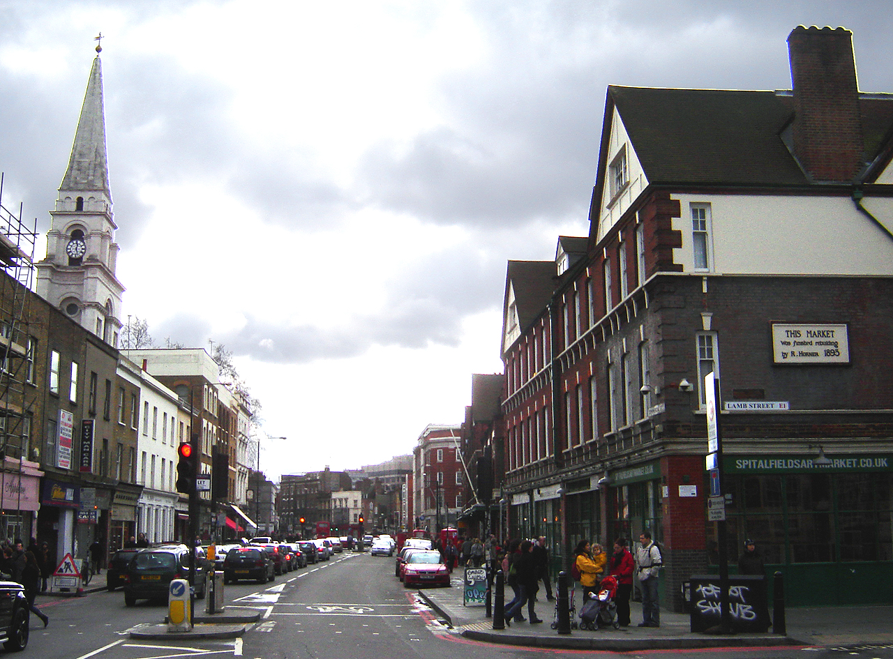
Commercial Street is an arterial road in Tower Hamlets, east London that runs north to south from Shoreditch High Street to Whitechapel High Street through the East End district of Spitalfields. The road is a section of the A1202 London Inner Ring Road and as such forms part of the boundary of the London congestion charge zone. As the name implies, Commercial Street has historically been dominated by industrial and commercial activity, which it maintains to this day. It is on the City fringes, and much industry that was seen as too noisome for the City was once exiled to such areas as this. However, since the early 1990s the street has grown increasingly fashionable, while maintaining its busy commercial feel. History Spitalfields was historically one of the poorest, most overcrowded and most crime-ridden districts in London: a parliamentary report of 1838 described this area as harbouring "an extremely immoral population; women of the lowest character, receivers of stolen go ... [...More Info...] [...Related Items...] OR: [Wikipedia] [Google] [Baidu] |


.jpg)


