|
SzatmΟΓr County
SzatmΟΓr County ( hu, SzatmΟΓr vΟΓrmegye ) was an administrative county (comitatus) of the Kingdom of Hungary, situated south of the river Tisza. Most of its territory is now divided between Romania and Hungary, while a very small area is part of Ukraine. The capital of the county was NagykΟΓroly (now Carei). Geography After 1876, SzatmΟΓr county shared borders with the former Hungarian counties of Szabolcs, Bereg, Ugocsa, MΟΓramaros, Szolnok-Doboka, SzilΟΓgy and Bihar. It was situated south of the river Tisza. The rivers Crasna, Some≈ü, LΡÉpu»ô and Tur flowed through the county. Its area was 6,257 km2 around 1910. History SzatmΟΓr county was formed in the 11th century, with the center in SzatmΟΓrnΟ©meti (now Satu Mare). In Ottoman times, the county mostly belonged to Partium. In 1876, when the administrative structure of the Kingdom of Hungary was changed, part of the territory of the former K≈ëvΟΓrvidΟ©k/ Chioar district was annexed to SzatmΟΓr. In 1920, the T ... [...More Info...] [...Related Items...] OR: [Wikipedia] [Google] [Baidu] |
Comitatus (Kingdom Of Hungary)
''Comitatus'' was in ancient times the Latin term for an armed escort or retinue. The term is used especially in the context of Germanic warrior culture for a warband tied to a leader by an oath of fealty and describes the relations between a lord and his retainers, or thanes (OE ΟΨegn). The concept is generally considered by scholars to be more of a literary trope rather than one of historical accuracy. Scholars Bruce Mitchell and Fred C. Robinson describe the ''comitatus'' more fully:An heroic warrior brought up in this 'comitatus''tradition would show a reckless disregard for his life. Whether he was doomed or not, courage was best, for the brave man could win ''lof'' lory among menwhile the coward might die before his time. This is the spirit which inspired the code of the ''comitatus''. While his lord lived, the warrior owed him loyalty unto death. If his lord were killed, the warrior had to avenge him or die in the attempt. The lord in his turn had the duty of being genero ... [...More Info...] [...Related Items...] OR: [Wikipedia] [Google] [Baidu] |
SzilΟΓgy County
SzilΟΓgy (Romanian: SΡÉlaj) was an administrative county (comitatus) of the Kingdom of Hungary. Its territory is now in north-western Romania. The capital of the county was Zilah (present-day ZalΡÉu in Romania). Geography SzilΟΓgy county shared borders with the Hungarian counties of Bihar, SzatmΟΓr, Szolnok-Doboka and Kolozs. The rivers Some≈ü and Crasna flowed through the county. Its territory was largely the same as that of the present Romanian county SΡÉlaj. Its area was 3,815 km2 around 1910. History SzilΟΓgy county was formed in 1876, when the counties of Kraszna (its center was Kraszna/ Crasna at first, then ValkΟ≥vΟΓralja/ Sub Cetate, later SzilΟΓgysomlyΟ≥/»‰imleu Silvaniei), KΟΕzΟ©p-Szolnok (its center was Zilah/ZalΡÉu) and the Egregy/Agrij district of Doboka County were united. In 1920, by the Treaty of Trianon, the county became part of Romania. It was returned to Hungary by the Second Vienna Award in 1940, with a slightly modified territory. After World W ... [...More Info...] [...Related Items...] OR: [Wikipedia] [Google] [Baidu] |
Ugocsa
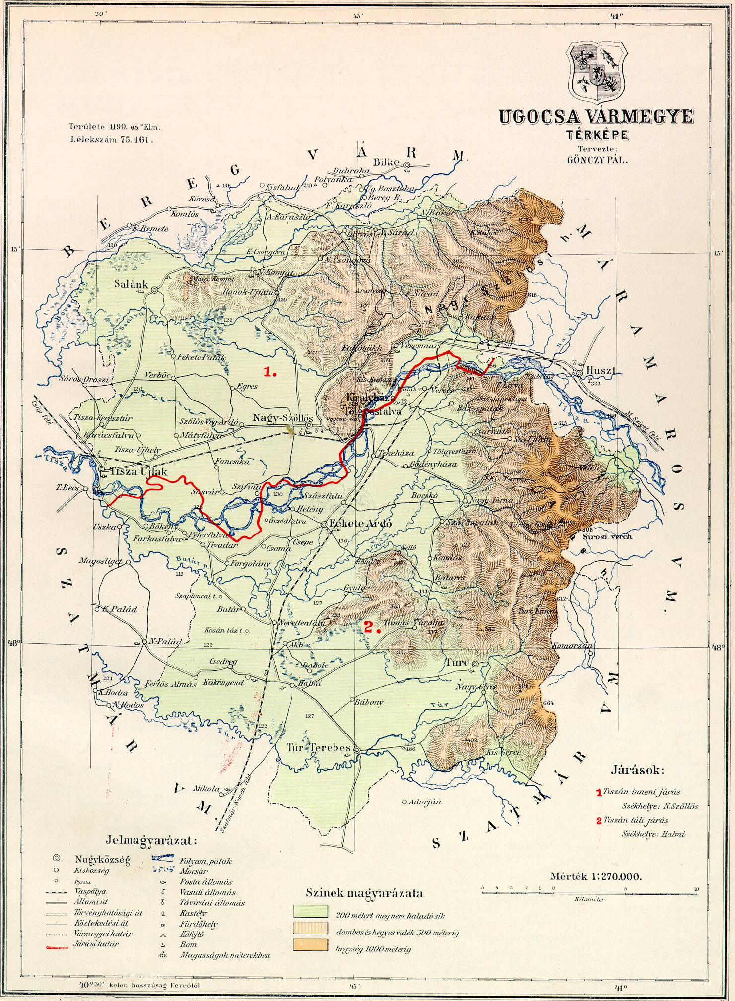
Ugocsa was an administrative county (comitatus) of the Kingdom of Hungary. Its territory is now in north-western Romania () and western Ukraine (). The capital of the county was Nagysz≈ëll≈ës (now Vynohradiv, Ukraine). Geography Ugocsa county shared borders with the Hungarian counties MΟΓramaros, SzatmΟΓr and Bereg. It was situated on both sides of the river Tisza. Its area was 1208 km around 1910. History In 1920, by the Treaty of Trianon most of the county (including Nagysz≈ëll≈ës) became part of newly formed Czechoslovakia, while a very little part remained in Hungary were joined to SzatmΟΓr County, which was merged to SzatmΟΓr-Ugocsa-Bereg County in 1923. The southern part βÄ™ including Halmi (today Halmeu) βÄ™ became part of Romania. In 1938, the western part of the former Czechoslovak part was returned to Hungary by the First Vienna Award, which became part of the newly formed Bereg-Ugocsa County βÄ™ as SzatmΟΓr County was recreated βÄ™ but shortly in 1939 the re ... [...More Info...] [...Related Items...] OR: [Wikipedia] [Google] [Baidu] |
Bereg (county)
Bereg ( rue, –ë–Β―Ä–Β“ë; ) was an administrative county (comitatus) of the Kingdom of Hungary. Its territory is now mostly in western Ukraine and a smaller part in northeastern Hungary. The capital of the county was BeregszΟΓsz ("Berehove" in Ukrainian, ''Berehovo'' in Rusyn, ''BergsaΟü'' in German, ''Beregovo'' in Russian, ''Bereg'' in Romanian). Geography Bereg county shared borders with the Austrian crownland Galicia (now in Poland and Ukraine) and the Hungarian counties MΟΓramaros, Ugocsa, SzatmΟΓr, Szabolcs and Ung. It was situated between the Carpathian Mountains in the north and the river Tisza in the south. Its area was 3788 km¬≤ around 1910. History Bereg is one of the oldest counties in Hungary. In 1920 the Treaty of Trianon assigned most of the territory to Czechoslovakia. The southwestern part remained in Hungary and the county of SzatmΟΓr-Ugocsa-Bereg was created in 1923. Following the First Vienna Award SzatmΟΓr County was recreated, thus Bereg-Ugocsa ... [...More Info...] [...Related Items...] OR: [Wikipedia] [Google] [Baidu] |
Treaty Of Trianon
The Treaty of Trianon (french: TraitΟ© de Trianon, hu, Trianoni bΟ©keszerz≈ëdΟ©s, it, Trattato del Trianon) was prepared at the Paris Peace Conference and was signed in the Grand Trianon chΟΔteau in Versailles on 4 June 1920. It formally ended World War I between most of the Allies of World War I and the Kingdom of Hungary. French diplomats played the major role in designing the treaty, with a view to establishing a French-led coalition of the newly formed states. It regulated the status of the Kingdom of Hungary and defined its borders generally within the ceasefire lines established in NovemberβÄ™December 1918 and left Hungary as a landlocked state that included , 28% of the that had constituted the pre-war Kingdom of Hungary (the Hungarian half of the Austro-Hungarian monarchy). The truncated kingdom had a population of 7.6 million, 36% compared to the pre-war kingdom's population of 20.9 million. Though the areas that were allocated to neighbouring countries had a ... [...More Info...] [...Related Items...] OR: [Wikipedia] [Google] [Baidu] |
Satmar County Josephinische Landesaufnahme, 1782-85
Satmar ( Yiddish: ΉΓΉê÷ΖΉ‰ΉûΉê÷ΖΉ®, Hebrew: ΉΓΉêΉ‰ΉûΉ®) is a Hasidic group founded in 1905 by Grand Rebbe Joel Teitelbaum, in the city of SzatmΟΓrnΟ©meti, Hungary (now Satu Mare in Romania). The group is an offshoot of the Sighet Hasidic dynasty. Following World War II, it was re-established in New York. Satmar is the largest Hasidic dynasty in the world, with some 26,000 households. It is characterized by extreme conservatism, complete rejection of modern culture, and fierce anti-Zionism. Satmar sponsors a comprehensive education and media system in Yiddish, and its members use Yiddish as a primary language. The sect also sponsors and leads the Central Rabbinical Congress, which serves as an umbrella organization for other very conservative, anti-Zionist, and mostly Hungarian-descended ultra-Orthodox communities. After Joel Teitelbaum's death in 1979, he was succeeded by his nephew, Moshe Teitelbaum. Since the latter's death in 2006, the dynasty is split between his two sons, ... [...More Info...] [...Related Items...] OR: [Wikipedia] [Google] [Baidu] |
Partium
Partium (from Latin '' partium'', the genitive of '' pars'' "part, portion") or ''RΟ©szek'' (in Hungarian) was a historical and geographical region in the Kingdom of Hungary during the early modern and modern periods. It consisted of the eastern and northeastern parts of Hungary proper.During the early modern period, Hungary was divided and Transylvania, despite being part of the Lands of the Hungarian Crown, was recognized as a distinct polity. The reunification of Transylvania and "Hungary proper" happened in 1868. At times, it included Miskolc and Kassa (today Ko≈Γice, Slovakia). History In 1526, after the Battle of MohΟΓcs, the Kingdom of Hungary was overrun by the Ottomans, but effectively split into 3 parts in 1541 when the Ottomans captured Buda. The Habsburgs got a foothold in the north and west ( Royal Hungary), with the new capital Pressburg (Pozsony, today's Bratislava). King John I of Hungary from the ZΟΓpolya house, the former voivode of Transylvania and t ... [...More Info...] [...Related Items...] OR: [Wikipedia] [Google] [Baidu] |
Ottoman Hungary
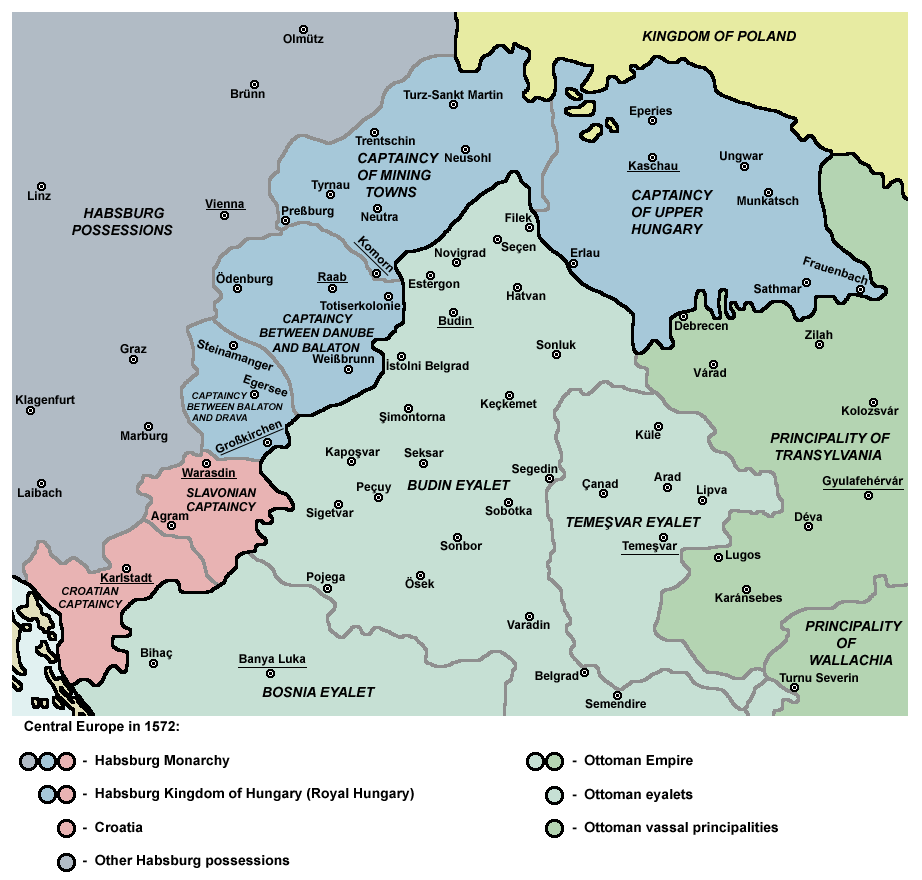
Ottoman Hungary ( hu, TΟΕrΟΕk hΟ≥doltsΟΓg) was the southern and central parts of what had been the Kingdom of Hungary in the late medieval period, which were conquered and ruled by the Ottoman Empire from 1541 to 1699. The Ottoman rule covered almost the entire region of the Great Hungarian Plain (except the northeastern parts) and Southern Transdanubia. The territory was invaded and annexed to the Ottoman Empire by Sultan Suleiman the Magnificent between 1521 and 1541. The north-western rim of the Hungarian kingdom remained unconquered and recognised members of the House of Habsburg as Kings of Hungary, giving it the name "Royal Hungary". The boundary between the two thereupon became the frontline in the OttomanβÄ™Habsburg wars over the next 150 years. Following the defeat of the Ottomans in the Great Turkish War, most of Ottoman Hungary was ceded to the Habsburgs under the Treaty of Karlowitz in 1699. During the period of Ottoman rule, Hungary was divided for administrative ... [...More Info...] [...Related Items...] OR: [Wikipedia] [Google] [Baidu] |
Tur (river)
The Tur ( hu, TΟΚr) is a tributary of the river Tisza. Its sources are located in the Oa»ô Mountains in Romania. The Tur starts at the confluence of its headwaters, the ''Gorova'' and ''Turi»ôor''. It then flows through Satu Mare County in Romania. The main town on the Tur is Turulung. The river then forms the border between Romania and Ukraine on a reach of , and the border between Romania and Hungary for . The Tur joins the Tisza river near SzatmΟΓrcseke in Hungary. Its basin size is .Analysis of the Tisza River Basin 2007 IPCDR Tributaries The following rivers are tributari ...[...More Info...] [...Related Items...] OR: [Wikipedia] [Google] [Baidu] |
LΡÉpu»ô (river)
The LΡÉpu»ô ( hu, LΟΓpos) is a right tributary of the river Some»ô in Romania. It originates in the LΡÉpu»ô Mountains, Maramure»ô County. It discharges into the Some»ô in Bu»ôag, west of Baia Mare. e-calauza.ro It flows through the communes BΡÉiu»¦, , , Vima MicΡÉ, |


