|
Sydney Harbour (Nova Scotia)
Sydney Harbour ( Mi'kmawi'simk: ''L'sipuktuk'') is the 10-mile long Y-shaped inlet of the Atlantic, oriented southwest-northeast on the northeast shore of Cape Breton Island, Nova Scotia, Canada. At its upper reaches, the harbour forks to form 2 arms, the Northwest Arm and the South Arm. The South Arm is fed upstream by the Sydney River. Sydney Harbour is the maritime hub for the Cape Breton Regional Municipality. The South Arm affords year-round ice-free deep-water anchorage for large ships, including cruise ships. The harbour's east shore formerly held a coke (fuel) and steel mill belonging to the Sydney Steel Corporation, operating from 1901-2001 with peak production from 1960-1980. Muggah Creek, near the steel mill, transported material (including polychlorinated biphenyl) into the Sydney Harbour, resulting in the area around the mouth of the creek to have some of the most contaminated marine sediment known (as of 2003). The harbour underwent major dredging in 2011, cleari ... [...More Info...] [...Related Items...] OR: [Wikipedia] [Google] [Baidu] |
Mi'kmaq Language
The Mi'kmaq (also ''Mi'gmaq'', ''Lnu'', ''Miꞌkmaw'' or ''Miꞌgmaw''; ; ) are a First Nations people of the Northeastern Woodlands, indigenous to the areas of Canada's Atlantic Provinces and the Gaspé Peninsula of Quebec as well as the northeastern region of Maine. The traditional national territory of the Mi'kmaq is named Miꞌkmaꞌki (or Miꞌgmaꞌgi). There are 170,000 Mi'kmaq people in the region, (including 18,044 members in the recently formed Qalipu First Nation in Newfoundland.) Nearly 11,000 members speak Miꞌkmaq, an Eastern Algonquian language. Once written in Miꞌkmaw hieroglyphic writing, it is now written using most letters of the Latin alphabet. The Mi'kmaq, Maliseet, and Pasamaquoddy nations signed a series of treaties known as the Covenant Chain of Peace and Friendship Treaties with the British Crown throughout the eighteenth century; the first was signed in 1725, and the last in 1779. The Miꞌkmaq maintain that they did not cede or give up their land t ... [...More Info...] [...Related Items...] OR: [Wikipedia] [Google] [Baidu] |
Atlantic
The Atlantic Ocean is the second-largest of the world's five oceans, with an area of about . It covers approximately 20% of Earth's surface and about 29% of its water surface area. It is known to separate the " Old World" of Africa, Europe and Asia from the "New World" of the Americas in the European perception of the World. The Atlantic Ocean occupies an elongated, S-shaped basin extending longitudinally between Europe and Africa to the east, and North and South America to the west. As one component of the interconnected World Ocean, it is connected in the north to the Arctic Ocean, to the Pacific Ocean in the southwest, the Indian Ocean in the southeast, and the Southern Ocean in the south (other definitions describe the Atlantic as extending southward to Antarctica). The Atlantic Ocean is divided in two parts, by the Equatorial Counter Current, with the North(ern) Atlantic Ocean and the South(ern) Atlantic Ocean split at about 8°N. Scientific explorations of the Atlanti ... [...More Info...] [...Related Items...] OR: [Wikipedia] [Google] [Baidu] |
Nautical Chart
A nautical chart is a graphic representation of a sea area and adjacent coastal regions. Depending on the scale of the chart, it may show depths of water and heights of land (topographic map), natural features of the seabed, details of the coastline, navigational hazards, locations of natural and human-made aids to navigation, information on tides and currents, local details of the Earth's magnetic field, and human-made structures such as harbours, buildings, and bridges. Nautical charts are essential tools for marine navigation; many countries require vessels, especially commercial ships, to carry them. Nautical charting may take the form of charts printed on paper (raster navigational charts) or computerized electronic navigational charts. Recent technologies have made available paper charts which are printed "on demand" with cartographic data that has been downloaded to the commercial printing company as recently as the night before printing. With each daily download, critica ... [...More Info...] [...Related Items...] OR: [Wikipedia] [Google] [Baidu] |
Container Terminal
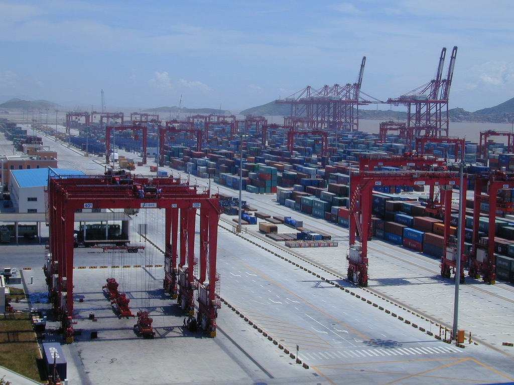
A container port or container terminal is a facility where cargo containers are transshipped between different transport vehicles, for onward transportation. The transshipment may be between container ships and land vehicles, for example trains or trucks, in which case the terminal is described as a ''maritime container port''. Alternatively, the transshipment may be between land vehicles, typically between train and truck, in which case the terminal is described as an ''inland container port''. In November 1932, the first inland container port in the world was opened by the Pennsylvania Railroad company in Enola, Pennsylvania. Port Newark-Elizabeth on the Newark Bay in the Port of New York and New Jersey is considered the world's first maritime container port. On April 26, 1956, the Ideal X was rigged for an experiment to use standardized cargo containers that were stacked and then unloaded to a compatible truck chassis at Port Newark. The concept had been developed by the M ... [...More Info...] [...Related Items...] OR: [Wikipedia] [Google] [Baidu] |
North Sydney, Nova Scotia
North Sydney (Scottish Gaelic: ''Suidni A Tuath'' or ''Am Bàr'') is a former town and current community in Nova Scotia's Cape Breton Regional Municipality. Located on the north side of Sydney Harbour, along the eastern coast of Cape Breton Island, North Sydney is an important port in Atlantic Canada, serving as the western terminus of the Marine Atlantic ferry service. It acts as the marine link for the Trans-Canada Highway to Newfoundland and is often termed "The Gateway To Newfoundland" for that reason. Marine Atlantic ferries currently operate from North Sydney's terminal to the ports of Channel-Port aux Basques and Argentia. The Crown Corporation is one of the largest employers in the area. History North Sydney was settled around 1785 by European and Loyalist settlers. It emerged as a major shipbuilding centre in the early 19th century, building many brigs and brigantines for the English market, later moving on to larger barques, and in 1851 to the full-rigged ''Lo ... [...More Info...] [...Related Items...] OR: [Wikipedia] [Google] [Baidu] |
Edwardsville, Nova Scotia
Edwardsville is a community in the Canadian province of Nova Scotia, located in the Cape Breton Regional Municipality on Cape Breton Island. It is named for King Edward VII. Demographics In the 2021 Census of Population conducted by Statistics Canada, Edwardsville had a population of 287 living in 119 of its 127 total private dwellings, a change of from its 2016 population of 267. With a land area of , it had a population density of in 2021. See also * Royal eponyms in Canada In Canada, a number of sites and structures are named for royal individuals, whether a member of the past French royal family, British royal family, or present Canadian royal family thus reflecting the country's status as a constitutional monarch ... References Edwardsville on Destination Nova Scotia Communities in the Cape Breton Regional Municipality Designated places in Nova Scotia General Service Areas in Nova Scotia {{CapeBretonNS-geo-stub ... [...More Info...] [...Related Items...] OR: [Wikipedia] [Google] [Baidu] |
Container Ship
A container ship (also called boxship or spelled containership) is a cargo ship that carries all of its load in truck-size intermodal containers, in a technique called containerization. Container ships are a common means of commercial intermodal freight transport and now carry most seagoing non-bulk cargo. Container ship capacity is measured in twenty-foot equivalent units (TEU). Typical loads are a mix of 20-foot (1-TEU) and 40-foot (2-TEU) ISO-standard containers, with the latter predominant. Today, about 90% of non-bulk cargo worldwide is transported by container ships, and the largest modern container ships can carry up to 24,000 TEU (e.g., '' Ever Ace''). Container ships now rival crude oil tankers and bulk carriers as the largest commercial seaborne vessels. History There are two main types of dry cargo: bulk cargo and break bulk cargo. Bulk cargoes, like grain or coal, are transported unpackaged in the hull of the ship, generally in large volume. Break-bulk car ... [...More Info...] [...Related Items...] OR: [Wikipedia] [Google] [Baidu] |
Dredging
Dredging is the excavation of material from a water environment. Possible reasons for dredging include improving existing water features; reshaping land and water features to alter drainage, navigability, and commercial use; constructing dams, dikes, and other controls for streams and shorelines; and recovering valuable mineral deposits or marine life having commercial value. In all but a few situations the excavation is undertaken by a specialist floating plant, known as a dredger. Dredging is carried out in many different locations and for many different purposes, but the main objectives are usually to recover material of value or use, or to create a greater depth of water. Dredges have been classified as suction or mechanical. Dredging has significant environmental impacts: it can disturb marine sediments, leading to both short- and long-term water pollution, destroy important seabed ecosystems, and can release human-sourced toxins captured in the sediment. Description ... [...More Info...] [...Related Items...] OR: [Wikipedia] [Google] [Baidu] |
Marine Sediment
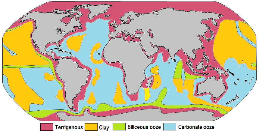
Marine sediment, or ocean sediment, or seafloor sediment, are deposits of insoluble particles that have accumulated on the seafloor. These particles have their origins in soil and rocks and have been transported from the land to the sea, mainly by rivers but also by dust carried by wind and by the flow of glaciers into the sea. Additional deposits come from marine organisms and chemical precipitation in seawater, as well as from underwater volcanoes and meteorite debris. Except within a few kilometres of a mid-ocean ridge, where the volcanic rock is still relatively young, most parts of the seafloor are covered in sediment. This material comes from several different sources and is highly variable in composition. Seafloor sediment can range in thickness from a few millimetres to several tens of kilometres. Near the surface seafloor sediment remains unconsolidated, but at depths of hundreds to thousands of metres the sediment becomes lithified (turned to rock). Rates of sediment ... [...More Info...] [...Related Items...] OR: [Wikipedia] [Google] [Baidu] |
Polychlorinated Biphenyl
Polychlorinated biphenyls (PCBs) are highly carcinogenic chemical compounds, formerly used in industrial and consumer products, whose production was banned in the United States by the Toxic Substances Control Act in 1979 and internationally by the Stockholm Convention on Persistent Organic Pollutants in 2001. They are organic chlorine compounds with the formula C12 H10−''x'' Cl''x''; they were once widely used in the manufacture of carbonless copy paper, as heat transfer fluids, and as dielectric and coolant fluids for electrical equipment. Because of their longevity, PCBs are still widely in use, even though their manufacture has declined drastically since the 1960s, when a host of problems were identified. With the discovery of PCBs' environmental toxicity, and classification as persistent organic pollutants, their production was banned by United States federal law in 1978, and by the Stockholm Convention on Persistent Organic Pollutants in 2001. The International Agency ... [...More Info...] [...Related Items...] OR: [Wikipedia] [Google] [Baidu] |
Sydney Steel Corporation
Sydney Steel Corporation (SYSCO) was a Crown corporation in the province of Nova Scotia, Canada. It owned and operated a steel mill in Sydney. Early history of steelmaking in Sydney An integrated steel mill was established on the southeast side of Sydney Harbour in the Whitney Pier neighbourhood of Sydney, Nova Scotia in 1901 by American investors. This entity was named Dominion Iron and Steel Company Limited (DISCO). Coal from the Dominion Coal Company Limited (DOMCO) was used to create coke to fuel the blast furnaces for smelting iron ore which arrived from Bell Island in Newfoundland. In 1920, DISCO, the Nova Scotia Steel and Coal Company (SCOTIA) in Sydney Mines, and the Wabana ore mine on Bell Island were acquired by the British Empire Steel Corporation (BESCO). In 1930, BESCO reorganized as Dominion Steel and Coal Corporation (DOSCO). Hawker Siddeley Canada purchased DOSCO in 1957. Donald Commission Hawker Siddeley sought to eliminate money losing operations and i ... [...More Info...] [...Related Items...] OR: [Wikipedia] [Google] [Baidu] |
Steel Mill
A steel mill or steelworks is an industrial plant for the manufacture of steel. It may be an integrated steel works carrying out all steps of steelmaking from smelting iron ore to rolled product, but may also be a plant where steel semi-finished casting products are made from molten pig iron or from scrap. History Since the invention of the Bessemer process, steel mills have replaced ironworks, based on puddling or fining methods. New ways to produce steel appeared later: from scrap melted in an electric arc furnace and, more recently, from direct reduced iron processes. In the late 19th and early 20th centuries the world's largest steel mill was the Barrow Hematite Steel Company steelworks located in Barrow-in-Furness, United Kingdom. Today, the world's largest steel mill is in Gwangyang, South Korea. [...More Info...] [...Related Items...] OR: [Wikipedia] [Google] [Baidu] |


.png)
