|
Sweet Grass County
Sweet Grass County is a county located in the U.S. state of Montana. As of the 2020 census, the population was 3,678. Its county seat is Big Timber. The county was founded in 1895. History The Montana Legislature authorized Sweet Grass County in 1895, taking parts of Park, Meagher, and Yellowstone counties. That boundary was altered in 1913 when Stillwater County was formed from a portion of Sweet Grass; again in 1917 with the formation of Wheatland County, and in 1920 with the formation of Golden Valley County. Climate Sweet Grass County's climate is generally dry and cool, specified as Dfc in the Köppen-Geiger climate classification (subarctic or boreal). Average annual precipitation of 15 inches (380mm) comes in rain and snow. The summer precipitation accumulation (April through September) averages 10.5 inches (267mm). The average summer high temperature is 75.3 °F (24 °C) and the average minimum temperature during that period is 44.2 °F (6.8 °C). July and August ... [...More Info...] [...Related Items...] OR: [Wikipedia] [Google] [Baidu] |
Big Timber, Montana
Big Timber is a city in, and the county seat of Sweet Grass County, Montana, United States. The population was 1,650 at the 2020 census. Big Timber takes its name from Big Timber Creek, which was named by William Clark because of the large cottonwood trees. The post office was established in 1880, closed, then reopened in 1882 with Ella Burns as postmaster. As a stop on the Northern Pacific Railroad, Big Timber became a major wool-shipping depot. It became the county seat in 1895. A fire in 1908 destroyed half the commercial buildings and a third of the residential homes. Geography Big Timber is located at (45.833224, -109.950361). According to the United States Census Bureau, the city has a total area of , of which is land and is water. Climate Big Timber has a cool semi-arid climate (Köppen ''BSk'') bordering on a humid continental climate (''Dfb''). Although winters can be frigid, frequent chinook winds will raise temperatures above on an average twenty days between ... [...More Info...] [...Related Items...] OR: [Wikipedia] [Google] [Baidu] |
Carnegie Public Library (Big Timber, Montana)
The Carnegie Public Library at 314 McLeod Street (Montana Secondary Highway 298, S-298) in Big Timber, Montana, Big Timber, Montana, United States, is a Carnegie library which was built in 1913. It has also been known as Big Timber Carnegie Library. It was listed on the National Register of Historic Places in 2002. It was designed by architects Link & Haire in Classical Revival architecture, Classical Revival style. With . See also * List of Carnegie libraries in Montana * National Register of Historic Places listings in Sweet Grass County, Montana References External links National Register of Historic Places in Sweet Grass County, Montana Neoclassical architecture in Montana Library buildings completed in 1913 1913 establishments in Montana Libraries on the National Register of Historic Places in Montana {{Montana-NRHP-stub ... [...More Info...] [...Related Items...] OR: [Wikipedia] [Google] [Baidu] |
Interstate 90 In Montana
Interstate 90 (I-90) is an east–west transcontinental Interstate Highway across the northern United States, linking Seattle to Boston. The portion in the state of Montana is in length, passing through fourteen counties in central and southern Montana. Due to the large size of Montana, it is the longest segment of I-90 within a single state. Route description Mineral County I-90 enters Montana and Mineral County from Shoshone County, Idaho over the high Lookout Pass, which traverses the Coeur d'Alene Mountains of the Bitterroot Range, and immediately has its first interchange, a partial cloverleaf interchange serving extreme northwest Mineral County and access to Lookout Pass Ski and Recreation Area. The highway continues southeasterly through woodlands, paralleling the St. Regis River, before meeting the Dena Mora (Lookout Pass) rest area east of the Idaho–Montana border. About from the rest stop is a diamond interchange, serving a small minor road into th ... [...More Info...] [...Related Items...] OR: [Wikipedia] [Google] [Baidu] |
Irish Americans
, image = Irish ancestry in the USA 2018; Where Irish eyes are Smiling.png , image_caption = Irish Americans, % of population by state , caption = Notable Irish Americans , population = 36,115,472 (10.9%) alone or in combination 10,899,442 (3.3%) Irish alone 33,618,500(10.1%) alone or in combination 9,919,263 (3.0%) Irish alone , popplace = Boston New York City Scranton Philadelphia New Orleans Pittsburgh Cleveland Chicago Baltimore Detroit Milwaukee Louisville New England Delaware Valley Coal Region Los Angeles Las Vegas Atlanta Sacramento San Diego Houston Dallas San Francisco Palm Springs, California Fairbanks and most urban areas , langs = English ( American English dialects); a scant speak Irish , rels = Protestant (51%) Catholic (36%) Other (3%) No religion (10%) (2006) , related = Anglo-Irish people Breton Americans Cornish Americans English Americans Irish Au ... [...More Info...] [...Related Items...] OR: [Wikipedia] [Google] [Baidu] |
English Americans
English Americans (historically known as Anglo-Americans) are Americans whose ancestry originates wholly or partly in England. In the 2020 American Community Survey, 25.21 million self-identified as being of English origin. The term is distinct from British Americans, which includes not only English Americans but also Scottish, Scotch-Irish (descendents of Ulster Scots from Ulster, Ireland), Welsh, Cornish and Manx Americans from the whole of the United Kingdom. Demographers regard the reported number of English Americans as a serious undercount, as the index of inconsistency is high and many if not most Americans of English ancestry have a tendency to identify simply as "Americans" or if of mixed European ancestry, identify with a more recent and differentiated ethnic group. In the 1980 census, 49.6 million Americans claimed English ancestry. At 26.34%, this was the largest group amongst the 188 million people who reported at least one ancestry. The population was 226 m ... [...More Info...] [...Related Items...] OR: [Wikipedia] [Google] [Baidu] |
German Americans
German Americans (german: Deutschamerikaner, ) are Americans who have full or partial German ancestry. With an estimated size of approximately 43 million in 2019, German Americans are the largest of the self-reported ancestry groups by the United States Census Bureau in its American Community Survey. German Americans account for about one third of the total population of people of German ancestry in the world. Very few of the German states had colonies in the new world. In the 1670s, the first significant groups of German immigrants arrived in the British colonies, settling primarily in Pennsylvania, New York and Virginia. The Mississippi Company of France moved thousands of Germans from Europe to Louisiana and to the German Coast, Orleans Territory between 1718 and 1750. Immigration ramped up sharply during the 19th century. There is a "German belt" that extends all the way across the United States, from eastern Pennsylvania to the Oregon coast. Pennsylvania, with 3.5 millio ... [...More Info...] [...Related Items...] OR: [Wikipedia] [Google] [Baidu] |
Norwegian Americans
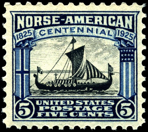
Norwegian Americans ( nb, Norskamerikanere, nn, Norskamerikanarar) are Americans with ancestral roots in Norway. Norwegian immigrants went to the United States primarily in the latter half of the 19th century and the first few decades of the 20th century. There are more than 4.5 million Norwegian Americans, according to the 2021 U.S. census,; most live in the Upper Midwest and on the West Coast of the United States. Immigration Viking-era exploration Norsemen from Greenland and Iceland were the first Europeans to reach North America. Leif Erikson reached North America via Norse settlements in Greenland around the year 1000. Norse settlers from Greenland founded the settlement of L'Anse aux Meadows and Point Rosee in Vinland, in what is now Newfoundland, Canada. These settlers failed to establish a permanent settlement because of conflicts with indigenous people and within the Norse community. Colonial settlement The Netherlands, and especially the cities of Amsterdam and ... [...More Info...] [...Related Items...] OR: [Wikipedia] [Google] [Baidu] |
Race (United States Census)
Race and ethnicity in the United States census, defined by the federal Office of Management and Budget (OMB) and the United States Census Bureau, are the Self-concept, self-identified categories of Race and ethnicity in the United States, race or races and ethnicity chosen by residents, with which they most closely identify, and indicate whether they are of Hispanic or Latino (demonym), Latino origin (the only Race and ethnicity in the United States, categories for ethnicity). The racial categories represent a social-political construct for the race or races that respondents consider themselves to be and, "generally reflect a social definition of race recognized in this country." OMB defines the concept of race as outlined for the U.S. census as not "scientific or anthropological" and takes into account "social and cultural characteristics as well as ancestry", using "appropriate scientific methodologies" that are not "primarily biological or genetic in reference." The race cat ... [...More Info...] [...Related Items...] OR: [Wikipedia] [Google] [Baidu] |
Population Density
Population density (in agriculture: standing stock or plant density) is a measurement of population per unit land area. It is mostly applied to humans, but sometimes to other living organisms too. It is a key geographical term.Matt RosenberPopulation Density Geography.about.com. March 2, 2011. Retrieved on December 10, 2011. In simple terms, population density refers to the number of people living in an area per square kilometre, or other unit of land area. Biological population densities Population density is population divided by total land area, sometimes including seas and oceans, as appropriate. Low densities may cause an extinction vortex and further reduce fertility. This is called the Allee effect after the scientist who identified it. Examples of the causes of reduced fertility in low population densities are * Increased problems with locating sexual mates * Increased inbreeding Human densities Population density is the number of people per unit of area, usuall ... [...More Info...] [...Related Items...] OR: [Wikipedia] [Google] [Baidu] |
2000 United States Census
The United States census of 2000, conducted by the Census Bureau, determined the resident population of the United States on April 1, 2000, to be 281,421,906, an increase of 13.2 percent over the 248,709,873 people enumerated during the 1990 census. This was the twenty-second federal census and was at the time the largest civilly administered peacetime effort in the United States. Approximately 16 percent of households received a "long form" of the 2000 census, which contained over 100 questions. Full documentation on the 2000 census, including census forms and a procedural history, is available from the Integrated Public Use Microdata Series. This was the first census in which a state – California – recorded a population of over 30 million, as well as the first in which two states – California and Texas – recorded populations of more than 20 million. Data availability Microdata from the 2000 census is freely available through the Integrated Public Use Microdata Serie ... [...More Info...] [...Related Items...] OR: [Wikipedia] [Google] [Baidu] |
Lewis And Clark National Forest
Lewis and Clark National Forest is located in west central Montana, United States. Spanning , the forest is managed as two separate zones. The eastern sections, under the Jefferson Division, is a mixture of grass and shrublands dotted with "island" pockets of forested areas. Here, cattle leases to local ranchers as well as timber harvesting are the norm. The western Rocky Mountain Division, which straddles the Continental divide, is managed chiefly for environmental preservation, as much of the land has been designated as wilderness. Forest headquarters are located in Great Falls, Montana. Local ranger district offices have been established in Choteau, Harlowton, Neihart, Stanford, and White Sulphur Springs. The forest lands were defined and established by the federal government in 1897, following its Treaty of 1896 with the Blackfeet establishing their adjacent reservation. This forest is one of the oldest forest preserves in the U.S. The forest is named in honor of the membe ... [...More Info...] [...Related Items...] OR: [Wikipedia] [Google] [Baidu] |
Gallatin National Forest
The Gallatin National Forest (now known as the Custer-Gallatin National Forest) is a United States National Forest located in South-West Montana. Most of the Custer-Gallatin goes along the state's southern border, with some of it a part of North-West Wyoming. Geography The forest area comprises a total of with around located in the Gallatin Forest area and within the Custer. Most of the Gallatin borders Yellowstone National Park and is a part of the Greater Yellowstone Ecosystem, an area which encompasses almost in and around the park. The Custer National Forest is spread out along Eastern Montana and the North-West side of Wyoming, with most of its land being held in Montana. The forest stretches through about six counties, including Park, Gallatin, Sweet Grass, Madison, Carbon, and Meagher. There are six separate mountain ranges within the forest including the Gallatin, Madison, Bridger, Crazy, Absaroka, and Beartooth Ranges. The Beartooth's are home to Granit ... [...More Info...] [...Related Items...] OR: [Wikipedia] [Google] [Baidu] |


