|
Sunset Bay State Park
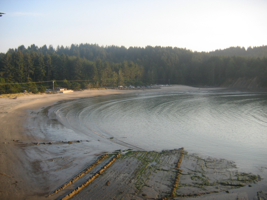
Sunset Bay State Park is a state park in the U.S. state of Oregon. Administered by the Oregon Parks and Recreation Department, it is about south of Cape Arago Lighthouse and outside the town of Charleston on Coos Bay. The park offers a crescent shaped beach, tide pools, hiking trails and a year-round campground. The park is one of three along the Cape Arago Highway, which runs along the Pacific Ocean west of U.S. Route 101. Sunset Bay State Park is about north of Shore Acres State Park and about north of Cape Arago State Park. A hiking trail links Sunset Bay to Shore Acres. Land for the park was acquired in stages through 1984. Coos County donated the original tract to the state in 1948. In 1954, Ralph Barker donated a parcel with a water supply. The Bureau of Land Management later added tracts through a grant to the state, which also bought, exchanged, or otherwise acquired land from private owners. The combined size of the parcels is about . Sunset Bay is home to one ... [...More Info...] [...Related Items...] OR: [Wikipedia] [Google] [Baidu] |
Coos Bay, Oregon
Coos Bay ( Coos language: Atsixiis) is a city located in Coos County, Oregon, United States, where the Coos River enters Coos Bay on the Pacific Ocean. The city borders the city of North Bend, and together they are often referred to as one entity called either Coos Bay-North Bend or Oregon's Bay Area. Coos Bay's population as of the 2020 census was 15,985 residents, making it the most populous city on the Oregon Coast. Oregon's Bay Area is estimated to be home to 32,308 (Coos Bay Census County Division). History Prior to Europeans first visiting the Oregon coast, Native American tribes claimed the Coos Bay region as their homeland for thousands of years."Bay Area History" [...More Info...] [...Related Items...] OR: [Wikipedia] [Google] [Baidu] |
Coos County, Oregon
Coos County ( ) is one of the 36 counties in the U.S. state of Oregon. As of the 2020 census, the population was 64,929. The county seat is Coquille. The county was formed from the western parts of Umpqua and Jackson counties. It is named after a tribe of Native Americans who live in the region. Coos County comprises the Coos Bay, OR Micropolitan Statistical Area. History The name Coos originated from the name of the Native American tribe that had settled the area. "Coos" loosely translates to "lake" or "place of pines". Lewis and Clark noted Cook-koo-oose. Early maps and documents spelled it Kowes, Cowes, Coose, Koos, among others. Although exploration and trapping in the area occurred as early as 1828, the first European-American settlement was established at Empire City in 1853 by members of the Coos Bay Company; this is now part of Coos Bay, Oregon. Coos County was created by the Territorial Legislature from parts of Umpqua, and Jackson counties on December 22, 1 ... [...More Info...] [...Related Items...] OR: [Wikipedia] [Google] [Baidu] |
Oceanic Climate
An oceanic climate, also known as a marine climate, is the humid temperate climate sub-type in Köppen classification ''Cfb'', typical of west coasts in higher middle latitudes of continents, generally featuring cool summers and mild winters (for their latitude), with a relatively narrow annual temperature range and few extremes of temperature. Oceanic climates can be found in both hemispheres generally between 45 and 63 latitude, most notably in northwestern Europe, northwestern America, as well as New Zealand. Precipitation Locations with oceanic climates tend to feature frequent cloudy conditions with precipitation, low hanging clouds, and frequent fronts and storms. Thunderstorms are normally few, since strong daytime heating and hot and cold air masses meet infrequently in the region. In most areas with an oceanic climate, precipitation comes in the form of rain for the majority of the year. However, some areas with this climate see some snowfall annually during winter. M ... [...More Info...] [...Related Items...] OR: [Wikipedia] [Google] [Baidu] |
Oregon Coast
The Oregon Coast is a coastal region of the U.S. state of Oregon. It is bordered by the Pacific Ocean to its west and the Oregon Coast Range to the east, and stretches approximately from the California state border in the south to the Columbia River in the north. The region is not a specific geological, environmental, or political entity, and includes the Columbia River Estuary. The Oregon Beach Bill of 1967 allows free beach access to everyone. In return for a pedestrian easement and relief from construction, the bill eliminates property taxes on private beach land and allows its owners to retain certain beach land rights. Traditionally, the Oregon Coast is regarded as three distinct sub–regions: * The North Coast, which stretches from the Columbia River to Cascade Head. * The Central Coast, which stretches from Cascade Head to Reedsport. * The South Coast, which stretches from Reedsport to the Oregon–California border. The largest city is Coos Bay, population 16,700 i ... [...More Info...] [...Related Items...] OR: [Wikipedia] [Google] [Baidu] |
Spruce
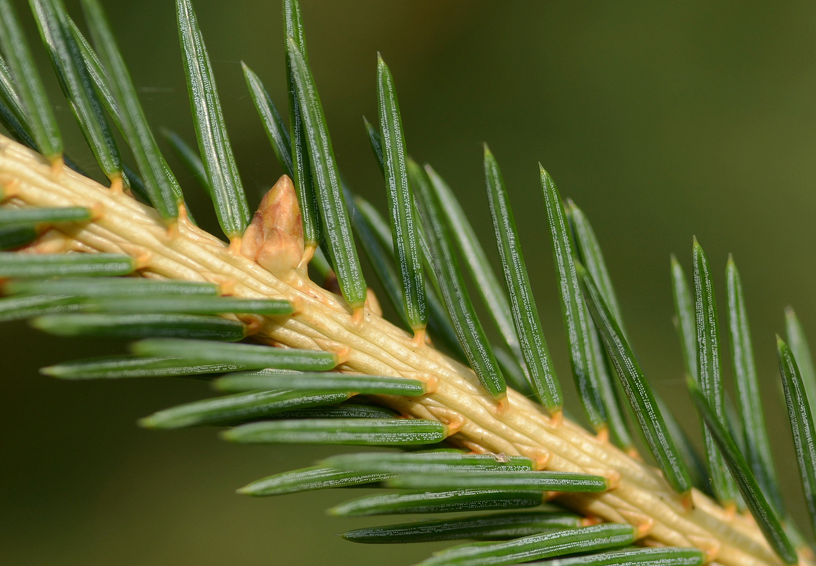
A spruce is a tree of the genus ''Picea'' (), a genus of about 35 species of coniferous evergreen trees in the family Pinaceae, found in the northern temperate and boreal (taiga) regions of the Earth. ''Picea'' is the sole genus in the subfamily Piceoideae. Spruces are large trees, from about 20 to 60 m (about 60–200 ft) tall when mature, and have whorled branches and conical form. They can be distinguished from other members of the pine family by their needles (leaves), which are four-sided and attached singly to small persistent peg-like structures (pulvini or sterigmata) on the branches, and by their cones (without any protruding bracts), which hang downwards after they are pollinated. The needles are shed when 4–10 years old, leaving the branches rough with the retained pegs. In other similar genera, the branches are fairly smooth. Spruce are used as food plants by the larvae of some Lepidoptera (moth and butterfly) species, such as the eastern spruce budwo ... [...More Info...] [...Related Items...] OR: [Wikipedia] [Google] [Baidu] |
Cascadia Subduction Zone
The Cascadia subduction zone is a convergent plate boundary that stretches from northern Vancouver Island in Canada to Northern California in the United States. It is a very long, sloping subduction zone where the Explorer, Juan de Fuca, and Gorda plates move to the east and slide below the much larger mostly continental North American Plate. The zone varies in width and lies offshore beginning near Cape Mendocino, Northern California, passing through Oregon and Washington, and terminating at about Vancouver Island in British Columbia. The Explorer, Juan de Fuca, and Gorda plates are some of the remnants of the vast ancient Farallon Plate which is now mostly subducted under the North American Plate. The North American Plate itself is moving slowly in a generally southwest direction, sliding over the smaller plates as well as the huge oceanic Pacific Plate (which is moving in a northwest direction) in other locations such as the San Andreas Fault in central and southern Califo ... [...More Info...] [...Related Items...] OR: [Wikipedia] [Google] [Baidu] |
Ghost Forest
Ghost forests are areas of dead trees in former forests, typically in coastal regions where rising sea levels or tectonic shifts have altered the height of a land mass. Forests located near the coast or estuaries may also be at risk of dying through saltwater poisoning, if invading seawater reduces the amount of freshwater that deciduous trees receive for sustenance. By looking at the stratigraphic record it is possible to reconstruct a series of events that lead to the creation of a ghost forest where, in a convergent plate boundary, there has been orogenic uplift, followed by earthquakes resulting in subsidence and tsunamis, altering the coast and creating a ghost forest. Formations Sea level changes When there is a change in sea level, coastal regions may become inundated with sea water. This can alter coastal areas and kill large areas of trees, leaving behind what is called a “ghost forest.” This type of ghost forest may develop in a variety of environments and in man ... [...More Info...] [...Related Items...] OR: [Wikipedia] [Google] [Baidu] |
Bureau Of Land Management
The Bureau of Land Management (BLM) is an agency within the United States Department of the Interior responsible for administering federal lands. Headquartered in Washington DC, and with oversight over , it governs one eighth of the country's landmass. President Harry S. Truman created the BLM in 1946 by combining two existing agencies: the General Land Office and the Grazing Service. The agency manages the federal government's nearly of subsurface mineral estate located beneath federal, state and private lands severed from their surface rights by the Homestead Act of 1862. Most BLM public lands are located in these 12 western states: Alaska, Arizona, California, Colorado, Idaho, Montana, Nevada, New Mexico, Oregon, Utah, Washington and Wyoming. The mission of the BLM is "to sustain the health, diversity, and productivity of the public lands for the use and enjoyment of present and future generations." Originally BLM holdings were described as "land nobody wanted" because home ... [...More Info...] [...Related Items...] OR: [Wikipedia] [Google] [Baidu] |
Cape Arago State Park
Cape Arago State Park is a state park in the U.S. state of Oregon, administered by the Oregon Parks and Recreation Department. Cape Arago is north of Bandon and 15 miles southwest of Coos Bay on Cape Arago Highway in Coos County. History In 1579, Sir Francis Drake is purported to have sought shelter for his ship, the ''Golden Hind'', around Cape Arago."History of Coos Bay" . City of Coos Bay. Accessed September 2010. The headland was originally named Cape Gregory by James Cook on March 12, 1778 after Saint Gregory
Pope Gregory I ( la, Gregorius I; – 12 March 604), commonly known as Saint Gr ...
[...More Info...] [...Related Items...] OR: [Wikipedia] [Google] [Baidu] |
Oregon Parks And Recreation Department
The Oregon Parks and Recreation Department (OPRD), officially known (in state law) as the State Parks and Recreation Department, is the government agency of the U.S. state of Oregon which operates its system of state parks. In addition, it has programs to protect and provide public access to natural and historic resources within the state, including the State Historic Preservation Office, Oregon Heritage Commission, Oregon Commission on Historic Cemeteries, recreation trails, the Ocean Shores Recreation Area, scenic waterways and the Willamette River Greenway. The department's chief sources of funding are the Oregon Lottery, state park user fees. and recreation vehicle license fees. The department also manages the system of rest areas along the highways and freeways within the state. In 2006 the department was delegated responsibility for managing the Oregon State Fair.Heine, Steven Robert. ''The Oregon State Fair Images of America''. Arcadia Publishing. 2007-08-20. pp. 7–8. The ... [...More Info...] [...Related Items...] OR: [Wikipedia] [Google] [Baidu] |
Shore Acres State Park
Shore Acres State Park is a state park south of Coos Bay in the U.S. state of Oregon. It is one of three state parks along the Cape Arago Highway, which runs along the Pacific Ocean west of U.S. Route 101. Sunset Bay State Park is about north of Shore Acres, and Cape Arago State Park is about a mile south. The park features of formal gardens including a rose-testing plot and Japanese lily pond, as well as ocean views and beach access. In the cooler months, visitors can watch storms and migrating whales from the park's sandstone cliffs. Another seasonal attraction is the Shore Acres Holiday Lights, lasting from Thanksgiving to New Year's Eve, when the gardens are decorated with lights and illuminated sculptures. Shore Acres was originally an estate owned by Louis J. Simpson, a Coos County timber baron and son of shipping magnate Asa Meade Simpson. After fire and financial losses devastated his estate holdings, Simpson sold the land to the State of Oregon Oregon ... [...More Info...] [...Related Items...] OR: [Wikipedia] [Google] [Baidu] |

_(cooD0088).jpg)


