|
Sunniside, Gateshead
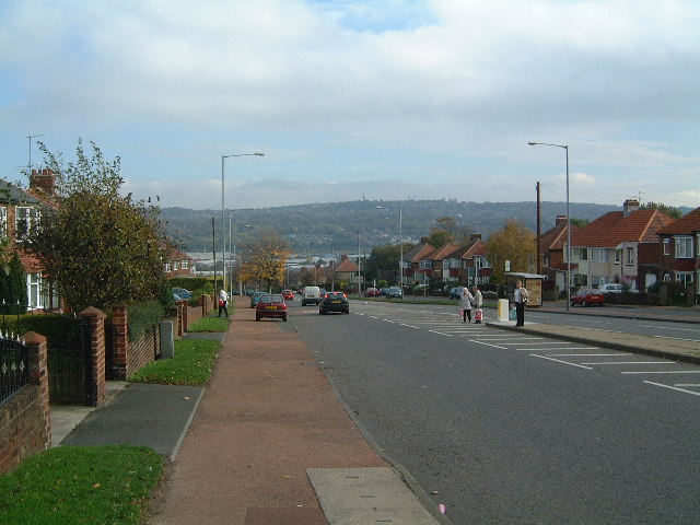
Sunniside is a village in the Metropolitan Borough of Gateshead, which is located around from Newcastle upon Tyne. Prior to the creation of the county of Tyne and Wear in 1974, it was part of Whickham Urban District, which in turn formed a part of County Durham. Sunniside has a busy Front Street, with a collection of pubs, shops, and amenities. The village is surrounded mainly by farmland, with plantations of trees to the east, whilst also neighbouring the villages of Byermoor, Marley Hill and Whickham. The village is mostly housing, with older terraced properties situated near to the shops, and large housing estates built from the 1960s onward radiating from this area. It has a large park to the north of the village, next to Burnthouse Lane. Attractions near to the village include Beamish Museum and Tanfield Railway. The A692 road runs directly through the centre of the village and is used by many transport companies as a direct route to the town of Consett: this road carries ... [...More Info...] [...Related Items...] OR: [Wikipedia] [Google] [Baidu] |
Metropolitan Borough Of Gateshead
The Metropolitan Borough of Gateshead is a metropolitan borough in the metropolitan county of Tyne and Wear, North East England. It includes Gateshead, Rowlands Gill, Whickham, Blaydon, Ryton, Felling, Pelaw, Dunston and Low Fell. The borough forms part of the Tyneside conurbation, centred on Newcastle upon Tyne. It is bordered by the local authorities areas of Newcastle upon Tyne to the north, Northumberland to the west, County Durham to the south, Sunderland to the south-east, and South Tyneside to the east. The borough had a population of over 202,000. History The district is located within the historic county boundaries of County Durham. It is south of the River Tyne, the historic county boundary between Northumberland and Durham. The metropolitan borough was formed in 1974 through the merger of the county borough of Gateshead with the urban districts of Felling, Whickham, Blaydon, Ryton and part of Chester-le-Street Rural District, with the borough placed in the new ... [...More Info...] [...Related Items...] OR: [Wikipedia] [Google] [Baidu] |
Lobley Hill
Lobley Hill is located in the west of the old County Borough of Gateshead within the Metropolitan Borough of Gateshead in Tyne and Wear, North East England having been previously part of the parish of Whickham. In its Demographic Profile for the Lobley Hill Plan Area produced in 2008 the Metropolitan Borough of Gateshead quoted the 2001 census showing Lobley Hill had a population of around 6,199 of which 48% were males and 52% were females. Later at the 2011 Census, the ward was called Lobley Hill and Bensham. The population of this Gateshead MBC ward was 10,698. Development of the community The current Lobley Hill is defined by its boundaries as it has grown to fill the hillside while development along its eastern edge has encroached significantly since the first of the present housing was built in 1930s. The River Team lies just beyond what would have been considered a part of Lobley Hill separating it from the Teams, Bensham and Saltwell, Tyne and Wear areas of Gateshe ... [...More Info...] [...Related Items...] OR: [Wikipedia] [Google] [Baidu] |
MetroCentre (shopping Centre)
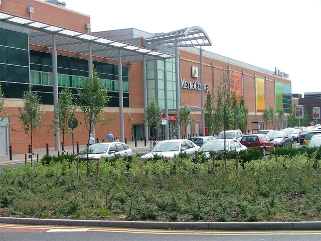
Metrocentre is a shopping centre and entertainment complex in the Dunston, Tyne and Wear, Dunston area of Gateshead. It is located on the former site of Dunston Power Station, near to the River Tyne. Metrocentre opened in stages, with the first phase opening on 28 April 1986, and the official opening being held on 14 October that year. It has more than 300 shops occupying over of retail floor space, making it the second-largest shopping centre in the UK, behind Westfield London. Additional retail space can be found in the adjoining Metro Retail Park and MetrOasis. History Metrocentre's construction was financed by the Church Commissioners, Church Commissioners of England, and was masterminded by John Hall (businessman), Sir John Hall's company, Cameron Hall Developments. The ground upon which it is built was purchased for £100,000 in the early 1970s. Access to the development was facilitated by an urban development grant from the Secretary of State for the Environment, Transp ... [...More Info...] [...Related Items...] OR: [Wikipedia] [Google] [Baidu] |
Consett
Consett is a town in County Durham, England, about south-west of Newcastle upon Tyne. It had a population of 27,394 in 2001 and an estimate of 25,812 in 2019. History Consett sits high on the edge of the Pennines. Its' name originates in the Old English ''Cunecsheafod'' ("Cunec's headland"), first recorded in the 13th century. In 1841, it was a village community of only 145, but it was about to become a boom town: below the ground were coking coal and blackband iron ore, and nearby was limestone. These three ingredients were needed for blast furnaces to produce iron and steel. The town is perched on the steep eastern bank of the River Derwent and owes its origins to industrial development arising from lead mining in the area, together with the development of the steel industry in the Derwent Valley, which is said to have been initiated by immigrant German cutlers and sword-makers from Solingen, who settled in the village of Shotley Bridge during the 17th century. During the ... [...More Info...] [...Related Items...] OR: [Wikipedia] [Google] [Baidu] |
Stanley, County Durham
Stanley is a former colliery town and civil parish in County Durham, North East England. Centred on a hilltop between Chester-le-Street and Consett, the town lies south west of Gateshead. Stanley was formerly divided into three distinct settlements – the main town of West Stanley and the mining villages of East Stanley and South Stanley. Through a process of gradual expansion, these have become amalgamated into one town, with East and South Stanley no longer officially used as town names (although they are still recognised colloquially). The civil parish of Stanley was created in 2007 and takes in not only Stanley, but the villages of Annfield Plain, Tanfield, Craghead, Catchgate, Tantobie, Tanfield Lea, South Moor, White-le-Head, Bloemfontein, Clough Dene, Greencroft, Harelaw, Kip Hill, The Middles, New Kyo, No Place, Oxhill, Quaking Houses, Shield Row, and West Kyo. The current parish covers the vast majority of the former Stanley Urban District Council area, with the ... [...More Info...] [...Related Items...] OR: [Wikipedia] [Google] [Baidu] |
Carlisle Lake District Airport
Carlisle Lake District Airport is a regional airport located east north-east of Carlisle, England. Due to the COVID-19 epidemic, the passenger terminal has been closed as from the 1st of April 2020 "until further notice". Carlisle has a CAA Public Use Aerodrome Licence that allows flights up to a maximum takeoff weight authorised (MTWA) of 12.5 tonnes. The airport is located on a hillside above the River Irthing. The airport has been the location for some prehistoric excavations. Since May 2009, the airport has been owned by Esken (formerly known as Stobart Group) on a 150-year lease. Between December 2014 and September 2015, a £12 million freight distribution centre was built on the south-eastern corner of the site, which is now leased to Eddie Stobart Logistics. Stobart Group also intended to build a further warehousing and distribution hub from 2017 on land adjacent to the freight distribution centre. After financial assistance from the Cumbria Local Enterprise Part ... [...More Info...] [...Related Items...] OR: [Wikipedia] [Google] [Baidu] |
Teesside International Airport
Teesside International Airport , previously Durham Tees Valley Airport, is an international airport located between Darlington and Stockton-on-Tees, Northern England. It is about south-west of Middlesbrough. The airport serves the North East, primarily Teesside, County Durham and North Yorkshire. The airport has a Civil Aviation Authority (CAA) Public Use Aerodrome Licence (number P518) that allows flights for the public transport of passengers and for flight instruction. Tees Valley Combined Authority owns three-quarters of the airport and Teesside Airport Foundation owns the remainder. Originally Royal Air Force (RAF) station Middleton St George, the aerodrome became Tees-Side Airport in 1964, Teesside International Airport in 1987, and Durham Tees Valley Airport in 2004 before reverting to Teesside International Airport in 2019 following a poll indicating 93% of locals preferred the name, with the change occurring on 25 July 2019. 'Teesside Airport' was common on local ro ... [...More Info...] [...Related Items...] OR: [Wikipedia] [Google] [Baidu] |
Newcastle International Airport
Newcastle International Airport is an international airport in Newcastle upon Tyne, England, UK. Located approximately from Newcastle City Centre, it is the primary and busiest airport in North East England, and the second busiest in Northern England. , Newcastle International handled just under 5.2 million passengers annually. Newcastle Airport has a Civil Aviation Authority Public Use Aerodrome Licence (Number P725) that allows flights for the public transport of passengers or for flying instruction. In 2019, it was named the best airport in Europe of those serving between 5m and 15m passengers annually by Airports Council International (ACI) for the second consecutive year. Ownership The airport is owned by seven local authorities (51%) and AMP Capital (49%). The seven local authorities are: City of Newcastle, City of Sunderland, Durham County Council, Gateshead MBC, North Tyneside MBC, Northumberland County Council, and South Tyneside MBC. In October 2012 Copenhage ... [...More Info...] [...Related Items...] OR: [Wikipedia] [Google] [Baidu] |
Ian Mearns
James Ian Mearns (born 21 April 1957) is a British Labour Party politician. He has been the Member of Parliament (MP) for Gateshead since the 2010 general election. He is a member of the Socialist Campaign Group parliamentary caucus. Early life Born in Newcastle upon Tyne to a World War II veteran, Mearns was raised Catholic and educated at St Mary's RC Primary School (Forest Hall) and having passed the 11 plus exam at St Mary's RC Technical school (Newcastle). He grew up supporting Newcastle United F.C., and has been a fan of the club for over 50 years. Political origins In the 1980s Mearns was a member and Northern Regional Chair of the Labour Party Young Socialists, and a supporter of the Militant Tendency. He ceased being a supporter of the group before becoming a Gateshead Councillor in 1983, serving as a Councillor for the Saltwell ward until 2010. During this period he chaired Gateshead Council's Education Committee and in the Council Cabinet before becoming Deputy Lea ... [...More Info...] [...Related Items...] OR: [Wikipedia] [Google] [Baidu] |
Member Of Parliament
A member of parliament (MP) is the representative in parliament of the people who live in their electoral district. In many countries with bicameral parliaments, this term refers only to members of the lower house since upper house members often have a different title. The terms congressman/congresswoman or deputy are equivalent terms used in other jurisdictions. The term parliamentarian is also sometimes used for members of parliament, but this may also be used to refer to unelected government officials with specific roles in a parliament and other expert advisers on parliamentary procedure such as the Senate Parliamentarian in the United States. The term is also used to the characteristic of performing the duties of a member of a legislature, for example: "The two party leaders often disagreed on issues, but both were excellent parliamentarians and cooperated to get many good things done." Members of parliament typically form parliamentary groups, sometimes called caucuse ... [...More Info...] [...Related Items...] OR: [Wikipedia] [Google] [Baidu] |
Labour Party (UK)
The Labour Party is a political party in the United Kingdom that has been described as an alliance of social democrats, democratic socialists and trade unionists. The Labour Party sits on the centre-left of the political spectrum. In all general elections since 1922, Labour has been either the governing party or the Official Opposition. There have been six Labour prime ministers and thirteen Labour ministries. The party holds the annual Labour Party Conference, at which party policy is formulated. The party was founded in 1900, having grown out of the trade union movement and socialist parties of the 19th century. It overtook the Liberal Party to become the main opposition to the Conservative Party in the early 1920s, forming two minority governments under Ramsay MacDonald in the 1920s and early 1930s. Labour served in the wartime coalition of 1940–1945, after which Clement Attlee's Labour government established the National Health Service and expanded the welfa ... [...More Info...] [...Related Items...] OR: [Wikipedia] [Google] [Baidu] |
Gateshead (UK Parliament Constituency)
Gateshead is a constituency represented in the House of Commons of the UK Parliament since it was re-established in 2010 by Ian Mearns of the Labour Party. History First creation The seat was first created by the Reform Act 1832 as a single-member parliamentary borough. It was abolished under the Representation of the People Act 1948 for the 1950 general election and split into Gateshead East and Gateshead West. Revival As a result of the Boundary Commission's Fifth Periodic Review of Westminster constituencies, the seat was re-established for the 2010 general election, combining over half of the electorates of both of the abolished constituencies of Gateshead East and Washington West, and Tyne Bridge. Boundaries 1832-1918 Under the Parliamentary Boundaries Act 1832, the contents of the borough were defined as the Parish of Gateshead and part of the Chapelry of Heworth in the Parish of Jarrow. ''See map on Vision of Britain website.'' 1918-1950 * The Co ... [...More Info...] [...Related Items...] OR: [Wikipedia] [Google] [Baidu] |


