|
Sungai Besi Expressway
The Sungai Besi Expressway (Expressway 9, E9) is a controlled-access highway in the Klang Valley region of Peninsular Malaysia. The expressway runs between Serdang, Selangor, Serdang and Ampang, Selangor, Ampang, Selangor through southeastern Kuala Lumpur, parallel and directly adjacent to the North–South Expressway southern route, North–South Expressway and the Kuala Lumpur–Seremban Expressway. Route background The expressway begins at Serdang, Selangor, Serdang on the outskirts of Universiti Putra Malaysia, where it continues from the Kajang Dispersal Link Expressway. The expressway then runs northwards immediately east of the North–South Expressway southern route, North–South Expressway through Seri Kembangan into Sungai Besi. The expressway continues alongside the Kuala Lumpur–Seremban Expressway, running through Bandar Tasik Selatan, Kuchai Lama, Salak South and Cheras, Kuala Lumpur, Cheras. The expressway then diverts northeastwards to Pandan Jaya and Pandan In ... [...More Info...] [...Related Items...] OR: [Wikipedia] [Google] [Baidu] |
Kajang Dispersal Link Expressway
Kajang Dispersal Link Expressway, SILK, also known as Kajang SILK Highway (Malay Language, Malay: ''Sistem Lingkaran-Lebuhraya Kajang''), is an expressway built to disperse and regulate the traffic flow in Kajang, Selangor, Malaysia. The expressway is to allow motorists to bypass the town centre of Kajang. It is also useful as the main ring road of Kajang. The Kilometre Zero is located at Mines Interchange near Seri Kembangan. History Kajang Dispersal Link Expressway used to be called Jalan Kajang–Puchong (Jalan Sungai Chua on Kajang town side) 11 and Jalan Balakong 3211. The huge traffic jams that clogged traffic flow in Kajang town centre were the main reason behind the construction of the highway. Construction began in 2002. The expressway was completed in 2003 and began operation on 15 June 2004. Features Kajang Dispersal Link Expressway is fully lit at night and has 11 multi-level interchanges. The expressway uses the Touch 'n Go and Smart TAG electronic payment systems. ... [...More Info...] [...Related Items...] OR: [Wikipedia] [Google] [Baidu] |
Mines Resort City
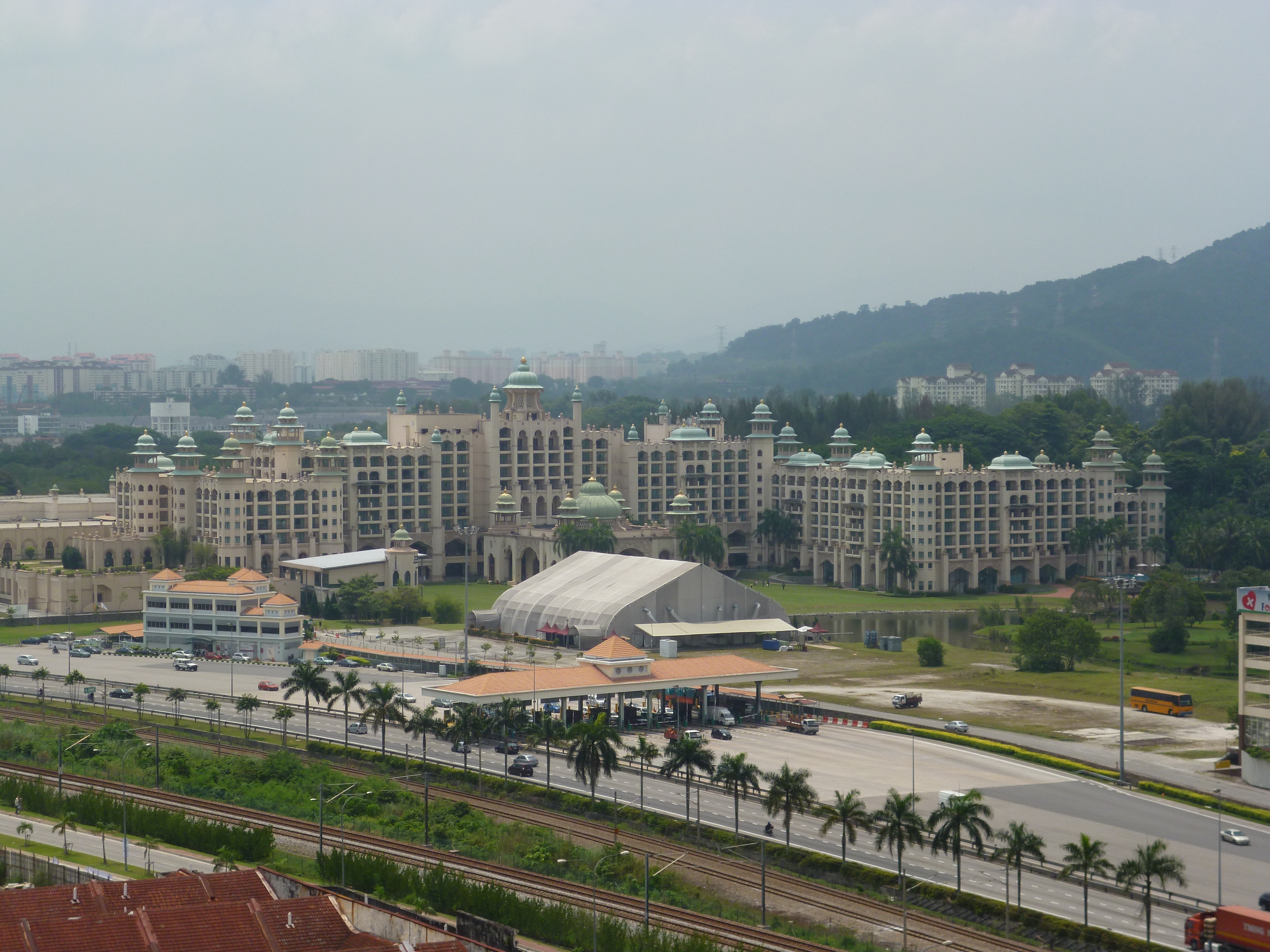
Mines Wellness City, formerly known as Mines Resort City, is an integrated Health and Wellness resort township in Seri Kembangan, Selangor, Malaysia. Background The land was formerly the world's largest open cast tin mine. Currently the development consists of: * Palace of the Golden Horses - a luxury hotel; * Mines Wellness Hotel - healthcare-oriented hotel; * The Australian International School Malaysia (AISM); * Golden Horses Health Sanctuary; * The Mines shopping mall; * Mines Waterfront Business Park; * Mines Resort & Golf Club; * Mines International Exhibition Convention Centre (MIECC); and * The Heritage Residences and Retail * Philea It is both an expansion and transformation of the former Mines Resort City. The expansion of the city is part of the government's Economic Transformation Plan (ETP) which is spearheaded by PEMANDU (Performance Management and Delivery Unit), under the Prime Minister's Department. It was announced on 11 January 2011 by the prime minister of ... [...More Info...] [...Related Items...] OR: [Wikipedia] [Google] [Baidu] |
Cheras, Kuala Lumpur
Cheras (; Pha̍k-fa-sṳ: Tsiâu-lai) is a suburban and a district, straddling both the Federal Territory of Kuala Lumpur and Hulu Langat District in the state of Selangor, Malaysia. The township is located to the south-east of downtown Kuala Lumpur. Cheras is also adjacent to Ampang to the north and Kajang to the south, both of which are major towns within the metropolitan area of taman sgr perdana cheras.Ayu Aziz. (2003, February). Rediscovering Cheras. Malaysian Business,01. , from ProQuest Asian Business and Reference. (Document ID: 299258681). The district mainly consist of Chinese residents, which also make up the majority of voters for the Cheras electorate. Cheras name may origin from the Cheras dynasty from India. Cholas , Cheran and Pandiyan are 3 dynasty which was ruling south India during the year 800 to 1300. The Cholas came to Malaysia , Indonesia and IndoChina. The name of Cheras may origin from the Cheras kingdom in india. We can refer to Cheras dynasty ... [...More Info...] [...Related Items...] OR: [Wikipedia] [Google] [Baidu] |
Bandar Tasik Selatan
Bandar Tasik Selatan () (English: South Lake City) is a township in Sungai Besi, Kuala Lumpur, Malaysia. It was established in 1991. Transportation Bandar Tasik Selatan is notable for the coterminous Bandar Tasik Selatan railway station, which is a rail interchange with Intercity, KTM Komuter, LRT and KLIA Transit (airport express) services serving this station. The township is also served by the Terminal Bersepadu Selatan Bus Terminal (TBS). Bus services * : Bandar Tasik Selatan station - MRT Taman Connaught * : Desa Tasik - Hospital Universiti Kebangsaan Malaysia (HUKM) via Bandar Tasik Selatan station - Desa Tasik Besides the Tasik Selatan station, the Bandar Tasik Selatan Integrated Transport Terminal which includes the TBS Bus terminal intends as one of the major bus A bus (contracted from omnibus, with variants multibus, motorbus, autobus, etc.) is a road vehicle that carries significantly more passengers than an average car or van. It is most commonly used in p ... [...More Info...] [...Related Items...] OR: [Wikipedia] [Google] [Baidu] |
Universiti Putra Malaysia
University of Putra Malaysia ( Malay: ''Universiti Putra Malaysia''), abbreviated as UPM, is a Malaysian public research university located in Serdang, Selangor. Formerly it was named Universiti Pertanian Malaysia (Agricultural University of Malaysia), focusing on agricultural sciences and related fields. Since the 1990s, the fields of study have expanded to include human ecology, languages, architecture, medicine, computer science and biotechnology. Currently there are 15 faculties, 11 institutes and 2 schools covering these as well as agriculture, forestry, veterinary medicine, economics, engineering, sciences, and education. UPM has been recognised as a research university since 2006, one of five present in Malaysia. In 2010, self-accreditation status was awarded by Malaysian Qualifications Agency to simplify the procedure of accrediting academic programs, strengthening its own Internal Quality Assurance (IQA) system to compete among local universities. It is ranked 123rd ... [...More Info...] [...Related Items...] OR: [Wikipedia] [Google] [Baidu] |
North–South Expressway Southern Route
The North–South Expressway Southern Route is an interstate controlled-access highway running parallel to the southwestern coast of Peninsular Malaysia. The expressway forms the south section of the North–South Expressway, connecting the states of Selangor, Negeri Sembilan, Malacca and Johor. It begins at Seri Kembangan, near the state/territory boundary between Selangor and Kuala Lumpur and travels southwards to end at Pandan-Tebrau in Johor. The expressway is the third longest in Peninsular Malaysia, after its northern counterpart and the East Coast Expressway. The Kilometre Zero of the entire expressway is located at the Pandan Interchange with the Johor Bahru Eastern Dispersal Link Expressway. Route background Sungai Besi to Nilai North The expressway begins at the Sungai Besi toll plaza. The Kuala Lumpur–Seremban Expressway links Sungai Besi toll plaza to Jalan Istana and the Besraya Expressway near the Sungai Besi RMAF base. This section is a six-lane carriageway. ... [...More Info...] [...Related Items...] OR: [Wikipedia] [Google] [Baidu] |
Kuala Lumpur
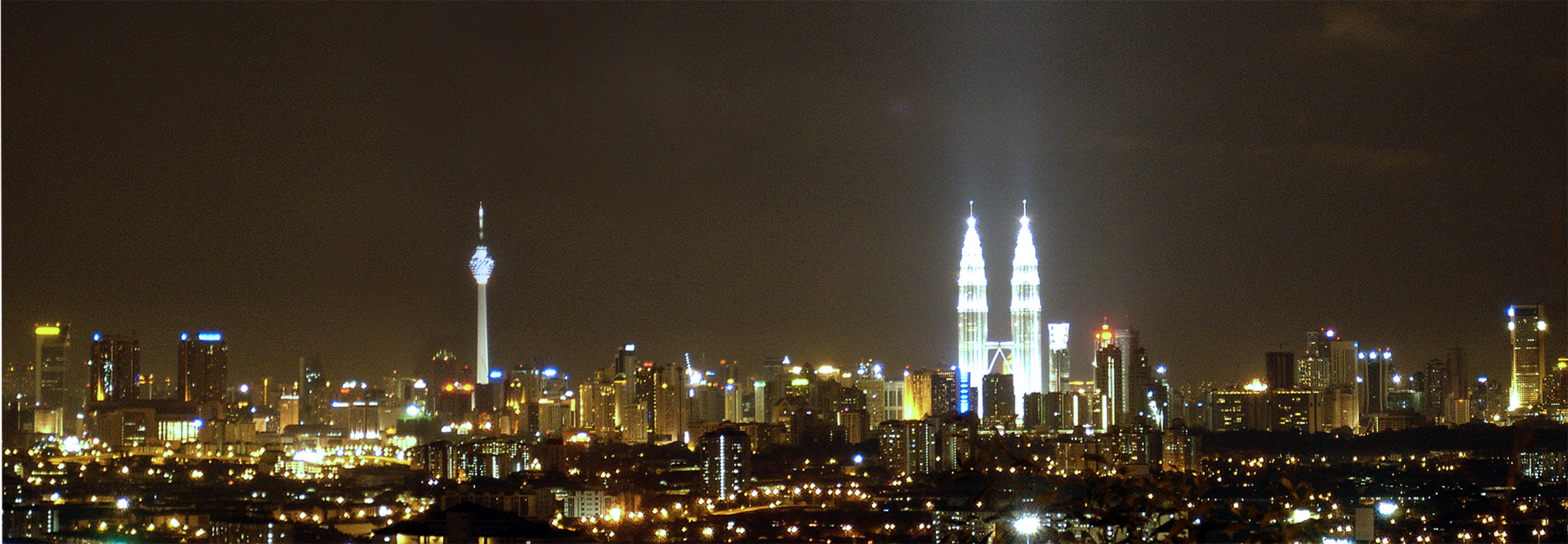
, anthem = '' Maju dan Sejahtera'' , image_map = , map_caption = , pushpin_map = Malaysia#Southeast Asia#Asia , pushpin_map_caption = , coordinates = , subdivision_type = Country , subdivision_name = , subdivision_type1 = Administrative areas , subdivision_name1 = , established_title = Establishment , established_date = 1857 , established_title2 = City status , established_date2 = 1 February 1972 , established_title3 = Transferred to federal jurisdiction , established_date3 = 1 February 1974 , government_type = Federal administrationwith local government , governing_body = Kuala Lumpur City Hall , leader_title = Mayor , leader_name = Mahadi bin Che Ngah , total_type = Federal territory , area_footnotes = , area_total_km2 = 2 ... [...More Info...] [...Related Items...] OR: [Wikipedia] [Google] [Baidu] |
Peninsular Malaysia
Peninsular Malaysia ( ms, Semenanjung Malaysia; Jawi: سمننجڠ مليسيا), or the States of Malaya ( ms, Negeri-negeri Tanah Melayu; Jawi: نڬري-نڬري تانه ملايو), also known as West Malaysia or the Malaysian Peninsula, is the part of Malaysia that occupies the southern half of the Malay Peninsula in Southeast Asia and the nearby islands. Its area totals , which is nearly 40% of the total area of the country; the other 60% is in East Malaysia. For comparison, it is slightly larger than England (130,395 km2). It shares a land border with Thailand to the north and a maritime border with Singapore to the south. Across the Strait of Malacca to the west lies the island of Sumatra, and across the South China Sea to the east lie the Natuna Islands of Indonesia. At its southern tip, across the Strait of Johor, lies the island country of Singapore. Peninsular Malaysia accounts for the majority (roughly 81.3%) of Malaysia's population and economy; as of 2017, it ... [...More Info...] [...Related Items...] OR: [Wikipedia] [Google] [Baidu] |
Klang Valley
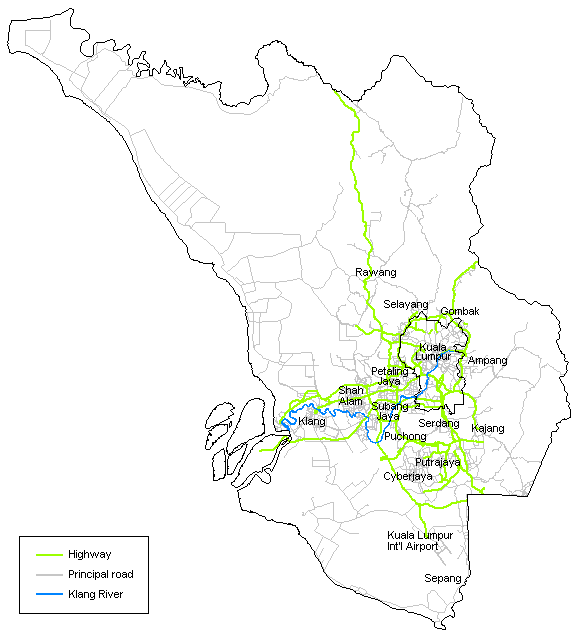
Klang Valley ( ms, Lembah Klang; zh, 巴生谷; ) is an urban conglomeration in Malaysia that is centered in the federal territories of Kuala Lumpur and Putrajaya, and includes its adjoining cities and towns in the state of Selangor. It is conterminous with Greater Kuala Lumpur, although there are variations between the two. The Klang Valley is geographically delineated by the Titiwangsa Mountains to the north and east and the Strait of Malacca to the west. It extends to Rawang in the northwest, Semenyih in the southeast, and Klang and Port Klang in the southwest. The conurbation is the heartland of Malaysia's industry and commerce. As of 2020, the Klang Valley is home to roughly 8 million people. Origin The valley is named after the Klang River, the principal river that flows through it that starts at Klang Gates Quartz Ridge in Gombak and flows into the Straits of Malacca in Port Klang, The river is closely linked to the early development of the area as a cluster of tin ... [...More Info...] [...Related Items...] OR: [Wikipedia] [Google] [Baidu] |
Controlled-access Highway
A controlled-access highway is a type of highway that has been designed for high-speed vehicular traffic, with all traffic flow—ingress and egress—regulated. Common English terms are freeway, motorway and expressway. Other similar terms include ''throughway'' and '' parkway''. Some of these may be limited-access highways, although this term can also refer to a class of highways with somewhat less isolation from other traffic. In countries following the Vienna convention, the motorway qualification implies that walking and parking are forbidden. A fully controlled-access highway provides an unhindered flow of traffic, with no traffic signals, intersections or property access. They are free of any at-grade crossings with other roads, railways, or pedestrian paths, which are instead carried by overpasses and underpasses. Entrances and exits to the highway are provided at interchanges by slip roads (ramps), which allow for speed changes between the highway and arterials ... [...More Info...] [...Related Items...] OR: [Wikipedia] [Google] [Baidu] |


%2C_Kuala_Lumpur.jpg)

_Nilai_(Exit_215)_2.jpg)


