|
Sunderland Bridge, County Durham
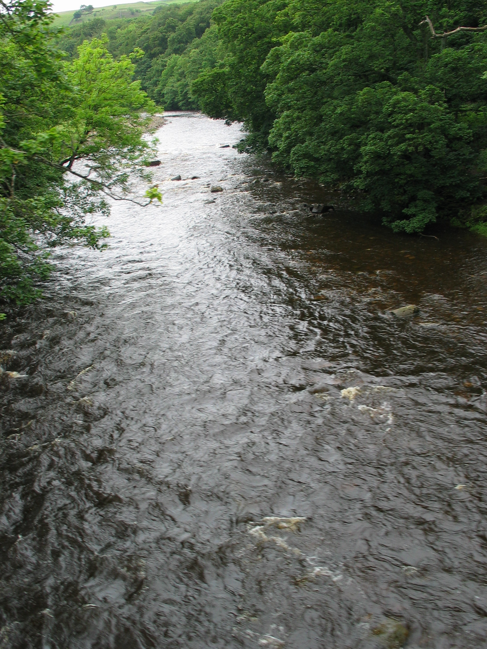
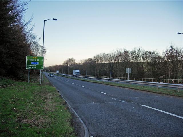
Sunderland Bridge is a bridge just outside the village also called Sunderland Bridge in County Durham, England. It lies close to the confluence of the River Wear and River Browney. Sunderland Bridge originally carried the Great North Road (A1) across the River Wear, and probably dates back to the 14th century. It is built of dressed sandstone with four semicircular arches. The bridge has undergone several rebuilds, with the end arches being rebuilt in 1770, the parapets widened in 1822, and new end walls built in the 19th century. It is a grade I listed structure. When a new bridge was needed as the existing bridge was not wide enough to cope with traffic, Croxdale Bridge was constructed to the east of the existing bridge. The A1 at this point was later re-designated as the A167, and Croxdale Bridge continues to carry this road. Sunderland Bridge now carries very little road traffic after Durham County Council closed off the old route of the Great North Road at local request. ... [...More Info...] [...Related Items...] OR: [Wikipedia] [Google] [Baidu] |
Sunderland Bridge (village)
Sunderland Bridge is a village and former civil parish, now in the parish of Croxdale and Hett, in the County Durham district, in the ceremonial county of Durham, England. It is about south of Durham city. In 1961 the parish had a population of 907. The village takes its name from a grade I listed bridge just outside the village. Sunderland meaning sundered or separated land, in this case parish lands separated from the parish of St. Oswald's in Durham City, by the River Wear. The village is home to St. Bartholomew's Church, a Victorian church built between 1843 and 1846 (by George Pickering) and extended between 1876 and 1878 (by C.H. Fowler), with the addition of a new nave and chancel. The church was built to serve the new settlement of Croxdale Colliery which had rapidly developed less than half a mile south of the village to house workers for the new mine workings in the area (now simply known as Croxdale). The land for the church was given by the Salvin family of nearby Cr ... [...More Info...] [...Related Items...] OR: [Wikipedia] [Google] [Baidu] |
County Durham
County Durham ( ), officially simply Durham,UK General Acts 1997 c. 23Lieutenancies Act 1997 Schedule 1(3). From legislation.gov.uk, retrieved 6 April 2022. is a ceremonial county in North East England.North East Assembly �About North East England. Retrieved 30 November 2007. The ceremonial county spawned from the historic County Palatine of Durham in 1853. In 1996, the county gained part of the abolished ceremonial county of Cleveland.Lieutenancies Act 1997 . Retrieved 27 October 2014. The county town is the of |
River Wear
The River Wear (, ) in North East England rises in the Pennines and flows eastwards, mostly through County Durham to the North Sea in the City of Sunderland. At long, it is one of the region's longest rivers, wends in a steep valley through the cathedral city of Durham and gives its name to Weardale in its upper reach and Wearside by its mouth. Etymology The origin behind the hydronym ''Wear'' is uncertain but is generally understood to be Celtic. The ''River Vedra'' on the Roman Map of Britain may very well be the River Wear. The name may be derived from Brittonic ''*wejr'' (<''*wẹ:drā''), which meant "a bend" (c.f ''-gwair-''). An alternative but very problematic etymology might involve ''*wẹ:d-r-'', from a lengthened form of the |
River Browney
The River Browney is a river in County Durham, England, and the largest tributary of the River Wear. The River Browney rises from a spring in Head Plantation, on the eastern slope of Skaylock Hill, about a mile south east of Waskerley. The spring rises approximately from a tributary stream to the River Wear, in an area of moorland, forestry and springs, and of disused coal mines, quarries and mineral railway lines, remnants of an industrial past. Running eastwards towards Lanchester, the river skirts to the south of the village. Continuing eastwards past Langley Park and Witton Gilbert, the river then turns south and skirts the western edge of Durham. The Browney is joined by the River Deerness north of Langley Moor and finally joins the Wear to the south of Durham, close to Sunderland Bridge. Until the last ice age, the Browney entered the River Wear just north of Durham City, in Pelaw Woods. The Browney was contaminated by local industry, particularly lead and coal mini ... [...More Info...] [...Related Items...] OR: [Wikipedia] [Google] [Baidu] |
A1 Road (Great Britain)
The A1 is the longest numbered road in the UK, at . It connects Greater London, London, the capital of England, with Edinburgh, the capital of Scotland. It passes through or near North London, Hatfield, Hertfordshire, Hatfield, Welwyn Garden City, Stevenage, Baldock, Letchworth, Letchworth Garden City, Biggleswade, St Neots, Huntingdon, Peterborough, Stamford, Lincolnshire, Stamford, Grantham, Newark-on-Trent, Retford, Doncaster, York, Pontefract, Wetherby, Ripon, Darlington, Durham, England, Durham, Sunderland, Tyne and Wear, Sunderland, Gateshead, Newcastle upon Tyne, Morpeth, Northumberland, Morpeth, Alnwick and Berwick-upon-Tweed. It was designated by the Department for Transport, Ministry of Transport in 1921, and for much of its route it followed various branches of the historic Great North Road (Great Britain), Great North Road, the main deviation being between Boroughbridge and Darlington. The course of the A1 has changed where towns or villages have been bypass (road), ... [...More Info...] [...Related Items...] OR: [Wikipedia] [Google] [Baidu] |
Sandstone
Sandstone is a clastic sedimentary rock composed mainly of sand-sized (0.0625 to 2 mm) silicate grains. Sandstones comprise about 20–25% of all sedimentary rocks. Most sandstone is composed of quartz or feldspar (both silicates) because they are the most resistant minerals to weathering processes at the Earth's surface. Like uncemented sand, sandstone may be any color due to impurities within the minerals, but the most common colors are tan, brown, yellow, red, grey, pink, white, and black. Since sandstone beds often form highly visible cliffs and other topographic features, certain colors of sandstone have been strongly identified with certain regions. Rock formations that are primarily composed of sandstone usually allow the percolation of water and other fluids and are porous enough to store large quantities, making them valuable aquifers and petroleum reservoirs. Quartz-bearing sandstone can be changed into quartzite through metamorphism, usually related to ... [...More Info...] [...Related Items...] OR: [Wikipedia] [Google] [Baidu] |
Parapet
A parapet is a barrier that is an extension of the wall at the edge of a roof, terrace, balcony, walkway or other structure. The word comes ultimately from the Italian ''parapetto'' (''parare'' 'to cover/defend' and ''petto'' 'chest/breast'). Where extending above a roof, a parapet may simply be the portion of an exterior wall that continues above the edge line of the roof surface, or may be a continuation of a vertical feature beneath the roof such as a fire wall or party wall. Parapets were originally used to defend buildings from military attack, but today they are primarily used as guard rails, to conceal rooftop equipment, reduce wind loads on the roof, and to prevent the spread of fires. In the Bible the Hebrews are obligated to build a parapet on the roof of their houses to prevent people falling (Deuteronomy 22:8). Parapet types Parapets may be plain, embattled, perforated or panelled, which are not mutually exclusive terms. *Plain parapets are upward extensions of ... [...More Info...] [...Related Items...] OR: [Wikipedia] [Google] [Baidu] |
Listed Building
In the United Kingdom, a listed building or listed structure is one that has been placed on one of the four statutory lists maintained by Historic England in England, Historic Environment Scotland in Scotland, in Wales, and the Northern Ireland Environment Agency in Northern Ireland. The term has also been used in the Republic of Ireland, where buildings are protected under the Planning and Development Act 2000. The statutory term in Ireland is " protected structure". A listed building may not be demolished, extended, or altered without special permission from the local planning authority, which typically consults the relevant central government agency, particularly for significant alterations to the more notable listed buildings. In England and Wales, a national amenity society must be notified of any work to a listed building which involves any element of demolition. Exemption from secular listed building control is provided for some buildings in current use for worship, ... [...More Info...] [...Related Items...] OR: [Wikipedia] [Google] [Baidu] |
Croxdale Bridge
Croxdale is a village in the civil parish of Croxdale and Hett, situated about south of Durham City, in County Durham , England and on the A167 road, formerly part of the Great North Road. It is on the route of the East Coast Main Line and at one time had a station. The railway crosses over Croxdale Viaduct, built in 1872, just north of the village. The Weardale Way long distance footpath passes through the nearby Croxdale Hall estate. History The village originates from a small settlement around Croxdale Hall which is about half a mile to the north east of the modern village. First mentioned in records as Crokesteil in 1195 the name may come from a Viking named Krokr and the shape of the river bends that meander like a tail. Ownership of Croxdale dates back to 1291 when it was owned by a Roger Routhberi. By the 1350s ownership of Croxdale had passed to Robert de Whalton a treasurer of Brittany. De Whalton's granddaughter Agnes married a Gerard Salvin in 1409 and the Croxdale es ... [...More Info...] [...Related Items...] OR: [Wikipedia] [Google] [Baidu] |
A167 Road
The A167 and A167(M) is a road in North East England. It is partially a trunk road and partially a motorway, where it is commonly referred to as Newcastle Central Motorway. Most of the road’s route was formerly that of the A1, until it was re-routed with the opening of the A1(M) in the 1960s. Route The route starts from the A168 at Topcliffe, North Yorkshire and runs to Cowgate, Tyne and Wear where the route splits in two. The northern fork continues to Kenton Bar, where it meets the A1 and the A696, while the southern fork heads west, again terminating at the A1, this time at Westerhope. From the Topcliffe A168 Junction, the route runs north through Northallerton, and crosses the A66 road just east of the A66(M) section. It runs on through Darlington, across A1(M) junction 59, and on to Newton Aycliffe, Ferryhill, Durham and Chester-le-Street. The A167 bypass at Chilton near Ferryhill was completed and opened to traffic on 20 June 2005. Construction had started in ... [...More Info...] [...Related Items...] OR: [Wikipedia] [Google] [Baidu] |
Brandon And Byshottles
Brandon and Byshottles is a civil parish and electoral ward in County Durham, England. According to the 2001 census it had a population of 17,774 increasing to 18,509 at the 2011 Census. The parish includes Brandon, New Brancepeth, Broompark, Langley Moor, Ushaw Moor, Meadowfield, Waterhouses and Esh Winning. Unusually, the parish shares jurisdiction over a quarry south of Esh Winning, with the neighbouring parish of Brancepeth. For electoral purposes the parish is divided into wards; * Central Ward (includes Brandon) - elects four parish councillors * East Ward (includes Langley Moor) - elects three parish councillors * North Ward (includes New Brancepeth) - elects three parish councillors * South Ward (includes Meadowfield and Browney) - elects three parish councillors * Ushaw Moor Ward (includes Ushaw Moor and Broompark) - elects four parish councillors * West Ward (includes Esh Winning and Waterhouses) - elects four parish councillors Currently, a majority of the Counc ... [...More Info...] [...Related Items...] OR: [Wikipedia] [Google] [Baidu] |
Croxdale And Hett
Croxdale and Hett is a civil parish in County Durham, England. It is situated approximately four miles south of Durham. The population of the civil parish as taken at the 2011 census was 866. The parish comprises the settlements of: * Croxdale * Hett * Sunderland Bridge For electoral purposes the parish is divided into two wards: * Hett — covers the village of Hett and elects three parish councillors. * Sunderland Bridge — covers the villages of Croxdale and Sunderland Bridge and elects six parish councillors. Labour currently has a majority on the parish council. History The parish was formed on 1 April 1986 from the parishes of Hett, Sunderland Bridge and part of Spennymoor Spennymoor is a town and civil parish in County Durham (district), County Durham, England. It is south of the River Wear and is south of Durham, England, Durham. The civil parish includes the villages of Kirk Merrington, Middlestone Moor, Byers .... References External links Civil par ... [...More Info...] [...Related Items...] OR: [Wikipedia] [Google] [Baidu] |


Saunders_Quarry-1.jpg)


