|
Summerlands, Victoria
Summerlands is a locality and a former residential subdivision on Phillip Island in Victoria, Australia, located in the south-west corner of the island, close to a little penguin breeding colony. In 1985, the Victorian government decided that, to protect the penguin rookery, further development of the subdivision would be prohibited and all the properties would be progressively purchased by the state. History In the early 20th century, the Summerland Peninsula had remained relatively untouched by European settlement compared to the rest of the island. Although chicory, mustard and oats for horse fodder were grown there, the land was of minimal pastoral or agricultural value. As a result, the penguin colony there survived while others on the island did not. Subdivision of the area was carried out from the 1920s until the 1960s. The first subdivision consisted of 12 large allotments, along with features such as a roundabout and cypress trees that were still visible decades later. ... [...More Info...] [...Related Items...] OR: [Wikipedia] [Google] [Baidu] |
Melbourne
Melbourne ( ; Boonwurrung/Woiwurrung: ''Narrm'' or ''Naarm'') is the capital and most populous city of the Australian state of Victoria, and the second-most populous city in both Australia and Oceania. Its name generally refers to a metropolitan area known as Greater Melbourne, comprising an urban agglomeration of 31 local municipalities, although the name is also used specifically for the local municipality of City of Melbourne based around its central business area. The metropolis occupies much of the northern and eastern coastlines of Port Phillip Bay and spreads into the Mornington Peninsula, part of West Gippsland, as well as the hinterlands towards the Yarra Valley, the Dandenong and Macedon Ranges. It has a population over 5 million (19% of the population of Australia, as per 2021 census), mostly residing to the east side of the city centre, and its inhabitants are commonly referred to as "Melburnians". The area of Melbourne has been home to Aboriginal ... [...More Info...] [...Related Items...] OR: [Wikipedia] [Google] [Baidu] |
Summerland Peninsula
The Summerland Peninsula is located at the western end of Phillip Island in Victoria, Australia. The peninsula lies within the Gippsland Plain Bioregion and is a site of high conservation significance. As part of a protected area the peninsula supports a diverse array of animal and plant life, including a number of species listed as of conservation concern by international, federal and state bodies including the International Union for the Conservation of Nature, Environment Protection and Biodiversity Conservation Act 1999 (EPBC Act), the Flora and Fauna Guarantee Act 1988 (FFG Act) and it is a BirdLife International Important Bird Area.Phillip Island Nature Parks Department of Environment. (2012).Environment Plan 2012 - 2017 (PDF) ''Phillip Island Nature Parks''. Retrieved 2016-05-01. It is home to one of the largest Little Penguin (''Eudyptula minor'') breeding colonies in Australia, the second largest breeding colony of Australian Fur Seals (''Arctocephalus pusillus doriferus ... [...More Info...] [...Related Items...] OR: [Wikipedia] [Google] [Baidu] |
Phillip Island
Phillip Island (Boonwurrung: ''Corriong'', ''Worne'' or ''Millowl'') is an Australian island about south-southeast of Melbourne, Victoria. The island is named after Governor Arthur Phillip, the first Governor of New South Wales, by explorer and seaman George Bass, who sailed in an whaleboat, arriving from Sydney on 5 January 1798. Phillip Island forms a natural breakwater for the shallow waters of the Western Port. It is long and wide, with an area of about . It has of coastline and is part of the Bass Coast Shire. A concrete bridge (originally a wooden bridge) connects the mainland town San Remo with the island town Newhaven. In the 2016 census, the island's permanent population was 10,387, compared to 7,071 in 2001.2001 Population Statistics Bass Coast Shire Council Website Durin ... [...More Info...] [...Related Items...] OR: [Wikipedia] [Google] [Baidu] |
Phillip Island Nature Park
Phillip Island Nature Park (PINP) is a conservation park located on Phillip Island, Victoria, Australia. Created in 1996, the park is owned by the Victorian State Government, however it is a self-funding commercial attraction for the purpose of animal conservation and research. An oil spill off the island in January, 2000 led to a worldwide appeal for hand knit penguin sweaters. Located 1.5 hours drive south of Melbourne, PINP covers several separate areas over 1805 hectares. The parks include Pyramid Rock, Rhyll Inlet, Seal Rocks, and Cape Woolamai, with specific viewing and attraction areas that include the Nobbies Centre (seals, dolphins, and shark viewing), the Penguin Parade (little penguins coming ashore at dusk), Koala Conservation Centre, and the Churchill Island Heritage Farm. Phillip Island’s Penguin Paradeis the only commercial venue in the world where you can see penguins in their own environment and attracts tourists from different parts of the world. The Koala C ... [...More Info...] [...Related Items...] OR: [Wikipedia] [Google] [Baidu] |
Nobbies Centre
The Nobbies Centre is an ecotourism destination located at Point Grant, on the western tip of Phillip Island, Victoria, Australia. Once known as the Seal Rocks Sea Life Centre, the centre is managed by the Phillip Island Nature Park, and features educational displays, a cafe, a children's play area, and a gift shop. Overlooking Seal Rocks, Australia’s largest colony of fur seals, with an estimated 16,000 inhabiting the area, around half a million people visit the centre yearly, with 53% being international visitors. A network of boardwalks outside the centre allow visitors to view the seal colony, The Nobbies, and The Blowhole. History Work towards a privately developed marine centre at Point Grant commenced in January 1995 where a call for tenders was made by the Kennett Government. The winner was Seal Rocks Victoria Australia Pty Ltd (SRVA), which signed a 25-year build-operate-transfer contract with the State of Victoria in March 1997. The centre opened in April 1998 as th ... [...More Info...] [...Related Items...] OR: [Wikipedia] [Google] [Baidu] |
Cypress
Cypress is a common name for various coniferous trees or shrubs of northern temperate regions that belong to the family Cupressaceae. The word ''cypress'' is derived from Old French ''cipres'', which was imported from Latin ''cypressus'', the latinisation of the Greek κυπάρισσος (''kyparissos''). Cypress trees are a large classification of conifers, encompassing the trees and shrubs from the cypress family (Cupressaceae) and many others with the word “cypress” in their common name. Many cypress trees have needle-like, evergreen foliage and acorn-like seed cones. Species Species that are commonly known as cypresses include: Most prominently: *Cypress (multiple species within the genus '' Cupressus'') Otherwise: *African cypress (''Widdringtonia'' species), native to Southern Africa *Bald, Pond, and Montezuma cypresses (''Taxodium'' species), native to North America *Chinese swamp cypress (''Glyptostrobus pensilis''), Vietnam, critically endangered *Cordilleran ... [...More Info...] [...Related Items...] OR: [Wikipedia] [Google] [Baidu] |
Roundabout
A roundabout is a type of circular intersection or junction in which road traffic is permitted to flow in one direction around a central island, and priority is typically given to traffic already in the junction.''The New Shorter Oxford English Dictionary,'' Volume 2, Clarendon Press, Oxford (1993), page 2632 Engineers use the term modern roundabout to refer to junctions installed after 1960 that incorporate various design rules to increase safety. Both modern and non-modern roundabouts, however, may bear street names or be identified colloquially by local names such as rotary or traffic circle. Compared to stop signs, traffic signals, and earlier forms of roundabouts, modern roundabouts reduce the likelihood and severity of collisions greatly by reducing traffic speeds and minimizing T-bone and head-on collisions. Variations on the basic concept include integration with tram or train lines, two-way flow, higher speeds and many others. For pedestrians, traffic exiting th ... [...More Info...] [...Related Items...] OR: [Wikipedia] [Google] [Baidu] |
Mustard Plant
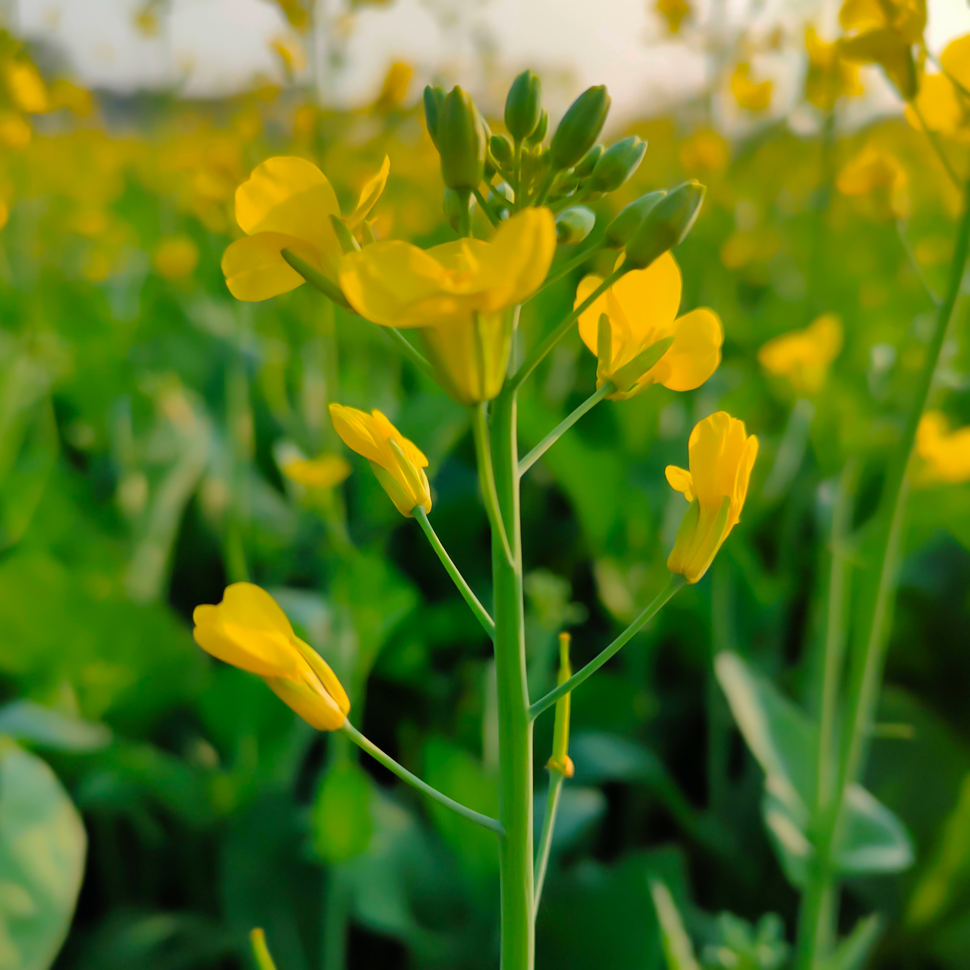
The mustard plant is any one of several plant species in the genera ''Brassica'' and ''Sinapis'' in the family Brassicaceae (the mustard family). Mustard seed is used as a spice. Grinding and mixing the seeds with water, vinegar, or other liquids creates the yellow condiment known as Mustard (condiment), prepared mustard. The seeds can also be pressed to make mustard oil, and the edible leaves can be eaten as Brassica juncea, mustard greens. Many vegetables are cultivated varieties of mustard plants; domestication may have begun 6,000 years ago. History Although some varieties of mustard plants were well-established crops in Hellenistic and Roman Empire, Roman times, Zohary and Hopf note, "There are almost no Archaeology, archeological records available for any of these crops." Wild forms of mustard and its relatives, the radish and turnip, can be found over West Asia and Europe, suggesting their domestication took place somewhere in that area. However, Zohary and Hopf conclu ... [...More Info...] [...Related Items...] OR: [Wikipedia] [Google] [Baidu] |
Chicory
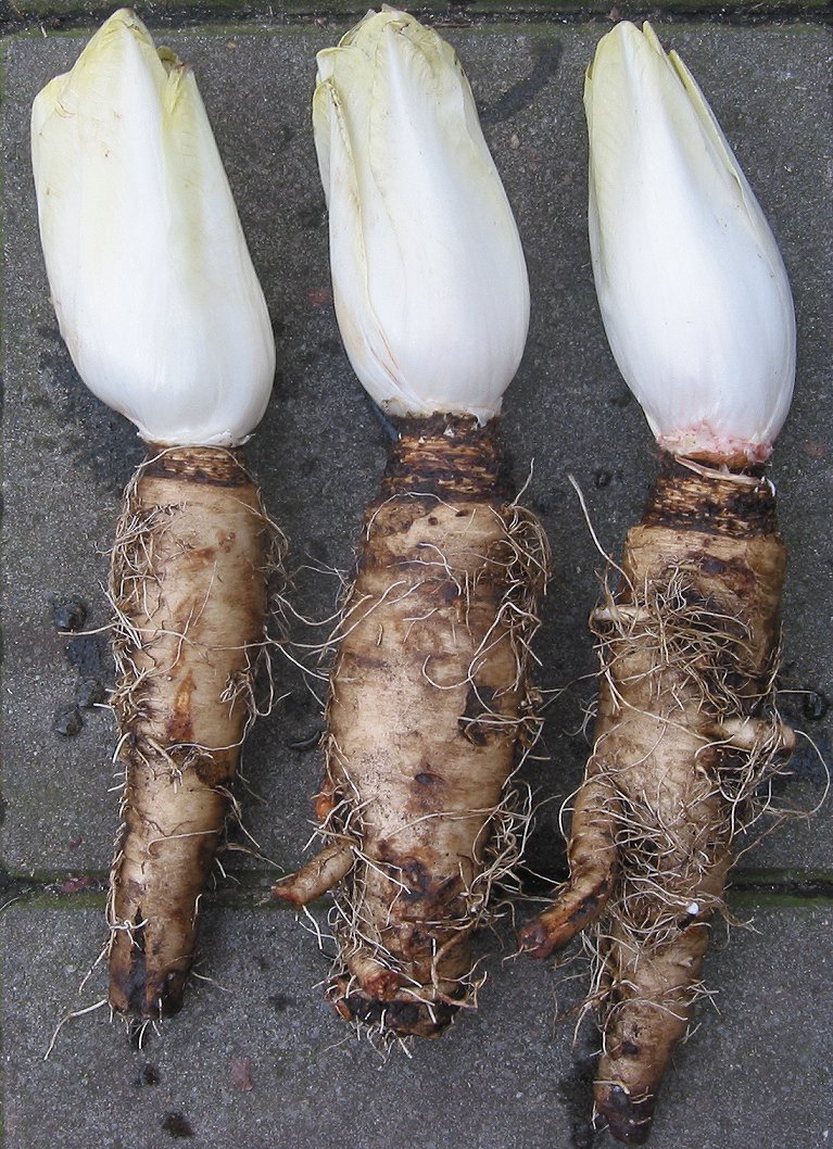
Common chicory ('' Cichorium intybus'') is a somewhat woody, perennial herbaceous plant of the family Asteraceae, usually with bright blue flowers, rarely white or pink. Native to the Old World, it has been introduced to North America and Australia. Many varieties are cultivated for salad leaves, chicons ( blanched buds), or roots (var. ''sativum''), which are baked, ground, and used as a coffee substitute and food additive. In the 21st century, inulin, an extract from chicory root, has been used in food manufacturing as a sweetener and source of dietary fiber. Chicory is grown as a forage crop for livestock. "Chicory" is also the common name in the United States for curly endive ('' Cichorium endivia''); these two closely related species are often confused. Description When flowering, chicory has a tough, grooved, and more or less hairy stem. It can grow to tall. The leaves are stalked, lanceolate and unlobed; they range from in length (smallest near the top) and wide. The ... [...More Info...] [...Related Items...] OR: [Wikipedia] [Google] [Baidu] |
Government Of Victoria (Australia)
The Victoria State Government, also referred to as just the Victorian Government, is the state-level authority for Victoria, Australia. Like all state governments, it is formed by three independent branches: the executive, the judicial, and the parliament. As a parliamentary constitutional monarchy, the State Government was first formed in 1851 when Victoria first gained the right to responsible government. The Constitution of Australia regulates the relationship between the Victorian Government and the Australian Government, and cedes legislative and judicial supremacy to the federal government on conflicting matters. The Victoria State Government enforces acts passed by the parliament through government departments, statutory authorities, and other public agencies. The Government is formally presided over by the Governor, who exercises executive authority granted by the state's constitution through the Executive Council, a body consisting of senior cabinet ministers. In re ... [...More Info...] [...Related Items...] OR: [Wikipedia] [Google] [Baidu] |
Wonthaggi, Victoria
Wonthaggi is a seaside town located south east of Melbourne via the South Gippsland and Bass Highways, in the Bass Coast Shire of Gippsland, Victoria, Australia. Known originally for its coal mining, it is now the largest town in South Gippsland, a regional area with extensive tourism, beef and dairy industries. The name "Wonthaggi" is an Australian Aboriginal name meaning "home" from the Boonwurrung (south-central Kulin). It was used in the area some time before 1 August 1910 when the town was founded. History The Boonwurrung aboriginal people were custodians of this stretch of coast for thousands of years prior to white settlement. The Boakoolawal clan lived in the Kilcunda area south of the Bass River, and the Yowenjerre were west of the Tarwin River along what is now the Bunurong Marine and Coastal Park. Middens containing charcoal and shellfish mark the location of their campsites along the coast. Coal was discovered by explorer William Hovell at Cape Paterson in 1 ... [...More Info...] [...Related Items...] OR: [Wikipedia] [Google] [Baidu] |


