|
Sullivan Line
The Sullivan Line originally marked in 1816 forms three quarters of the border between Missouri and Iowa and an extension of it forms the remainder. The line was initially created to establish the limits of Native American territory (they would not be permitted south of it); disputes over the boundary were to erupt into the Honey War. Area prior to Sullivan's Survey In 1804, in the Treaty of St. Louis the Sac and Fox ceded Missouri north of the Gasconade River (but not their villages on the Mississippi River near Keokuk, Iowa). In 1808, in the Treaty of Fort Clark, the Osage Nation ceded all of Missouri and Arkansas west of the fort (now called Fort Osage in Jackson County, Missouri). The exact boundaries of the treaties were never formally surveyed. Resentments about the treaties caused many members of the tribe to side with the British in the War of 1812. At the conclusion of the war, the tribes in the 1815 Treaties of Portage des Sioux reaffirmed the earlier treaties. ... [...More Info...] [...Related Items...] OR: [Wikipedia] [Google] [Baidu] |
War Of 1812
The War of 1812 (18 June 1812 – 17 February 1815) was fought by the United States of America and its indigenous allies against the United Kingdom and its allies in British North America, with limited participation by Spain in Florida. It began when the United States declared war on 18 June 1812 and, although peace terms were agreed upon in the December 1814 Treaty of Ghent, did not officially end until the peace treaty was ratified by Congress on 17 February 1815. Tensions originated in long-standing differences over territorial expansion in North America and British support for Native American tribes who opposed US colonial settlement in the Northwest Territory. These escalated in 1807 after the Royal Navy began enforcing tighter restrictions on American trade with France and press-ganged men they claimed as British subjects, even those with American citizenship certificates. Opinion in the US was split on how to respond, and although majorities in both the House and ... [...More Info...] [...Related Items...] OR: [Wikipedia] [Google] [Baidu] |
Des Moines Rapids
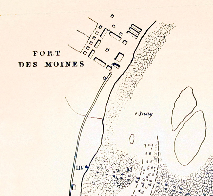
The Des Moines Rapids between Nauvoo, Illinois and Keokuk, Iowa-Hamilton, Illinois is one of two major rapids on the Mississippi River that limited Steamboat traffic on the river through the early 19th century. The rapids just above the confluence of the Des Moines River were to contribute to the Honey War in the 1830s between Missouri and Iowa over the Sullivan Line that separates the two states. Various attempts to make the river navigable started in 1837 when a channel was blasted through the rapids by U.S. Army Corps of Engineers team led by Robert E. Lee. A canal around the rapids was built in 1877. It is now obliterated by Lock and Dam No. 19. The other major rapids barring traffic on the Mississippi is the Rock Island Rapids. The Mississippi in its natural state widens from to in width at Nauvoo as it drops over over shallow limestone rocks to the confluence with Des Moines. According to records its mean depth through the rapids was and "much less" in man ... [...More Info...] [...Related Items...] OR: [Wikipedia] [Google] [Baidu] |
Magnetic Declination
Magnetic declination, or magnetic variation, is the angle on the horizontal plane between magnetic north (the direction the north end of a magnetized compass needle points, corresponding to the direction of the Earth's magnetic field lines) and true north (the direction along a meridian towards the geographic North Pole). This angle varies depending on position on the Earth's surface and changes over time. Somewhat more formally, Bowditch defines variation as “the angle between the magnetic and geographic meridians at any place, expressed in degrees and minutes east or west to indicate the direction of magnetic north from true north. The angle between magnetic and grid meridians is called grid magnetic angle, grid variation, or grivation.” By convention, declination is positive when magnetic north is east of true north, and negative when it is to the west. ''Isogonic lines'' are lines on the Earth's surface along which the declination has the same constant value, and line ... [...More Info...] [...Related Items...] OR: [Wikipedia] [Google] [Baidu] |
Farmington, Iowa
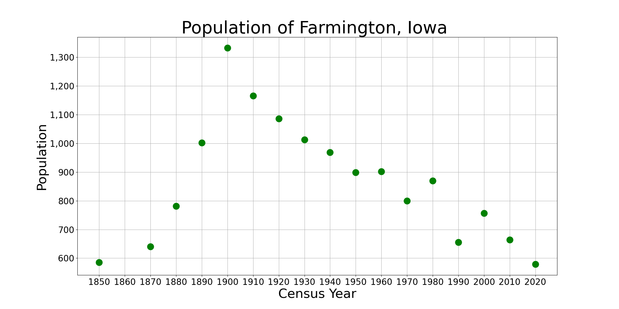
Farmington is a city in Van Buren County, Iowa, Van Buren County, Iowa, United States. The population was 579 at the time of the 2020 United States Census, 2020 census. History Farmington was laid out in 1839. It was named after Farmington, Connecticut. The town was incorporated on January 11, 1841. Farmington has suffered from several major floods of the Des Moines River, most notably in 1993, when a "500-year-flood" caused major damage to the buildings near the river, including a one-block area bordered by Walnut, Second, and Third Streets. The houses in this block were subsequently razed, and the property was purchased by the City of Farmington to create "Wild Rose City Park." Geography Farmington is located at (40.6397, -91.7394), on the left (east) bank of the Des Moines River. According to the United States Census Bureau, the city has a total area of , all land. Demographics 2010 census As of the census of 2010, there were 664 people, 299 households, and 170 families ... [...More Info...] [...Related Items...] OR: [Wikipedia] [Google] [Baidu] |
Sheridan, Missouri
Sheridan is a city in northwest Worth County, Missouri, United States, near the Platte River. The population was 195 at the 2010 census. History A post office called Sheridan has been in operation since 1887. Sheridan was the name of a local family. Geography Sheridan is located on Missouri Route 246 one mile east of the Worth county line and 3.5 miles south of the Missouri-Iowa state line. The Platte River flows past one-half mile to the east.''Missouri Atlas & Gazetteer,'' DeLorme, 1st ed., 198, p. 14 According to the United States Census Bureau, the city has a total area of , all land. Demographics 2010 census As of the census of 2010, there were 195 people, 98 households, and 52 families residing in the city. The population density was . There were 141 housing units at an average density of . The racial makeup of the city was 95.4% White, 1.5% Asian, 1.0% from other races, and 2.1% from two or more races. Hispanic or Latino of any race were 1.5% of the population. There ... [...More Info...] [...Related Items...] OR: [Wikipedia] [Google] [Baidu] |
Indian Removal Act Of 1830
The Indian Removal Act was signed into law on May 28, 1830, by United States President Andrew Jackson. The law, as described by Congress, provided "for an exchange of lands with the Indians residing in any of the states or territories, and for their removal west of the river Mississippi." During the Presidency of Jackson (1829-1837) and his successor Martin Van Buren (1837-1841) more than 60,000 Indians from at least 18 tribes were forced to move west of the Mississippi River where they were allocated new lands. The southern tribes were resettled mostly in Indian Territory (Oklahoma). The northern tribes were resettled initially in Kansas. With a few exceptions the United States east of the Mississippi and south of the Great Lakes was emptied of its Indian population. The movement westward of the Indian tribes was characterized by a large number of deaths occasioned by the hardships of the journey. Also available in reprint from thHistory News Network The U.S. Congress approve ... [...More Info...] [...Related Items...] OR: [Wikipedia] [Google] [Baidu] |
Indian Boundary Line (1816)
Indian or Indians may refer to: Peoples South Asia * Indian people, people of Indian nationality, or people who have an Indian ancestor ** Non-resident Indian, a citizen of India who has temporarily emigrated to another country * South Asian ethnic groups, referring to people of the Indian subcontinent, as well as the greater South Asia region prior to the 1947 partition of India * Anglo-Indians, people with mixed Indian and British ancestry, or people of British descent born or living in the Indian subcontinent * East Indians, a Christian community in India Europe * British Indians, British people of Indian origin The Americas * Indo-Canadians, Canadian people of Indian origin * Indian Americans, American people of Indian origin * Indigenous peoples of the Americas, the pre-Columbian inhabitants of the Americas and their descendants ** Plains Indians, the common name for the Native Americans who lived on the Great Plains of North America ** Native Americans in the U ... [...More Info...] [...Related Items...] OR: [Wikipedia] [Google] [Baidu] |
Des Moines River
The Des Moines River () is a tributary of the Mississippi River in the upper Midwestern United States that is approximately long from its farther headwaters.U.S. Geological Survey. National Hydrography Dataset high-resolution flowline dataThe National Map , accessed May 26, 2011 The largest river flowing across the state of Iowa, it rises in southern Minnesota and flows across Iowa from northwest to southeast, passing from the glaciated plains into the unglaciated hills near the capital city of Des Moines, named after the river, in the center of the state. The river continues to flow at a southeastern direction away from Des Moines, later flowing directly into the Mississippi River. The Des Moines River forms a short portion of Iowa's border with Missouri in Lee County. The Avenue of the Saints, a four-lane highway from St. Paul, Minnesota to St. Louis, Missouri, passes over this section; the highway is designated Route 27 in both Iowa and Missouri, and was completed in the ear ... [...More Info...] [...Related Items...] OR: [Wikipedia] [Google] [Baidu] |
Kansas City Downtown Airport
Charles B. Wheeler Downtown Airport is a city-owned, public-use airport serving Kansas City, Missouri. Located in Clay County, this facility is included in the National Plan of Integrated Airport Systems, which categorized it as a general aviation reliever airport. History This airport replaced Richards Field as Kansas City's main airport. It was dedicated as ''New Richards Field'' in 1927 by Charles Lindbergh and was soon renamed Kansas City Municipal Airport. Its prominent tenant was Trans World Airlines (TWA), which was headquartered in Kansas City. The airport was built in the Missouri River bottoms next to the rail tracks at the Hannibal Bridge. At the time air travel was considered to be handled in conjunction with rail traffic. The airport had limited area for expansion (Fairfax Airport across the Missouri River in Kansas City, Kansas covered a larger area). Airplanes had to avoid the Quality Hill and the Downtown Kansas City skyline south of the south end of t ... [...More Info...] [...Related Items...] OR: [Wikipedia] [Google] [Baidu] |
Kaw Point
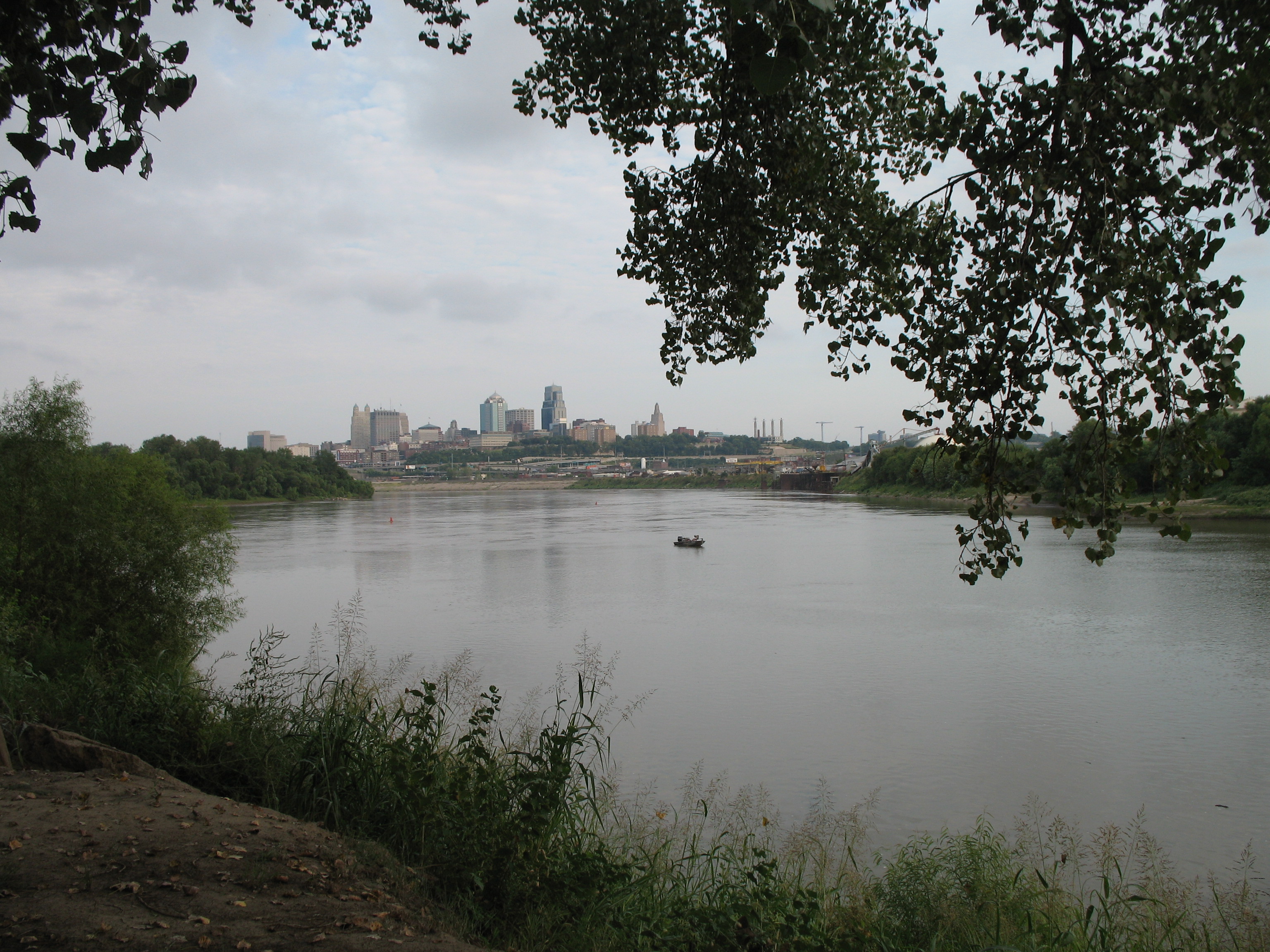
Kaw Point is the point where the Kansas River (Kaw River) terminates at the Missouri River in the West Bottoms area of Kansas City, Kansas. It is also where the Missouri River ceases its southerly course and turns to flow generally east through the state of Missouri to the Mississippi River at St. Louis. Kawsmouth is the confluence of the Kansas River and the Missouri River, south of Kaw Point. History Kaw Point is within the land originally claimed by Spain, then by France, until ultimately the United States bought it as part of the Louisiana Purchase in 1803. The Lewis and Clark Expedition party camped at Kaw Point from June 26–28, 1804, on their way from St. Louis to the Pacific Ocean. Captain William Clark wrote on June 27, 1804, that "the about the mouth of this river is fine." The expedition's journals noted that the location would be appropriate for a fort, and teemed with deer, elk, bison, bear, and many "Parrot queets", the now extinct Carolina parakeet. It is the ... [...More Info...] [...Related Items...] OR: [Wikipedia] [Google] [Baidu] |


