|
Success Park 'n' Ride
Success Park 'n' Ride was a Transperth bus station located next to the current Cockburn Central Train/Bus Interchange. It was established on 21 March 1999 and decommissioned on 22 December 2007. After that it was superseded by its nearby station in Cockburn Central. Bus routes There were two bus routes travelling to Fremantle while three bus routes travelling to the Perth City via Kwinana Freeway and the rest of them serving the nearby suburbs around the bus station. ; *133 to Beeliar *134 to Beeliar *137 to Success *139 to Banjup *193 to Banjup *194 to Booragoon bus station via Murdoch Park 'n' Ride *612 Special event services *794 to Esplanade Busport via Kwinana Freeway ; *183 to Esplanade Busport via Kwinana Freeway & Murdoch Park 'n' Ride *193 to Esplanade Busport via Kwinana Freeway ; *136 to Fremantle station *510 to Fremantle station ; *183 to Aubin Grove *188 to Murdoch Park 'n' Ride Murdoch Park 'n' Ride was a Transperth bus station located in Murdoch ... [...More Info...] [...Related Items...] OR: [Wikipedia] [Google] [Baidu] |
Success, Western Australia
Success is a southern suburb of Perth, the capital city of Western Australia, located within the City of Cockburn. The name ''Success'' comes from Captain James Stirling's ship . Urban development of Success didn't begin until the early 1990s when the Kwinana Freeway was extended to Forrest Road (now Armadale Road and Beeliar Drive). The population grew from 4,854 in the 2006 census to 10,148 in the 2016 census. Amenities and facilities Success is home to Cockburn Gateway Shopping City, which features more than 180 stores, including Kmart (replaced Target in October 2020), Coles, Woolworths, Aldi, and Big W. The shopping centre also features five alfresco dining areas. Aubin Grove railway station is located at the southeastern end of Success and services the southern end of the suburb. The northern end is serviced by Cockburn Central railway station Cockburn Central station ( ) is a bus and railway station on the Transperth network. It is located at the juncture o ... [...More Info...] [...Related Items...] OR: [Wikipedia] [Google] [Baidu] |
Public Transport Authority (Western Australia)
The Public Transport Authority (PTA) is a statutory authority that oversees the operation of all public transport in Western Australia. History The Public Transport Authority was formed on 1 July 2003 in accordance with the ''Public Transport Authority Act 2003'' as the body overseeing the provision of public transport in Western Australia. It operates bus, ferry and train services in Perth under the Transperth brand, regional road coach and train services in regional Western Australia under the Transwa brand and manages school bus services.Annual Report for year ended 30 June 2015 Public Transport Authority Services The Public Transport Authority runs many services. They are: * |
Transperth
Transperth is the brand name of the public transport system serving the city and suburban areas of Perth, the state capital of Western Australia. It is managed by the Public Transport Authority (PTA), a state government organisation. Train operations are done by Transperth Train Operations, a division of the PTA. Bus operations are contracted out to Swan Transit, Path Transit and Transdev. Ferry operations are contracted out to Captain Cook Cruises. History In August 1986, the Metropolitan Transport Trust was rebranded as Transperth. In February 1995 the provision of ferry services was contracted to Captain Cook Cruises."Competitive Tendering" ''Australian Bus Panorama'' issue 10/6 February 1995 page 20. In September 1993, the Government announced Transperth would be corporatised and opened up to competition. In February 1995 in preparation for privatisation, Transperth was restructured with the operation of services transferred to MetroBus, with ownership of the buses ... [...More Info...] [...Related Items...] OR: [Wikipedia] [Google] [Baidu] |
Cockburn Central Railway Station
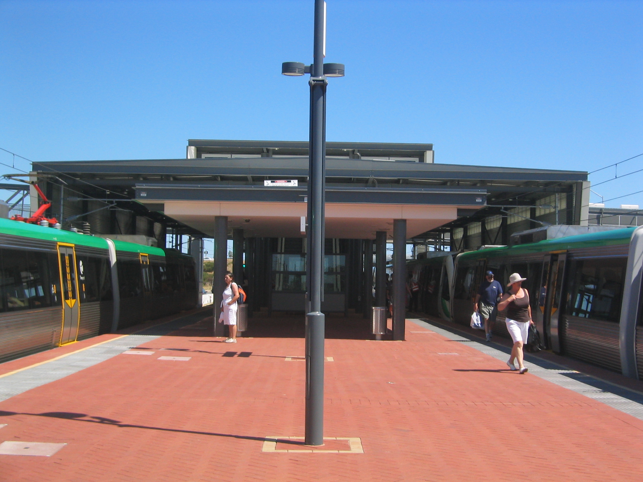
Cockburn Central station ( ) is a bus and railway station on the Transperth network. It is located at the juncture of the Mandurah andonce completed Thornlie lines, from Perth station inside the median strip of the Kwinana Freeway serving the suburb of Cockburn Central. History During planning, the station was known as Thomsons Lake station. Cockburn Central railway station was designed to subsume the nearby Success Park 'n' Ride bus station. The Park 'n' Ride was decommissioned after the railway station opened. The contract for the construction of Cockburn Central railway station, Kwinana railway station and Wellard railway station was awarded to the consortium of DORIC Constructions and Brierty Contractors in March 2005. This contract was labelled "package B", and had a cost of $32 million. Construction on the station began in mid-2005. Cockburn Central station opened along with the rest of the Mandurah line on 23 December 2007. When the station opened, Cockburn Cent ... [...More Info...] [...Related Items...] OR: [Wikipedia] [Google] [Baidu] |
Cockburn Central Railway Station, Perth
Cockburn Central station ( ) is a bus and railway station on the Transperth network. It is located at the juncture of the Mandurah andonce completed Thornlie lines, from Perth station inside the median strip of the Kwinana Freeway serving the suburb of Cockburn Central. History During planning, the station was known as Thomsons Lake station. Cockburn Central railway station was designed to subsume the nearby Success Park 'n' Ride bus station. The Park 'n' Ride was decommissioned after the railway station opened. The contract for the construction of Cockburn Central railway station, Kwinana railway station and Wellard railway station was awarded to the consortium of DORIC Constructions and Brierty Contractors in March 2005. This contract was labelled "package B", and had a cost of $32 million. Construction on the station began in mid-2005. Cockburn Central station opened along with the rest of the Mandurah line on 23 December 2007. When the station opened, Cockburn Cent ... [...More Info...] [...Related Items...] OR: [Wikipedia] [Google] [Baidu] |
Fremantle Railway Station, Perth
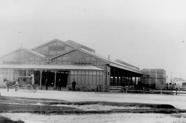
Fremantle railway station is the terminus of Transperth's Fremantle line in Western Australia. History The original Fremantle station opened in Cliff Street on 1 March 1881 as the terminus of the Eastern Railway to Guildford via Perth. As the Eastern Railway was extended its importance grew, becoming an important hub for gold miners arriving in Western Australia via ship and then travelling to the Yilgarn and Eastern Goldfields when the line opened to Kalgoorlie in 1896. In 1907, a new station and marshalling yards were established 300 metres to the north-east on the site of the former Fremantle Railway Workshops to better service the newly constructed Fremantle Harbour. The station was designed by William Dartnall, Chief Engineer of Existing Lines of the Railway Department in 1905. The construction contract, at an estimated cost of £80,000, was awarded in May 1906 to S.B. Alexander and completed on 20 April 1907, with the official opening on 1 July 1907. Originall ... [...More Info...] [...Related Items...] OR: [Wikipedia] [Google] [Baidu] |
Kwinana Freeway
The Kwinana Freeway is a freeway in and beyond the southern suburbs of Perth, Western Australia, linking central Perth with Mandurah to the south. It is the central section of State Route 2, which continues north as Mitchell Freeway to Clarkson, and south as Forrest Highway towards Bunbury. A section between Canning and Leach highways is also part of National Route 1. Along its route are interchanges with several major roads, including Roe Highway and Mandjoogoordap Drive. The northern terminus of the Kwinana Freeway is at the Narrows Bridge, which crosses the Swan River, and the southern terminus is at Pinjarra Road, east of Mandurah. Planning for the Kwinana Freeway began in the 1950s, and the first segment in South Perth was constructed between 1956 and 1959. The route has been progressively widened and extended south since then. During the 1980s, the freeway was extended to South Street in Murdoch, and in June 2001, it reached Safety Bay Road in Baldivis. Th ... [...More Info...] [...Related Items...] OR: [Wikipedia] [Google] [Baidu] |
Beeliar, Western Australia
Beeliar is a suburb of Perth, Western Australia, located within the City of Cockburn. The name refers to the Beeliar people, a group of Aboriginal Australians who had land rights over the southern half of Perth's metropolitan area. The suburb contains the Thomsons Lake Nature Reserve. "Beeliar" is a Noongar word that translates to "river" or "water running through". The suburb was named after an early settler-colonialist, Robert Menli Lyon, who recorded and interacted with the local Aboriginal group in the area circa the nineteenth century. Before European contact, the suburb was occupied by the Beeliar group of the Whadjuk nation, who are part of the broader Noongar language region. The Noongar peoples have Dreaming stories related to the creation of the landforms in Beeliar and had lore that outlined the maintenance and care of the land. Oral history records and archaeology account for the Beeliar-Noongar belonging to the Beeliar suburb and its neighbouring areas. The reg ... [...More Info...] [...Related Items...] OR: [Wikipedia] [Google] [Baidu] |
Booragoon Bus Station
Booragoon bus station is a Transperth bus station located next to the Westfield Booragoon shopping centre in Booragoon, Western Australia Booragoon is a southern suburb of Perth, Western Australia, located within the City of Melville. Booragoon is the indigenous name for the lower reaches of the Canning River. It is home to Westfield Booragoon Westfield Booragoon (former .... It has 13 stands and is served by nine Transperth routes, in addition to a number of school buses and School Special services. The original Booragoon bus station opened in September 1976. Booragoon bus station, is located at the corner of Riseley and Marmion Streets, and is the fourth bus station to have existed on the shopping centre premises, being built upon the site previously occupied by the Booragoon Hotel. Previous iterations of the bus station have existed at various locations on the premises, including at the main entrance from Riseley Street, adjacent the Booragoon Hotel (slightly we ... [...More Info...] [...Related Items...] OR: [Wikipedia] [Google] [Baidu] |
Murdoch Park 'n' Ride
Murdoch Park 'n' Ride was a Transperth bus station located in Murdoch, Western Australia. It opened on 14 December 1994 with parking for 583 cars. On 31 January 2007 it closed to facilitate the construction of Murdoch railway station, which incorporated a bus facility on a bridge structure extending over the Kwinana Freeway carriageways and train station. Transperth
Transperth is the brand name of the public transport system serving the city and suburban areas of Perth, the state capital of Western Australia. It is managed by the Public Transport Author ...
[...More Info...] [...Related Items...] OR: [Wikipedia] [Google] [Baidu] |
Elizabeth Quay Bus Station
Elizabeth Quay Bus Station, formerly the Esplanade Busport, is a Transperth bus station, located at the southern edge of the Perth CBD in Western Australia, next to the Perth Convention Exhibition Centre and Elizabeth Quay railway station. It has 35 stands and is served by 55 Transperth routes operated by Path Transit, Swan Transit and Transdev WA. It is also served by South West Coach Lines services. Description Elizabeth Quay Bus Station is located west of Elizabeth Quay railway station, adjacent to Mounts Bay Road, the Perth Convention Exhibition Centre, and the Ernst & Young Building. There are bus access points to the north-west (Mounts Bay Road and Mills Street), north (Mounts Bay Road westbound, entry only), and south-east ( Kwinana Freeway ramps and William Street). The passenger entrances are at the north and south ends of the upper level concourse, and there are multiple pedestrian bridges connecting the bus station to the buildings north of Mounts Bay Road. The con ... [...More Info...] [...Related Items...] OR: [Wikipedia] [Google] [Baidu] |
.jpg)


