|
Subdivisions Of Mongolia
The country of Mongolia is divided into 21 provinces ( mn, аймаг, ''aimag'') and the capital (нийслэл, ''niislel'') Ulaanbaatar. Secondary subdivisions outside Ulaanbaatar are called " sum" (сум, often transcribed as ''soum''). In 2006, Mongolia had 331 sums.Mongolian Statistical Yearbook 2006, p. 64 Sums are further subdivided into bags (баг). While sums always have a permanent settlement as administrative center, many bags don't. Ulaanbaatar is divided into nine düüregs (дүүрэг, usually translated as ''district''), which are further subdivided into khoroos (хороо, most often translated as ''subdistrict'', ''microdistrict'' or simply ''district''). Administrative Units Officially, Mongolia is divided into 3 administrative tiers, with different types of administrative unit on each tier: References {{Asia in topic, Subdivisions of Mongolia Mongolia; Mongolian script: , , ; lit. "Mongol Nation" or "State of Mongolia" () is a land ... [...More Info...] [...Related Items...] OR: [Wikipedia] [Google] [Baidu] |
Mongolia
Mongolia; Mongolian script: , , ; lit. "Mongol Nation" or "State of Mongolia" () is a landlocked country in East Asia, bordered by Russia to the north and China to the south. It covers an area of , with a population of just 3.3 million, making it the world's most sparsely populated sovereign nation. Mongolia is the world's largest landlocked country that does not border a closed sea, and much of its area is covered by grassy steppe, with mountains to the north and west and the Gobi Desert to the south. Ulaanbaatar, the capital and largest city, is home to roughly half of the country's population. The territory of modern-day Mongolia has been ruled by various nomadic empires, including the Xiongnu, the Xianbei, the Rouran, the First Turkic Khaganate, and others. In 1206, Genghis Khan founded the Mongol Empire, which became the largest contiguous land empire in history. His grandson Kublai Khan conquered China proper and established the Yuan dynasty. After the co ... [...More Info...] [...Related Items...] OR: [Wikipedia] [Google] [Baidu] |
Provinces Of Mongolia
A province is almost always an administrative division within a country or state. The term derives from the ancient Roman ''provincia'', which was the major territorial and administrative unit of the Roman Empire's territorial possessions outside Italy. The term ''province'' has since been adopted by many countries. In some countries with no actual provinces, "the provinces" is a metaphorical term meaning "outside the capital city". While some provinces were produced artificially by colonial powers, others were formed around local groups with their own ethnic identities. Many have their own powers independent of central or federal authority, especially in Canada and Pakistan. In other countries, like China or France, provinces are the creation of central government, with very little autonomy. Etymology The English word ''province'' is attested since about 1330 and derives from the 13th-century Old French , which itself comes from the Latin word , which referred to the sphere ... [...More Info...] [...Related Items...] OR: [Wikipedia] [Google] [Baidu] |
Aimag
An aimag (, ; xal, әәмг, ), originally a Mongolian word meaning 'tribe', is an administrative subdivision in Mongolia, Russia, and in the Inner Mongolia region of China. Mongolia In Mongolia, an aimag is the first-level administrative subdivision. The country currently has 21 aimags. The capital Ulan Bator is administrated as an independent municipality. During the Qing dynasty, Khalkha was subdivided into four aimags ( Setsen Khan Aimag, Tüsheet Khan Aimag, Sain Noyon Khan Aimag and Zasagt Khan Aimag). An aimag was further subdivided into "banners" (''khoshuu''). Each aimag had an assembly of the local nobility, commonly named "league" in English (''chuulga'' in Mongolian). This administrative structure was kept until 1930, when the current structure with smaller aimags, subdivided into sums, was introduced. Inner Mongolia In Inner Mongolia, aimags (in the Inner Mongolian context, usually translated as "league", from ) are a prefecture-level subdivision, first ... [...More Info...] [...Related Items...] OR: [Wikipedia] [Google] [Baidu] |
Ulaanbaatar
Ulaanbaatar (; mn, Улаанбаатар, , "Red Hero"), previously anglicized as Ulan Bator, is the capital and most populous city of Mongolia. It is the coldest capital city in the world, on average. The municipality is located in north central Mongolia at an elevation of about in a valley on the Tuul River. The city was originally founded in 1639 as a nomadic Buddhist monastic center, changing location 28 times, and was permanently settled at its current location in 1778. During its early years, as Örgöö (anglicized as Urga), it became Mongolia's preeminent religious center and seat of the Jebtsundamba Khutuktu, the spiritual head of the Gelug lineage of Tibetan Buddhism in Mongolia. Following the regulation of Qing-Russian trade by the Treaty of Kyakhta in 1727, a caravan route between Beijing and Kyakhta opened up, along which the city was eventually settled. With the collapse of the Qing Empire in 1911, the city was a focal point for independence efforts, leading ... [...More Info...] [...Related Items...] OR: [Wikipedia] [Google] [Baidu] |
Sums Of Mongolia
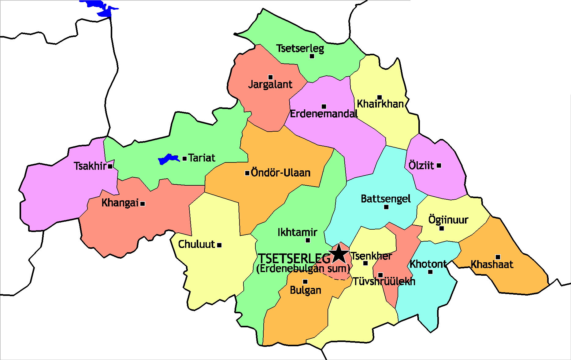
A district ( mn, сум, , , ; "arrow"), is a second level administrative subdivision of Mongolia. The 21 Provinces of Mongolia are divided into 331 districts.Montsame News Agency. ''Mongolia''. 2006, Foreign Service office of Montsame News Agency, , p. 46 On average, each district administers a territory of with about 5,000 inhabitants, primarily nomadic herders. Its total revenue is 120 million Mongolian tögrög, Tögrög, 90% of which comes from national subsidies. Each district is again subdivided into ''bags'' (brigades; sometimes spelled ''baghs''). Most bags are of an entirely virtual nature. Their purpose is to sort the families of nomads in the district into groups, without a permanent human settlement. Officially, and occasionally on maps, many district seats (sum centers) bear a name different from that of the district. However, in practice the district seat (sum center) is most often referred to under the name of the district, to the point of the official name ... [...More Info...] [...Related Items...] OR: [Wikipedia] [Google] [Baidu] |
Düüreg
Ulaanbaatar (; mn, Улаанбаатар, , "Red Hero"), previously anglicized as Ulan Bator, is the capital and most populous city of Mongolia. It is the coldest capital city in the world, on average. The municipality is located in north central Mongolia at an elevation of about in a valley on the Tuul River. The city was originally founded in 1639 as a nomadic Buddhist monastic center, changing location 28 times, and was permanently settled at its current location in 1778. During its early years, as Örgöö (anglicized as Urga), it became Mongolia's preeminent religious center and seat of the Jebtsundamba Khutuktu, the spiritual head of the Gelug lineage of Tibetan Buddhism in Mongolia. Following the regulation of Qing-Russian trade by the Treaty of Kyakhta in 1727, a caravan route between Beijing and Kyakhta opened up, along which the city was eventually settled. With the collapse of the Qing Empire in 1911, the city was a focal point for independence efforts, leadin ... [...More Info...] [...Related Items...] OR: [Wikipedia] [Google] [Baidu] |
Khoroo
A khoroo ( mn, хороо) is an administrative subdivision of Ulaanbaatar, the capital of Mongolia. The term is often translated as subdistrict or microdistrict, although the latter might lead to confusion with khoroolols. A khoroo is below the level of a düüreg Ulaanbaatar (; mn, Улаанбаатар, , "Red Hero"), previously anglicized as Ulan Bator, is the capital and most populous city of Mongolia. It is the coldest capital city in the world, on average. The municipality is located in north c ... (district). As of 2020 there is a total of 173 ''khoroo''. Each khoroo has an identifying number within its düüreg. List of khoroo References Districts of Ulaanbaatar Types of administrative division {{Mongolia-geo-stub ... [...More Info...] [...Related Items...] OR: [Wikipedia] [Google] [Baidu] |
Microdistrict
Microdistrict, or microraion (russian: микрорайо́н, ''mikrorajón''), is a residential complex—a primary structural element of the residential area construction in the Soviet Union and in some post-Soviet and former Socialist states. Residential districts in most of the cities and towns in Russia and the republics of the former Soviet Union were built in accordance with this concept. According to the Construction Rules and Regulations of the Soviet Union, a typical microdistrict covered the area of 10–60 hectares (30–160 acres), up to but not exceeding 80 hectares (200 acres) in some cases, and comprised residential dwellings (usually multi-story apartment buildings) and public service buildings. As a general rule, major motor roads, greenways, and natural obstacles served as boundaries between microdistricts, allowing an overall reduction in city road construction and maintenance costs and emphasizing public transportation. Major motor ro ... [...More Info...] [...Related Items...] OR: [Wikipedia] [Google] [Baidu] |
Municipal Districts Of Mongolia
Ulaanbaatar is divided into nine düüregs ( mn, Дүүрэг) or municipal districts: Baganuur, Bagakhangai, Bayangol, Bayanzürkh, Chingeltei, Khan Uul, Nalaikh, Songino Khairkhan and Sükhbaatar. Each district is subdivided into khoroos, of which there are 173. Each düüreg also serves as a constituency that elects one or more representatives into the State Great Khural, the national parliament. Demographics Although administratively part of Ulaanbaatar, Nalaikh and Baganuur are separate cities. Bagakhangai and Baganuur are noncontiguous exclaves, the former located within the Töv Province Töv ( mn, Төв, , ; "central") is one of the 21 Aimags of Mongolia, aimags (provinces) of Mongolia. The national capital Ulaanbaatar is located roughly at its center, but the city itself is administrated as an independent municipality. Geogr ..., the latter on the border between the Töv and Khentii provinces. References {{Districts of Ulaanbaatar Subdivisions of Mongolia ... [...More Info...] [...Related Items...] OR: [Wikipedia] [Google] [Baidu] |
Khoroo
A khoroo ( mn, хороо) is an administrative subdivision of Ulaanbaatar, the capital of Mongolia. The term is often translated as subdistrict or microdistrict, although the latter might lead to confusion with khoroolols. A khoroo is below the level of a düüreg Ulaanbaatar (; mn, Улаанбаатар, , "Red Hero"), previously anglicized as Ulan Bator, is the capital and most populous city of Mongolia. It is the coldest capital city in the world, on average. The municipality is located in north c ... (district). As of 2020 there is a total of 173 ''khoroo''. Each khoroo has an identifying number within its düüreg. List of khoroo References Districts of Ulaanbaatar Types of administrative division {{Mongolia-geo-stub ... [...More Info...] [...Related Items...] OR: [Wikipedia] [Google] [Baidu] |
Districts Of Mongolia
A district ( mn, сум, , , ; "arrow"), is a second level administrative subdivision of Mongolia. The 21 Provinces of Mongolia are divided into 331 districts.Montsame News Agency. ''Mongolia''. 2006, Foreign Service office of Montsame News Agency, , p. 46 On average, each district administers a territory of with about 5,000 inhabitants, primarily nomadic herders. Its total revenue is 120 million Tögrög, 90% of which comes from national subsidies. Each district is again subdivided into ''bags'' (brigades; sometimes spelled ''baghs''). Most bags are of an entirely virtual nature. Their purpose is to sort the families of nomads in the district into groups, without a permanent human settlement. Officially, and occasionally on maps, many district seats (sum centers) bear a name different from that of the district. However, in practice the district seat (sum center) is most often referred to under the name of the district, to the point of the official name of the district se ... [...More Info...] [...Related Items...] OR: [Wikipedia] [Google] [Baidu] |


