|
Strzyżów
Strzyżów is a town in Strzyżów County, Subcarpathian Voivodeship, Poland, along the Wisłok river valley. Strzyżów is one of the towns within the Strzyżowsko-Dynowskie Foothill, located south-east of Kraków and 30 km from Rzeszów. According to statistics from June 30, 2010 from GUS (the Central Statistical Office in Poland), there are 8,782 inhabitants. History The history of Strzyżów dates back to the 9th century, to the times of the Wiślanie tribe (Vistulans) when a legendary pagan Vistulan prince is said to have built a watchtower by Stobnica and Wisłok river called "Strzeżno", for the defence of eastern borders of his land. In 1279, in Buda (Hungary), the Pope's legate named Bishop Philip confirmed the abbot's right to take a special tax (a tithe) from Czudec and Strzyżów. Strzyżów obtained city rights between 1373 and 1397. The town was surrounded by a soil defence embankment (Zawale Street still exists and it relates to that embankment). Thes ... [...More Info...] [...Related Items...] OR: [Wikipedia] [Google] [Baidu] |
Gmina Strzyżów
__NOTOC__ Gmina Strzyżów is an urban-rural gmina (administrative district) in Strzyżów County, Subcarpathian Voivodeship, in south-eastern Poland. Its seat is the town of Strzyżów, which lies approximately south-west of the regional capital Rzeszów. The gmina covers an area of , and as of 2006 its total population is 20,645 (out of which the population of Strzyżów amounts to 8,703, and the population of the rural part of the gmina is 11,942). The gmina contains part of the protected area called Czarnorzeki-Strzyżów Landscape Park. Villages Apart from the town of Strzyżów, Gmina Strzyżów contains the villages and settlements of Bonarówka, Brzeżanka, Dobrzechów, Gbiska, Glinik Charzewski, Glinik Zaborowski, Godowa, Grodzisko, Łętownia, Tropie, Wysoka Strzyżowska, Żarnowa, Zawadka and Żyznów. Neighbouring gminas Gmina Strzyżów is bordered by the gminas of Czudec, Korczyna, Niebylec, Wielopole Skrzyńskie, Wiśniowa and Wojaszówka Woja ... [...More Info...] [...Related Items...] OR: [Wikipedia] [Google] [Baidu] |
Strzyżów County
__NOTOC__ Strzyżów County ( pl, powiat strzyżowski) is a unit of territorial administration and local government (powiat) in Subcarpathian Voivodeship, south-eastern Poland. It came into being on January 1, 1999, as a result of the Polish local government reforms passed in 1998. Its administrative seat and only town is Strzyżów, which lies south-west of the regional capital Rzeszów. The county covers an area of . As of 2019 its total population is 61,505, out of which the population of Strzyżów is 8,884and the rural population is 52,621. Places of interest Places of historical interest include the palace and park complex in Wiśniowa, the 15th century church complex in Strzyżów, the 18th century manorial complex on Modrzewiowa Street in Strzyżów, synagogues in Czudec, Niebylec and Strzyżów, the palace complex in Żyznów, wooden churches in Lutcza and Gogołów and Greek Catholic Churches in Brzeżanka and Oparówka. There are also two complexes of fortificatio ... [...More Info...] [...Related Items...] OR: [Wikipedia] [Google] [Baidu] |
Subcarpathian Voivodeship
Subcarpathian Voivodeship or Subcarpathia Province (in pl, Województwo podkarpackie ) is a voivodeship, or province, in the southeastern corner of Poland. Its administrative capital and largest city is Rzeszów. Along with the Marshall, it is governed by the Subcarpathian Regional Assembly. Historically, most of the province's territory was part of the Kingdom of Galicia–Volhynia, the Kingdom of Galicia and Lodomeria and the Ruthenian Voivodeship. In the interwar period, it was part of the Lwów Voivodeship. The voivodeship was created on 1 January 1999 out of the former Rzeszów, Przemyśl, Krosno and (partially) Tarnów and Tarnobrzeg Voivodeships, pursuant to the Polish local-government reforms adopted in 1998. The name derives from the region's location near the Carpathian Mountains, and the voivodeship comprises areas of two historic regions of Eastern Europe — Lesser Poland (western and northwestern counties) and Red Ruthenia. During the interwar period (1918-1 ... [...More Info...] [...Related Items...] OR: [Wikipedia] [Google] [Baidu] |
Czudec
Czudec is a town in Strzyżów County, Subcarpathian Voivodeship, in south-eastern Poland. It is the seat of the gmina (administrative district) called Gmina Czudec. It lies in Lesser Poland, approximately north-east of Strzyżów and south-west of the regional capital Rzeszów. The village has a population of 2,900, and has a rail station on the secondary-importance line from Rzeszów to Jasło. The history of Czudec dates back to the year 1185, when Mikołaj Bogoria from the town of Bogoria near Sandomierz granted a number of Lesser Poland’s villages to the newly established Koprzywnica Cistercian abbey. Among those villages was Czudec. In 1263 in Tarnów, Lesser Poland's prince Bolesław V the Chaste met with Daniel of Galicia, to establish a border between the two states. According to their agreement, Czudec was to remain within Lesser Poland, while nearby Rzeszów belonged to Red Ruthenia. On September 11, 1427, King Władysław Jagiełło granted Magdeburg rights town ... [...More Info...] [...Related Items...] OR: [Wikipedia] [Google] [Baidu] |
List Of Polish Counties
__NOTOC__ The following is an alphabetical list of all 380 county-level entities in Poland. A county or powiat (pronounced ''povyat'') is the second level of Polish administrative division, between the voivodeship (provinces) and the gmina (municipalities or communes; plural "gminy"). The list includes the 314 "land counties" (''powiaty ziemskie'') and the 66 "city counties" (''miasta na prawach powiatu'' or ''powiaty grodzkie''). For general information about these entities, see the article on powiats. The following information is given in the list: *English name (as used in Wikipedia) *Polish name (does not apply to most city counties, since these are not translated). Note that sometimes two different counties have the same name in Polish (for example, Brzeg County and Brzesko County both have the original name ''powiat brzeski''). *County seat (not given in the case of city counties, as the seat is simply the city itself). Note that sometimes the seat is not part of the count ... [...More Info...] [...Related Items...] OR: [Wikipedia] [Google] [Baidu] |
Wisłok
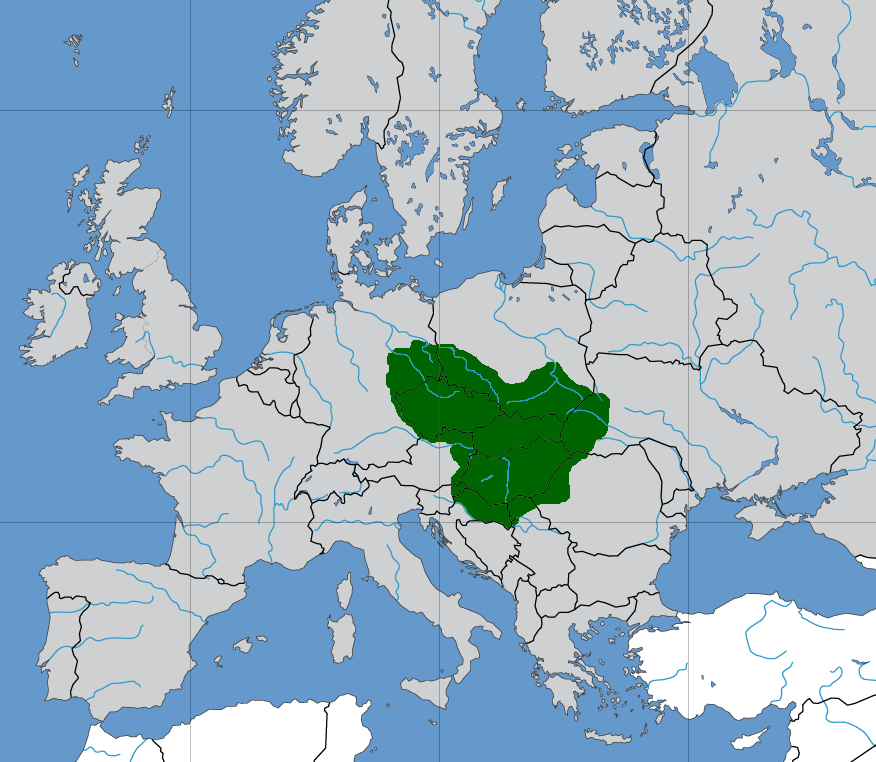
Wisłok is a river in south-eastern Poland, a tributary of the San River, with a length of 220 kilometres and a basin area of 3,538 km2 (all in Poland). The root of the name ''Vis-lok'' is Indo-European or pre-Indo-European. The first metal bridges on highways were built in Galicia. They were bridges on the Wisłok river in Rzeszów (1877) and Raba in Książnica (1877). The construction of the first latticework metal bridges in Poland's territories. History There is no data on the settlements in the early Iron period when an old trade route crossed the region along Wisłok River Valley. The Wisłok valley must have been an important trade route and human settlement axis as early as 9th or 10th century. The region subsequently became part of the Great Moravian state. Upon the invasion of the Hungarian tribes into the heart of the Great Moravian Empire around 899, the Lendians of the area declared their allegiance to Hungarian Empire. The region then became a site of conte ... [...More Info...] [...Related Items...] OR: [Wikipedia] [Google] [Baidu] |
Rzeszów
Rzeszów ( , ; la, Resovia; yi, ריישא ''Raisha'')) is the largest city in southeastern Poland. It is located on both sides of the Wisłok River in the heartland of the Sandomierz Basin. Rzeszów has been the capital of the Subcarpathian Voivodeship (province) since 1 January 1999, and is also the county seat, seat of Rzeszów County. The history of Rzeszów dates back to the Middle Ages. It received city rights and privileges from King Casimir III the Great in 1354. Local trade routes connecting Europe with the Middle East and the Ottoman Empire resulted in the city's early prosperity and development. In the 16th century, Rzeszów had a connection with Gdańsk and the Baltic Sea. It also experienced growth in commerce and craftsmanship, especially under local Szlachta, rulers and noblemen. Following the Partitions of Poland, Rzeszów was annexed by the Austrian Empire and did not regain its position until it Second Polish Republic, returned to Poland after World War I. Rze ... [...More Info...] [...Related Items...] OR: [Wikipedia] [Google] [Baidu] |
Polish Car Number Plates
Vehicle registration plates of Poland indicate the region of registration of the vehicle given the number plate. According to Polish law, the registration plate is tied to the vehicle, not the owner. There is no possibility for the owner to keep the licence number for use on a different car, even if it's a cherished registration. The licence plates are issued by the powiat (county) of the vehicle owner's registered address of residence, in the case of a natural person. If it is owned by a legal person, the place of registration is determined by his/her address. Vehicles leased under operating leases and many de facto finance leases will be registered at the address of the lessor. When a vehicle changes hands, the new owner must apply for new vehicle registration document bearing his or her name and registered address. The new owner may obtain a new licence plate although it is not necessary when the new owner's residence address is in the same district as the previous owner's. In ... [...More Info...] [...Related Items...] OR: [Wikipedia] [Google] [Baidu] |
Confederation Of Bar
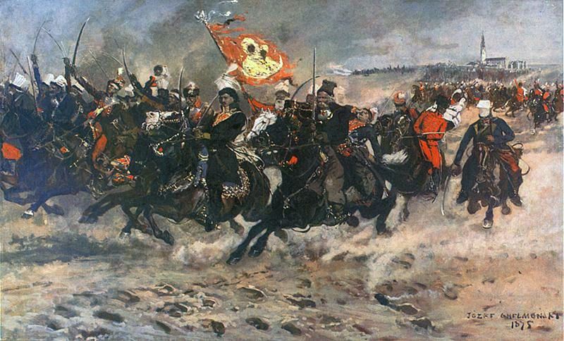
The Bar Confederation ( pl, Konfederacja barska; 1768–1772) was an association of Poland, Polish nobles (szlachta) formed at the fortress of Bar, Ukraine, Bar in Podolia (now part of Ukraine) in 1768 to defend the internal and external independence of the Polish–Lithuanian Commonwealth against Russian Empire, Russian influence and against King Stanisław August Poniatowski, Stanislaus II Augustus with Polish reformers, who were attempting to limit the power of the Commonwealth's wealthy magnates. The founders of the Bar Confederation included the magnates Adam Stanisław Krasiński, Bishop of Kamianets-Podilskyi, Kamieniec, Karol Stanisław "Panie Kochanku" Radziwiłł, Karol Stanisław Radziwiłł, Kazimierz Pułaski, Casimir Pulaski, his father and brothers and Michał Krasiński. Its creation led to a civil war and contributed to the First Partition of Poland, First Partition of the Polish–Lithuanian Commonwealth. Maurice Benyovszky was the best known European Bar Con ... [...More Info...] [...Related Items...] OR: [Wikipedia] [Google] [Baidu] |
Casimir Pulaski
Kazimierz Michał Władysław Wiktor Pułaski of the Ślepowron coat of arms (; ''Casimir Pulaski'' ; March 4 or March 6, 1745 Makarewicz, 1998 October 11, 1779) was a Polish nobleman, soldier, and military commander who has been called, together with his counterpart Michael Kovats de Fabriczy, "the father of the American cavalry." Born in Warsaw and following in his father's footsteps, he became interested in politics at an early age. He soon became involved in the military and in revolutionary affairs in the Polish–Lithuanian Commonwealth. Pulaski was one of the leading military commanders for the Bar Confederation and fought against the Commonwealth's foreign domination. When this uprising failed, he was driven into exile. Following a recommendation by Benjamin Franklin, Pulaski traveled to North America to help in the American Revolutionary War. He distinguished himself throughout the revolution, most notably when he saved the life of George Washington. Pulaski became ... [...More Info...] [...Related Items...] OR: [Wikipedia] [Google] [Baidu] |
Partitions Of Poland
The Partitions of Poland were three partitions of the Polish–Lithuanian Commonwealth that took place toward the end of the 18th century and ended the existence of the state, resulting in the elimination of sovereign Poland and Lithuania for 123 years. The partitions were conducted by the Habsburg monarchy, the Kingdom of Prussia, and the Russian Empire, which divided up the Commonwealth lands among themselves progressively in the process of territorial seizures and annexations. The First Partition was decided on August 5, 1772 after the Bar Confederation lost the war with Russia. The Second Partition occurred in the aftermath of the Polish–Russian War of 1792 and the Targowica Confederation of 1792 when Russian and Prussian troops entered the Commonwealth and the partition treaty was signed during the Grodno Sejm on January 23, 1793 (without Austria). The Third Partition took place on October 24, 1795, in reaction to the unsuccessful Polish Kościuszko Uprising the previ ... [...More Info...] [...Related Items...] OR: [Wikipedia] [Google] [Baidu] |
Kingdom Of Galicia And Lodomeria
The Kingdom of Galicia and Lodomeria,, ; pl, Królestwo Galicji i Lodomerii, ; uk, Королівство Галичини та Володимирії, Korolivstvo Halychyny ta Volodymyrii; la, Rēgnum Galiciae et Lodomeriae also known as Austrian Galicia or colloquially Austrian Poland, was a constituent possession of the Habsburg monarchy in the historical region of Galicia in Eastern Europe. The crownland was established in 1772. The lands were annexed from the Polish-Lithuanian Commonwealth as part of the First Partition of Poland. In 1804 it became a crownland of the newly proclaimed Austrian Empire. From 1867 it was a crownland within the Cisleithanian or Austrian half of the dual monarchy of Austria-Hungary. It maintained a degree of provincial autonomy. Its status remained unchanged until the dissolution of the monarchy in 1918. The domain was initially carved in 1772 from the south-western part of the Polish–Lithuanian Commonwealth. During the following pe ... [...More Info...] [...Related Items...] OR: [Wikipedia] [Google] [Baidu] |


