|
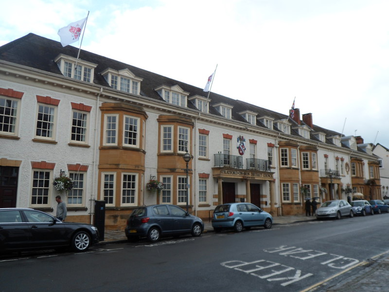
Stratford-on-Avon (district)
Stratford-on-Avon is a local government district in southern Warwickshire, England. The district is named "Stratford-on-Avon" unlike its main town of Stratford-upon-Avon where the district council is based. The district is mostly rural and covers most of the southern half of Warwickshire. As well as Stratford, other significant places in the district includes the towns of Alcester, Southam, Shipston-on-Stour and Henley-in-Arden, and the large villages of Bidford-on-Avon, Studley and Wellesbourne, plus numerous other smaller villages and hamlets. It borders the Warwickshire districts of Warwick to the north, and Rugby to the north-east. It also borders the neighbouring counties of the West Midlands, Worcestershire, Gloucestershire, Oxfordshire, and Northamptonshire. History The district was formed on 1 April 1974 under the Local Government Act 1972 by the merger of the municipal borough of Stratford-upon-Avon, Alcester Rural District, Shipston-on-Stour Rural District, Southa ... [...More Info...] [...Related Items...] OR: [Wikipedia] [Google] [Baidu] |
Non-metropolitan District
Non-metropolitan districts, or colloquially "shire districts", are a type of local government district in England. As created, they are sub-divisions of non-metropolitan counties (colloquially ''shire counties'') in a two-tier arrangement. Non-metropolitan districts with borough status are known as boroughs, able to appoint a mayor and refer to itself as a borough council. Non-metropolitan districts Non-metropolitan districts are subdivisions of English non-metropolitan counties which have a two-tier structure of local government. Most non-metropolitan counties have a county council and several districts, each with a borough or district council. In these cases local government functions are divided between county and district councils, to the level where they can be practised most efficiently: *Borough/district councils are responsible for local planning and building control, local roads, council housing, environmental health, markets and fairs, refuse collection and recyclin ... [...More Info...] [...Related Items...] OR: [Wikipedia] [Google] [Baidu] |
ONS Coding System
ONS codes are geocodes maintained by the United Kingdom's Office for National Statistics to represent a wide range of geographical areas of the UK, for use in tabulating census and other statistical data. These codes are also known as GSS codes, where GSS refers to the ''Government Statistical Service'' of which ONS is part. The previous hierarchical system of codes was replaced as from January 2011 by a nine-character code for all types of geography, in which there is no relation between the code for a lower-tier area and the corresponding parent area. The older coding system has now been phased out. Geography of the UK Census Information from the 2011 Census is published for a wide variety of geographical units. These areas include: * Counties in England * Districts within English counties, and Unitary Authority areas served by one council providing district and county functions * Unitary council areas in Wales, Scotland, and Northern Ireland * Civil parishes ( communities i ... [...More Info...] [...Related Items...] OR: [Wikipedia] [Google] [Baidu] |
Borough Of Rugby
The Borough of Rugby is a local government district with borough status in eastern Warwickshire, England. The borough comprises the town of Rugby where the council has its headquarters, and the rural areas surrounding the town. The borough has a population of 114,400 (2021). Of which, 78,125 live in Rugby itself and the remainder living in the surrounding areas. Aside from Rugby itself, more notable settlements include Binley Woods, Brinklow, Clifton-upon-Dunsmore, Dunchurch, Long Lawford, Monks Kirby, Ryton-on-Dunsmore, Stretton-on-Dunsmore and Wolston, and the new large development of Houlton. The borough stretches from Coventry to the west, to the borders with Northamptonshire and Leicestershire to the east. It borders the Warwickshire districts of Warwick to the south-west, Stratford to the south, and Nuneaton and Bedworth to the north-west. It includes a large area of the West Midlands Green Belt in the mostly rural area between Rugby and Coventry. Between 2011 and 202 ... [...More Info...] [...Related Items...] OR: [Wikipedia] [Google] [Baidu] |
Warwick District
Warwick is a local government district of central Warwickshire in England. It borders the Borough of Rugby and Stratford-on-Avon District in Warwickshire as well as the West Midlands County (of which Coventry and Solihull are within the historic boundaries of Warwickshire). The City of Coventry is to the north and northeast, the Stratford-on-Avon District to the southwest and south, the Borough of Rugby to the east, and the Borough of Solihull to the west and northwest. The district is centred around a conurbation that includes the towns of Warwick, Leamington Spa and Whitnash which had a population of 95,000. The district also includes the town of Kenilworth and the surrounding rural areas. In February 2021 it was announced that both Warwick District councillors and their Stratford counterparts had "agreed the next steps towards closer working between both District Councils, which could see a recommendation to Government for a merger of the two councils in July 2024." However in ... [...More Info...] [...Related Items...] OR: [Wikipedia] [Google] [Baidu] |

.jpg)