|
Strandavatnet
Strandavatnet is a lake in Hol municipality, Norway. The lake covers an area of , and lies above sea level.' The lake is a reservoir for the Rud hydroelectric powerstation in Hovet, Buskerud. In 1952/1953 a dam was constructed which lifted the lake level 28 meters, thus the lake varies between 950 and 978 m above sea level. First rock filling dam in Norway The dam in the Strandavatnet was the first rock filling (embankment) dam in Norway. You can see the dam on your left hand side from FV 50 at Myrland (the road to Raggsteindalen goes over the dam). The Hol 1 power station, in Hovet, Buskerud Hovet is a mountain village in Hol, Buskerud, Norway. Hovet is located between Strandavatnet and Hovsfjorden. Hovet is the site of Hovet Chapel (''Hovet kapell''). The church is located in the south-east slope of a hill that shoots out into t ... utilizes water from two watercourses, Urunda, where Strandavatnet, is the intake reservoir, and Votna where Varaldset is the intake reservo ... [...More Info...] [...Related Items...] OR: [Wikipedia] [Google] [Baidu] |
Hovet, Buskerud
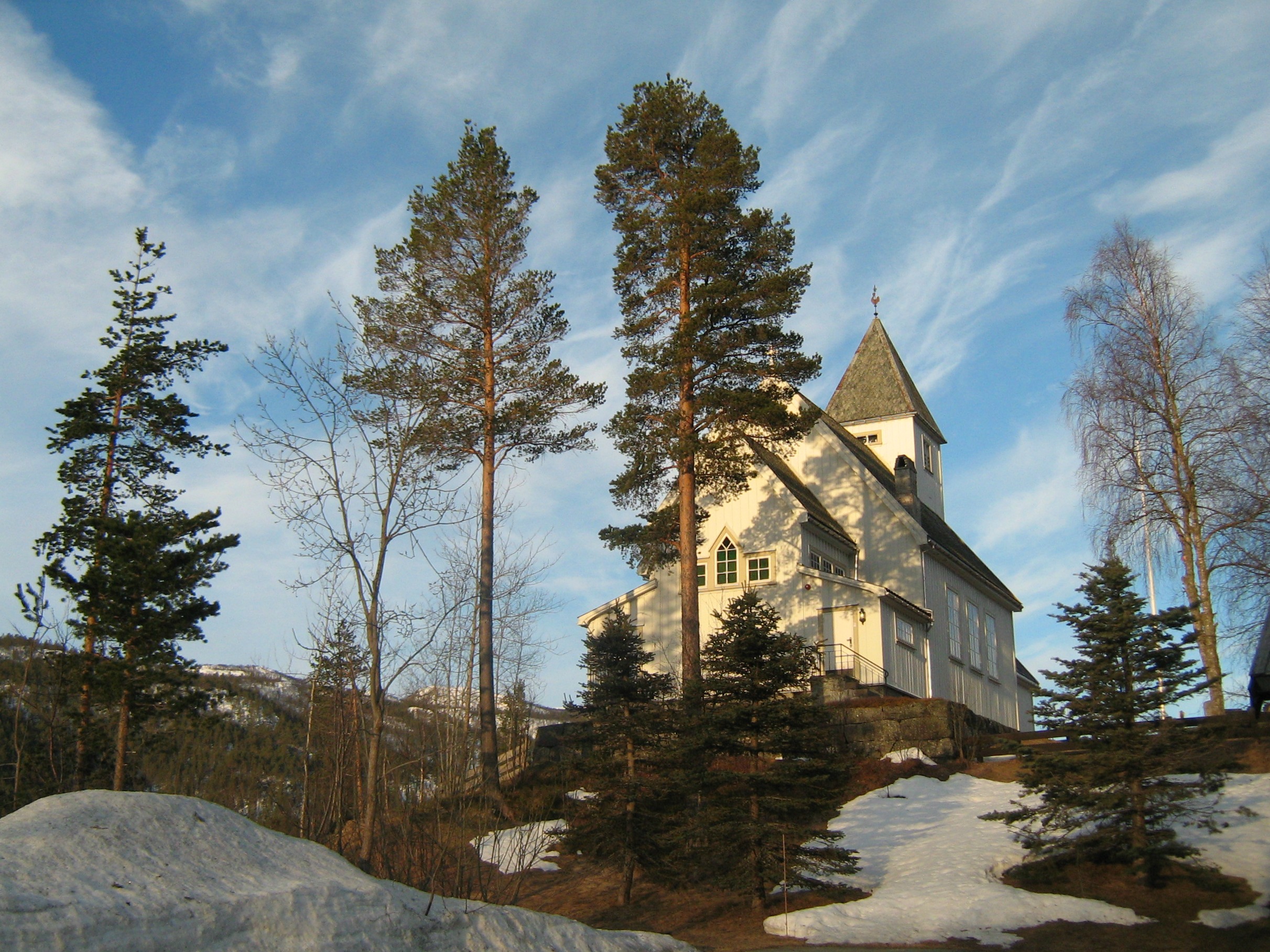
Hovet is a mountain village in Hol, Buskerud, Norway. Hovet is located between Strandavatnet and Hovsfjorden. Hovet is the site of Hovet Chapel (''Hovet kapell''). The church is located in the south-east slope of a hill that shoots out into the valley from the north. It was constructed from drawings prepared by architect Ole Stein and inaugurated in 1910. The walls are built of timber frame and rest on a grouted natural stone foundation. All roofs are covered with slate. Håkonsæt Fjellvilla is a mountain villa. It is situated in the centre of Hovet, near Hallingskarvet National Park, 15 minutes from Skisenter Hallingskarvet in Sudndalen, Hovet. and 20 min from the ski resorts of Geilo. Hallingdal Hovet belongs to the traditional district of Hallingdal, the Halling Valley, created by the Hallingdalselva or Hallingdal River. "Elva" is Norwegian for river. The Hallingdal River, also named "big river" or Storåni, originates from the Hardangervidda national park, streams via ... [...More Info...] [...Related Items...] OR: [Wikipedia] [Google] [Baidu] |
Norway
Norway, officially the Kingdom of Norway, is a Nordic country in Northern Europe, the mainland territory of which comprises the western and northernmost portion of the Scandinavian Peninsula. The remote Arctic island of Jan Mayen and the archipelago of Svalbard also form part of Norway. Bouvet Island, located in the Subantarctic, is a dependency of Norway; it also lays claims to the Antarctic territories of Peter I Island and Queen Maud Land. The capital and largest city in Norway is Oslo. Norway has a total area of and had a population of 5,425,270 in January 2022. The country shares a long eastern border with Sweden at a length of . It is bordered by Finland and Russia to the northeast and the Skagerrak strait to the south, on the other side of which are Denmark and the United Kingdom. Norway has an extensive coastline, facing the North Atlantic Ocean and the Barents Sea. The maritime influence dominates Norway's climate, with mild lowland temperatures on the se ... [...More Info...] [...Related Items...] OR: [Wikipedia] [Google] [Baidu] |
Urunda And Votna Watercourses
Urunda (russian: Урунда; ba, Орондо, ''Orondo'') is a rural locality (a village) in Akberdinsky Selsoviet, Iglinsky District, Bashkortostan The Republic of Bashkortostan or Bashkortostan ( ba, Башҡортостан Республикаһы, Bashqortostan Respublikahy; russian: Республика Башкортостан, Respublika Bashkortostan),; russian: Респу́блик� ..., Russia. The population was 192 as of 2010. There are 8 streets. Geography Urunda is located 55 km south of Iglino (the district's administrative centre) by road. Beloretsk is the nearest rural locality. References Rural localities in Iglinsky District {{Iglinsky-geo-stub ... [...More Info...] [...Related Items...] OR: [Wikipedia] [Google] [Baidu] |
Lakes Of Viken (county)
A lake is an area filled with water, localized in a basin, surrounded by land, and distinct from any river or other outlet that serves to feed or drain the lake. Lakes lie on land and are not part of the ocean, although, like the much larger oceans, they do form part of the Earth's water cycle. Lakes are distinct from lagoons, which are generally coastal parts of the ocean. Lakes are typically larger and deeper than ponds, which also lie on land, though there are no official or scientific definitions. Lakes can be contrasted with rivers or streams, which usually flow in a channel on land. Most lakes are fed and drained by rivers and streams. Natural lakes are generally found in mountainous areas, rift zones, and areas with ongoing glaciation. Other lakes are found in endorheic basins or along the courses of mature rivers, where a river channel has widened into a basin. Some parts of the world have many lakes formed by the chaotic drainage patterns left over from the last ice ... [...More Info...] [...Related Items...] OR: [Wikipedia] [Google] [Baidu] |


