|
Stinson Lake
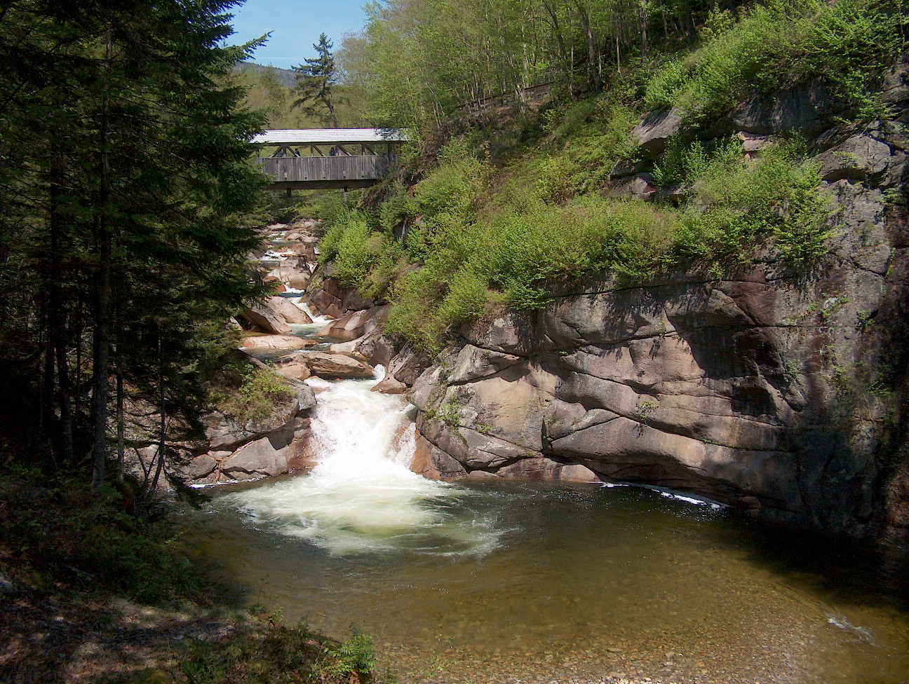
Stinson Lake is a water body located in the town of Rumney in Grafton County, New Hampshire, United States. The lake is in the southern part of the White Mountains and is the largest lake in the White Mountain National Forest. Water from Stinson Lake flows via Stinson Brook, the Baker River, and the Pemigewasset River to the Merrimack River. The lake is a result of glacier deposits. It has a maximum depth of , with a few shallow banks around the southern rim. It has a cove to the southwest with a dam to stabilize the lake level. Stinson is one of the few lakes around the region without parasitic plants. Its waters are very clear, with visibility to of depth. Stinson Lake lies in the northern corner of Rumney, just south of the town boundary with [...More Info...] [...Related Items...] OR: [Wikipedia] [Google] [Baidu] |
Grafton County, New Hampshire
Grafton County is a county in the U.S. state of New Hampshire. As of the 2020 census, the population was 91,118. Its county seat is North Haverhill, a village within the town of Haverhill. Until 1972, the county courthouse and other offices were in downtown Woodsville, a larger village within the town of Haverhill. Grafton County is part of the Claremont-Lebanon, NH– VT Micropolitan Statistical Area. The county is the home of Dartmouth College and Plymouth State University. '' Progressive Farmer'' rated Grafton County fourth in its list of the "Best Places to Live in Rural America" in 2006, citing low unemployment (despite slow economic growth), a favorable cost of living, and the presence of White Mountain National Forest, the state's only national forest. History Grafton was one of the five counties originally identified for New Hampshire in 1769. It was named for Augustus FitzRoy, 3rd Duke of Grafton, who had been a supporter of American causes in Parliament, and ... [...More Info...] [...Related Items...] OR: [Wikipedia] [Google] [Baidu] |
Ellsworth, New Hampshire
Ellsworth is a town in Grafton County, New Hampshire, United States. The population was 93 at the 2020 census. Ellsworth is the only dry town in New Hampshire. History The town was originally known as "Trecothick", after Barlow Trecothick, a Bostonian who moved to London. He was an alderman, a Member of Parliament (MP), and a Lord Mayor of the City of London. He had a country estate at Addington, London, now called Addington Palace. The name of the town was changed to "Ellsworth" in 1802, in honor of Chief Justice Oliver Ellsworth. The first census of the town, in 1800, reported 47 residents. Geography According to the United States Census Bureau, the town has a total area of , of which are land and are water, comprising 0.58% of the town. The town is drained in the north by Hubbard Brook and in the south by West Branch Brook, except for the southwest corner, which is drained by Sucker Brook, a tributary of Stinson Lake in neighboring Rumney. Hubbard and West Branch ... [...More Info...] [...Related Items...] OR: [Wikipedia] [Google] [Baidu] |
Brown Bullhead
The brown bullhead (''Ameiurus nebulosus'') is a fish of the family Ictaluridae that is widely distributed in North America. It is a species of bullhead catfish and is similar to the black bullhead (''Ameiurus melas'') and yellow bullhead (''Ameiurus natalis''). It was originally described as ''Pimelodus nebulosus'' by Charles Alexandre Lesueur in 1819, and is also referred to as ''Ictalurus nebulosus''. The brown bullhead is also widely known as the "mud pout", "horned pout", "hornpout", or simply "mud cat", a name also used with the other bullhead species. The brown bullhead is important as a clan symbol of the Ojibwe people. In their tradition, the bullhead or is one of six beings that came out of the sea to form the original clans. Appearance The brown bullhead grows to be approximately in length and is a darker brown-green dorsally, growing lighter green and yellow towards the ventral surface. The belly is off-white or cream, and the fish has no scales. Additionally, th ... [...More Info...] [...Related Items...] OR: [Wikipedia] [Google] [Baidu] |
Chain Pickerel
The chain pickerel (''Esox niger'') is a species of freshwater fish in the pike family (family Esocidae) of order Esociformes. The chain pickerel and the American pickerel (''E. americanus'') belong to the ''Esox'' genus of pike. Taxonomy French naturalist Charles Alexandre Lesueur described the chain pickerel in 1818. Its species name is the Latin word ''niger'' "black". Nicknames in the southeastern United States are the "southern pike", "grass pike", "jack", "jack fish", and "eastern pickerel". Description The chain pickerel has a distinctive, dark, chain-like pattern on its greenish sides. There is a vertical dark marking underneath the eye, which helps to distinguish the chain pickerel from redfin pickerel (''Esox americanus americanus'') and grass pickerel (''E. americanus vermiculatus''), in which the mark curves posteriorly. Its body outline resembles that of the northern pike (''E. lucius''). Unlike northern pike, however, the opercles and cheeks of chain pickerel are ... [...More Info...] [...Related Items...] OR: [Wikipedia] [Google] [Baidu] |
Lake Trout
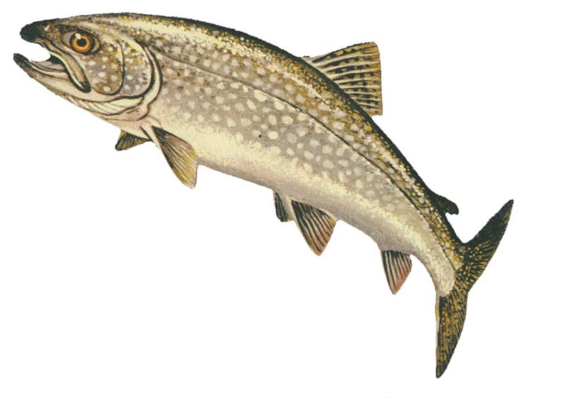
The lake trout (''Salvelinus namaycush'') is a freshwater char living mainly in lakes in northern North America. Other names for it include mackinaw, namaycush, lake char (or charr), touladi, togue, and grey trout. In Lake Superior, it can also be variously known as siscowet, paperbelly and lean. The lake trout is prized both as a game fish and as a food fish. Those caught with dark coloration may be called ''mud hens''. Taxonomy It is the only member of the subgenus ''Cristovomer'', which is more derived than the subgenus '' Baione'' (the most basal clade of ''Salvelinus'', containing the brook trout (''S. fontinalis'') and silver trout (''S. agasizii'')) but still basal to the other members of ''Salvelinus''. Range From a zoogeographical perspective, lake trout have a relatively narrow distribution. They are native only to the northern parts of North America, principally Canada, but also Alaska and, to some extent, the northeastern United States. Lake trout have been wide ... [...More Info...] [...Related Items...] OR: [Wikipedia] [Google] [Baidu] |
Rainbow Trout
The rainbow trout (''Oncorhynchus mykiss'') is a species of trout native to cold-water tributaries of the Pacific Ocean in Asia and North America. The steelhead (sometimes called "steelhead trout") is an anadromous (sea-run) form of the coastal rainbow trout or Columbia River redband trout that usually returns to freshwater to spawn after living two to three years in the ocean. Freshwater forms that have been introduced into the Great Lakes and migrate into tributaries to spawn are also called steelhead. Adult freshwater stream rainbow trout average between , while lake-dwelling and anadromous forms may reach . Coloration varies widely based on subspecies, forms, and habitat. Adult fish are distinguished by a broad reddish stripe along the lateral line, from gills to the tail, which is most vivid in breeding males. Wild-caught and hatchery-reared forms of the species have been transplanted and introduced for food or sport in at least 45 countries and every continent except ... [...More Info...] [...Related Items...] OR: [Wikipedia] [Google] [Baidu] |
Campton, New Hampshire
Campton is a town in Grafton County, New Hampshire, United States. The population was 3,343 at the 2020 census. Campton, which includes the villages of Blair, Campton Hollow, Lower Campton and West Campton, is home to Blair State Forest and Livermore Falls State Forest. It is located in the foothills of the White Mountains, and parts of the White Mountain National Forest are in the northeast and northwest. History Both Campton and adjacent Rumney were granted by Governor Benning Wentworth in 1761 to Jabez Spencer of East Haddam, Connecticut, then settled about 1765. But Captain Spencer died before terms of the charter, which required settlement by 50 families, each farming for every 50 received, were fulfilled. Two families, named Fox and Taylor, first settled here in 1765. In 1767, Governor John Wentworth issued the heirs and others a new grant. Campton got its name when the first proprietors built a camp here to survey the two towns. Although the surface is mountainous and ... [...More Info...] [...Related Items...] OR: [Wikipedia] [Google] [Baidu] |
Merrimack River
The Merrimack River (or Merrimac River, an occasional earlier spelling) is a river in the northeastern United States. It rises at the confluence of the Pemigewasset and Winnipesaukee rivers in Franklin, New Hampshire, flows southward into Massachusetts, and then flows northeast until it empties into the Gulf of Maine at Newburyport. From Pawtucket Falls in Lowell, Massachusetts, onward, the Massachusetts–New Hampshire border is roughly calculated as the line three miles north of the river. The Merrimack is an important regional focus in both New Hampshire and Massachusetts. The central-southern part of New Hampshire and most of northeast Massachusetts is known as the Merrimack Valley. Several U.S. naval ships have been named and USS ''Merrimac'' in honor of this river. The river is perhaps best known for the early American literary classic ''A Week on the Concord and Merrimack Rivers'' by Henry David Thoreau. Etymology and spelling The etymology of the name of the ... [...More Info...] [...Related Items...] OR: [Wikipedia] [Google] [Baidu] |
Stinson Lake, New Hampshire
Stinson Lake is an unincorporated community in the town of Rumney in Grafton County, New Hampshire, United States. It is located at the south end of Stinson Lake Stinson Lake is a water body located in the town of Rumney in Grafton County, New Hampshire, United States. The lake is in the southern part of the White Mountains and is the largest lake in the White Mountain National Forest. Water from Stin ..., around the lake's outlet. The village is north of the village of Rumney, via Stinson Lake Road. References Unincorporated communities in Grafton County, New Hampshire Unincorporated communities in New Hampshire {{NewHampshire-geo-stub ... [...More Info...] [...Related Items...] OR: [Wikipedia] [Google] [Baidu] |
Pemigewasset River
The Pemigewasset River , known locally as "The Pemi", is a river in the state of New Hampshire, the United States. It is in length and (with its tributaries) drains approximately . The name "Pemigewasset" comes from the Abenaki word ''bemijijoasek'' əmidzidzoasək meaning "where side (entering) current is". Geography The Pemigewasset originates at Profile Lake in Franconia Notch State Park, in the town of Franconia. It flows south through the White Mountains and merges with the Winnipesaukee River to form the Merrimack River at Franklin. The Merrimack then flows through southern New Hampshire, northeastern Massachusetts and into the Atlantic Ocean. The Interstate 93 highway runs parallel with the river between Franconia Notch and New Hampton. The river passes through the communities of Lincoln, North Woodstock, Woodstock, Thornton, Campton, Plymouth, Holderness, Ashland, Bridgewater, Bristol, New Hampton, Hill, Sanbornton, and Franklin. The river descends over water ... [...More Info...] [...Related Items...] OR: [Wikipedia] [Google] [Baidu] |
Baker River (New Hampshire)
The Baker River, or ''Asquamchumauke'' (an Abenaki word meaning "salmon spawning place"), is a river in the White Mountains region of New Hampshire in the United States. It rises on the south side of Mount Moosilauke and runs south and east to empty into the Pemigewasset River in Plymouth. The river traverses the towns of Warren, Wentworth, and Rumney. It is part of the Merrimack River watershed. The Baker River's name recalls Lt. Thomas Baker (1682–1753), whose company of 34 scouts from Northampton, Massachusetts, passed down the river's valley in 1712 and destroyed a Pemigewasset Indian village. Along this river on April 28, 1752, John Stark and Amos Eastman were captured by Abenaki warriors and taken to Saint-François-du-Lac, Quebec, near Montreal. John Stark's brother William Stark escaped, and David Stinson was killed during the ambush. On the 1835 Thomas Bradford map of New Hampshire, the river is shown as "Bakers" River, originating on "Mooshillock Mtn." Major t ... [...More Info...] [...Related Items...] OR: [Wikipedia] [Google] [Baidu] |


