|
Stinson L-13
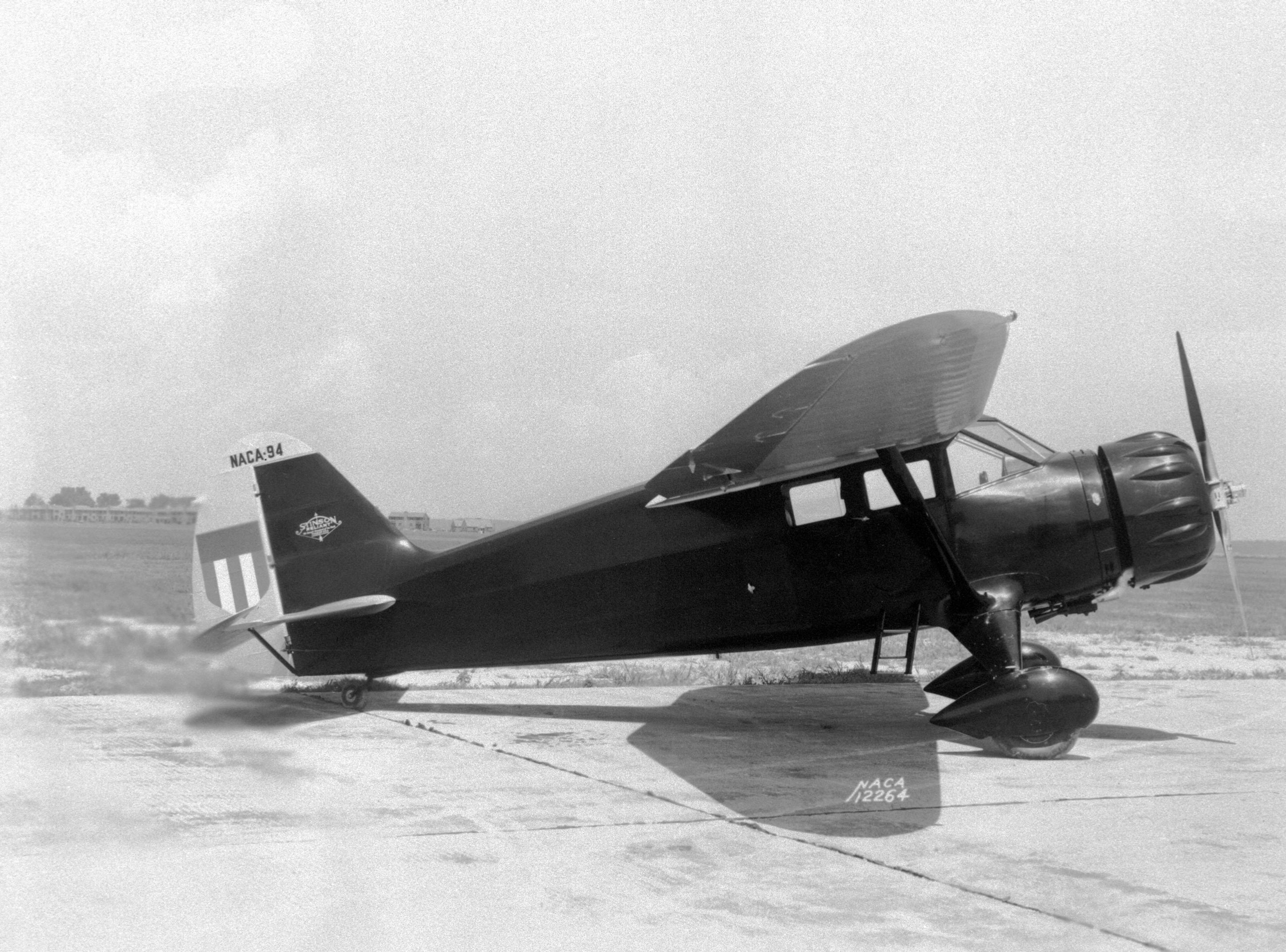
The Stinson L-13 (sometimes known as the Grasshopper, like other aircraft of its type) was a US military utility aircraft first flown in 1945. Development The aircraft design was developed at Stinson in response to a request from the United States Army Air Force for a light observation/liaison unit. At that time Stinson was a subsidiary of Consolidated Vultee. The first two prototypes were constructed at the Stinson facility in Michigan. In 1948 the Convair board were restructuring their various units, and negotiated to sell the Stinson subsidiary to Piper Aircraft. The L-13 project was specifically not included in the assets of the sale, however, and Convair continued its production in-house; ultimately building 300 units as the Convair L-13. It was a conventional high-wing tailwheel monoplane used for observation, liaison, and air ambulance duties, which typically require low landing speeds and short landing rolls. It was fitted with oversize viewing areas to increase its recon ... [...More Info...] [...Related Items...] OR: [Wikipedia] [Google] [Baidu] |
Stinson Aircraft Company
The Stinson Aircraft Company was an aircraft manufacturing company in the United States between the 1920s and the 1950s. History The Stinson Aircraft Company was founded in Dayton, Ohio, in 1920 by aviator Edward “Eddie” Stinson, the brother of aviator Katherine Stinson. After five years of business ventures, Eddie made Detroit, Michigan the focus of his future flying endeavors while still flying as a stunt pilot, earning $100,000 a year for his efforts — a huge sum in those days. Stinson found Detroit's business community receptive to his plans to develop his own airplane. Alfred V. Verville and a group of local businessmen — the Detroit Board of Commerce's Aviation Committee — supported Stinson's plans to establish the Stinson Aircraft Syndicate in 1925 and provided $25,000 to design and build a prototype, an enclosed cockpit, 4-place biplane, powered by a Wright Whirlwind J-4 air-cooled radial engine test flighted at Packard Field in Roseville, Michigan, a nort ... [...More Info...] [...Related Items...] OR: [Wikipedia] [Google] [Baidu] |
Korean War
, date = {{Ubl, 25 June 1950 – 27 July 1953 (''de facto'')({{Age in years, months, weeks and days, month1=6, day1=25, year1=1950, month2=7, day2=27, year2=1953), 25 June 1950 – present (''de jure'')({{Age in years, months, weeks and days, month1=6, day1=25, year1=1950) , place = Korean Peninsula, Yellow Sea, Sea of Japan, Korea Strait, China–North Korea border , territory = Korean Demilitarized Zone established * North Korea gains the city of Kaesong, but loses a net total of {{Convert, 1506, sqmi, km2, abbr=on, order=flip, including the city of Sokcho, to South Korea. , result = Inconclusive , combatant1 = {{Flag, First Republic of Korea, name=South Korea, 1949, size=23px , combatant1a = {{Plainlist , * {{Flagicon, United Nations, size=23px United Nations Command, United Nations{{Refn , name = nbUNforces , group = lower-alpha , On 9 July 1951 troop constituents were: US: 70.4%, ROK: 23.3% other UNC: 6.3%{{Cite ... [...More Info...] [...Related Items...] OR: [Wikipedia] [Google] [Baidu] |
Heritage Flight Museum
The Heritage Flight Museum is an aviation museum located at Skagit Regional Airport just west of Burlington, Washington. History The museum was founded by the family of Apollo 8 astronaut William Anders in 1996 and was originally located at Bellingham International Airport. The museum moved to Skagit Regional Airport in 2013. The museum announced plans for an expansion in 2018. Ground was broken on 22 March 2021. Collection * Beechcraft AT-11 Kansan * Beechcraft T-34 Mentor * Beechcraft T-34 Mentor * Beechcraft T-34 Mentor * Bell H-13 Sioux * Bell UH-1B Iroquois * Boeing-Stearman PT-13 Kaydet * North American T-6 Texan, Canadian Car & Foundry Harvard IV – converted to resemble a Mitsubishi A6M2 Zero * Cessna O-1 Bird Dog * Cessna O-2 Skymaster * de Havilland Canada DHC-2 Beaver * Douglas A-1 Skyraider * Fairchild PT-19 * Interstate Cadet * Mikoyan-Gurevich MiG-21PFM * North American AT-6D Texan * North American AT-6F Texan * North American P-51D Mustang * Northrop F-89 Scor ... [...More Info...] [...Related Items...] OR: [Wikipedia] [Google] [Baidu] |
Chino, California
Chino ( ; Spanish for "Curly") is a city in the western end of San Bernardino County, California, United States, with Los Angeles County to its west and Orange County to its south in the Southern California region. Chino is adjacent to Chino Hills, California. Chino's surroundings have long been a center of agriculture and dairy farming, providing milk products in Southern California and much of the southwestern United States. Chino's agricultural history dates back to the Spanish land grant forming Rancho Santa Ana del Chino. The area specialized in fruit orchards, row crops, and dairy. Chino is bounded by Chino Hills and Los Angeles County to the west, Pomona to the northwest, unincorporated San Bernardino County (near Montclair) to the north, Ontario to the northeast, Eastvale to the southeast in Riverside County and Orange County to the southwest. It is easily accessible via the Chino Valley (71) and Pomona (60) freeways. The population was 77,983 at the 2010 census. ... [...More Info...] [...Related Items...] OR: [Wikipedia] [Google] [Baidu] |
Planes Of Fame Air Museum
Planes of Fame Air Museum is an aviation museum in Chino, California,World War II Museums , Planes of Fame Air Museum, Retrieved March 5, 2011. Warbird Alley, California, Retrieved March 5, 2011. and Valle, .Planes of Fame Air Museum AviationMuseum.eu, Retrieved March ... [...More Info...] [...Related Items...] OR: [Wikipedia] [Google] [Baidu] |
Honolulu, Hawaii
Honolulu (; ) is the capital and largest city of the U.S. state of Hawaii, which is in the Pacific Ocean. It is an unincorporated county seat of the consolidated City and County of Honolulu, situated along the southeast coast of the island of Oahu, and is the westernmost and southernmost major U.S. city. Honolulu is Hawaii's main gateway to the world. It is also a major hub for business, finance, hospitality, and military defense in both the state and Oceania. The city is characterized by a mix of various Asian, Western, and Pacific cultures, reflected in its diverse demography, cuisine, and traditions. ''Honolulu'' means "sheltered harbor" or "calm port" in Hawaiian; its old name, ''Kou'', roughly encompasses the area from Nuuanu Avenue to Alakea Street and from Hotel Street to Queen Street, which is the heart of the present downtown district. The city's desirability as a port accounts for its historical growth and importance in the Hawaiian archipelago and the broader Pa ... [...More Info...] [...Related Items...] OR: [Wikipedia] [Google] [Baidu] |
Pearl Harbor Aviation Museum
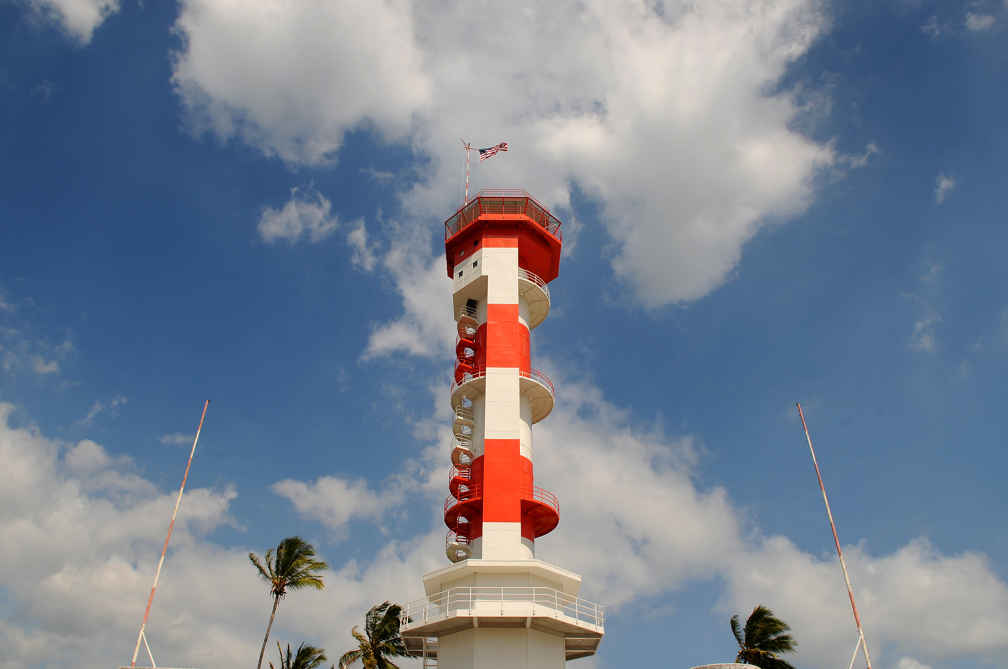
Pearl Harbor Aviation Museum (formerly the Pacific Aviation Museum Pearl Harbor) is a non-profit founded in 1999 to develop an aviation museum in Hawaii. Part of Senator Daniel Inouye's vision for a rebirth of Ford Island, the museum hosts a variety of aviation exhibits with a majority relating directly to the attack on Pearl Harbor and World War II. The first section of the museum, hangar 37, opened with the museum on December 7, 2006, and features much of the museum's static exhibits. The museum's hangars show damage from the attacks on Pearl Harbor from December 7, 1941. The museum has been involved in community events ranging from preservation of historical landmarks to educational tours throughout Hawai'i. The focus devoted efforts to restoring the Ford Island control tower and signed a lease with the Navy to begin repairs. Visitors to the museum gain access via tour bus from the Pearl Harbor Historic Sites on Halawa landing. The museum has received awards for their effort ... [...More Info...] [...Related Items...] OR: [Wikipedia] [Google] [Baidu] |
Santa Teresa, New Mexico
Santa Teresa is a census-designated place (CDP) in Dona Ana County, New Mexico, United States. It is home to the Santa Teresa Port of Entry and is part of the Las Cruces Metropolitan Statistical Area, although geographically it is considerably closer to El Paso, Texas than to Las Cruces. While the United States Census Bureau has defined Santa Teresa as a CDP, the census definition of the area may not precisely correspond to local understanding of the area with the same name. The population was 4,258 at the 2010 census. History In 2015, the community of Santa Teresa petitioned the Doña Ana County Board of Commissioners to incorporate it as a city. When Sunland Park proposed annexing Santa Teresa, every Board member agreed that Sunland Park had no jurisdiction over Santa Teresa, whereupon Sunland Park filed an appeal to that decision with the New Mexico Supreme Court. Geography Santa Teresa is located at (31.853273, -106.641302). According to the United States Census Bureau ... [...More Info...] [...Related Items...] OR: [Wikipedia] [Google] [Baidu] |
War Eagles Air Museum
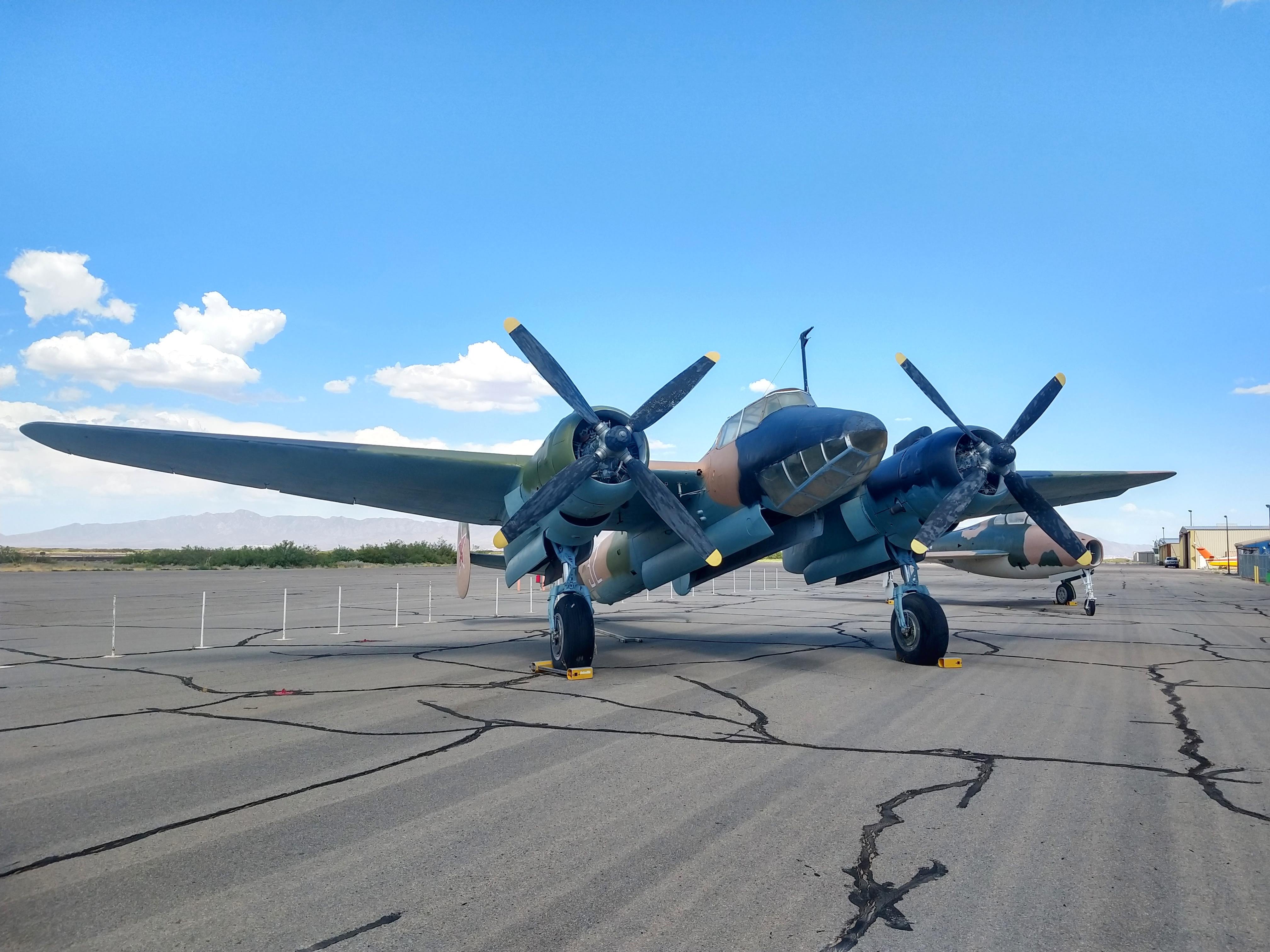
War Eagles Air Museum is an aerospace and automotive museum with several exhibits. It is located at Doña Ana County International Jetport in Santa Teresa, New Mexico. History The museum was established by West Texas engineer, rancher and oilman John T. MacGuire and his wife Betty MacGuire. As pilots, they began collecting warbirds after encountering them in Oshkosh, Wisconsin in 1979. As the collection grew, they looked for a place to build a museum to display their collection. After considering several options such as Las Cruces, New Mexico and Reno, Nevada, John decided to build the museum closer to their home near the Doña Ana County International Airport. The facility unofficially opened to the public on 13 September 1989. Shortly after opening, the museum purchased a Tupolev Tu-2 from China. The museum completed a expansion in 1996. Aircraft * Bell OH-58 Kiowa * Boeing PT-13D * Canadair CT-133 Silver Star * Canadair Sabre 6 * Cessna 140 * Cessna T-37B Tweet * ... [...More Info...] [...Related Items...] OR: [Wikipedia] [Google] [Baidu] |
Atwater, California
Atwater is a city on California State Route 99, State Route 99 in Merced County, California, Merced County, California, United States. Atwater is west-northwest of Merced, California, Merced, at an elevation of . The population as of the 2020 United States census, 2020 census was 31,970, up from 28,168 in 2010. Geography Atwater is in northern Merced County, between Merced, the county seat, to the southeast and Livingston, California, Livingston to the northwest. According to the United States Census Bureau, the city has a total area of . 99.92% of it is land and 0.08% is water. The city includes Castle Air Museum, but does not include the former Castle Air Force Base proper, now repurposed as Castle Airport. History The railroad reached Atwater in the 1870s, and a town grew around it. The first post office opened in 1880. Atwater incorporated in 1922. The name honors Marshall D. Atwater, a wheat farmer whose land was used by the railroad for its station. North of the town is t ... [...More Info...] [...Related Items...] OR: [Wikipedia] [Google] [Baidu] |
Castle Air Museum
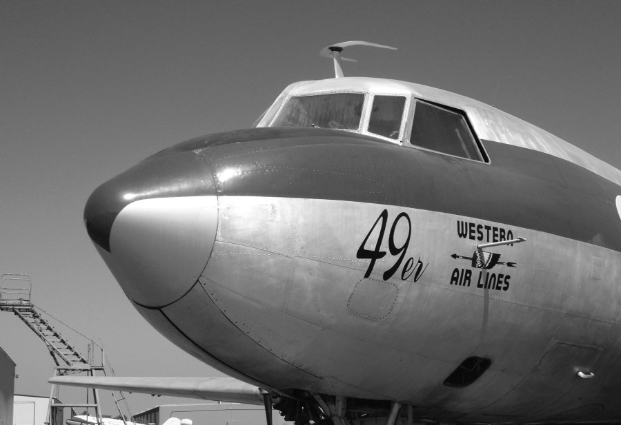
Castle Air Museum is a military aviation museum located in Atwater, California, United States adjacent to Castle Airport, a former United States Air Force Strategic Air Command base which was closed in 1995, after the end of the Cold War. It is one of the largest aerospace museums displaying vintage aircraft in the western United States. History and information The museum opened with 12 aircraft on 20 June 1981 as a branch of the United States Air Force Museum system. Only four months later, an additional four aircraft were placed on display. Then in 1983, an audit criticized leadership for poor accountability of resources, displaying aircraft outside the museum's mission, and lack of security. When Castle Air Force Base was closed in April 1995 and became Castle Airport, the museum similarly became private. The loss of federal funding eventually caused financial problems for the museum. It currently displays over 60 restored World War II, Korean War, Cold War, and modern era a ... [...More Info...] [...Related Items...] OR: [Wikipedia] [Google] [Baidu] |
Fayetteville, Arkansas
Fayetteville () is the second-largest city in Arkansas, the county seat of Washington County, and the biggest city in Northwest Arkansas. The city is on the outskirts of the Boston Mountains, deep within the Ozarks. Known as Washington until 1829, the city was named after Fayetteville, Tennessee, from which many of the settlers had come. It was incorporated on November 3, 1836, and was rechartered in 1867. The three-county Northwest Arkansas Metropolitan Statistical Area is ranked 102nd in terms of population in the United States with 560,709 in 2021 according to the United States Census Bureau. The city had a population of 95,230 in 2021. Fayetteville is home to the University of Arkansas, the state's flagship university. When classes are in session, thousands of students on campus change up the pace of the city. Thousands of Arkansas Razorbacks alumni and fans travel to Fayetteville to attend football, basketball, and baseball games. The city of Fayetteville is collo ... [...More Info...] [...Related Items...] OR: [Wikipedia] [Google] [Baidu] |


