|
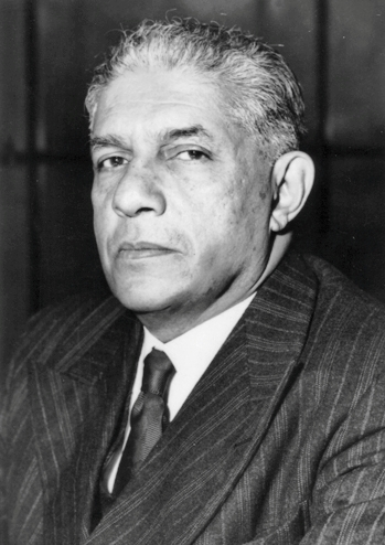
Stephen Montagu Burrows
Sir Stephen Montagu Burrows CIE (26 December 1856 – 4 March 1935) was a British amateur historian, author and Ceylonese civil servant. Stephen Montagu Burrows was born in Headington, Oxfordshire, England on 26 December 1856, the second son of Montagu Burrows, a naval historian and professor at Oxford University, and Mary Anna née Whalley-Smythe-Gardiner, daughter of Sir James Whalley Smythe Gardiner, 3rd Baronet. He studied at Eton College and Exeter College, Oxford, graduating with a Bachelor of Arts in Classical Studies in 1879 and a Master of Arts in 1884. He joined the Ceylon Civil Service in 1880 and was attached to the Kandy Kachcheri. In June 1881, he was appointed the private secretary to Lieutenant-Governor John Douglas and in November was made a Justice of the Peace (JP) and Assistant Coroner for Colombo. On 2 June 1882, he was assigned to the Queen's Advocates' Department. He was made an JP and the additional police magistrate for Galle on 25 August the same y ... [...More Info...] [...Related Items...] OR: [Wikipedia] [Google] [Baidu] |
Headington
Headington is an eastern suburb of Oxford, England. It is at the top of Headington Hill overlooking the city in the Thames valley below, and bordering Marston to the north-west, Cowley to the south, and Barton and Risinghurst to the east. The life of the large residential area is centred upon London Road, the main road between London and Oxford. History The site of Headington shows evidence of continued occupation from the Stone Age, as the 2001 field excavations in Barton Lane found, suggesting a date in the 11th century BC. Pottery was found on the Manor Ground, suggesting an Iron Age settlement there in the 7th century BC. Roman kilns from about 300 have been found, including one now on display at the Museum of Oxford. Anglo-Saxon burial remains from about 500 have also been discovered. Headington's toponym is derived from the Old English ''Hedena's dun'', meaning "Hedena's hill", when it was the site of a palace or hunting lodge of the Kings of Mercia. In a charter of 1 ... [...More Info...] [...Related Items...] OR: [Wikipedia] [Google] [Baidu] |
Galle
Galle ( si, ගාල්ල, translit=Gālla; ta, காலி, translit=Kāli) (formerly Point de Galle) is a major city in Sri Lanka, situated on the southwestern tip, from Colombo. Galle is the provincial capital and largest city of Southern Province, Sri Lanka and is the capital of Galle District. Galle was known as ''Gimhathiththa'' before the arrival of the Portuguese in the 16th century, when it was the main port on the island. Ibn Batuta, a Moroccan Berber Muslim traveller in the 14th century, referred to it as ''Qali''. Galle reached the height of its development in the 18th century, during the Dutch colonial period. Galle is the best example of a fortified city built by the Portuguese in South and Southeast Asia, showing the interaction between Portuguese architectural styles and native traditions. The city was extensively fortified by the Dutch during the 17th century from 1649 onwards. The Galle fort is a world heritage site and is the largest remaining fortres ... [...More Info...] [...Related Items...] OR: [Wikipedia] [Google] [Baidu] |
North Western Province, Sri Lanka
North Western Province ( si, වයඹ පළාත ''Wayamba Paḷāta'', ta, வட மேல் மாகாணம் ''Vada Mael Mākāṇam'') is a province of Sri Lanka. The province consists of the districts of Kurunegala and Puttalam. Its capital is Kurunegala, which has a population of 28,571. The province is known mainly for its numerous coconut plantations. Other main towns in this province are Chilaw (24,712) and Puttalam (45,661), which are both small fishing towns. The majority of the population of Wayamba province is of Sinhalese ethnicity. There is also a substantial Sri Lankan Moor minority around Puttalam and Sri Lankan Tamils in Udappu and Munneswaram. Fishing, prawn farming and rubber tree plantations are other prominent industries of the region. The province has an area of 7,888 km2, and a population of 2,370,075 (2011 census). Geography Climate The climate of Wayamba is tropical, with a marked dry season, and temperatures averaging between 20 � ... [...More Info...] [...Related Items...] OR: [Wikipedia] [Google] [Baidu] |
Nuwara Eliya
Nuwara Eliya ( si, නුවර එළිය ; ta, நுவரெலியா) is a city in the hill country of the Central Province, Sri Lanka. Its name means "city on the plain (table land)" or "city of light". The city is the administrative capital of Nuwara Eliya District, with a picturesque landscape and temperate climate. It is at an altitude of 1,868 m (6,128 ft) and is considered to be the most important location for tea production in Sri Lanka. The city is overlooked by Pidurutalagala, the tallest mountain in Sri Lanka. Nuwara Eliya is known for its temperate, cool climatethe coolest area in Sri Lanka. History The city was founded by Samuel Baker, the explorer of Lake Albert and the upper Nile in 1846. Nuwara Eliya's climate lent itself to becoming the prime sanctuary of the British civil servants and planters in Ceylon. Nuwara Eliya, called Little England, was a hill country retreat where the British colonialists could immerse themselves in their pastimes su ... [...More Info...] [...Related Items...] OR: [Wikipedia] [Google] [Baidu] |
Trincomalee
Trincomalee (; ta, திருகோணமலை, translit=Tirukōṇamalai; si, ත්රිකුණාමළය, translit= Trikuṇāmaḷaya), also known as Gokanna and Gokarna, is the administrative headquarters of the Trincomalee District and major resort port city of Eastern Province, Sri Lanka. Located on the east coast of the island overlooking the Trincomalee Harbour, north-east of Colombo, south-east of Jaffna and miles north of Batticaloa, Trincomalee has been one of the main centres of Sri Lankan Tamil language speaking culture on the island for over two millennia. With a population of 99,135, the city is built on a peninsula of the same name, which divides its inner and outer harbours. People from Trincomalee are known as Trincomalians and the local authority is Trincomalee Urban Council. Trincomalee city is home to the famous Koneswaram temple from where it developed and earned its historic Tamil name ''Thirukonamalai''. The town is home to other hist ... [...More Info...] [...Related Items...] OR: [Wikipedia] [Google] [Baidu] |
Kegalle
Kegalle ( si, කෑගල්ල; ta, கேகாலை) is a large town in Sabaragamuwa Province of Sri Lanka. It is located on the Colombo–Kandy road, approximately from Colombo and from Kandy. It is the main town in the Kegalle District, which is one of two districts which comprise Sabaragamuwa Province. The town is governed by an Urban Council. Kegalle has an agricultural based economy and mainly produces rubber. The surrounding area produces graphite, precious stones and agricultural products such as rice. It is the nearest town to the Pinnawala Elephant Orphanage, a major tourist attraction in the area, which is to the north-east. History The history of the area dates back to the stone age of Sri Lanka. According to evidence there had been a prosperous civilisation in Kegalle prior to 28,000 years. The caves of Beli lena, Dorawaka lena, Alu lena, Asmadala, Padavigampola, Batalegala, Lenagala, Ambala Kanda, Halamada, Heenatipana, Uthuwankanda, Beligala, Salawa, Y ... [...More Info...] [...Related Items...] OR: [Wikipedia] [Google] [Baidu] |
Evening Standard
The ''Evening Standard'', formerly ''The Standard'' (1827–1904), also known as the ''London Evening Standard'', is a local free daily newspaper in London, England, published Monday to Friday in tabloid format. In October 2009, after being purchased by Russian businessman Alexander Lebedev, the paper ended a 180-year history of paid circulation and became a free newspaper, doubling its circulation as part of a change in its business plan. Emily Sheffield became editor in July 2020 but resigned in October 2021. History From 1827 to 2009 The newspaper was founded by barrister Stanley Lees Giffard on 21 May 1827 as ''The Standard''. The early owner of the paper was Charles Baldwin. Under the ownership of James Johnstone, ''The Standard'' became a morning paper from 29 June 1857. ''The Evening Standard'' was published from 11 June 1859. ''The Standard'' gained eminence for its detailed foreign news, notably its reporting of events of the American Civil War (1861–1865 ... [...More Info...] [...Related Items...] OR: [Wikipedia] [Google] [Baidu] |
The Sydney Morning Herald
''The Sydney Morning Herald'' (''SMH'') is a daily compact newspaper published in Sydney, New South Wales, Australia, and owned by Nine. Founded in 1831 as the ''Sydney Herald'', the ''Herald'' is the oldest continuously published newspaper in Australia and "the most widely-read masthead in the country." The newspaper is published in compact print form from Monday to Saturday as ''The Sydney Morning Herald'' and on Sunday as its sister newspaper, '' The Sun-Herald'' and digitally as an online site and app, seven days a week. It is considered a newspaper of record for Australia. The print edition of ''The Sydney Morning Herald'' is available for purchase from many retail outlets throughout the Sydney metropolitan area, most parts of regional New South Wales, the Australian Capital Territory and South East Queensland. Overview ''The Sydney Morning Herald'' publishes a variety of supplements, including the magazines ''Good Weekend'' (included in the Saturday edition of ''Th ... [...More Info...] [...Related Items...] OR: [Wikipedia] [Google] [Baidu] |
Australia
Australia, officially the Commonwealth of Australia, is a Sovereign state, sovereign country comprising the mainland of the Australia (continent), Australian continent, the island of Tasmania, and numerous List of islands of Australia, smaller islands. With an area of , Australia is the largest country by area in Oceania and the world's List of countries and dependencies by area, sixth-largest country. Australia is the oldest, flattest, and driest inhabited continent, with the least fertile soils. It is a Megadiverse countries, megadiverse country, and its size gives it a wide variety of landscapes and climates, with Deserts of Australia, deserts in the centre, tropical Forests of Australia, rainforests in the north-east, and List of mountains in Australia, mountain ranges in the south-east. The ancestors of Aboriginal Australians began arriving from south east Asia approximately Early human migrations#Nearby Oceania, 65,000 years ago, during the Last Glacial Period, last i ... [...More Info...] [...Related Items...] OR: [Wikipedia] [Google] [Baidu] |
Inverell, New South Wales
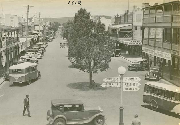
Inverell is a large town in northern New South Wales, Australia, situated on the Macintyre River, close to the Queensland border. It is also the centre of Inverell Shire. Inverell is located on the Gwydir Highway on the western slopes of the Northern Tablelands. It has a temperate climate. In the , the population of Inverell was 12,057 and the Inverell Shire population was 17,853. History Prior to white settlement, the Gamilaraay Nation (commonly known as Kamilaroi) of Aboriginal peoples lived in and occupied this region. In 1848, Alexander Campbell held the Inverell Station on the Macintyre River. The name derives from the name of Mr. MacIntyre's estate. The word is of Gaelic origin, and signifies "meeting place of the swans"; from "Inver", a meeting place, and "Ell", a swan. The MacIntyre River and Swanbrook Creek join here. The area was also known as "Green Swamp" in the 1850s. Wheat growers, Colin and Rosanna Ross established a store there in 1853, when he asked that a ... [...More Info...] [...Related Items...] OR: [Wikipedia] [Google] [Baidu] |
Matale
Matale ( Sinhala: මාතලේ, ta, மாத்தளை, translit=Māttaḷai) is the administrative capital city of the Matale District. It is the most urbanised and populated centre in the district. Matale is also the second largest municipal and urban centre in central province after Kandy. It is located at the heart of the central hills of the island and lies in a broad, fertile valley at an elevation of above sea level. Surrounding the city are the Knuckles Mountain Range, the foothills were called ''Wiltshire'' by the British. They have also called this place as Matelle. History Matale is the only district of Sri Lanka, where an ancient book of written history is found. It is known as ''Pannagamam - பன்னாகமம் ("Five Headed Serpent" in English) of Goddess Muthumari in Sri Muthumariamman Temple, Matale.'' The most important historical incident in Matale is writing the thripitaka which was held during the ruling period of king Walagamba in 89-77 B ... [...More Info...] [...Related Items...] OR: [Wikipedia] [Google] [Baidu] |
Polonnaruwa
Poḷonnaruwa, ( si, පොළොන්නරුව, translit=Poḷonnaruva; ta, பொலன்னறுவை, translit=Polaṉṉaṟuvai) also referred as Pulathisipura and Vijayarajapura in ancient times, is the main town of Polonnaruwa District in North Central Province, Sri Lanka. The modern town of Polonnaruwa is also known as New Town, and the other part of Polonnaruwa remains as the royal ancient city of the Kingdom of Polonnaruwa. The second oldest of all Sri Lanka's kingdoms, Polonnaruwa was first established as a military post by the Sinhalese kingdom. It was renamed Jananathamangalam by the Chola dynasty after their successful invasion of the country's then capital, Anuradhapura, in the 10th century. The ''Ancient City of Polonnaruwa'' has been declared a World Heritage Site. Modern Polonnaruwa is undergoing a major development project known as the "Awakening of Polonnaruwa," championed by former President Maithripala Sirisena. It envisions the development of all s ... [...More Info...] [...Related Items...] OR: [Wikipedia] [Google] [Baidu] |


