|
Stemwede
Stemwede is a municipality in the Minden-Lübbecke district, in North Rhine-Westphalia, Germany. Following a recent regional reorganization, in 1973, the former districts of Dielingen-Wehdem and Levern were consolidated and the district of "Stemwede" created. The new name was chosen because for a thousand years the area along the Stemweder Berg (mountain) was popularly referred to as Stemwede. Geography Stemwede is situated approximately 20 km north-west of Lübbecke Lübbecke (; wep, Lübke) is a town in northeast North Rhine-Westphalia in north Germany. This former county town lies on the northern slopes of the Wiehen Hills (''Wiehengebirge'') and has around 26,000 inhabitants. The town is part of district .... Subdivisions of the town The municipality of Stemwede is divided into 3 districts (consisting of the following villages each): References External links * * {{MindenLübbecke-geo-stub ... [...More Info...] [...Related Items...] OR: [Wikipedia] [Google] [Baidu] |
Minden-Lübbecke
Minden-Lübbecke is a ''Kreis'' (district) in the northeastern part of North Rhine-Westphalia, Germany. Neighboring districts are Diepholz, Nienburg, Schaumburg, Lippe, Herford, Osnabrück. Geography This is the northernmost district of North Rhine-Westphalia. It protrudes into Lower Saxon territory. The Weser River enters the district in the southeast and leaves to the north. In the south of the district the river runs through a narrow gorge, which is formed by two mountain chains, the Wiehen Hills in the west and the Wesergebirge in the east. This gorge is called Porta Westfalica, since it marks the ancient border of Westphalia. History Minden-Lübbecke is roughly identical with the medieval Bishopric of Minden. At its biggest extent in the 13th century, it later lost territory until it came finally to be around the size of today's district. In the 17th century the principality came into the possession of Brandenburg and thus Prussia. Lost for a time to Napoleonic France, it ... [...More Info...] [...Related Items...] OR: [Wikipedia] [Google] [Baidu] |
North Rhine-Westphalia
North Rhine-Westphalia (german: Nordrhein-Westfalen, ; li, Noordrien-Wesfale ; nds, Noordrhien-Westfalen; ksh, Noodrhing-Wäßßfaale), commonly shortened to NRW (), is a States of Germany, state (''Land'') in Western Germany. With more than 18 million inhabitants, it is the List of German states by population, most populous state of Germany. Apart from the city-states, it is also the List of German states by population density, most densely populated state in Germany. Covering an area of , it is the List of German states by area, fourth-largest German state by size. North Rhine-Westphalia features 30 of the 81 German municipalities with over 100,000 inhabitants, including Cologne (over 1 million), the state capital Düsseldorf, Dortmund and Essen (all about 600,000 inhabitants) and other cities predominantly located in the Rhine-Ruhr metropolitan area, the largest urban area in Germany and the fourth-largest on the European continent. The location of the Rhine-Ruhr at the h ... [...More Info...] [...Related Items...] OR: [Wikipedia] [Google] [Baidu] |
Germany
Germany,, officially the Federal Republic of Germany, is a country in Central Europe. It is the second most populous country in Europe after Russia, and the most populous member state of the European Union. Germany is situated between the Baltic and North seas to the north, and the Alps to the south; it covers an area of , with a population of almost 84 million within its 16 constituent states. Germany borders Denmark to the north, Poland and the Czech Republic to the east, Austria and Switzerland to the south, and France, Luxembourg, Belgium, and the Netherlands to the west. The nation's capital and most populous city is Berlin and its financial centre is Frankfurt; the largest urban area is the Ruhr. Various Germanic tribes have inhabited the northern parts of modern Germany since classical antiquity. A region named Germania was documented before AD 100. In 962, the Kingdom of Germany formed the bulk of the Holy Roman Empire. During the 16th ce ... [...More Info...] [...Related Items...] OR: [Wikipedia] [Google] [Baidu] |
Lübbecke
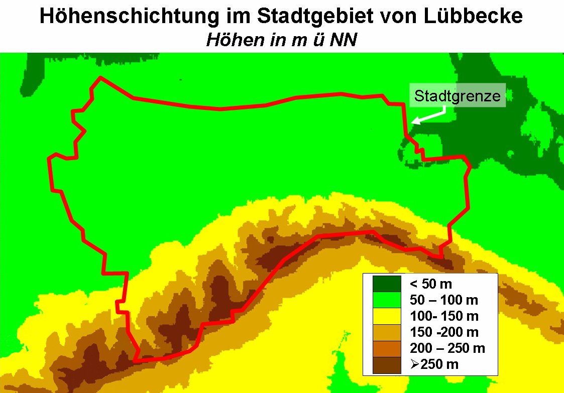
Lübbecke (; wep, Lübke) is a town in northeast North Rhine-Westphalia in north Germany. This former county town lies on the northern slopes of the Wiehen Hills (''Wiehengebirge'') and has around 26,000 inhabitants. The town is part of district of Minden-Lübbecke within the ''Regierungsbezirk'' of Detmold in the Ostwestfalen-Lippe region. Lübbecke was first mentioned in the records in 775 as ''hlidbeki'' and was given town rights in 1279. Geography Lübbecke is situated just north of the Wiehen Hills, approx. north of Herford and west of Minden. Location Lübbecke is located in northeast North Rhine-Westphalia, north of East Westphalia-Lippe (''Ostwestfalen-Lippe''), in the southwestern part of the district of Minden-Lübbecke. From a landscape perspective, the town lies in the west of the Minden Land. Geographically, most of the built-up area is on the North German Plain. Only its southern suburbs lie on the northern slope of the Wiehen Hills, whose crest that marks t ... [...More Info...] [...Related Items...] OR: [Wikipedia] [Google] [Baidu] |

.jpg)
