|
State Road 77 (Florida)
State Road 77 (SR 77) is a major north–south artery in Florida's Panhandle, connecting Panama City to the south with Alabama State Route 109 and Dothan, Alabama to the north. State Road 77 is mostly a four-lane non-limited-access highway from its south terminus intersection with U.S. Route 98 Business and State Road 30 north to its intersection with State Road 20. Current plans are under way to widen the route to four lanes north to the Florida–Alabama border in the near future. Route description Panama City and Bay County State Road 77 begins in Panama City at US Business Route 98 (Sixth Street) as a continuation of North Cove Boulevard, which itself spans as far south as Bunkers Cove. The route shares the additional name of Martin Luther King Jr. Boulevard. The first site along the road is an ambulance depot next to the Bay Medical Center Sacred Heart Health System. The road is a major four-lane divided boulevard throughout the city, and one of the important cross-stre ... [...More Info...] [...Related Items...] OR: [Wikipedia] [Google] [Baidu] |
Panama City, Florida
Panama City is a city in and the county seat of Bay County, Florida, United States. Located along U.S. Highway 98 (US 98), it is the largest city between Tallahassee and Pensacola. It is the more populated city of the Panama City–Lynn Haven, Florida metropolitan statistical area. Panama City was severely damaged when Hurricane Michael made landfall as a Category 5 hurricane on October 10, 2018. As of the 2020 census, the population was 35,392, down from the figure of 36,484 at the 2010 census. When Panama City was incorporated in 1909, its original city limits were 15th Street (Hwy 98) on the north, Balboa Avenue on the west and Bay Avenue on the east. Name The development in this once unincorporated part of Northwest Florida had previous names such as Floriopolis, Park Resort, and Harrison. In 1906, the development was named Panama City and it was first incorporated as Panama City in 1909. When Panama City was incorporated, its original city limits were 15th Str ... [...More Info...] [...Related Items...] OR: [Wikipedia] [Google] [Baidu] |
Northwest Florida Beaches International Airport
Northwest Florida Beaches International Airport is a public airport northwest of Panama City, Florida, United States, in Bay County. The airport is owned by the Panama City-Bay County Airport & Industrial District, and is north of Panama City Beach, near West Bay. It replaced Panama City–Bay County International Airport (Fannin Field, PFN), which was located in Panama City. The airport opened for commercial flights on May 23, 2010, and is the first international airport in the United States designed and built since the September 11 attacks. The airport currently has no scheduled international flights, due to the small population in the surrounding areas and the fact that the demand for visitation to Panama City is mostly regional and/or national. The airport authority originally decided to name it Northwest Florida–Panama City International Airport, but airlines and the general public asked the airport authority to use a more regional name. History In the late 1990s, the ... [...More Info...] [...Related Items...] OR: [Wikipedia] [Google] [Baidu] |
Louisville And Nashville Railroad
The Louisville and Nashville Railroad , commonly called the L&N, was a Class I railroad that operated freight and passenger services in the southeast United States. Chartered by the Commonwealth of Kentucky in 1850, the road grew into one of the great success stories of American business. Operating under one name continuously for 132 years, it survived civil war and economic depression and several waves of social and technological change. Under Milton H. Smith, president of the company for 30 years, the L&N grew from a road with less than of track to a system serving fourteen states. As one of the premier Southern railroads, the L&N extended its reach far beyond its namesake cities, stretching to St. Louis, Memphis, Atlanta, and New Orleans. The railroad was economically strong throughout its lifetime, operating freight and passenger trains in a manner that earned it the nickname, "The Old Reliable." Growth of the railroad continued until its purchase and the tumultuous rail ... [...More Info...] [...Related Items...] OR: [Wikipedia] [Google] [Baidu] |
Chipley (Amtrak Station)
Chipley station is a former intercity railroad station in Chipley, Florida. It is currently the headquarters of the Washington County Historical Society. The grounds include two former train stations: the Louisville and Nashville Depot and Bill Lee Station. The station was served by Amtrak's '' Sunset Limited'' train until service was suspended after Hurricane Katrina struck in 2005. Amtrak has proposed reopening the station as part of a restored ''Sunset Limited'' route in the future. History Chipley, Florida, named for William Dudley Chipley, came into existence as a stop on the Pensacola and Atlantic Railroad around 1882. The P&A was absorbed by the Louisville and Nashville Railroad, who built the Louisville and Nashville Depot in downtown Chipley. Later, rail service was moved to a smaller building close to the tracks, Bill Lee Station. This served as Chipley's stop on Amtrak The National Railroad Passenger Corporation, doing business as Amtrak () , is the national pa ... [...More Info...] [...Related Items...] OR: [Wikipedia] [Google] [Baidu] |
Pensacola And Atlantic Railroad
The Pensacola and Atlantic Railroad (P&A) was a company incorporated by an act of the Florida Legislature on March 4, 1881, to run from Pensacola to the Apalachicola River near Chattahoochee, a distance of about . No railroad had ever been built across the sparsely populated panhandle of Florida, which left Pensacola isolated from the rest of the state. William D. Chipley and Frederick R. De Funiak, both of whom are commemorated in the names of towns later built along the P&A line ( Chipley and DeFuniak Springs), were among the founding officers of the railroad company. Chipley was general manager of the Pensacola Railroad, (formerly the Pensacola and Louisville Railroad, originally the Alabama and Florida Railroad, completed in 1860). The Pensacola Railroad connected Pensacola with the large, prosperous Louisville and Nashville Railroad (L&N) at Pollard, Alabama, about northward. The Pensacola Railroad had become a subsidiary of the L&N on October 20, 1880. It was Chipley, ... [...More Info...] [...Related Items...] OR: [Wikipedia] [Google] [Baidu] |
Florida State Road 273
State Road 273 (SR 273) is a north–south highway in the panhandle in the U.S. state of Florida that extends from State Road 77 (SR 77) in Chipley to U.S. Route 231 (US 231) in Campbellton. SR 273 runs through both Washington and Jackson counties, and most, if not all of the road is a two-lane undivided highway. Between its termini, SR 273 intersects with no state roads other than former ones. A former section of the road south of Chipley is now County Road 273. Route description State Road 273 begins at a blinker-light intersection with State Road 77 in Chipley, Florida as Glenwood Avenue, which is a west-to-east street that continues west as a city local city street until it reaches North First Street. The road remains at this trajectory for the first four blocks, and does not start to turn north until after the intersection with Bennett Drive. From that point on, the road is named the Chipley-Campbellton Highway. During this curve to the north, it encounters the headquarte ... [...More Info...] [...Related Items...] OR: [Wikipedia] [Google] [Baidu] |
Chipley, Florida
Chipley is a city in and the county seat of Washington County, Florida, Washington County, Florida, United States, located between Tallahassee, Florida, Tallahassee and Pensacola, Florida, Pensacola. Its population was 3,605 in the 2010 U.S. Census. The area is served by Chipley High School. Originally called "Orange", the city was renamed Chipley in 1882 for William Dudley Chipley, president of the Pensacola and Atlantic Railroad and Florida state senator from 1895 to 1897. During the cold snap of January 1985, a temperature of 2 degrees was recorded at one of the town's golf courses, making it the second-coldest Florida temperature ever recorded and the lowest January reading for the state. Geography Chipley is located at . The city is located in the Florida Panhandle along Interstate 10 in Florida, Interstate 10 and U.S. Route 90 in Florida, U.S. Route 90. U.S. Route 90 runs through the downtown area from west to east as Jackson Avenue, and leads east 10 mi (16 km) to Cottonda ... [...More Info...] [...Related Items...] OR: [Wikipedia] [Google] [Baidu] |
Interstate 10 In Florida
Interstate 10 (I-10) runs for in Florida as the easternmost section of an east–west Interstate Highway in the southern United States. It is also the eastern end of one of three coast-to-coast Interstates, along with I-80 and I-90. The highway runs east from the Alabama border, traveling through the Panhandle of Florida, serving the major cities of Pensacola, Tallahassee, Lake City, ending at Jacksonville, and carries the hidden Florida Department of Transportation (FDOT) designation of State Road 8 (SR 8). Route description The Interstate runs roughly parallel to US Highway 90 (US 90) (which intersects I-10 at five different points along its route), but is a more direct route, bypassing the central cores of many cities. I-10 runs through some of the least populated areas of the state. I-10 crosses into Florida at Alabama state line at the Perdido River, just west of Pensacola, in Escambia County. Florida State Road 297 (SR 297, sout ... [...More Info...] [...Related Items...] OR: [Wikipedia] [Google] [Baidu] |
Falling Waters State Park
Falling Waters State Park is a Florida state park located three miles (5 km) south of Chipley, Washington County in northwestern Florida. The park contains a waterfall, the highest in the state known as "Falling Waters Falls”. History The sinkholes at Falling Waters State Park were used as a hideout by Indian warriors fighting against Andrew Jackson during the Seminole Wars. The park is the site of a Civil War era gristmill. The gristmill was powered by the waterfall in Falling Waters Sink. Later, in 1891, a distillery was constructed on the site. The park is also the site of the first oil well in Florida. It was drilled in 1919 based on information from local legends and a 400-year-old Spanish diary. The well, which reached a depth of never proved to hold a commercially viable amount of oil and was capped in 1921. The park was deeded to the state in 1962 by the Washington County Development authority. Park facilities such as a picnic pavilion and restrooms were ... [...More Info...] [...Related Items...] OR: [Wikipedia] [Google] [Baidu] |
County Road 276 (Washington County, Florida)
__NOTOC__ Year 276 ( CCLXXVI) was a leap year starting on Saturday (link will display the full calendar) of the Julian calendar. At the time, it was known as the Year of the Consulship of Tacitus and Aemilianus (or, less frequently, year 1029 ''Ab urbe condita''). The denomination 276 for this year has been used since the early medieval period, when the Anno Domini calendar era became the prevalent method in Europe for naming years. Events By place Roman Empire * Emperor Tacitus doubles the silver content of the aurelianianus, and halves its tariffing to 2.5 d.c. They carry the value marks X.I. * Tacitus campaigns successfully against the Goths who have invaded Asia Minor, and his half-brother, the praetorian prefect Marcus Annius Florianus, continues the campaign. * Tacitus' cousin Maximinus administers Syria in a harsh manner, and is assassinated by local men of power, who are joined in the conspiracy by the faction responsible for having assassinated Aurelian in th ... [...More Info...] [...Related Items...] OR: [Wikipedia] [Google] [Baidu] |
Dirt Road
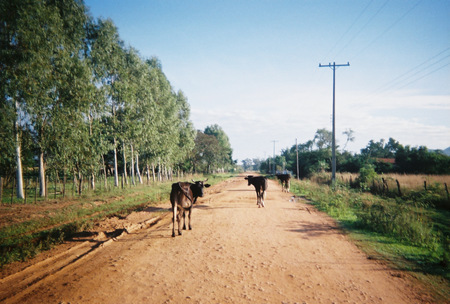
A dirt road or track is a type of unpaved road not paved with asphalt, concrete, brick, or stone; made from the native material of the land surface through which it passes, known to highway engineers as subgrade material. Dirt roads are suitable for vehicles; a narrower path for pedestrians, animals, and possibly small vehicles would be called a dirt track—the distinction is not well-defined. Unpaved roads with a harder surface made by the addition of material such as gravel and aggregate (stones), might be referred to as dirt roads in common usage but are distinguished as improved roads by highway engineers. (Improved unpaved roads include gravel roads, laterite roads, murram roads and macadamized roads.) Compared to a gravel road, a dirt road is not usually graded regularly to produce an enhanced camber to encourage rainwater to drain off the road, and drainage ditches at the sides may be absent. They are unlikely to have embankments through low-lying areas. This lea ... [...More Info...] [...Related Items...] OR: [Wikipedia] [Google] [Baidu] |


