|
State Express Transport Corporation
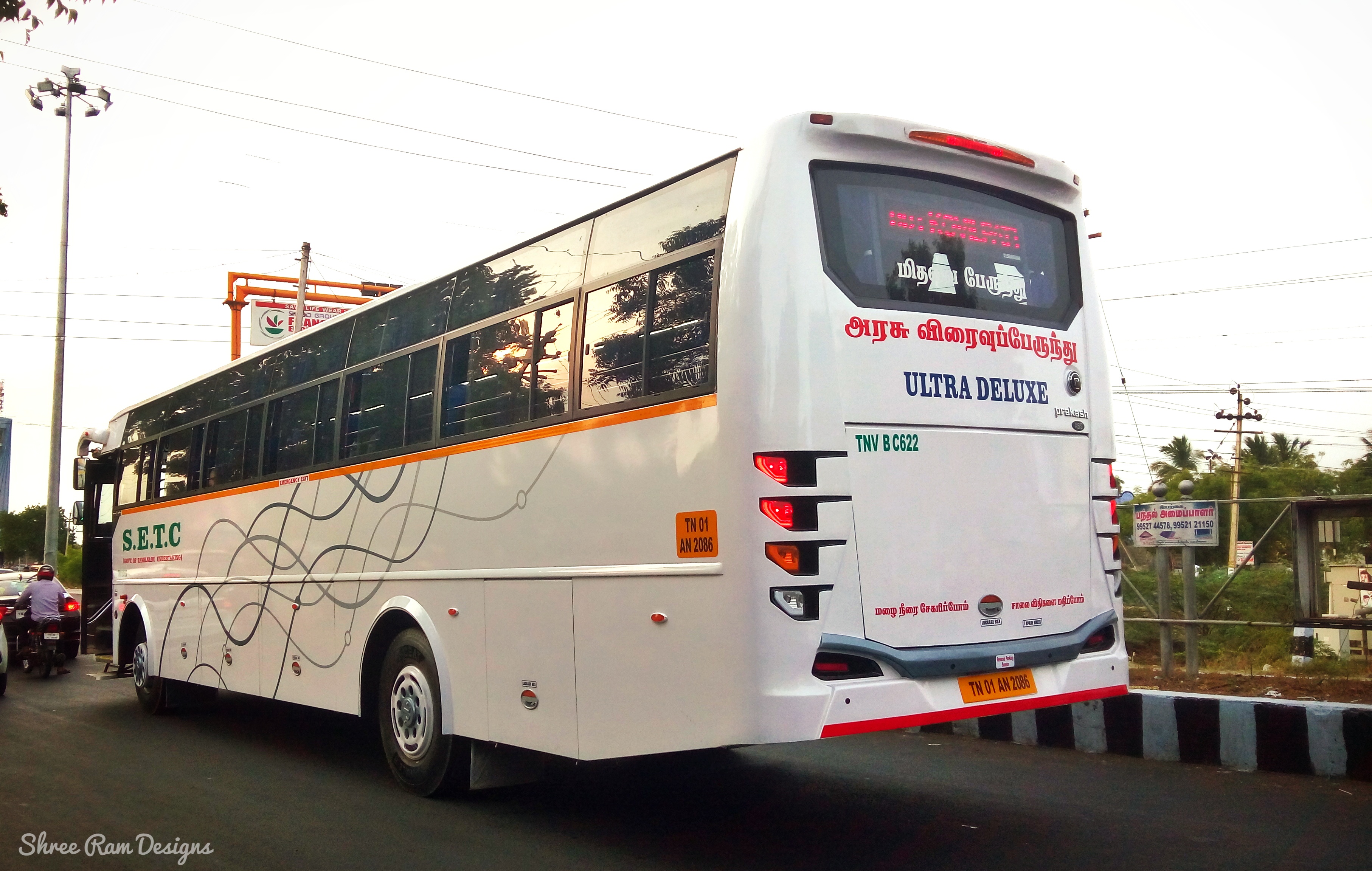
State Express Transport Corporation (Tamil Nadu) Ltd - (SETC) is a state-owned transport corporation that runs long-distance mofussil services exceeding 300 km and above throughout the state of Tamil Nadu and major cities in adjoining states of Andhra Pradesh, Karnataka, Kerala and the union territory of Puducherry. History A separate entity exclusively for operating long-distance express services was conceived by the Government of Tamil Nadu in 1975, and the services were transferred to the newly formed express wing of Pallavan Transport Corporation with effect from 15 September 1975. It was registered formally on 14 January 1980 and renamed as Thiruvalluvar Transport Corporation (TTC) in honor of the Tamil poet Thiruvalluvar. During the 1990s, JJTC was formed, which operated interstate routes of the erstwhile TTC. JJTC was then renamed as RGTC in 1996. Both TTC and RGTC were later merged into the State Express Transport Corporation (SETC) in 1997. Depot Types of services ... [...More Info...] [...Related Items...] OR: [Wikipedia] [Google] [Baidu] |
Government Of Tamil Nadu
Government of Tamil Nadu is the subnational government for the Indian state of Tamil Nadu. It is seated at Fort St George, Chennai. The legislature of Tamil Nadu was bicameral until 1986, when it was replaced by a unicameral legislature, like most other states in India. Structure The Governor is the constitutional head of state while the Chief Minister heads the council of ministers. The Chief Justice of the Madras High Court is the ''head of the judiciary''. Officials M. K. Stalin is the Chief Minister of Tamil Nadu. Munishwar Nath Bhandari is the acting Chief Justice of Madras High Court. The Chief Secretary is V. Irai Anbu, IAS. Administrative divisions The state of Tamil Nadu has a population of 72,138,959 as per the 2011 Census and covers an area of 130,058 km2. The major administrative units of the state constitute 38 districts, 76 revenue divisions, 220 taluks, 21 municipal corporations, 150 municipalities, 385 panchayat unions (blocks), 561 town pan ... [...More Info...] [...Related Items...] OR: [Wikipedia] [Google] [Baidu] |
Koyambedu
Koyambedu is a neighbourhood in Chennai, India. Situated in the western part of Chennai city, the Koyambedu area has become a major hub of activity in Chennai City after the inauguration of the Koyambedu market in 1996 and the Chennai Mofussil Bus Terminus (CMBT) in 2002. The area is active round the clock owing to the movement of people and goods through the day, with uninterrupted transport facilities such as long-route buses, autos, share autos, vegetable goods carriers and so forth. Etymology The name of the neighbourhood comes from ''ko'' meaning horse, ''ambu'' meaning arrow, and ''pedu'' meaning fence, when Lava and Kusha caught the horse sent by Rama in a fence made of arrows. Access Koyambedu is connected to both the Chennai Central Railway Station in Park Town and the Chennai International Airport in Tirusulam. The Poonamallee High Road (NH4) connects Koyambedu to the Chennai Central Railway Station, while the Jawaharlal Nehru Road (also known as Inner Ring Road ... [...More Info...] [...Related Items...] OR: [Wikipedia] [Google] [Baidu] |
Nagapattinam
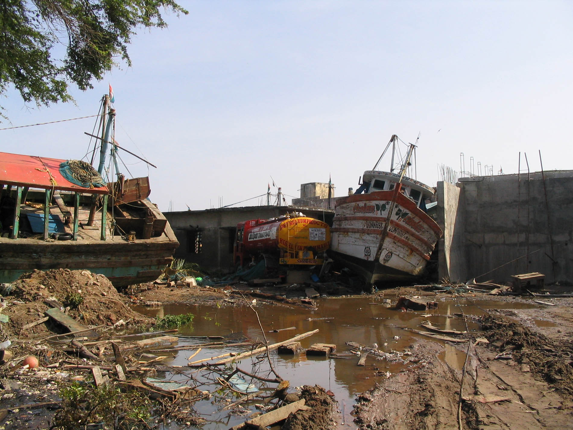
Nagapattinam (''nākappaṭṭinam'', previously spelt Nagapatnam or Negapatam) is a town in the Indian state of Tamil Nadu and the administrative headquarters of Nagapattinam District. The town came to prominence during the period of Medieval Cholas (9th–12th century CE) and served as their important port for commerce and east-bound naval expeditions. The Chudamani Vihara in Nagapattinam constructed by the Srivijayan king Sri Mara Vijayattungavarman of the Sailendra dynasty with the help of Rajaraja Chola I was an important Buddhist structure in those times. Nagapattinam was settled by the Portuguese and, later, the Dutch under whom it served as the capital of Dutch Coromandel from 1660 to 1781. In November 1781, the town was conquered by the British East India Company. It served as the capital of Tanjore district from 1799 to 1845 under Madras Presidency of the British. It continued to be a part of Thanjavur district in Independent India. In 1991, it was made the headquar ... [...More Info...] [...Related Items...] OR: [Wikipedia] [Google] [Baidu] |
Nagapattinam District
Nagapattinam district is one of the 38 districts (a coastal district) of Tamil Nadu state in southern India. Nagapattinam district was carved out by bifurcating the erstwhile composite Thanjavur district on 19 October 1991. The town of Nagapattinam is the district headquarters. As of 2011, the district had a population of 697,069 with a sex-ratio of 1,025 females for every 1,000 males. Until Mayiladuthurai district was created out of it on 24 March 2020, Nagapattinam was the only discontiguous district in Tamil Nadu. Etymology ''Nagapattinam'' is derived from ''Nagar'', referring to people, and ''pattinam'' referring to town. In Tamil ''Pattinam'' and ''paakkam'' depicts coastal towns. The town was also called ''Cholakula Vallipattinam'' during the Chola period, when it was one of the important ports. Ptolemy refers to Nagapattinam as Nikam and mentions it as one of the most important trade centres of the ancient Tamil country. This view is doubtful as there is no contemporary e ... [...More Info...] [...Related Items...] OR: [Wikipedia] [Google] [Baidu] |
Kumbakonam
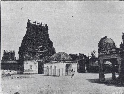
Kumbakonam (formerly spelt as Coombaconum or Combaconum) or Kudanthai is a city municipal corporation in the Thanjavur district in the States of India, Indian state of Tamil Nadu. It is located from Thanjavur and from Chennai and is the headquarters of the Kumbakonam taluk of Thanjavur district. It is the second largest city in the district after Thanjavur. The city is bounded by two rivers, the Kaveri River to the north and Arasalar River to the south. Kumbakonam is known as a "Temple town" due to the prevalence of a number of Hindu temple, temples here and is noted for its Mahamaham festival, which happens once in 12 years, attracting people from all over the country. Kumbakonam dates back to the Sangam period and was ruled by the Early Cholas, Pallavas, Mutharaiyar dynasty, Medieval Cholas, Later Cholas, Pandyas, the Vijayanagara Empire, Madurai Nayaks, Thanjavur Nayaks and the Thanjavur Marathas. It rose to be a prominent town between the seventh and ninth centuries AD, wh ... [...More Info...] [...Related Items...] OR: [Wikipedia] [Google] [Baidu] |
Thanjavur
Thanjavur (), also Tanjore, Pletcher 2010, p. 195 is a city in the Indian state of Tamil Nadu. Thanjavur is the 11th biggest city in Tamil Nadu. Thanjavur is an important center of South Indian religion, art, and architecture. Most of the Great Living Chola Temples, which are UNESCO World Heritage Monuments, are located in and around Thanjavur. The foremost among these, the Brihadeeswara Temple, is located in the centre of the city. Thanjavur is also home to Tanjore painting, a painting style unique to the region. Thanjavur is the headquarters of the Thanjavur District. The city is an important agricultural centre located in the Kaveri Delta and is known as the ''Rice bowl of Tamil Nadu''. Thanjavur is administered by a municipal corporation covering an area of and had a population of 290,720 in 2011. Roadways are the major means of transportation, while the city also has rail connectivity. The nearest airport is Tiruchirapalli International Airport, located away from th ... [...More Info...] [...Related Items...] OR: [Wikipedia] [Google] [Baidu] |
Thanjavur District
Thanjavur District is one of the Districts of Tamil Nadu, 38 districts of the States and territories of India, state of Tamil Nadu, in southeastern India. Its headquarters is Thanjavur. The district is located in the delta of the Cauvery River and is mostly agrarian. As of 2011, Thanjavur district had a population of 2,405,890 with a sex-ratio of 1,035 females for every 1,000 males. Geography The district is located at in Central Tamil Nadu bounded on the northeast by Mayiladuthurai district, on the east by Tiruvarur District, on the south by the Palk Strait of Bay of Bengal on the west by Pudukkottai District and Tiruchirappalli District, Tiruchirappalli, small border with Cuddalore district, Cuddalore on the northeast and on the north by the river Kollidam, across which lie part of Tiruchirappalli District, Tiruchirappalli, and Ariyalur district, Ariyalur districts. Demographics According to 2011 census of India, 2011 census, Thanjavur district had a population of 2,4 ... [...More Info...] [...Related Items...] OR: [Wikipedia] [Google] [Baidu] |
Tiruchirappalli
Tiruchirappalli () ( formerly Trichinopoly in English), also called Tiruchi or Trichy, is a major tier II city in the Indian state of Tamil Nadu and the administrative headquarters of Tiruchirappalli district. The city is credited with being the best livable city and the cleanest city of Tamil Nadu, as well as the fifth safest city for women in India. It is the fourth largest city as well as the fourth largest urban agglomeration in the state. Located south of Chennai and north of Kanyakumari, Tiruchirappalli sits almost at the geographic centre of Tamil Nadu state. The Cauvery Delta begins west of the city where the Kaveri river splits into two, forming the island of Srirangam which is now incorporated into the Tiruchirappalli City Municipal Corporation. The city occupies an area of and had a population of 916,857 in 2011. Tiruchirappalli's recorded history begins in the 3rd century BC, when it was under the rule of the Cholas. The city has also been ruled by the Pall ... [...More Info...] [...Related Items...] OR: [Wikipedia] [Google] [Baidu] |
Coimbatore
Coimbatore, also spelt as Koyamputhur (), sometimes shortened as Kovai (), is one of the major metropolitan cities in the Indian state of Tamil Nadu. It is located on the banks of the Noyyal River and surrounded by the Western Ghats. Coimbatore is the second largest city in Tamil Nadu after Chennai in terms of population and the 16th largest urban agglomeration in India as per the census 2011. It is administered by the Coimbatore Municipal Corporation and is the administrative capital of Coimbatore District. In 1981 Coimbatore formed as third municipal corporation in Tamil Nadu after Chennai and Madurai. Podanur Junction is the oldest Railway station in Coimbatore City. The city is one of the largest exporters of Jewellery, Wet grinders, Poultry and Auto Components; the "Coimbatore Wet Grinder" and the "Kovai Cora Cotton" are recognised as Geographical Indications by the Government of India. Being a hub of textile industry in South India, the city is sometimes referred to as ... [...More Info...] [...Related Items...] OR: [Wikipedia] [Google] [Baidu] |
Coimbatore District
Coimbatore district is one of the 38 districts in the state of Tamil Nadu in India. Coimbatore is the administrative headquarters of the district. It is one of the most industrialized districts and a major textile, industrial, commercial, educational, information technology, healthcare and manufacturing hub of Tamil Nadu. The region is bounded by Tiruppur district in the east, Nilgiris district in the north, Erode district in the north-east, Palakkad district, Idukki district and small parts of Thrissur district and Ernakulam district of neighboring state of Kerala in the west and south respectively. As of 2011, Coimbatore district had a population of 3,458,045 with a sex-ratio of 1,000 and literacy rate of 84%. Coimbatore district was part of the historical Kongu Nadu and was ruled by the Cheras as it served as the eastern entrance to the Palakkad Gap, the principal trade route between the west coast and Tamil Nadu. Coimbatore was in the middle of the Roman trade route ... [...More Info...] [...Related Items...] OR: [Wikipedia] [Google] [Baidu] |
Salem, Tamil Nadu
Salem (), is a major city in Salem district, located on the banks of Thirumanimutharu river in the Indian state of Tamil Nadu. Salem is the List of cities in Tamil Nadu by population, sixth largest urban agglomeration and metropolitan city in the state by population next to Chennai, Coimbatore, Madurai, Tiruchirappalli and Tiruppur and the sixth largest city in Tamil Nadu by area covering . History Early period During the third century BCE, there was period of Bogar – a notable Tamil Siddhar and at that time Jainism and Buddhism arrived. Around the beginning of the common era, the existence of a culturally and economically advanced society in Salem two thousand years ago is evident from the discovery of silver coins of the Roman Emperor Nero, Tiberices Claudices Nero (37–68 CE) in Koneripatti of Salem in 1987. Later Pandya dynasty started ruling the region around Salem. Later Pallava dynasty rises in Salem. After that Mahendra Varma Pallava came to Salem and Saivite pri ... [...More Info...] [...Related Items...] OR: [Wikipedia] [Google] [Baidu] |


_Lake.jpg)