|
Stari Grad (Novi Sad)
Stari grad ( sr-cyr, Стари град) is an urban neighborhood of the city of Novi Sad, Serbia. It is the main part of Novi Sad, and it is also known as City Centre. In the Serbian language, the name "Stari grad" means "Old Town". Location Borders The eastern borders of Stari grad are Kej žrtava racije (Quay of the victims of raid) and Beogradski kej (Belgrade Quay), the southern border is Bulevar Cara Lazara (Tzar Lazar Boulevard), the western border is Bulevar oslobođenja (Liberation Boulevard), the north-western borders are Jevrejska ulica (Jewish Street), Šafarikova ulica (Šafarik Street), Ulica Jovana Subotića (Jovan Subotić Street), and Temerinska ulica (Temerin Street), and the northern borders are Ulica Miloša Bajića (Miloš Bajić Street), Trg Republike (Square of the Republic), Daničićeva ulica (Daničić Street), Ulica Zlatne grede (Zlatna Greda Street), Pašićeva ulica (Pašić Street), Ulica Matice srpske (Matica Srpska Street), Sterijina ulica (Sterija ... [...More Info...] [...Related Items...] OR: [Wikipedia] [Google] [Baidu] |
Neighborhoods And Suburbs Of Novi Sad
This is a list of the neighbourhoods and suburbs of Novi Sad. Neighbourhoods on the left bank of the Danube * Stari Grad (Old City, City Centre) *Bulevar * Liman (Liman I, Liman II, Liman III, Liman IV) * Almaški Kraj *Podbara ** Industrial Zone North 3 *Salajka (Slavija) * Pervazovo Naselje (Pejinovo Naselje) * Rotkvarija *Banatić * Sajmište * Grbavica *Adamovićevo Naselje *Telep (Severni Telep, Južni Telep) *Adice * Bistrica (Novo Naselje) **Savina **Tozin Sokak (Šonsi) **Šarengrad (Jamajka) **Rasadnik (Radna Zona Zapad) ** Industrial Zone West **Satelit ***Mali Satelit ***Tozinovac *Veternička Rampa *Detelinara (Stara Detelinara, Nova Detelinara) *Avijatičarsko Naselje (Avijacija) *Jugovićevo *Novo Groblje *Sajlovo * Industrial Zone South (Radna Zona Sever 2) *University campus * Ribarsko Ostrvo * Kameničko Ostrvo (Kamenička Ada) * Klisa (Gornja Klisa, Donja Klisa) *Slana Bara *Vidovdansko Naselje * Veliki Rit * Mali Beograd * Mišin Salaš * Industrial Zone ... [...More Info...] [...Related Items...] OR: [Wikipedia] [Google] [Baidu] |
Grbavica (Novi Sad)
Grbavica ( sr, Грбавица) is an area of the city Novi Sad, Serbia. Borders The northern border of Grbavica is Futoška ulica (Futoška Street), the western borders are Ulica Vojvode Knićanina (Vojvoda Knićanin Street) and Ulica Kola srpskih sestara (Kolo srpskih sestara Street), the southern border is Bulevar Cara Lazara (Tzar Lazar Boulevard), and the eastern border is Bulevar Oslobođenja (Liberation Boulevard). Name origin Grbavica got its name from the Sarajevo settlement with the same name. When Grbavica in Novi Sad was built, the city used the same urbanistic plans, thus keeping the same name as well. Neighbouring settlements The neighbouring settlements are: Sajmište in the north, Stari Grad in the east, Liman in the south, and Adamovićevo Naselje in the west. Features The city's Catholic and Jewish graveyards are located in Grbavica. See also * Neighborhoods of Novi Sad This is a list of the neighbourhoods and suburbs of Novi Sad. Neighbou ... [...More Info...] [...Related Items...] OR: [Wikipedia] [Google] [Baidu] |
Novi Sad Municipality
Novi Sad ( sr-Cyrl, Нови Сад, ; hu, Újvidék, ; german: Neusatz; see below for other names) is the second largest city in Serbia and the capital of the autonomous province of Vojvodina. It is located in the southern portion of the Pannonian Plain on the border of the Bačka and Syrmia geographical regions. Lying on the banks of the Danube river, the city faces the northern slopes of Fruška Gora. , Novi Sad proper has a population of 231,798 while its urban area (including the adjacent settlements of Petrovaradin and Sremska Kamenica) comprises 277,522 inhabitants. The population of the administrative area of the city totals 341,625 people. Novi Sad was founded in 1694 when Serb merchants formed a colony across the Danube from the Petrovaradin Fortress, a strategic Habsburg military post. In subsequent centuries, it became an important trading, manufacturing and cultural centre, and has historically been dubbed ''the Serbian Athens''. The city was heavily devastated ... [...More Info...] [...Related Items...] OR: [Wikipedia] [Google] [Baidu] |
Štrand
Štrand ( sr-cyr, Штранд) is a popular beach on the Danube river in Novi Sad, Vojvodina, Serbia. It is located near the Liberty Bridge, in the city quarter known as Liman. History Štrand was built back in 1911, as a beach for local people; later it was expanded several times. Its name derives from the German word ''Strand'', meaning simply ''beach'' (In German, an initial ''s'' is usually pronounced as ''sh'' when it comes before a consonant, as in the Yiddish-English ''shtick'', thus, the Serbian ''š'' correctly bears a diacritic A diacritic (also diacritical mark, diacritical point, diacritical sign, or accent) is a glyph added to a letter or to a basic glyph. The term derives from the Ancient Greek (, "distinguishing"), from (, "to distinguish"). The word ''diacriti ... reflecting this). During the summer, Štrand has around 20,000 visitors daily. External links Photo gallery References {{DEFAULTSORT:Strand Tourism in Novi Sad Beaches of Serbia ... [...More Info...] [...Related Items...] OR: [Wikipedia] [Google] [Baidu] |
Liman, Novi Sad
Liman ( sr-Cyrl, Лиман) is an urban neighborhood of the city of Novi Sad, Serbia. It is located to the south of the city centre, along the Danube river, covering an area of 3.98 km2. It is a relatively new part of the city, built between 1960s and 1990s on what previously were marshes. It is divided into four parts, numbered by Roman numerals: Liman I (with University campus), II, III and IV, which match the chronology of its development. Location Borders The northern border of Liman is Bulevar Cara Lazara (Tsar Lazar Boulevard), the western borders are Ulica Ribarsko ostrvo (Ribarsko ostrvo Street) and Ulica Sima Matavulja (Simo Matavulj Street), while the southern and eastern border is Danube river (i.e. Sunčani kej - "The Sunny Quay"). The neighbouring neighbourhoods are: Telep in the west, Adamovićevo Naselje, Grbavica and Stari Grad in the north, and Ribarsko ostrvo (not a settlement, but tourist destination) in the south. In the south-east of the settlement ... [...More Info...] [...Related Items...] OR: [Wikipedia] [Google] [Baidu] |
Újvidék Városháza 1900
Novi Sad ( sr-Cyrl, Нови Сад, ; hu, Újvidék, ; german: Neusatz; #Name, see below for other names) is the List of cities in Serbia, second largest city in Serbia and the capital of the autonomous province of Vojvodina. It is located in the southern portion of the Pannonian Plain on the border of the Bačka and Syrmia geographical regions. Lying on the banks of the Danube river, the city faces the northern slopes of Fruška Gora. , Novi Sad proper has a population of 231,798 while its urban area (including the adjacent settlements of Petrovaradin and Sremska Kamenica) comprises 277,522 inhabitants. The population of the administrative area of the city totals 341,625 people. Novi Sad was founded in 1694 when Serb merchants formed a colony across the Danube from the Petrovaradin Fortress, a strategic Habsburg military post. In subsequent centuries, it became an important trading, manufacturing and cultural centre, and has historically been dubbed ''the Serbian Athens''. Th ... [...More Info...] [...Related Items...] OR: [Wikipedia] [Google] [Baidu] |
Military Frontier
The Military Frontier (german: Militärgrenze, sh-Latn, Vojna krajina/Vojna granica, Војна крајина/Војна граница; hu, Katonai határőrvidék; ro, Graniță militară) was a borderland of the Habsburg monarchy and later the Austrian and Austro-Hungarian Empire. It acted as the ''cordon sanitaire'' against incursions from the Ottoman Empire. The establishment of the new defense system in Hungary and Croatia took place in the 16th century, following the election of Ferdinand I as king. Six districts under special military administration were established in Hungary and Croatia. The Croatian Military Frontier and the Slavonian Military Frontier came under the jurisdiction of the Croatian Sabor and ban. In 1627, they were placed under the direct control of the Habsburg military. For more than two centuries, they would retain complete civilian and military authority over the area, up to the abolition of the Military Frontier in 1881. During the 17th ce ... [...More Info...] [...Related Items...] OR: [Wikipedia] [Google] [Baidu] |
Ratzen Statt, 1698
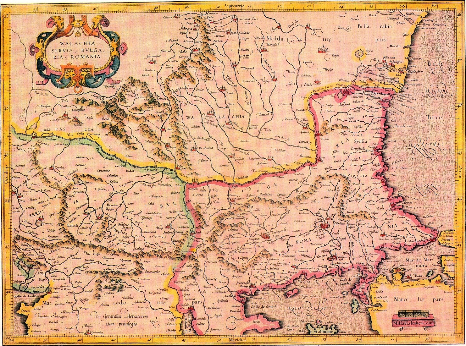
Rascians ( sr, Раши, Рашани / ''Raši, Rašani''; la, Rasciani, Natio Rasciana) was a historical term for Serbs. The term was derived from the Latinized name for the central Serbian region of Raška ( la, Rascia; sr-Cyrl, Рашка). In medieval and early modern Western sources, exonym ''Rascia'' was often used as a designation for Serbian lands in general, and consequently the term ''Rasciani'' became one of the most common designations for Serbs. Because of the increasing migratory concentration of Serbs in the southern Pannonian Plain, since the late 15th century, those regions also became referred to as ''Rascia'', since they were largely inhabited by ''Rasciani'' (Rascians). Among those regions, term ''Rascia'' (Raška) was most frequently used for territories spanning from western Banat to central Slavonia, including the regions of Syrmia, Bačka, and southern Baranja. From the 16th to the 18th century, those regions were contested between the Ottoman Empire and ... [...More Info...] [...Related Items...] OR: [Wikipedia] [Google] [Baidu] |
Matica Srpska
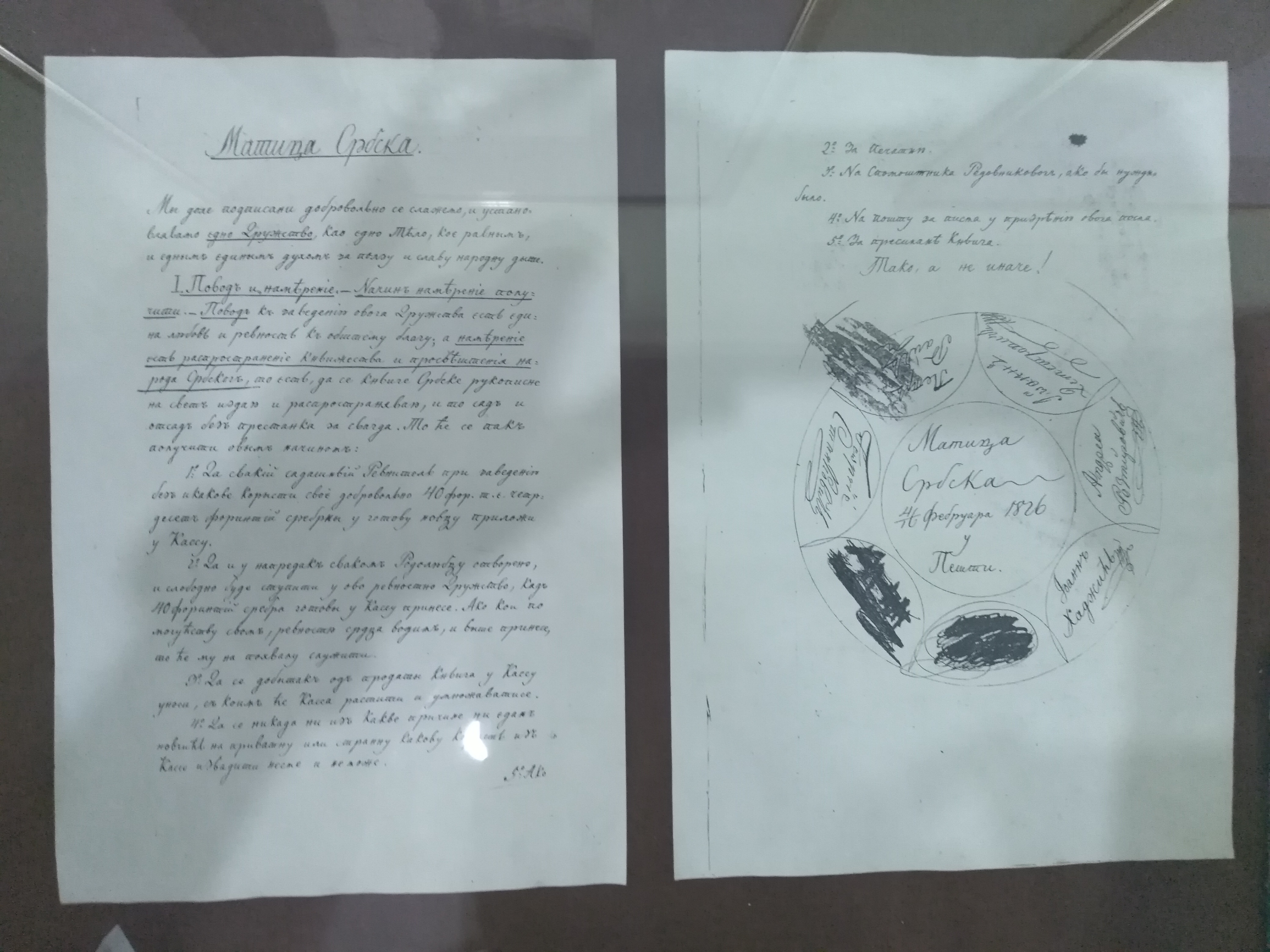
The Matica srpska ( sr-Cyrl, Матица српска, Matica srpska, la, Matrix Serbica, grc, Μάτιτσα Σρπσκα) is the oldest Serbian language independent, non-profit, non-governmental and cultural-scientific Serbian national institution. It was founded on June 1, 1826 in Pest (today a part of Budapest) by the Serbian habsburg legislator Jovan Hadžić and other prominent members of the Serbian Revolution and National Revival. The Matica was moved to Novi Sad in 1864. It is the oldest matica in the world. The main goals are to restore and promote Serbian national and cultural identity in the fields of art, science, spiritual creativity, economy and public life as well as to care for social development of Serbia. The literary and cultural society played a huge role in the flourishing of science and culture of the Serbs of Vojvodina, Serbia. The need for national homogenization, enlightenment, as well as the publication of Serbian books, were the main reasons for ... [...More Info...] [...Related Items...] OR: [Wikipedia] [Google] [Baidu] |
Necropolis
A necropolis (plural necropolises, necropoles, necropoleis, necropoli) is a large, designed cemetery with elaborate tomb monuments. The name stems from the Ancient Greek ''nekropolis'', literally meaning "city of the dead". The term usually implies a separate burial site at a distance from a city, as opposed to tombs within cities, which were common in various places and periods of history. They are different from grave fields, which did not have structures or markers above the ground. While the word is most commonly used for ancient sites, the name was revived in the early 19th century and applied to planned city cemeteries, such as the Glasgow Necropolis. Necropoli in the ancient world Egypt Ancient Egypt is noted for multiple necropoleis. Ancient Egyptian funerary practices and beliefs about the afterlife led to the construction of several extensive necropoleis to secure and provision the dead in the hereafter. These necropoleis are therefore major archaeological si ... [...More Info...] [...Related Items...] OR: [Wikipedia] [Google] [Baidu] |
Bronze Age
The Bronze Age is a historic period, lasting approximately from 3300 BC to 1200 BC, characterized by the use of bronze, the presence of writing in some areas, and other early features of urban civilization. The Bronze Age is the second principal period of the three-age system proposed in 1836 by Christian Jürgensen Thomsen for classifying and studying ancient societies and history. An ancient civilization is deemed to be part of the Bronze Age because it either produced bronze by smelting its own copper and alloying it with tin, arsenic, or other metals, or traded other items for bronze from production areas elsewhere. Bronze is harder and more durable than the other metals available at the time, allowing Bronze Age civilizations to gain a technological advantage. While terrestrial iron is naturally abundant, the higher temperature required for smelting, , in addition to the greater difficulty of working with the metal, placed it out of reach of common use until the end o ... [...More Info...] [...Related Items...] OR: [Wikipedia] [Google] [Baidu] |

.jpg)


